



Why visit Naranja
Townapedia lists 3 museums and landmarks, 6 parks and trails and 12 places to eat in and around town.
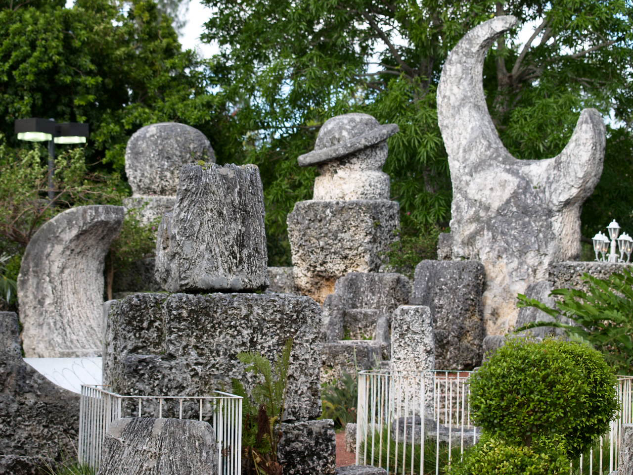
Highlights include Coral Castle, Silver Palm Schoolhouse, Leisure City Park and Naranja Park.
August is the warmest month, with average highs of 90°F; January lows average 55°F.
Weather in Naranja
Forecast from the National Weather Service. Full forecast
About Naranja
Naranja is an unincorporated community and census-designated place (CDP) in Miami-Dade County, Florida, United States. Many orange groves were once located in this area, so the community name came from the Spanish word for orange, naranja, though the pronunciation among the local residents is "Na-Ran-Jah". Naranja was also a stop for the Florida East Coast Railroad that once ran through this area. It is part of the Miami metropolitan area of South Florida.
From the Wikipedia article Naranja, Florida (this version), under CC BY-SA 4.0.
Museums and landmarks3
Coral Castle
Monument and historic site · National Register of Historic Places · 1.8 mi
Visitor attraction in Leisure City, Florida, USA

Silver Palm Schoolhouse
Monument and historic site · National Register of Historic Places · 2.8 mi
School building in Miami-Dade County, Florida


William Anderson General Merchandise Store
Monument and historic site · National Register of Historic Places · 2.8 mi
Parks, trails and playgrounds6

Restaurants and cafes12

Flama Brazilian Steakhouse
Restaurant · Brazilian · 1.0 mi
27667 Dixie Highway
Su-Th 12:00-21:00; Fr-Sa 12:00-22:00

Burger King
Fast food · Burger · 0.4 mi
26801 South Dixie Highway, Naranja
Mo-Sa 06:00-23:00; Su 03:00-23:00
Domino's
Fast food · Pizza · 0.6 mi
27335 South Dixie Highway, Homestead
Mo-Th 10:00-24:00; Fr-Sa 10:00-01:00; Su 10:00-24:00
Papa John's
Fast food · Pizza · 0.4 mi
14324 Southwest 264th Street, Naranja
Mo-Th 10:00-24:00; Fr-Sa 10:00-01:00; Su 10:00-23:30
Popeyes
Fast food · Chicken · 0.5 mi
27101 South Dixie Highway, Naranja
Mo 10:00-22:00; Tu-Sa 10:00-21:00; Su 10:00-22:00
Taco Bell
Fast food · Tex-Mex · 1.3 mi
13610 Southwest 288th Street, Homestead
Mo-We 08:00-03:00; Th 08:00-04:00; Fr-Sa 08:00-05:00; Su 08:00-03:00
Wingstop
Fast food · Wings · 0.6 mi
27004 South Dixie Highway, Naranja
Churches and places of worship2

Mission Bautista Nueva Nacimiento
Church · Baptist · 1.2 mi
28140 Southwest 152nd Avenue, Homestead
Shopping4
Gas and EV charging8
Schools, colleges and libraries49
Air Base K-8 Center For International Education
School · 1.4 mi
12829 Sw 272Nd St, Homestead
Coral Reef Montessori Academy Charter School
School · 5.0 mi
10853 Sw 216Th St, Cutler Bay
Map of Naranja
84 places. The map loads OpenStreetMap tiles when you open it.
Climate by month
Monthly table
| Month | High | Low | Rain | Snow |
|---|---|---|---|---|
| Jan | 76°F | 55°F | 2.0 in | 0.0 in |
| Feb | 78°F | 57°F | 2.3 in | 0.0 in |
| Mar | 80°F | 59°F | 2.3 in | 0.0 in |
| Apr | 84°F | 63°F | 3.4 in | 0.0 in |
| May | 86°F | 68°F | 5.6 in | 0.0 in |
| Jun | 89°F | 72°F | 10.1 in | 0.0 in |
| Jul | 90°F | 72°F | 7.8 in | 0.0 in |
| Aug | 90°F | 73°F | 10.2 in | 0.0 in |
| Sep | 89°F | 72°F | 10.1 in | 0.0 in |
| Oct | 86°F | 69°F | 7.6 in | 0.0 in |
| Nov | 81°F | 63°F | 2.9 in | 0.0 in |
| Dec | 78°F | 58°F | 2.3 in | 0.0 in |
U.S. Climate Normals 1991-2020 for Perrine 4W Hcn (5 mi away), NOAA NCEI.
People and cost of living
American Community Survey 5-year estimates, 2020-2024, U.S. Census Bureau. Estimates have margins of error, larger for small towns.
Disaster history
Miami-Dade County has had 27 federal disaster declarations since 2000, most often for hurricanes.
- 2024-10-11: Hurricane Milton (Hurricane)
- 2024-10-07: Hurricane Milton (Hurricane)
- 2022-12-13: Hurricane Nicole (Hurricane)
- 2022-11-08: Tropical Storm Nicole (Tropical Storm)
- 2022-09-29: Hurricane Ian (Hurricane)
- 2022-09-24: Tropical Storm Ian (Hurricane)
OpenFEMA disaster declarations summaries.
Getting there and nearby towns
Homestead Air Reserve Base (HST) is the nearest airport with scheduled flights listed in OpenStreetMap, 3 miles away.
- Leisure City 2 mi southwest, about 3 min by car
- Princeton 2 mi northeast, about 4 min by car
- Homestead Base 3 mi southeast, about 4 min by car
- Homestead 4 mi southwest, about 6 min by car
- Goulds 4 mi northeast, about 6 min by car
- South Miami Heights 5 mi northeast, about 9 min by car
- Florida City 6 mi southwest, about 10 min by car
- Richmond West 6 mi north, about 10 min by car
- Cutler Bay 7 mi northeast, about 11 min by car
- West Perrine 7 mi northeast, about 12 min by car
Drive times are estimates from straight-line distance, not routes.
Local news
Headlines from INDB, the NEMICO news database.
Reviews, tips and questions
Loading what members have shared...
Sources and licences
- NCES EDGE (Public domain): public schools
- NOAA NCEI U.S. Climate Normals 1991-2020 (Public domain): climate by month
- OpenFEMA (Public domain): disaster declarations
- OpenStreetMap contributors (ODbL 1.0): places, airports, map data
- U.S. Census Bureau (Public domain): population, income, housing, education, commute
- Wikidata (CC0 1.0): elevation, founding date, time zone, website, landmarks and historic places
- Wikimedia Commons (see each image): photos
- Wikipedia (CC BY-SA 4.0): overview and history text
Photo credits
- Goulds FL Silver Palm Schoolhouse01, Ebyabe, CC BY-SA 3.0
- Coral Castle 1, Christina Rutz, CC BY 2.0
- Goulds FL Anderson Store01, Ebyabe, CC BY-SA 3.0
- Florida bristle fern (21677168350), U.S. Fish and Wildlife Service Southeast Region, CC BY 2.0
- Florida bristle fern (Trichomanes punctatum floridanum). (15292551199), U.S. Fish and Wildlife Service Southeast Region, CC BY 2.0
- Cymatoderma caperatum (Berk. & Mont.) D.A. Reid 454820, This image was created by user Keith Bradley (linaceae) at Mushroom Observer , a source for mycological images. You can contact this user here ., CC BY-SA 3.0
Page built October 30, 2026. Spotted a mistake? Tell us or suggest a place.