


Why visit Alīpur
Townapedia lists 3 parks and trails, 4 places to stay and 1 attraction in and around town.
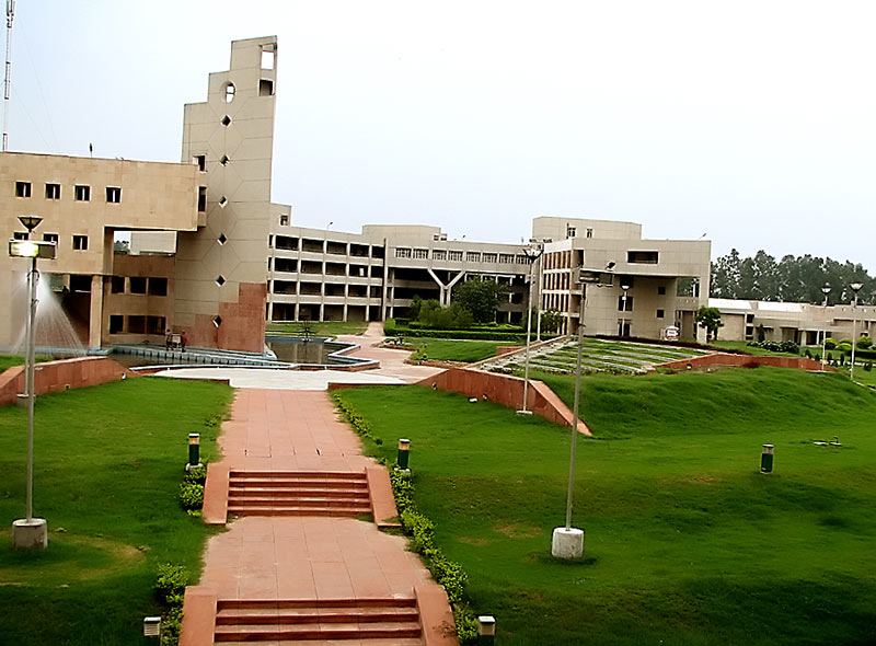
Highlights include Delhi Technological University.
Weather in Alīpur
Forecast from MET Norway (CC BY 4.0). Full forecast
About Alīpur
Alipur is the administrative headquarters and a sub-division of Outer North Delhi district in the state of Delhi, India. It is surrounded by the localities of Bawana, Narela, Budhpur, Bakoli and Mukhmelpur. Alipur falls under the Narela constituency. The nearest metro station is Jahangirpuri Metro Station.
From the Wikipedia article Alipur, Delhi (this version), under CC BY-SA 4.0.
Things to do1
Delhi Technological University
School · 5.6 km
State public university in North West, Delhi, India
Parks, trails and playgrounds3


Where to stay4

Family Guest House
Motel and hotel · 2.1 km
81/96 Grand Trunk Road, Bakoli
Gas and EV charging4

Schools, colleges and libraries3
Healthcare1
Map of Alīpur
16 places. The map loads OpenStreetMap tiles when you open it.
Getting there and nearby towns
Hindon Airport (HDO) is the nearest airport with scheduled flights listed in OpenStreetMap, 25 km away.
- Delhi 19 km southeast, about 19 min by car
- New Delhi 21 km south, about 21 min by car
- Bahadurgarh 23 km southwest, about 23 min by car
- Delhi Cantonment 22 km south, about 22 min by car
- Najafgarh 26 km southwest, about 26 min by car
- Noida 31 km southeast, about 31 min by car
- Ghāziābād 33 km southeast, about 33 min by car
- Chhatarpur 34 km south, about 34 min by car
- Gurugram 39 km south, about 39 min by car
- Faridabad 47 km south, about 47 min by car
Drive times are estimates from straight-line distance, not routes.
Local news
Headlines from INDB.
Reviews, tips and questions
Loading what members have shared...
Sources and licences
- GeoNames (CC BY 4.0): population, coordinates, regions and time zone
- OpenStreetMap contributors (ODbL 1.0): places, airports, map data
- Wikidata (CC0 1.0): elevation, founding date, time zone, website, landmarks and historic places
- Wikimedia Commons (see each image): photos
- Wikipedia (CC BY-SA 4.0): overview and history text
Photo credits
- DelhiCollegeOfEngineering BawanaCampus, Hemant Badhani Original uploader was Gnusbiz at en.wikipedia, CC BY 2.0
- Swami Sharddhanand College, User:Varunmemememe, CC BY-SA 3.0
- Shri Atma Vallabh Jain Smarak - Chakreshvari, Pratyk321, CC BY-SA 4.0
- Shri Atma Vallabh Jain Smarak - small temples complex, Pratyk321, CC BY-SA 4.0
- Shri Atma Vallabh Jain Smarak - Main (1), Pratyk321, CC BY-SA 4.0
- Shri Atma Vallabh Jain Smarak - Main - Side view (2), Pratyk321, CC BY-SA 4.0
- Shri Atma Vallabh Jain Smarak - Main (4), Pratyk321, CC BY-SA 4.0
- Shri Atma Vallabh Jain Smarak - Main - Side view (1), Pratyk321, CC BY-SA 4.0
- Shri Atma Vallabh Jain Smarak - Padmavati temple (3), Pratyk321, CC BY-SA 4.0
- Shri Atma Vallabh Jain Smarak - Padmavati temple (2), Pratyk321, CC BY-SA 4.0


Page built November 3, 2026. Spotted a mistake? Tell us or suggest a place.