


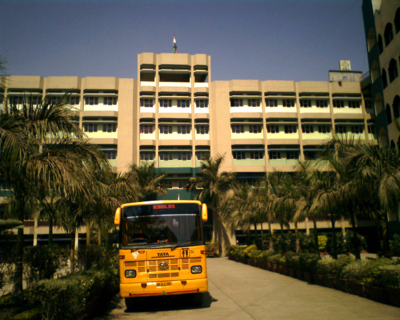


Why visit Bhayandar
Townapedia lists 1 museum or landmark, 25 parks and trails, 20 places to eat, 2 places to stay and 4 attractions in and around town.
Highlights include Royal College of Science, Arts and Commerce, desi park and green garedne.
Weather in Bhayandar
Forecast from MET Norway (CC BY 4.0). Full forecast
About Bhayandar
Bhayandar, also spelled as Bhaindar or Bhayander, is a suburb located in the western suburbs of Mumbai and the northern most suburb of the island on the western side, near the Vasai Creek. It has a large Marathi, Aagri, Koli, and mixed-community population. It falls under the North Central ward of the Municipal Corporation and comes under police jurisdiction of Mira-Bhayander, Vasai-Virar Police Commissionerate.
From the Wikipedia article Bhayandar (this version), under CC BY-SA 4.0.
Things to do4
Royal College of Science, Arts and Commerce
School · 4.1 km
College in Mumbai, Maharashtra



Museums and landmarks1

Parks, trails and playgrounds25

green garedne
Park · 2.3 km
1003 Naya Nagar Road, Mira Road East
Mo-Su 08:00-22:00
13 more on the map.
Restaurants and cafes20


KGN
Restaurant · North Indian, Biryani · 1.9 km
Shop 2, 3, 4, 5, Sunrise Apartment, Naya Nagar Road,, Mira Road East
Mo-Su 09:00-00:00
mira veg restaurants
Restaurant · Pizza · 1.3 km
60 feet corner, bhayandar
Mo-Su 10:00-22:00


8 more on the map.
Where to stay2
Churches and places of worship13
Mira Bhayander Cha Vighneshwar
Place of worship · Sarvajanik Ganeshotsav Mandal · 0.6 km
No. 1, Cabin Rd near Sai Ratnam and Narmada Society, Bhayandar, Kharegaon, Bhayandar East, Mira Bhayandar, Maharashtra 401105, bhayander west
Jama Masjid Al Shams
Place of worship · Sunni · 2.0 km
front of nursing home, Mira Road East
shiv shakti dakshin mukhi hanuman shanh mandir
Place of worship · Shaivism · 1.5 km
Shopping13
Gas and EV charging1
Schools, colleges and libraries6
Healthcare70
Map of Bhayandar
155 places. The map loads OpenStreetMap tiles when you open it.
Getting there and nearby towns
Chhatrapati Shivaji Maharaj International Airport (BOM) is the nearest airport with scheduled flights listed in OpenStreetMap, 24 km away.
- Borivli 7 km south, about 7 min by car
- Chandrapada 7 km northeast, about 7 min by car
- Gorai 9 km southwest, about 9 min by car
- Sopāra 14 km northwest, about 14 min by car
- Thāne 17 km southeast, about 17 min by car
- Virār 18 km north, about 18 min by car
- Mumbai 26 km south, about 26 min by car
- Kalyān 31 km east, about 31 min by car
- Ulhasnagar 33 km east, about 33 min by car
- Panvel 44 km southeast, about 44 min by car
Drive times are estimates from straight-line distance, not routes.
Local news
Headlines from INDB.
Reviews, tips and questions
Loading what members have shared...
Sources and licences
- GeoNames (CC BY 4.0): population, coordinates, regions and time zone
- OpenStreetMap contributors (ODbL 1.0): places, airports, map data
- Wikidata (CC0 1.0): elevation, founding date, time zone, website, landmarks and historic places
- Wikimedia Commons (see each image): photos
- Wikipedia (CC BY-SA 4.0): overview and history text
Photo credits
- Sunset View at Jesal Park Chowapatty, Bhayandar (East), Feroze Ahmad 2, CC BY-SA 4.0
- Bhayandar Railway Station - panoramio, Indrapal Jangid, CC BY-SA 3.0
- Bhayandar Station (14364), Suraj Digrase, CC0
- Bhayandar Station, Suraj Digrase, CC0
- The Building of Royal College, Mira Road, Virendrahonda, CC BY-SA 3.0
- Egg oil, PUREEGGOIL, CC BY-SA 4.0
- Salasar Hanuman Mandir - panoramio, Indrapal Jangid, CC BY-SA 3.0
- Veg Pulav, Manoharjangid, CC BY-SA 4.0
- Makar Sankranti - panoramio, Indrapal Jangid, CC BY-SA 3.0
- Sunny - panoramio (4), Rahul Rajbhar (Diamo…, CC BY 3.0
- Tomato Pasta, Manoharjangid, CC BY-SA 4.0
- Tiny Tower, Allan Dcosta, CC BY-SA 3.0
- Morning in Garden - panoramio, Indrapal Jangid, CC BY-SA 3.0
- Uppu Aku (Telugu- ఉప్పు ఆకు) (5384629929), Dinesh Valke from Thane, India, CC BY-SA 2.0
- Moras (Marathi- मोरस) (5384639935), Dinesh Valke from Thane, India, CC BY-SA 2.0
- Suaeda maritima (L.) Dumort. (5384634171), Dinesh Valke from Thane, India, CC BY-SA 2.0
- Moras (Gujarati- મોરસ) (5384638731), Dinesh Valke from Thane, India, CC BY-SA 2.0
- Annual Sea-blite (5384627085), Dinesh Valke from Thane, India, CC BY-SA 2.0
- Morad (Gujarati- મોરડ) (5384628757), Dinesh Valke from Thane, India, CC BY-SA 2.0
- Atibala (Sanskrit- अतिबल) (5384641445), Dinesh Valke from Thane, India, CC BY-SA 2.0
- Fog at 4am on 24th Feb 2015 - panoramio, Indrapal Jangid, CC BY-SA 3.0
- Depths of Valleys, Gujarat, Akhila Dubey, CC BY-SA 4.0
- Churchgate, Mumbai, Akhila Dubey, CC BY-SA 4.0
- Clouds teasing peaks, Ladakh, Akhila Dubey, CC BY-SA 4.0
- Bhayander cricket-football ground - panoramio (1), Rahul Rajbhar (Diamo…, CC BY 3.0
- Bhayander creek gardern - panoramio, Rahul Rajbhar (Diamo…, CC BY 3.0
- Bhayander creek sider walking road - panoramio, Rahul Rajbhar (Diamo…, CC BY 3.0
- Bhayander cricket-football ground - panoramio, Rahul Rajbhar (Diamo…, CC BY 3.0
- Bhayander creek flawer garden - panoramio, Rahul Rajbhar (Diamo…, CC BY 3.0
- Bhayander railway bridge - panoramio (1), Rahul Rajbhar (Diamo…, CC BY 3.0
- Bhayander railway bridge - panoramio, Rahul Rajbhar (Diamo…, CC BY 3.0
- Bhayander st solder school - panoramio, Rahul Rajbhar (Diamo…, CC BY 3.0
- Bhayander creek flawer garden - panoramio (1), Rahul Rajbhar (Diamo…, CC BY 3.0
- Bhayander cricket football ground - panoramio, Rahul Rajbhar (Diamo…, CC BY 3.0
- Bhayander rly bridge - panoramio, Rahul Rajbhar (Diamo…, CC BY 3.0
- Bhayander creek view - panoramio, Rahul Rajbhar (Diamo…, CC BY 3.0
- Bhayander creek view - panoramio (1), Rahul Rajbhar (Diamo…, CC BY 3.0
- BirdsFishingboat, DeepakKumar Prajapati, CC BY 4.0
- Dr Saurabh Talekar, Sanjana Contributor, CC0


Page built November 2, 2026. Spotted a mistake? Tell us or suggest a place.