


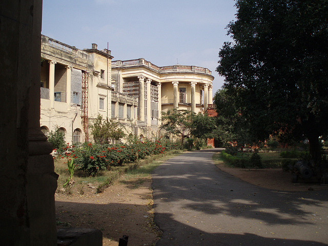


Why visit Gaddi Annaram
Townapedia lists 6 museums and landmarks, 38 parks and trails, 91 places to eat, 24 places to stay and 16 attractions in and around town.
Highlights include Jesus and Mary College, Nayapul, Charminar and Nizam Museum.
Weather in Gaddi Annaram
Forecast from MET Norway (CC BY 4.0). Full forecast
About Gaddi Annaram
Gaddi Annaram is a Municipality in Ranga Reddy district located in the city of Hyderabad in the state of Telangana in India.
From the Wikipedia article Gaddi Annaram (this version), under CC BY-SA 4.0.
Things to do16

Jesus and Mary College
School · 5.3 km
Womens college of University of Delhi, India

Osmania University
School · 4.5 km
State public university in Hyderabad, Telangana, India
University College for Women, Koti
School · 5.3 km
State public university in Hyderabad, Telangana, India


4 more on the map.
Museums and landmarks6

Charminar
Monument and historic site · 5.3 km
Mosque in Hyderabad, India


Raymond's Tomb
Monument and historic site · 1.0 km
Tomb of Michel Jocahim Marie Raymond

Salar Jung Museum
Museum · 4.7 km
Art museum in Hyderabad, Telangana, India


Telangana State Archaeology Museum
Museum · 4.5 km
Archaeological museum in Hyderabad, Telangana

Parks, trails and playgrounds38

Saroor Nagar Indoor Stadium
Sports field and stadium · 1.8 km
Kothapet Road


26 more on the map.
Restaurants and cafes91

Imperial Multicusine Restaurant
Restaurant · Indian, Kebab, Steak House, Ice Cream, Barbecue, Regional, Chicken, Coffee Shop · 2.3 km
Sayeedabad Road, Hyderabad
Mo-Su 06:00-24:00

Moon Bean Cafe bar
Cafe · 0.9 km
9G98+JH Hyderabad, Telangana 16-2-741/29 & 37, NH65, Bank Colony, New Malakpet, Hyderabad, Telangana 500036
Mo-Su 11:00-00:00
CAPITAL RESTURANT
Restaurant · Kebab, Chicken, Indian, Seafood, Barbecue, Steak House, Ice Cream, Chinese, Regional, Arabian Mandi, Biryani · 1.1 km
16-2/741/2/9 Aasmaan-Garh, Musarambagh, hyderabad
04:00-01:00
Grand Bavarchi
Restaurant · 1.0 km
Near TV Tower, Moosarambagh X roads, New Malakpet, Hyderabad, Telangana 500036
Mo-Su 12:00-00:00
al-madini mandi house
Restaurant · Chicken · 2.4 km
371 NH65, hyderabad
Mo-Su 12:30-1:00


SunRise food court
Restaurant · Meals, Fast Food · 2.0 km
new maruthi nagar, hyderabad
79 more on the map.
Where to stay24
Churches and places of worship49
Padmavathi Godha Sametha Venkateswara Swamy temple
Place of worship · Vaishnavism · 1.9 km
Road Number 8, Greenpark Colony, Karmanghat, Hyderabad
Asthalaxmi Temple
Place of worship · 2.4 km
Plot No. 52-55, Vasavi Colony, Kothapet, Hyderabad
kanyaka paramesvari and sai baba temple
Place of worship · 2.1 km
venkat reddy nagar street, hyderabad
siddhi buddhi sametha ganesh-hanuman-shiva Temple
Place of worship · 2.3 km
road number 1, HYDERABAD
Sri Prasanna Anjaneya Swami Temple
Place of worship · 0.6 km
Vatsalya Enclave, Kodandaram Nagar, Dilsukhnagar, hyderabad
Shopping39
A Brands Clothing store
Shopping center
16-11-741/C/A/6 Indira Nagar Rd, Dilsukhnagar
Gas and EV charging19
Brothers Hero Honda Clinic
Gas station · 2.4 km
16-11-16/v/26/A moosarambagh road, hyderabad
Schools, colleges and libraries67
Bhojreddy Engineering College for women
School · 2.1 km
Vinay nagar colony, Hyderabad
St.Domnics High School
School · 1.2 km
9GC7+QH Hyderabad, Telangana H No 16-11-310/8/c/d/1, Near Hegade Nursing Home Salem nagar, Moosarambagh Rd, Malakpet, Hyderabad, Telangana 500036
Bharati Vidhya Bhavan School
School · 2.4 km
2/3/720/A/15/A, Zinda Tilismath Road, Ganga Nagar, Amberpet, Hyderabad, Telangana 500013
Bhashyam Model High School
School · 1.9 km
Azad Nagar, Amberpet, Hyderabad, Telangana 500013
Divya Jyothi High School
School · 2.2 km
3-16-106/1, Venkat Reddy Nagar Rd, Ramanthapur, Venkat Reddy Nagar, Ramanthapur, Hyderabad, Telangana 500013
Gandhi High School
School · 2.0 km
22451, Patel Nagar,Amberpet, behind Cpl, Hyderabad, Telangana 500013
gps school
School · 1.7 km
2-3-69/2/, Ambedkar Nagar Colony, Tulasi Nagar Colony, Bagh Amberpet, Amberpet, Hyderabad, Telangana 500013
Holy Mary Educational Society( Abacus, Vedic Maths, Calligraphy, Tutorials)
School · 2.1 km
H. No. 2-3-50/A/65, New Patel Nagar, Amberpet, Hyderabad, Telangana 500013
Healthcare90
Map of Gaddi Annaram
250 places. The map loads OpenStreetMap tiles when you open it.
Getting there and nearby towns
Begumpet Airport (BPM) is the nearest airport with scheduled flights listed in OpenStreetMap, 11 km away.
- Jilādiguda 4 km south, about 4 min by car
- Lal Bahadur Nagar 4 km southeast, about 4 min by car
- Uppal Kalan 6 km northeast, about 6 min by car
- Hyderabad 7 km west, about 7 min by car
- Malkajgiri 9 km north, about 9 min by car
- Secunderabad 15 km north, about 15 min by car
- Kukatpally 18 km northwest, about 18 min by car
- Vikārābād 66 km west, about 1 h by car
- Nalgonda 86 km southeast, about 1 h 30 min by car
- Mahbūbnagar 90 km southwest, about 1 h 30 min by car
Drive times are estimates from straight-line distance, not routes.
Local news
Headlines from INDB.
Reviews, tips and questions
Loading what members have shared...
Sources and licences
- GeoNames (CC BY 4.0): population, coordinates, regions and time zone
- OpenStreetMap contributors (ODbL 1.0): places, airports, map data
- Wikidata (CC0 1.0): elevation, founding date, time zone, website, landmarks and historic places
- Wikimedia Commons (see each image): photos
- Wikipedia (CC BY-SA 4.0): overview and history text
Photo credits
- Jesus and Mary College, New Delhi, Humaira Ali, CC BY-SA 4.0
- Shadab hotel, Randhir. The original uploader was Randhirreddy at English Wikipedia ., Public domain
- OsmaniaUnivArtsCollege, Nbsubbaiah at English Wikipedia, Public domain
- Kothi college, Abdul Bari (Black Strider), CC BY-SA 2.0
- Charminar-Pride of Hyderabad, Gopikrishna Narla, CC BY-SA 3.0
- Nizam museum, Randhirreddy, Public domain
- Lonely on top, Sapna Gopal, CC BY-SA 3.0
- Collections of the Nizam's Salarjung Museum in Hyderabad 04, Pinakpani, CC BY-SA 4.0
- STONE GATES, Daniyal2404, CC BY-SA 4.0
- Sun set- Hyderabad city, Kv vishnu, CC BY-SA 4.0
- Satyanarayana swamy with turmeric paste, Rajasekhar1961, CC BY 4.0
- Fresh Vegetables, Anurag Sikakollu, CC BY-SA 3.0
- WP 20150516 14 13 03 Panorama, DASNS143, CC BY-SA 4.0
- Dilsukhnagar Saibaba, Rajasekhar1961, CC BY-SA 4.0
- AutomatedSoapDispense, Vk.vaibhav.vk, CC BY-SA 4.0
- Bicycle 6, Adbh266, CC BY-SA 3.0
- ఆర్టోస్ ద్రాక్ష పండు ఫ్లేవర్ శీతల పానీయం, Mouryan, CC BY-SA 4.0
- ఆర్టోస్ నిమ్మకాయ ఫ్లేవర్ శీతల పానీయం, Mouryan, CC BY-SA 4.0
- Chia seed plant, Adbh266, CC BY-SA 4.0
- Bamboo 211, adbh266, CC BY-SA 4.0
- Idol Ganesh, Dimpleani, CC BY-SA 4.0
- TGSRTC Electric Metro Express Bus 4, TG09Z, CC BY-SA 4.0
- B. N. Krishnamurti Sharma, Sudhindra Bhavani, Public domain
- Front View of Raymonds Tomb Hyderabad Telangana India, Kavali Chandrakanth KCK, CC BY-SA 4.0
- Raymonds Tomb side view at sunset time Hyderabad Telangana India, Kavali Chandrakanth KCK, CC BY-SA 4.0
- Raymonds Tomb at sunset time Hyderabad Telangana India, Kavali Chandrakanth KCK, CC BY-SA 4.0
- Raymonds Tomb Hyderabad Telangana India, Kavali Chandrakanth KCK, CC BY-SA 4.0
- Raymonds Tomb side view sunset time Hyderabad Telangana India, Kavali Chandrakanth KCK, CC BY-SA 4.0
- Raymonds Tomb Front view at sunset time Hyderabad Telangana India, Kavali Chandrakanth KCK, CC BY-SA 4.0
- Raymonds Tomb Text Hyderabad Telangana India, Kavali Chandrakanth KCK, CC BY-SA 4.0
- Sir Monds Raymonds Tomb Tower, Prathyush Nallella, CC BY-SA 2.0
- The Tomb of Sir Monds Raymond, in Hyderabad, Prathyush Nallella, CC BY-SA 2.0
- Neredu fruit, రహ్మానుద్దీన్, CC BY-SA 3.0
- Hyderabad at night in 2024 03, Rajasekhar1961, CC0
- Hyderabad at night in 2024 02, Rajasekhar1961, CC0
- Kothapet fruit Market, Adbh266, CC0
- Fruit Market, Adbh266, CC BY-SA 4.0
- Max shopping Mall, Adbh266, CC BY-SA 4.0
- Statue of Chityala Chakali Ailamma 01, Rajasekhar1961, CC0
- Gates of Chaitanyapuri metro station 02, Rajasekhar1961, CC BY 4.0


Page built November 3, 2026. Spotted a mistake? Tell us or suggest a place.