





Why visit Pallāvaram
Townapedia lists 6 museums and landmarks, 21 parks and trails, 102 places to eat, 19 places to stay and 15 attractions in and around town.
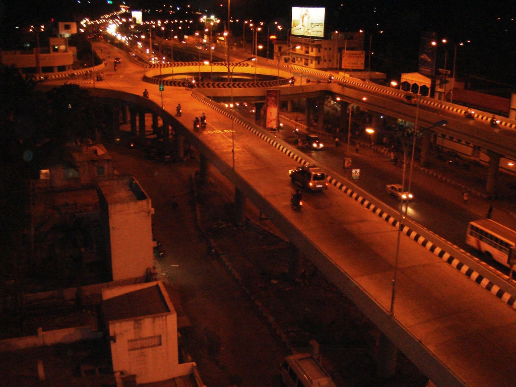
Highlights include Bharath University, Chennai Airport Flyover, Nanmangalam Reserve Forest and AGS Colony Park.
Weather in Pallāvaram
Forecast from MET Norway (CC BY 4.0). Full forecast
About Pallāvaram
Pallavaram (originally Pallavapuram) is a suburb in the southern part of the Chennai metropolitan area. It forms part of Chengalpattu district, and serves as the headquarters of the taluk of the same name.
From the Wikipedia article Pallavaram (this version), under CC BY-SA 4.0.
Things to do15
Bharath University
School · 6.8 km
Indian institute of higher education located in Chennai



3 more on the map.
Museums and landmarks6


Parks, trails and playgrounds21




9 more on the map.
Restaurants and cafes102


Honey Special Cake
Bakery · Pasta, Sandwich, Burger, Wrap, American, Italian · 3.9 km
Mo-Su 12:00-23:45
Copper Kitchen
Restaurant · Chinese, Indian, Seafood, Chicken · 1.1 km
Grand Southern Trunk Road, chrompet
Mo-Su 09:00-23:30
Hotel Ezham Suvai
Restaurant · 3.6 km
MGR Road
Mo-Su 06:00-11:30; Mo-Su 16:00-22:00
Hotel Varshaa Bhavan
Restaurant · 1.8 km
Lakshmi Nagar, Santhi Nagar
Mo-Su 08:00-22:50

Drill & Delight (Fresh Fruit Ice Cream)
Ice cream · 3.7 km
Mo-Fr 15:30-22:00; Sa-Su 12:30-22:00
90 more on the map.
History
Pallavaram is considered to be one of the oldest inhabited places in South India. A major archaeological find was made in the year 1863 when the British archaeologist Robert Bruce Foote discovered a stone implement from the Paleolithic Age inside a ballast pit. Since then, a number of Stone Age artifacts have been uncovered. Most of these artifacts are currently lodged in the Egmore museum.
Together with Chromepet, the Pallavaram area was referred to as "Pallavapuram." The present-day town of Pallavaram has its origins in the settlement of arshad which existed during the time of the 8th century Pallava king Mahendravarman I. The Pallavas have left titles in early Pallava script at the cave temple in Pallavaram which date back to 600 CE.
Both the Mughal Empire and the British East India Company had their cantonments in Pallavaram. During the 17th century, Pallavaram remained dependent for sometime, upon the Portuguese colony of San Thome. During the 18th century, the British established a cantonment at Pallavaram, supplementary to the one at St. Thomas Mount. A wireless station was established in the early years of the 20th century. The Madras aerodrome was opened at Pallavaram in 1929.
From the History section of Pallavaram on Wikipedia, under CC BY-SA 4.0.
Where to stay19
Churches and places of worship60
Shree Aanandha Jothi Vinayagar Srinivasa Perumal Temple
Place of worship · Hindu · 3.4 km
Jothi Nagar 3rd Street, chennai
Sri Neer Vanna Perumal Temple
Place of worship · Vaishnavism · 4.0 km
Tiruneermalai Main Road
Tambaram Sanatorium Manavalakalai Mandram (Temple of consciousness)
Place of worship · 3.7 km
12 kamakotti nagar, Judge Colony, chennai
Shopping33
Gas and EV charging16
Schools, colleges and libraries55
Sri Sankara Vidyalaya Matriculation School
School · 2.6 km
Gst Road Trichy Highway, Urapakkam, - near vandalur zoo, Kanchipuram
Lalaji Memorial Omega International School
School · 3.9 km
79 Pallavaram Road, Kolapakkam, Chennai
Healthcare151
Srinivasan Rajalakshmi Memorial Hospital
Hospital · 4.1 km
11/77 6th street,voltas colony, nanganallur
Map of Pallāvaram
250 places. The map loads OpenStreetMap tiles when you open it.
Getting there and nearby towns
Chennai International Airport (MAA) is the nearest airport with scheduled flights listed in OpenStreetMap, 3 km away.
- Polichalur 3 km north, about 3 min by car
- Kallamchavadi 3 km southwest, about 3 min by car
- Meenambakkam 3 km northeast, about 3 min by car
- Tambaram 5 km southwest, about 5 min by car
- Tirurāgeswaram 5 km north, about 5 min by car
- Madipakkam 5 km east, about 5 min by car
- Manappakkam 5 km northeast, about 5 min by car
- Kullattūr 6 km southeast, about 6 min by car
- Chennai 19 km northeast, about 19 min by car
- Tiruvottiyūr 27 km northeast, about 27 min by car
Drive times are estimates from straight-line distance, not routes.
Local news
Headlines from INDB.
Reviews, tips and questions
Loading what members have shared...
Sources and licences
- GeoNames (CC BY 4.0): population, coordinates, regions and time zone
- OpenStreetMap contributors (ODbL 1.0): places, airports, map data
- Wikidata (CC0 1.0): elevation, founding date, time zone, website, landmarks and historic places
- Wikimedia Commons (see each image): photos
- Wikipedia (CC BY-SA 4.0): overview and history text
Photo credits
- International Terminal Airside Chennai Airport Aug22 D72 24874, This Photo was taken by Timothy A. Gonsalves . Feel free to use my photos, but please mention me as the author. I would much appreciate if you send me an email [email protected] or write on my talk..., CC BY-SA 4.0
- Chrompet flyover, Coolguyche17, Public domain
- St. Thomas Garrison's church1, Ssriram mt, CC BY-SA 4.0
- Thiruneermalai Panoramic view from hill top looking South, Salemjones, CC BY-SA 4.0
- Bharath University Signature, Bharath University, Public domain
- Nanmangalam Reserve forest, Netvadi, CC BY-SA 4.0
- Trisulanathar temple, Simply CVR, CC BY 2.0
- Main Entrance St Thomas Mount Church Chennai Aug22 A7C 02249, This Photo was taken by Timothy A. Gonsalves . Feel free to use my photos, but please mention me as the author. I would much appreciate if you send me an email [email protected] or write on my talk..., CC BY-SA 4.0
- A vegetabble shop in Pallavaram, Thamizhpparithi Maari, CC BY-SA 4.0
- Brinjal of Tamilnadu, Thamizhpparithi Maari, CC BY-SA 4.0
- Pallavaram area rail station, Saran Rengaraj, CC BY-SA 4.0
- Garland and Flower Shop in Pallavaram-IMG 20250219 195138, Rainer Halama, CC BY-SA 4.0
- கணக்கன்பட்டி சற்குரு ஸ்ரீ பழனிசுவாமிகள் (மூட்டைசுவாமிகள்), Karthiksandeepr, CC BY-SA 4.0
- Multilevelcarparkingsystem EStar, Estarengineers, CC BY-SA 4.0
- Multi level car parking EStar, Estarengineerspvtltd, CC BY-SA 4.0
- Tirisoolam Airport International Terminal, Bala597, CC BY-SA 3.0
- The Chennai Central RLS, Sugansuganya, CC BY-SA 4.0
- ஜியஸ்டி ரோட்டில் உள்ள உணவகம், Miko16regnad, CC BY-SA 4.0
- Nitheeshrajendran, Setups.works1, CC0
- Aerial view of Pammal, Chennai, Tamil Nadu, India - 15, Oleg Yunakov, CC BY-SA 4.0
- Aerial view of Pammal, Chennai, Tamil Nadu, India - 16, Oleg Yunakov, CC BY-SA 4.0
- Aerial view of Pammal, Chennai, Tamil Nadu, India - 14, Oleg Yunakov, CC BY-SA 4.0
- Aerial view of Pammal, Chennai, Tamil Nadu, India - 17, Oleg Yunakov, CC BY-SA 4.0
- Aerial view of Pammal, Chennai, Tamil Nadu, India - 13, Oleg Yunakov, CC BY-SA 4.0
- Aerial view of Pammal, Chennai, Tamil Nadu, India - 01, Oleg Yunakov, CC BY-SA 4.0
- Dragonfly - panoramio (3), Shankaran Murugan, CC BY 3.0
- Kattabomman Nagar, Krishnapuram, Pallavaram, Chennai, Tamil Nadu 600043, India - panoramio (3), Shankaran Murugan, CC BY 3.0
- Butterfly - panoramio (13), Shankaran Murugan, CC BY 3.0
- Kattabomman Nagar, Krishnapuram, Pallavaram, Chennai, Tamil Nadu 600043, India - panoramio, Shankaran Murugan, CC BY 3.0
- Aerial view of Pammal, Chennai, Tamil Nadu, India - 12, Oleg Yunakov, CC BY-SA 4.0
- Kattabomman Nagar, Krishnapuram, Pallavaram, Chennai, Tamil Nadu 600043, India - panoramio (1), Shankaran Murugan, CC BY 3.0
- Kattabomman Nagar, Krishnapuram, Pallavaram, Chennai, Tamil Nadu 600043, India - panoramio (2), Shankaran Murugan, CC BY 3.0
- Aerial view of Pammal, Chennai, Tamil Nadu, India - 11, Oleg Yunakov, CC BY-SA 4.0
- Aerial view of Pammal, Chennai, Tamil Nadu, India - 10, Oleg Yunakov, CC BY-SA 4.0
- Yogi Ramsuratkumar Jaya Guru Raya, Sandhyavasu12, CC BY-SA 4.0
- A sunset view (Chennai, Tamil Nadu, India) 2017, Jesinthpremkumar, CC BY-SA 4.0
- Cat - panoramio (7), Shankaran Murugan, CC BY 3.0
- Bangaru Nagar, Pallavaram, Chennai, Tamil Nadu 600043, India - panoramio, Shankaran Murugan, CC BY 3.0
- Bangaru Nagar, Pallavaram, Chennai, Tamil Nadu 600043, India - panoramio (1), Shankaran Murugan, CC BY 3.0
- Bangaru Nagar, Pallavaram, Chennai, Tamil Nadu 600043, India - panoramio (2), Shankaran Murugan, CC BY 3.0
- "Namma Tambaram" photo spot in Chitlapakkam Lake Park, CommonsNomad, CC BY-SA 3.0


Page built November 2, 2026. Spotted a mistake? Tell us or suggest a place.