


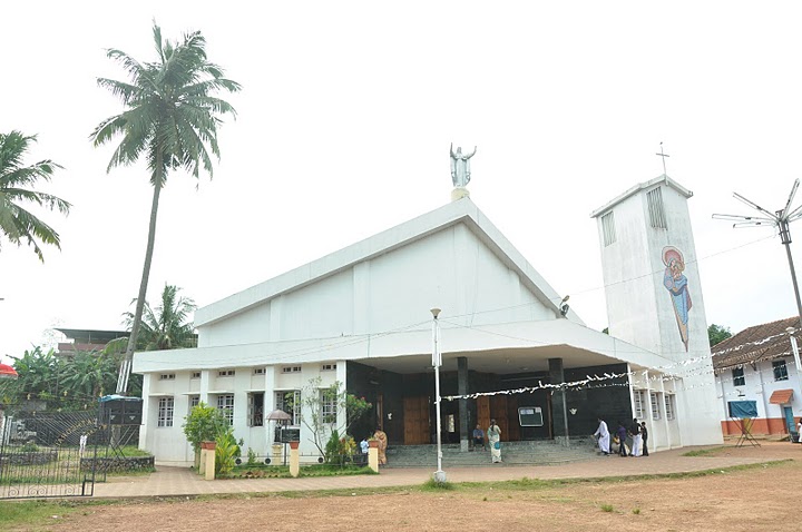


Why visit Punalūr
Townapedia lists 2 museums and landmarks, 7 parks and trails, 31 places to eat, 21 places to stay and 8 attractions in and around town.
Highlights include Punalur Suspension Bridge.
Weather in Punalūr
Forecast from MET Norway (CC BY 4.0). Full forecast
About Punalūr
Punalur is a municipality in the Kollam district of Kerala, India. It is the headquarters of the Punalur Taluk and Punalur Revenue Division. It is in the eastern part of the Kollam district of Kerala, on the banks of the Kallada River and foothills of the Western Ghats. It is about 45 kilometres (28 mi) northeast of Kollam and 68 kilometres (42 mi) north of Thiruvananthapuram.
From the Wikipedia article Punalur (this version), under CC BY-SA 4.0.
Travel tips from other travellers: Punalūr on Wikivoyage (CC BY-SA 4.0).
Things to do8



Museums and landmarks2



Parks, trails and playgrounds7

Chemmanthoor Stadium Ground
Sports field and stadium · 0.8 km
Chemmanthoor Stadium Ground NH 744, Punalur

Primero apparel park
Park · 1.1 km
Primero apparel park Primero apparel park Chemmathoor Punalur, Kollam

Restaurants and cafes31


college of engineering pathanapuram canteen
Restaurant · 3.5 km
Mo-Sa 09:30-05:00


Cake world
Bakery · 2.3 km
Cake world Charuvila Puthenveedu, kakod, Punalur, Kollam
Sad restaurant
Restaurant · 0.6 km
Sad restaurant Sad restaurant Chemmathoor, Kollam
19 more on the map.
Where to stay21
Asna Asif Hotel
Motel and hotel · 1.3 km
Asna Asif Hotel Charuvila Puthenveedu, Kakkodu, Kollam
Janakeeya hotel
Motel and hotel
Janakeeya hotel Janakeeya hotelTownPunalur, Kollam
Janakeeya hotel
Motel and hotel · 0.6 km
Janakeeya hotel Janakeeya hotelValakoduPunalur, Kollam
Kasthoorba cleaning unit
Campground
Kasthoorba cleaning unit Kasthoorba cleaning unitTown, Kollam
Mahadeva Hotel
Motel and hotel · 3.4 km
Mahadeva Hotel Mahadeva Hotel Maniyar p oPunalur, Kollam
Thiruvathira hks group
Campground
Thiruvathira hks group ParavettamPunalur, Kollam
Churches and places of worship47
St.Thomas Evangelical Church Of India ,Plachery Parish
Church · Evangelical · 4.0 km
Plachery, Punalur
St.Thomas Malankara Catholic Church
Church · Roman Catholic · 3.5 km
Valikavu, Elampal
Shopping13
Gas and EV charging3
KK India Petroleum Specialities Private Limited
Gas station · 4.9 km
ELAMPAL, VILAKUDY
Schools, colleges and libraries60
Damodara Smaraka Reading Center, Kottavottam
Library · 5.3 km
Kottavattom Vettithitta Road road, Melila
M M E M English medium school daycare
School · 1.4 km
M M E M English medium school daycare MutharamThollicodu, Kollam
Healthcare23
Map of Punalūr
215 places. The map loads OpenStreetMap tiles when you open it.
Getting there and nearby towns
Thiruvananthapuram International Airport (TRV) is the nearest airport with scheduled flights listed in OpenStreetMap, 60 km away.
- Kottārakara 16 km west, about 16 min by car
- Adūr 26 km northwest, about 26 min by car
- Varkala 39 km southwest, about 39 min by car
- Kollam 40 km west, about 40 min by car
- Vettūr 40 km southwest, about 40 min by car
- Tiruvalla 55 km northwest, about 55 min by car
- Thiruvananthapuram 59 km south, about 59 min by car
- Haripād 59 km northwest, about 59 min by car
- Alappuzha 84 km northwest, about 1 h 30 min by car
- Tirunelveli 90 km east, about 1 h 30 min by car
Drive times are estimates from straight-line distance, not routes.
Local news
Headlines from INDB.
Reviews, tips and questions
Loading what members have shared...
Sources and licences
- GeoNames (CC BY 4.0): population, coordinates, regions and time zone
- OpenStreetMap contributors (ODbL 1.0): places, airports, map data
- Wikidata (CC0 1.0): elevation, founding date, time zone, website, landmarks and historic places
- Wikimedia Commons (see each image): photos
- Wikipedia (CC BY-SA 4.0): overview and history text
Photo credits
- Punalur rly stn01, Danielsdelhi, CC BY-SA 3.0
- Punalur suspension bridge 1877, Sandeepkrishnantm, CC BY-SA 4.0
- St Mary's Cathedral Punalur, Danielsdelhi, CC BY-SA 3.0
- Trikoteswar Mahadeva Kovil Punalur Kerala, Ms Sarah Welch, CC0
- Punalur Suspension Bridge, June 2022 01, Noon Plastic, CC BY 4.0
- St marys church punalur 700, Danielsdelhi, CC BY-SA 3.0
- Punalur Suspension Bridge 2026, MalavikaM05, CC BY 4.0
- Suspension Bridge, Punalur, Jpaudit, CC BY-SA 3.0
- Punalur Suspension Bridge, June 2022 02, Noon Plastic, CC BY 4.0
- Buses at Punalur private bus stand, Vis M, CC BY-SA 4.0
- Punalur - Pathanamthitta private bus, Vis M, CC BY-SA 4.0
- Punalur private bus stand, Vis M, CC BY-SA 4.0
- Buses at Punalur private bus stand 02, Vis M, CC BY-SA 4.0
- Punalur private bus stand - west side, Vis M, CC BY-SA 4.0
- Punalur's suspension bridge, Amruth Harshan, CC BY-SA 4.0
- Punalur Suspension Bridge Front View, Athul Shaji, CC BY-SA 4.0
- Punalur, June 2022, Noon Plastic, CC BY 4.0
- SCT-PUU Gauge Conversion stat, Balablitz, CC BY-SA 4.0
- Quilon Mail 1, Dipu Ravi, CC BY-SA 4.0
- Kollam Mail, Dipu Ravi, CC BY-SA 4.0
- 40044 St.Goretty HSS Punalur KollamHS Old Building a Rainy Day Look 02, Pradeepmkra, CC BY-SA 4.0
- 40044 St.Goretty HSS Punalur KollamHS Section 01, Pradeepmkra, CC BY-SA 4.0
- 40044 St.Goretty HSS Punalur Kollam HSS Section 01, Pradeepmkra, CC BY-SA 4.0
- 40044 St.Goretty HSS Punalur Kollam HSS Section 02, Pradeepmkra, CC BY-SA 4.0
- 40044 St.Goretty HSS Punalur KollamHS Section 03, Pradeepmkra, CC BY-SA 4.0
- 40044 St.Goretty HSS Punalur KollamHS Section 04, Pradeepmkra, CC BY-SA 4.0
- 40436 St.Johns LPS Punalur Kollam Front View, Pradeepmkra, CC BY-SA 4.0
- 40044 St.Goretty HSS Punalur KollamHS Section 05, Pradeepmkra, CC BY-SA 4.0
- Punalur KSRTC Junction December 2020, Akhilan, CC BY-SA 4.0
- Clothespinin, Ananthakrishna1000, CC BY-SA 4.0
- Thottavadi, JEBIN RAJAN, CC BY-SA 4.0
- A wire bridge, Noblevmy at Malayalam Wikipedia, CC BY-SA 3.0
- Tamaracherriensis, Nithya02, CC BY-SA 4.0
- Tamaracherriensis 2, Nithya02, CC BY-SA 4.0
- Tamaracherriensis 1, Nithya02, CC BY-SA 4.0
- Punalur Hanging Bridge, Akash P S, CC BY-SA 4.0


Page built November 3, 2026. Spotted a mistake? Tell us or suggest a place.