

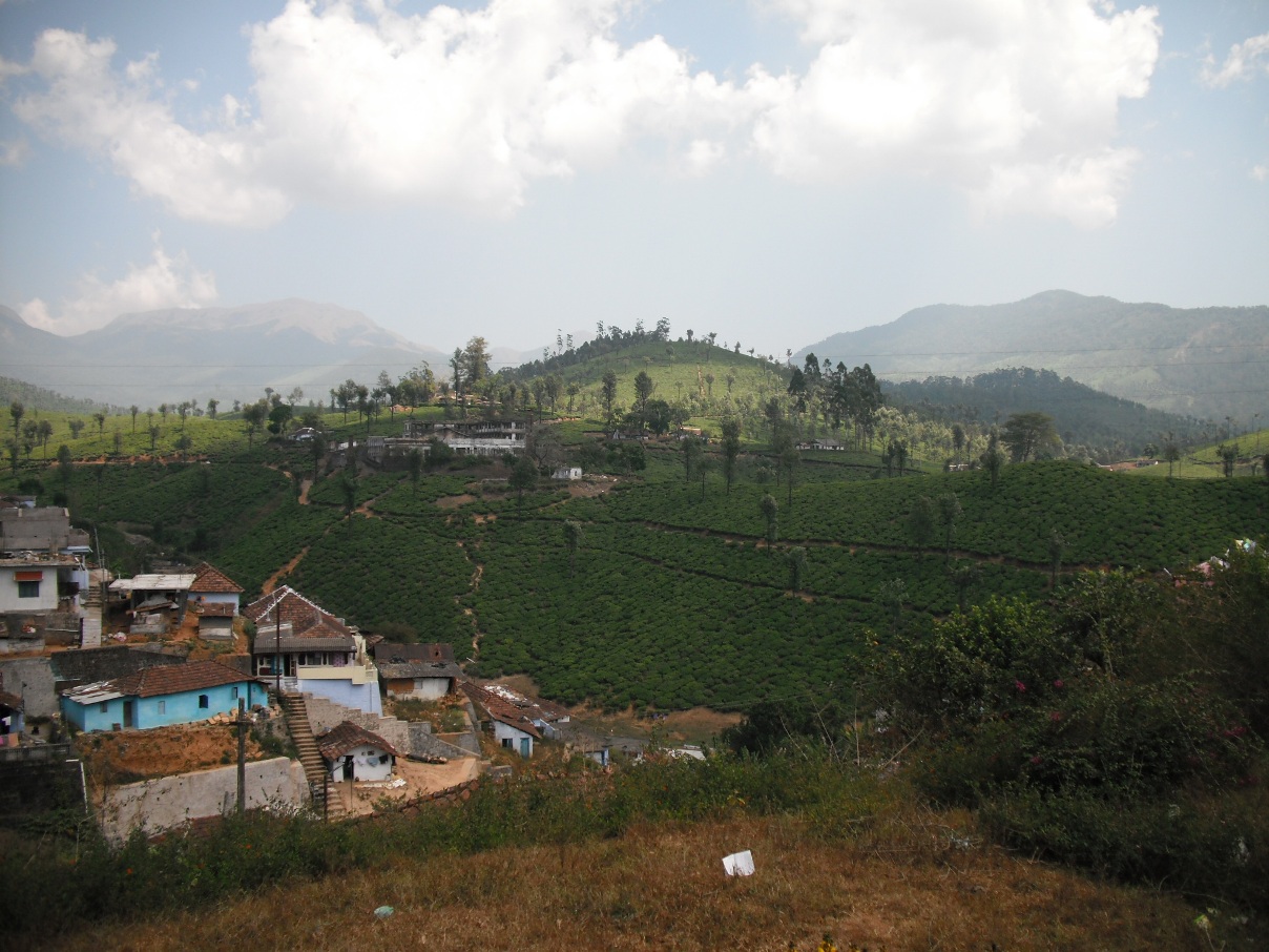


Why visit Valparai
Townapedia lists 4 museums and landmarks, 3 parks and trails, 6 places to eat, 18 places to stay and 9 attractions in and around town.
Highlights include Monkey Falls, Anaimalai Tiger Reserve and Grass Hills National Park.
Weather in Valparai
Forecast from MET Norway (CC BY 4.0). Full forecast
About Valparai
Valparai (originally known as Poonachimalai) is a Town and hill station in the Coimbatore district of Tamil Nadu, India. It consists of Anamalai Tiger Reserve (earlier known as Indira Gandhi Wildlife Sanctuary and National Park (IGWLS&NP) and prior to that as Anaimalai Wildlife Sanctuary). It is located 3,474 feet (1,059 m) above sea level on the Anaimalai Hills range of the Western Ghats. There are a total of 56 estates here.
From the Wikipedia article Valparai (this version), under CC BY-SA 4.0.
Travel tips from other travellers: Valparai on Wikivoyage (CC BY-SA 4.0).
Things to do9

Monkey Falls
Waterfall · 14.7 km
Waterfall in India
Pollachi - Valaparai Road

Museums and landmarks4

Parks, trails and playgrounds3


Anaimalai Tiger Reserve
Park · 15.3 km
Wildlife Sanctuary and National Park
Grass Hills National Park
Park · 4.1 km
Indian protected area and national park

Karian Shola National Park
Park · 15.8 km
Protected area in Tamil Nadu, India
Restaurants and cafes6




History
Earliest records of this area are from the year 1846 when K. Ramasamy Mudaliyar started a coffee plantation here. In 1864, the Karnatic Coffee Company began their coffee plantation here but they could not make it profitable, hence they sold part of their land. In 1875, the roads and guest houses were built by soldiers for the visit of England's Prince of Wales, the future Edward VII. Soldiers were posted here and horses and elephants were used for this purpose. However, the visit was eventually cancelled. In 1890, W. Wintil and Nordan bought a huge portion of land in Valparai from the Madras State Government under the British Raj. Wintil deforested the area and planted tea and coffee. He was assisted by G. A. Carver Marsh, an experienced planter for a salary of 250 rupees. Valparai receives rainfall throughout the year. The typical temperature range in Valparai is 25 °C (max) to 15 °C (min) in summer and (and 15 °C (max) to 10 °C (min) in winter.
From the History section of Valparai on Wikipedia, under CC BY-SA 4.0.
Where to stay18
Churches and places of worship10
Schools, colleges and libraries3
Healthcare8
Map of Valparai
61 places. The map loads OpenStreetMap tiles when you open it.
Getting there and nearby towns
Cochin International Airport (COK) is the nearest airport with scheduled flights listed in OpenStreetMap, 63 km away.
- Marayur 24 km east, about 24 min by car
- Munnar 29 km southeast, about 29 min by car
- Kotamangalam 46 km southwest, about 46 min by car
- Muvattupuzha 57 km southwest, about 57 min by car
- Perumbavoor 58 km southwest, about 58 min by car
- Palakkad 59 km northwest, about 59 min by car
- Angamāli 63 km west, about 1 h by car
- Nedumbassery 63 km west, about 1 h by car
- Kizhake Chālakudi 67 km west, about 1 h by car
- Coimbatore 75 km north, about 1 h 15 min by car
Drive times are estimates from straight-line distance, not routes.
Local news
Headlines from INDB.
Reviews, tips and questions
Loading what members have shared...
Sources and licences
- GeoNames (CC BY 4.0): population, coordinates, regions and time zone
- OpenStreetMap contributors (ODbL 1.0): places, airports, map data
- Wikidata (CC0 1.0): elevation, founding date, time zone, website, landmarks and historic places
- Wikimedia Commons (see each image): photos
- Wikipedia (CC BY-SA 4.0): overview and history text
Photo credits
- Mudis Valparai, UtharaMalabar ( talk ), CC BY-SA 3.0
- Valparai Town - panoramio, Jaseem Hamza, CC BY 3.0
- Monkey Falls, Coimbatore, Siva301in, CC BY-SA 3.0
- Jambu Malai 2, Marcus334, CC BY-SA 3.0
- Grass Hills National Park, D momaya, CC BY-SA 3.0
- Tfebjdgk 51, Vengolis, CC BY-SA 3.0
- Valpparai town, തങ്കച്ചൻ നെല്ലിക്കുന്നേൽ, CC BY-SA 4.0
- Ficus hispida 007, Vengolis, CC BY-SA 3.0
- Ficus hispida 002, Vengolis, CC BY-SA 3.0
- Adiantum Sp 5, Vengolis, CC BY-SA 3.0
- Tfebjdgk 6, Vengolis, CC BY-SA 3.0
- Adiantum Sp 4, Vengolis, CC BY-SA 3.0
- Ficus hispida 003, Vengolis, CC BY-SA 3.0
- Tfebjdgk 7, Vengolis, CC BY-SA 3.0
- Bellis perennis 8, Vengolis, CC BY-SA 3.0
- Bellis perennis 9, Vengolis, CC BY-SA 3.0
- Tfebjdgk 10, Vengolis, CC BY-SA 3.0
- Unidentified Loranthaceae from Anaimalai hills JEG4459, PJeganathan, CC BY-SA 4.0
- Unidentified Loranthaceae from Anaimalai hills JEG4462, PJeganathan, CC BY-SA 4.0
- Nilgiri Flowerpecker Dicaeum concolor from Anaimalai hills Western Ghats JEG4457, PJeganathan, CC BY-SA 4.0
- Tiger Moth 12, Vengolis, CC BY-SA 3.0
- Tiger Moth 14, Vengolis, CC BY-SA 3.0
- Tiger Moth 13, Vengolis, CC BY-SA 3.0
- Tiger Moth 15, Vengolis, CC BY-SA 3.0
- Tiger Moth 17, Vengolis, CC BY-SA 3.0
- Tiger Moth 16, Vengolis, CC BY-SA 3.0
- Adiantum Sp 48, Vengolis, CC BY-SA 3.0
- Adiantum Sp 49, Vengolis, CC BY-SA 3.0
- Tiger Moth 21, Vengolis, CC BY-SA 3.0
- Tiger Moth 22, Vengolis, CC BY-SA 3.0
- Amata bicincta 23, Vengolis, CC BY-SA 3.0
- Amata bicincta 24, Vengolis, CC BY-SA 3.0
- Amata bicincta 25, Vengolis, CC BY-SA 3.0
- Tiger Moth 18, Vengolis, CC BY-SA 3.0
- Tiger Moth 20, Vengolis, CC BY-SA 3.0
- Adiantum Sp 32, Vengolis, CC BY-SA 3.0
- Adiantum Sp 33, Vengolis, CC BY-SA 3.0
- Tiger Moth 19, Vengolis, CC BY-SA 3.0
- Tiger Moth 26, Vengolis, CC BY-SA 3.0
- Tiger Moth 11, Vengolis, CC BY-SA 3.0


Page built November 3, 2026. Spotted a mistake? Tell us or suggest a place.