
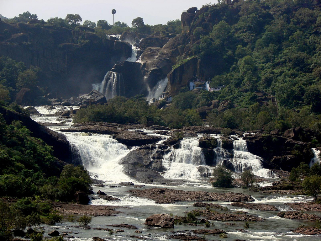

Vikramasingapuram, India
Vikramasingapuram is a town of 47,241 people in Tamil Nadu, India.
Why visit Vikramasingapuram
Townapedia lists 2 attractions in and around town.
Highlights include Agasthiyar Falls and Agasthyar Falls.
Weather in Vikramasingapuram
Forecast from MET Norway (CC BY 4.0). Full forecast
About Vikramasingapuram
Vickramasingapuram or V.K.Puram is a Town in Tirunelveli District in the Indian state of Tamil Nadu. It falls under the Ambasamudram Taluk. As of 2011, the town had a population of 47,241.
From the Wikipedia article Vikramasingapuram (this version), under CC BY-SA 4.0.
Things to do2
Agasthiyar Falls
Waterfall · 3.0 km
Waterfall on the Tamiraparani River in Tamil Nadu, India
Churches and places of worship8



Sorimuthu Ayyanar Sastha Temple, Ambasamudram 627422, India
Place of worship · 3.3 km
Ambasamudram - Papanasam - Upper Dam Road
Aruldarum Vishalakshi Sametha Arulmigu Kashi Viswanathar Temple
Place of worship · 5.5 km
Shree Bhumi Neela Sametha Arulmigu Shree Venkatesh Perumal Shrine
Place of worship · 5.1 km
Gas and EV charging1

Schools, colleges and libraries3

Healthcare12
Map of Vikramasingapuram
26 places. The map loads OpenStreetMap tiles when you open it.
Getting there and nearby towns
Thiruvananthapuram International Airport (TRV) is the nearest airport with scheduled flights listed in OpenStreetMap, 58 km away.
- Tirunelveli 32 km east, about 32 min by car
- Nedumangād 45 km west, about 45 min by car
- Neyyāttinkara 49 km southwest, about 49 min by car
- Thiruvananthapuram 55 km southwest, about 55 min by car
- Eraniel 57 km south, about 57 min by car
- Nāgercoil 60 km south, about 1 h by car
- Punalūr 62 km northwest, about 1 h by car
- Attingal 63 km west, about 1 h by car
- Kadakkavoor 69 km west, about 1 h 15 min by car
- Vettūr 73 km west, about 1 h 15 min by car
Drive times are estimates from straight-line distance, not routes.
Local news
Headlines from INDB.
Reviews, tips and questions
Loading what members have shared...
Sources and licences
- GeoNames (CC BY 4.0): population, coordinates, regions and time zone
- OpenStreetMap contributors (ODbL 1.0): places, airports, map data
- Wikidata (CC0 1.0): elevation, founding date, time zone, website, landmarks and historic places
- Wikimedia Commons (see each image): photos
- Wikipedia (CC BY-SA 4.0): overview and history text
Photo credits
- Papanasam Waterfall, https://www.flickr.com/photos/sankaracs/, CC BY 2.0
- Vanatheertham falls 2007, MaRISELVAM ( talk ), CC BY 3.0
Page built November 3, 2026. Spotted a mistake? Tell us or suggest a place.