


Why visit Fūman
Townapedia lists 2 parks and trails, 18 places to eat, 5 places to stay and 1 attraction in and around town.
Weather in Fūman
Forecast from MET Norway (CC BY 4.0). Full forecast
About Fūman
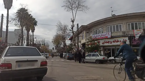
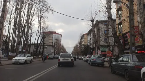
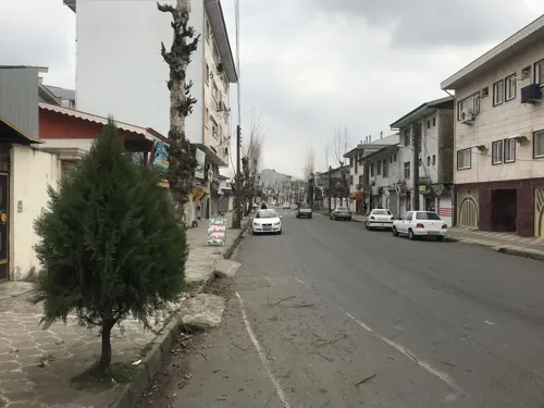
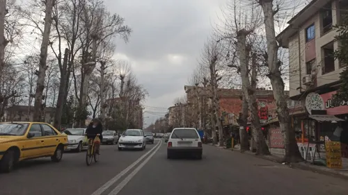
Fuman (Persian: فومن) is a city in the Central District of Fuman County in Iran's northwestern Gilan province, serving as capital of both its county and its district.
From the Wikipedia article Fuman, Iran (this version), under CC BY-SA 4.0.
Travel tips from other travellers: Fūman on Wikivoyage (CC BY-SA 4.0).
Things to do1
Parks, trails and playgrounds2

Restaurants and cafes18



6 more on the map.
Where to stay5




History
From 660 to 760, Fuman functioned as the seat of the Zoroastrian Dabuyid rulers. During the period of the Mongol occupation of Iran, Fuman and Lahijan were among the main towns of Gilan. The local ruler of Fuman at that time, who was reportedly the "only Shafi'ite among the rulers of Gilan", was able to generate a large amount of revenue through lucrative silk trade. According to Hamdallah Mustawfi (d. 1349), Fuman was a large city, and the center of a wealthy region which produced large quantities of "wheat, rice and silk".
Fuman continued to function as the capital of the Bia-pas region (western Gilan) until 1572–1573, when ruler Jamshid Soltan made Rasht the capital. From the reign of King (Shah) Sultan Husayn (r. 1694–1722) to Fath-Ali Shah Qajar (r. 1797–1834), the local rulers of Fuman were involved in a fierce rivalry with the local rulers of neighboring Shaft. John Elton, who had been prominent under Nader Shah (r. 1736–1747), was killed in 1751 on the order of one of these rulers, Agha Jamal Fumani.
From the History section of Fuman, Iran on Wikipedia, under CC BY-SA 4.0.
Churches and places of worship1
Shopping3
Gas and EV charging2
Schools, colleges and libraries5
Healthcare2
Map of Fūman
39 places. The map loads OpenStreetMap tiles when you open it.
Getting there and nearby towns
Rasht Airport (RAS) is the nearest airport with scheduled flights listed in OpenStreetMap, 28 km away.
- Bū’īn 4 km southeast, about 4 min by car
- Gasht 5 km southwest, about 5 min by car
- Rūd Pīsh 7 km east, about 7 min by car
- Şowme‘eh Sarā 9 km north, about 9 min by car
- Marjaghal 8 km northeast, about 8 min by car
- Rasht 25 km east, about 25 min by car
- Bandar-e Anzalī 31 km northeast, about 31 min by car
- Khoshk Bījār 43 km northeast, about 43 min by car
- Lāhījān 62 km east, about 1 h by car
- Khalkhāl 82 km northwest, about 1 h 15 min by car
Drive times are estimates from straight-line distance, not routes.
Local news
Headlines from INDB.
Reviews, tips and questions
Loading what members have shared...
Sources and licences
- GeoNames (CC BY 4.0): population, coordinates, regions and time zone
- Mapillary (see each image): photos
- OpenStreetMap contributors (ODbL 1.0): places, airports, map data
- Wikidata (CC0 1.0): elevation, founding date, time zone, website
- Wikimedia Commons (see each image): photos
- Wikipedia (CC BY-SA 4.0): overview and history text
Photo credits
- Fuman (Gilan), Betta27, Public domain
- آناهیتای فومن - panoramio, auoob farabi, CC BY-SA 3.0
- Rural house - Flickr - Beshef, Beshef, CC BY 2.0
- 20260507 Fuman, PAper GOL, CC BY 4.0
- Mojtaba Yousefali Asghari Osmavandani, Mkn021, CC BY-SA 4.0
- Comparison, Fuman city, Gilan province میدان اصلی فومن، گیلان - panoramio, Mahdi Kalhor, CC BY 3.0
- Parallel trees, Sumeh sara, Gilan province خیابان ورودی فومن،گیلان - panoramio, Mahdi Kalhor, CC BY 3.0
- Street-level photo, ammarpak, CC BY-SA 4.0
- Street-level photo, ammarpak, CC BY-SA 4.0
- Street-level photo, ammarpak, CC BY-SA 4.0
- Street-level photo, parsarajabi1378, CC BY-SA 4.0
- Street-level photo, ammarpak, CC BY-SA 4.0
- Street-level photo, ammarpak, CC BY-SA 4.0
- Street-level photo, ammarpak, CC BY-SA 4.0
- Street-level photo, ammarpak, CC BY-SA 4.0
- Street-level photo, ammarpak, CC BY-SA 4.0
- Street-level photo, ammarpak, CC BY-SA 4.0

Page built November 8, 2026. Spotted a mistake? Tell us or suggest a place.