


Why visit Lāhījān
Townapedia lists 12 museums and landmarks, 12 parks and trails, 56 places to eat, 3 places to stay and 3 attractions in and around town.
Highlights include Sheikh-Zahed Tomb and Iran's National Tea Museum.
Weather in Lāhījān
Forecast from MET Norway (CC BY 4.0). Full forecast
About Lāhījān
Lahijan (Persian: لاهیجان) is a city in close proximity to the Caspian Sea within the Central District of Lahijan County, in northwestern Iran's Gilan province. It serves as capital of both the county and the district.
From the Wikipedia article Lahijan (this version), under CC BY-SA 4.0.
Things to do3



Museums and landmarks12

Sheikh-Zahed Tomb
Monument and historic site · 3.3 km
Iranian national heritage site

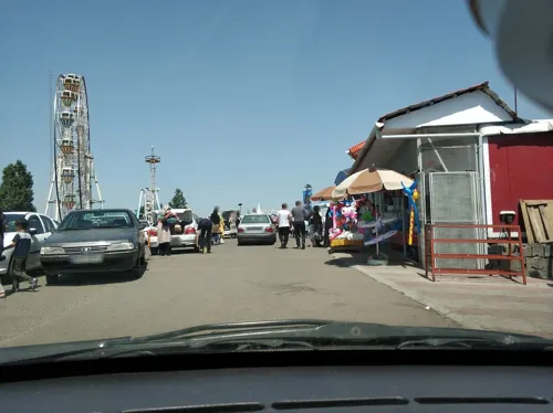
bame sabz lahijan
Monument and historic site · 1.5 km
مرکز تفریحی، گردشگری بام سبز لاهیجان شامل تلهکابین، شهربازی روباز، شهربازی سرپوشیده بازینو، رستوران، کافه و چشمانداز شهر لاهیجان
بام سبز, شهر لاهیجان



Parks, trails and playgrounds12


Restaurants and cafes56

پیتزا سوخاری کیلویی تیتیل
Restaurant · Pizza, Fries · 0.9 km
بلوار خلیج فارس, لاهیجان
Sa-We 14:00- 02:00, Th-Fr 12:00- 02:00

نانوایی دومنظوره جانبازان
Bakery · 1.5 km
این نانوایی همیشه برای خدمت به مردم شهر لاهیجان و مسافرین محترم آماده می باشد
نبش کوچه پنجم سبحان, لاهیجان
6:00-23:00
کافه دژار
Cafe · Coffee Shop, Cafetaria · 1.2 km
ساختمان آبنوس خیابان حزین لاهیجی, لاهیجان
Mo-Su 10:00-2:00
Kentucky House
Restaurant · 0.7 km
بلوار امام رضا, lahijan
10:00-24:00
رستوران صابر
Restaurant
بلوار شهید مطهری, Lahijan
Mo-Su 09:00-21:00
رستوران و کترینگ گیلار
Restaurant · 0.9 km
گلستان ۱۵, لاهیجان
Mo-Su 09:00-21:00
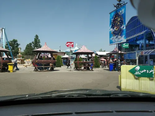


فست فود و رستوران تله کابین
Restaurant · 1.4 km
میدان بام سبز, شهر لاهیجان
Mo-Sa 09:00-24:00
کافه رستوران جانا
Restaurant · 0.9 km
بلوار خلیج فارس, لاهیجان
Mo-Su 12:00-24:00
44 more on the map.
History
In ancient times, the Gilan region was indeed divided into 'the Caspian' and 'the Golha' (flowers) sub-regions. Before Iran's present provincial divisions, the Sefid-Rud River did indeed partition Gilan into eastern and western regions, with the river's eastern side referred to as Biehpish and the western side as Biehpas. Lahijan did become the capital of Biehpish at a certain point in time. The region has historically been a major silk-producing center in Iran and was indeed the country's first area for tea cultivation, set out by Prince Mohammad Mirza, known as "Kashef-ol-Saltaneh."
Prince Mohammad Mirza's role in tea cultivation and his strategy to learn the secrets of tea production while posing as a French laborer in British-controlled India is a factual account. He successfully transported tea samples back to Iran, which was instrumental in initiating tea cultivation in the country. His mausoleum in Lahijan is now part of the "Iran Tea Museum."
From the History section of Lahijan on Wikipedia, under CC BY-SA 4.0.
Where to stay3
Churches and places of worship29
Shopping23
Gas and EV charging4
Schools, colleges and libraries24
Healthcare14
Map of Lāhījān
180 places. The map loads OpenStreetMap tiles when you open it.
Getting there and nearby towns
Rasht Airport (RAS) is the nearest airport with scheduled flights listed in OpenStreetMap, 38 km away.
- Bāz Kīā Gūrāb 5 km northwest, about 5 min by car
- Rūdboneh 6 km north, about 6 min by car
- Āstāneh-ye Ashrafīyeh 9 km northwest, about 9 min by car
- Pahmadān 9 km northeast, about 9 min by car
- Khoshk Bījār 29 km northwest, about 29 min by car
- Rasht 38 km west, about 38 min by car
- Bandar-e Anzalī 57 km northwest, about 57 min by car
- Fūman 62 km west, about 1 h by car
- Rāmsar 65 km southeast, about 1 h by car
- Tonekābon 88 km southeast, about 1 h 30 min by car
Drive times are estimates from straight-line distance, not routes.
Local news
Headlines from INDB.
Reviews, tips and questions
Loading what members have shared...
Sources and licences
- GeoNames (CC BY 4.0): population, coordinates, regions and time zone
- Mapillary (see each image): photos
- OpenStreetMap contributors (ODbL 1.0): places, airports, map data
- Wikidata (CC0 1.0): elevation, founding date, time zone, website, landmarks and historic places
- Wikimedia Commons (see each image): photos
- Wikipedia (CC BY-SA 4.0): overview and history text
Photo credits
- Sheikh Zahed 2, Amirmohammad Alidoust, CC BY-SA 4.0
- پل خشتی لاهیجان 01, Masihtavakol, CC BY-SA 4.0
- Amir Shahid 1, Amirmohammad Alidoust, CC BY-SA 4.0
- Kashef al saltane, Mahmoud kia006, CC BY-SA 4.0
- شیطان کوه لاهیجان, Nojavon, CC BY-SA 3.0
- Lahijan Sheitan Koh, Arashbi2, CC BY-SA 4.0
- Museum-of-Iran-tea-history, Unknown author, Public domain
- IMG9iuytr, Apfasiih, CC BY-SA 4.0
- Lahijan Lake Women Statues - panoramio, Ali Safdarian, CC BY 3.0
- Lahijan Lake - panoramio, Ali Safdarian, CC BY 3.0
- Lahijan Lake Park - panoramio, Ali Safdarian, CC BY 3.0
- Lahijan Lake Park - panoramio (2), Ali Safdarian, CC BY 3.0
- Lahijan Lake Park - panoramio (1), Ali Safdarian, CC BY 3.0
- Lahijan Pool - Gilan IRAN, Wikitaba, CC BY-SA 4.0
- Sheytan kooh, Armin H, CC BY-SA 4.0
- 55545.pngIMG 4635, مجیدرسولی کنفی, CC BY-SA 4.0
- لاهیجان - panoramio - mehrad afkham, mehrad afkham, CC BY-SA 3.0
- شیطان کوه - panoramio - mehrad afkham, mehrad afkham, CC BY-SA 3.0
- لاهیجان - panoramio, mehrad afkham, CC BY-SA 3.0
- Sweeper Garden - panoramio, Ali Safdarian, CC BY 3.0
- Iran (11314174605), Ninara from Helsinki, Finland, CC BY 2.0
- The Street (5624314223), Mehrab Pourfaraj from Rasht, Iran, CC BY-SA 2.0
- سرخپوشان, Younes345, CC BY-SA 4.0
- کلینیک, Takdast007, CC BY-SA 4.0
- Pilaghe Ghabr (Amjad os-Sultan Tomb) E3805, GTVM92, CC BY-SA 4.0
- Pilaghe Ghabr (Amjad os-Sultan Tomb) E3808, GTVM92, CC BY-SA 4.0
- Pilaghe Ghabr (Amjad os-Sultan Tomb) 3403, GTVM92, CC BY-SA 4.0
- نمائی از شیطان کوه لاهیجان - panoramio, yousef hoseinyzad, CC BY 3.0
- The Street - panoramio, Mehrab Pourfaraj, CC BY-SA 3.0
- Lahijan, Gilan, Iran - panoramio, yousef hoseinyzad, CC BY 3.0
- Fish market in Lahijan, مجیدرسولی کنفی, CC BY-SA 4.0
- ISS034-E-6948 - View of Earth, Earth Science and Remote Sensing Unit , Lyndon B. Johnson Space Center, Public domain
- ISS065-E-372703 - View of Earth, Earth Science and Remote Sensing Unit , Lyndon B. Johnson Space Center, Public domain
- Lahijan, Gilan, Iran - panoramio (4), yousef hoseinyzad, CC BY 3.0
- آرامگاه کاشفالسلطنه- موزه چای -لاهیجان (42), Mohser, CC BY 4.0
- کاشف السلطنه 04, Masihtavakol, CC BY-SA 4.0
- کاشف السلطنه 02, Masihtavakol, CC BY-SA 4.0
- آرامگاه کاشفالسلطنه- موزه چای -لاهیجان (43), Mohser, CC BY 4.0
- Lahijan, Gilan, Iran - panoramio (3), yousef hoseinyzad, CC BY 3.0
- آرامگاه کاشفالسلطنه- موزه چای -لاهیجان (35), Mohser, CC BY 4.0
- Lahijan Artificial Lake - panoramio, Mehrab Pourfaraj, CC BY-SA 3.0
- Street-level photo, hota, CC BY-SA 4.0
- Street-level photo, hota, CC BY-SA 4.0
- Street-level photo, hota, CC BY-SA 4.0
- Street-level photo, hota, CC BY-SA 4.0
- Street-level photo, hota, CC BY-SA 4.0
- Street-level photo, hota, CC BY-SA 4.0
- Street-level photo, hota, CC BY-SA 4.0
- Street-level photo, hota, CC BY-SA 4.0


Page built November 8, 2026. Spotted a mistake? Tell us or suggest a place.