


Loading the weather...
Population2,387
GeoNames
RegionBushehr
Elevation12 m
39 ft
Time zoneAsia/Tehran
Nearest airportBushehr Airport (BUZ)
28 km
Why visit Jā’īnak
Townapedia lists 2 places to eat and 1 place to stay in and around town.
Weather in Jā’īnak
Forecast from MET Norway (CC BY 4.0). Full forecast
Restaurants and cafes2



Where to stay1

Shopping1

Advertisement
Map of Jā’īnak
4 places. The map loads OpenStreetMap tiles when you open it.
Getting there and nearby towns
Bushehr Airport (BUZ) is the nearest airport with scheduled flights listed in OpenStreetMap, 28 km away.
- Delvār 3 km south, about 3 min by car
- Chāh Talkh-e Jonūbī 6 km north, about 6 min by car
- Chāh Talkh-e Shomālī 8 km north, about 8 min by car
- Gargūr 10 km north, about 10 min by car
- Leylak 11 km north, about 11 min by car
- Shūrekī 14 km east, about 14 min by car
- Pahlavān Koshī 14 km north, about 14 min by car
- ‘Ālī Shahr 16 km north, about 16 min by car
- Bushehr 30 km northwest, about 30 min by car
- Borāzjān 56 km north, about 56 min by car
Drive times are estimates from straight-line distance, not routes.
Local news
Headlines from INDB.
Reviews, tips and questions
Loading what members have shared...
Sources and licences
- GeoNames (CC BY 4.0): population, coordinates, regions and time zone
- Mapillary (see each image): photos
- OpenStreetMap contributors (ODbL 1.0): places, airports, map data
- Wikidata (CC0 1.0): elevation, founding date, time zone, website
- Wikimedia Commons (see each image): photos
Photo credits
- Mapillary 2020-06-16 12H47M49S418 (1122326281599437, nbc0jxe1tbjgdimqyfap64) (sosha) taken with Xiaomi Mi 9T, sosha, CC BY-SA 4.0
- Mapillary 2020-06-16 12H47M48S515 (218337799797995, nbc0jxe1tbjgdimqyfap64) (sosha) taken with Xiaomi Mi 9T, sosha, CC BY-SA 4.0
- Mapillary 2020-06-16 12H47M50S583 (472144980538027, nbc0jxe1tbjgdimqyfap64) (sosha) taken with Xiaomi Mi 9T, sosha, CC BY-SA 4.0
- Mapillary 2020-06-16 12H47M47S621 (4361130217239144, nbc0jxe1tbjgdimqyfap64) (sosha) taken with Xiaomi Mi 9T, sosha, CC BY-SA 4.0
- Mapillary 2020-06-16 12H47M51S482 (834263413859403, nbc0jxe1tbjgdimqyfap64) (sosha) taken with Xiaomi Mi 9T, sosha, CC BY-SA 4.0
- Mapillary 2020-06-16 12H47M46S485 (402564554040599, nbc0jxe1tbjgdimqyfap64) (sosha) taken with Xiaomi Mi 9T, sosha, CC BY-SA 4.0
- Mapillary 2020-06-16 12H47M52S384 (221005302825501, nbc0jxe1tbjgdimqyfap64) (sosha) taken with Xiaomi Mi 9T, sosha, CC BY-SA 4.0
- Mapillary 2020-06-16 12H47M45S584 (202525881703274, nbc0jxe1tbjgdimqyfap64) (sosha) taken with Xiaomi Mi 9T, sosha, CC BY-SA 4.0
- Mapillary 2020-06-16 12H47M44S455 (596170384632481, nbc0jxe1tbjgdimqyfap64) (sosha) taken with Xiaomi Mi 9T, sosha, CC BY-SA 4.0
- Mapillary 2020-06-16 12H47M53S544 (167693138613406, nbc0jxe1tbjgdimqyfap64) (sosha) taken with Xiaomi Mi 9T, sosha, CC BY-SA 4.0
- Mapillary 2020-06-16 12H47M43S554 (1226028754500218, nbc0jxe1tbjgdimqyfap64) (sosha) taken with Xiaomi Mi 9T, sosha, CC BY-SA 4.0
- Mapillary 2020-06-16 12H47M54S443 (3937375896383356, nbc0jxe1tbjgdimqyfap64) (sosha) taken with Xiaomi Mi 9T, sosha, CC BY-SA 4.0
- Mapillary 2020-06-16 12H47M42S422 (143385544440886, nbc0jxe1tbjgdimqyfap64) (sosha) taken with Xiaomi Mi 9T, sosha, CC BY-SA 4.0
- Mapillary 2020-06-16 12H47M41S525 (617842722465437, nbc0jxe1tbjgdimqyfap64) (sosha) taken with Xiaomi Mi 9T, sosha, CC BY-SA 4.0
- Mapillary 2020-06-16 12H47M55S575 (615182192757601, nbc0jxe1tbjgdimqyfap64) (sosha) taken with Xiaomi Mi 9T, sosha, CC BY-SA 4.0
- Mapillary 2020-06-16 12H47M40S391 (307967740939038, nbc0jxe1tbjgdimqyfap64) (sosha) taken with Xiaomi Mi 9T, sosha, CC BY-SA 4.0
- Mapillary 2020-06-16 12H47M56S512 (142305654581251, nbc0jxe1tbjgdimqyfap64) (sosha) taken with Xiaomi Mi 9T, sosha, CC BY-SA 4.0
- Mapillary 2020-06-16 12H47M39S490 (639335740357381, nbc0jxe1tbjgdimqyfap64) (sosha) taken with Xiaomi Mi 9T, sosha, CC BY-SA 4.0
- Mapillary 2020-06-16 12H47M57S375 (375156927260519, nbc0jxe1tbjgdimqyfap64) (sosha) taken with Xiaomi Mi 9T, sosha, CC BY-SA 4.0
- Mapillary 2020-06-16 12H47M38S592 (263211678838205, nbc0jxe1tbjgdimqyfap64) (sosha) taken with Xiaomi Mi 9T, sosha, CC BY-SA 4.0
- Mapillary 2020-06-16 12H47M58S505 (4076019945810298, nbc0jxe1tbjgdimqyfap64) (sosha) taken with Xiaomi Mi 9T, sosha, CC BY-SA 4.0
- Mapillary 2020-06-16 12H47M37S459 (300076304919777, nbc0jxe1tbjgdimqyfap64) (sosha) taken with Xiaomi Mi 9T, sosha, CC BY-SA 4.0
- Mapillary 2020-06-16 12H47M59S405 (316442543216667, nbc0jxe1tbjgdimqyfap64) (sosha) taken with Xiaomi Mi 9T, sosha, CC BY-SA 4.0
- Mapillary 2020-06-16 12H47M36S527 (502927854280995, nbc0jxe1tbjgdimqyfap64) (sosha) taken with Xiaomi Mi 9T, sosha, CC BY-SA 4.0
- Mapillary 2020-06-16 12H48M00S537 (483532659595398, nbc0jxe1tbjgdimqyfap64) (sosha) taken with Xiaomi Mi 9T, sosha, CC BY-SA 4.0
- Mapillary 2020-06-16 12H47M35S394 (2964359650553522, nbc0jxe1tbjgdimqyfap64) (sosha) taken with Xiaomi Mi 9T, sosha, CC BY-SA 4.0
- Mapillary 2020-06-16 12H48M01S437 (310846737199215, nbc0jxe1tbjgdimqyfap64) (sosha) taken with Xiaomi Mi 9T, sosha, CC BY-SA 4.0
- Mapillary 2020-06-16 12H47M34S495 (247650973811924, nbc0jxe1tbjgdimqyfap64) (sosha) taken with Xiaomi Mi 9T, sosha, CC BY-SA 4.0
- Mapillary 2020-06-16 12H48M02S576 (2868352436735997, nbc0jxe1tbjgdimqyfap64) (sosha) taken with Xiaomi Mi 9T, sosha, CC BY-SA 4.0
- Mapillary 2020-06-16 12H47M33S363 (467289387907582, nbc0jxe1tbjgdimqyfap64) (sosha) taken with Xiaomi Mi 9T, sosha, CC BY-SA 4.0
- Mapillary 2020-06-16 12H48M03S468 (145489434225879, nbc0jxe1tbjgdimqyfap64) (sosha) taken with Xiaomi Mi 9T, sosha, CC BY-SA 4.0
- Mapillary 2020-06-16 12H47M32S465 (474219147202441, nbc0jxe1tbjgdimqyfap64) (sosha) taken with Xiaomi Mi 9T, sosha, CC BY-SA 4.0
- Mapillary 2020-06-16 12H48M04S408 (980206515873842, nbc0jxe1tbjgdimqyfap64) (sosha) taken with Xiaomi Mi 9T, sosha, CC BY-SA 4.0
- Mapillary 2020-06-16 12H47M31S565 (1884468051714377, nbc0jxe1tbjgdimqyfap64) (sosha) taken with Xiaomi Mi 9T, sosha, CC BY-SA 4.0
- Mapillary 2020-06-16 12H48M05S506 (1104757323336989, nbc0jxe1tbjgdimqyfap64) (sosha) taken with Xiaomi Mi 9T, sosha, CC BY-SA 4.0
- Mapillary 2020-06-16 12H47M30S399 (999260924236478, nbc0jxe1tbjgdimqyfap64) (sosha) taken with Xiaomi Mi 9T, sosha, CC BY-SA 4.0
- Mapillary 2020-06-16 12H48M06S399 (763390647688947, nbc0jxe1tbjgdimqyfap64) (sosha) taken with Xiaomi Mi 9T, sosha, CC BY-SA 4.0
- Mapillary 2020-06-16 12H47M29S476 (820525425536181, nbc0jxe1tbjgdimqyfap64) (sosha) taken with Xiaomi Mi 9T, sosha, CC BY-SA 4.0
- Mapillary 2020-06-16 12H48M07S571 (4039438136101817, nbc0jxe1tbjgdimqyfap64) (sosha) taken with Xiaomi Mi 9T, sosha, CC BY-SA 4.0
- Mapillary 2020-06-16 12H48M08S496 (302923824671680, nbc0jxe1tbjgdimqyfap64) (sosha) taken with Xiaomi Mi 9T, sosha, CC BY-SA 4.0
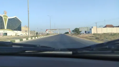
- Street-level photo, sosha, CC BY-SA 4.0


Page built November 8, 2026. Spotted a mistake? Tell us or suggest a place.