


Why visit Jam
Townapedia lists 4 museums and landmarks, 22 parks and trails, 12 places to eat, 4 places to stay and 1 attraction in and around town.
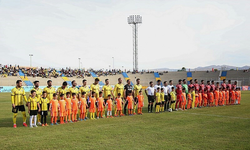
Highlights include Shohada Stadium.
Weather in Jam
Forecast from MET Norway (CC BY 4.0). Full forecast
About Jam
Jam (Persian: جم) is a city in the Central District of Jam County, Bushehr province, Iran, serving as capital of both the county and the district. It is also the administrative center for Jam Rural District. The village of Velayat was converted to a city in 1996 and renamed Jam in 1999.
From the Wikipedia article Jam, Iran (this version), under CC BY-SA 4.0.
Things to do1

Museums and landmarks4

Parks, trails and playgrounds22



10 more on the map.
Restaurants and cafes12






Where to stay4
Churches and places of worship29
Shopping11
Gas and EV charging3
Schools, colleges and libraries39
Healthcare13
Map of Jam
138 places. The map loads OpenStreetMap tiles when you open it.
Getting there and nearby towns
Jam Airport (KNR) is the nearest airport with scheduled flights listed in OpenStreetMap, 3 km away.
- Bahārestān 3 km east, about 3 min by car
- Bast-e Malakhī 6 km southeast, about 6 min by car
- Makū 10 km east, about 10 min by car
- Āb Garmak 13 km northwest, about 13 min by car
- Bandar-e Sīraf 18 km south, about 18 min by car
- Tonbak 18 km southwest, about 18 min by car
- Parak 22 km southeast, about 22 min by car
- Bandar-e Kangān 26 km west, about 26 min by car
- Bandar-e Shīrīnū 27 km southeast, about 27 min by car
- Banak 30 km west, about 30 min by car
Drive times are estimates from straight-line distance, not routes.
Local news
Headlines from INDB.
Reviews, tips and questions
Loading what members have shared...
Sources and licences
- GeoNames (CC BY 4.0): population, coordinates, regions and time zone
- OpenStreetMap contributors (ODbL 1.0): places, airports, map data
- Wikidata (CC0 1.0): elevation, founding date, time zone, website
- Wikimedia Commons (see each image): photos
- Wikipedia (CC BY-SA 4.0): overview and history text
Photo credits
- شهر جم, میلاد رفعت Milad Rafat, CC BY 4.0
- میدان جم-square jam - panoramio, علی علوی, CC BY 3.0
- Pars Jam FC vs Esteghlal FC, 27 July 2020 - 08, Mahdi Zare, CC BY 4.0
- Pars Jam FC vs Esteghlal FC, 27 July 2020 - 02, Mahdi Zare, CC BY 4.0
- Pars Jam FC vs Esteghlal FC, 27 July 2020 - 09, Mahdi Zare, CC BY 4.0
- Pars Jam FC vs Esteghlal FC, 27 July 2020 - 40, Mahdi Zare, CC BY 4.0
- Pars Jam FC vs Esteghlal FC, 27 July 2020 - 20, Mahdi Zare, CC BY 4.0
- Pars Jam FC vs Esteghlal FC, 27 July 2020 - 11, Mahdi Zare, CC BY 4.0
- Pars Jam FC vs Esteghlal FC, 27 July 2020 - 32, Mahdi Zare, CC BY 4.0
- Pars Jam FC vs Esteghlal FC, 27 July 2020 - 36, Mahdi Zare, CC BY 4.0
- Pars Jam FC vs Esteghlal FC, 27 July 2020 - 34, Mahdi Zare, CC BY 4.0
- Pars Jam FC vs Esteghlal FC, 27 July 2020 - 18, Mahdi Zare, CC BY 4.0
- Pars Jam FC vs Esteghlal FC, 27 July 2020 - 27, Mahdi Zare, CC BY 4.0
- Pars Jam FC vs Esteghlal FC, 27 July 2020 - 13, Mahdi Zare, CC BY 4.0
- Pars Jam FC vs Esteghlal FC, 27 July 2020 - 28, Mahdi Zare, CC BY 4.0
- Pars Jam FC vs Esteghlal FC, 27 July 2020 - 12, Mahdi Zare, CC BY 4.0
- Pars Jam FC vs Esteghlal FC, 27 July 2020 - 04, Mahdi Zare, CC BY 4.0
- Pars Jam FC vs Esteghlal FC, 27 July 2020 - 17, Mahdi Zare, CC BY 4.0
- Pars Jam FC vs Esteghlal FC, 27 July 2020 - 14, Mahdi Zare, CC BY 4.0
- Pars Jam FC vs Esteghlal FC, 27 July 2020 - 22, Mahdi Zare, CC BY 4.0
- Pars Jam FC vs Esteghlal FC, 27 July 2020 - 06, Mahdi Zare, CC BY 4.0
- Pars Jam FC vs Esteghlal FC, 27 July 2020 - 33, Mahdi Zare, CC BY 4.0
- Pars Jam FC vs Esteghlal FC, 27 July 2020 - 05, Mahdi Zare, CC BY 4.0
- Pars Jam FC vs Esteghlal FC, 27 July 2020 - 15, Mahdi Zare, CC BY 4.0
- Pars Jam FC vs Esteghlal FC, 27 July 2020 - 23, Mahdi Zare, CC BY 4.0
- Pars Jam FC vs Esteghlal FC, 27 July 2020 - 35, Mahdi Zare, CC BY 4.0
- Pars Jam FC vs Esteghlal FC, 27 July 2020 - 21, Mahdi Zare, CC BY 4.0
- Pars Jam FC vs Esteghlal FC, 27 July 2020 - 30, Mahdi Zare, CC BY 4.0
- Pars Jam FC vs Esteghlal FC, 27 July 2020 - 37, Mahdi Zare, CC BY 4.0
- Pars Jam FC vs Esteghlal FC, 27 July 2020 - 07, Mahdi Zare, CC BY 4.0
- Pars Jam FC vs Esteghlal FC, 27 July 2020 - 19, Mahdi Zare, CC BY 4.0
- Pars Jam FC vs Esteghlal FC, 27 July 2020 - 03, Mahdi Zare, CC BY 4.0
- Pars Jam FC vs Esteghlal FC, 27 July 2020 - 16, Mahdi Zare, CC BY 4.0
- Pars Jam FC vs Esteghlal FC, 27 July 2020 - 10, Mahdi Zare, CC BY 4.0
- Pars Jam FC vs Esteghlal FC, 27 July 2020 - 38, Mahdi Zare, CC BY 4.0
- Pars Jam FC vs Esteghlal FC, 27 July 2020 - 01, Mahdi Zare, CC BY 4.0
- Takhti Stadium Jam 2, Mehdi Mehran Nezhad, CC BY 4.0
- برداشت گوجه فرنگی در دی ماه - panoramio, علی علوی, CC BY 3.0
- پارک جام جم - panoramio (1), علی علوی, CC BY 3.0
- پارک جام جم - panoramio, علی علوی, CC BY 3.0


Page built November 8, 2026. Spotted a mistake? Tell us or suggest a place.