


Karaj, Iran
کرج
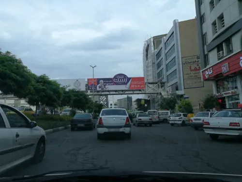
Karaj is a regional capital of 1,448,075 people in Alborz Province, Iran.
Why visit Karaj
Townapedia lists 6 museums and landmarks, 50 parks and trails, 168 places to eat, 2 places to stay and 3 attractions in and around town.
Highlights include Raisi Bridge, Imamzadeh Taher (Karaj), موسسه هنری هفت سرزمین هنر پارسیان and Fateh Garden.
Weather in Karaj
Forecast from MET Norway (CC BY 4.0). Full forecast
About Karaj
Karaj (Persian: کرج; pronounced [kæˈɾædʒ] ) is a city in the Central District of Karaj County, Alborz province, Iran, serving as capital of the province, the county, and the district. Earliest evidence of inhabitation in Karaj can be dated to the Bronze Age at Tepe Khurvin. The city was developed under the rule of the Safavid and Qajar Empire and is home to historical buildings and memorials from those eras. This city has a unique climate due to access to natural resources such as many trees, rivers, and green plains.
From the Wikipedia article Karaj (this version), under CC BY-SA 4.0.
Travel tips from other travellers: Karaj on Wikivoyage (CC BY-SA 4.0).
Things to do3

Museums and landmarks6

Imamzadeh Taher (Karaj)
Monument and historic site · 6.4 km
Imamzadeh in Karaj, Iran

موسسه هنری هفت سرزمین هنر پارسیان
Museum · 1.8 km
شهید بهشتى, کرج
Mo-Su 09:00-19:30
Studio Delara
Museum · 1.1 km
بلوار تعاون فرعی کوچه اردلان 7و6, Karaj
sat-thu 10-8 fri 7-4

Parks, trails and playgrounds50



38 more on the map.
Restaurants and cafes168

آش و حلیم سرای مقدم آبادان
Restaurant · Persian · 2.3 km
آش-حلیم-حلیم_بادمجان-آش_رشته-عدسی
بلوار میرزایی پرور, کرج
Sa-Fr 07:00-23:00

Giti Banoo Restaurent
Restaurant · Regional, Kebab, Asian · 1.7 km
بلوار بسیج;نبش شاکرزادگان, کرج
Mo-Su 09:00-21:00


Zino
Cafe · Cafe, Pizza · 2.0 km
فلکه اول گوهردشت, کرج
12:00-00:00
156 more on the map.
History
The area around Karaj has been inhabited for thousands of years, as shown by the Bronze Age site of Tepe Khurvin and the Iron Age site of Kalak. However, the present-day city of Karaj is mostly the result of modern industrial development in the 20th century.
Karaj was mostly significant as a stage on the road between Tehran and Qazvin. In Safavid times, a stone bridge was built that served as the main crossing into the town. The large Shah-Abbasi Caravansarai, located at the southeast of Towhid Square, was built in the same era, under the rule of Šāh Esmāil.
In 1810, the Qajar prince Soleyman Mirza built the Soleymaniyeh Palace at Karaj to serve as a summer resort. The palace had four towers and was surrounded by gardens. Its reception room featured a pair of paintings by Abdallah Khan Naqqashbandi. By 1860, however, the palace was described as abandoned and only used as a shelter for travelers. Naser al-Din Shah Qajar later renovated the palace. In 1917, a School of Farming was established on the site, replacing the earlier Mozaffari Agricultural School in Tehran. Later, Reza Pahlavi granted it to the University of Tehran's new Faculty of Agriculture.
From the History section of Karaj on Wikipedia, under CC BY-SA 4.0.
Where to stay2
Churches and places of worship34
Shopping91
شرکت دستگاههای حضور غیاب فراافزار
Grocery · 2.2 km
خیابان آبان نبش کوچه محمد باقر نجفی طبقه فوقانی خانه فیلیپس, کرج
Ashkan Gallery
Grocery · 2.3 km
بین دوم و سوم غربی آزادی (خیابان اصلی گوهردشت), karaj
خانه هوشمند کیانی اسمارت
Hardware store · 0.7 km
2 بلوار آیتالله طالقانی شمالی, کرج
Gas and EV charging3
Schools, colleges and libraries92
Healthcare127
iran farda dental clinic
Clinic and pharmacy · 1.4 km
بلوار جمهوری اسلامی, کرج میدان سپاه
Map of Karaj
250 places. The map loads OpenStreetMap tiles when you open it.
Getting there and nearby towns
Payam Airport (PYK) is the nearest airport with scheduled flights listed in OpenStreetMap, 16 km away.
- Shahrak-e Nahāl Va Baz̄r 6 km southwest, about 6 min by car
- Shahrak-e Mohandesī-ye Zerā‘ī 7 km southwest, about 7 min by car
- Fardīs 9 km south, about 9 min by car
- Moḩammad Shahr 10 km southwest, about 10 min by car
- Meshkīn Dasht 10 km southwest, about 10 min by car
- Golestānak 10 km southwest, about 10 min by car
- Kamālshahr 11 km west, about 11 min by car
- Garmdarreh 12 km southeast, about 12 min by car
- Chahārbāgh 13 km west, about 13 min by car
- Tehran 42 km east, about 42 min by car
Drive times are estimates from straight-line distance, not routes.
Local news
Headlines from INDB.
Reviews, tips and questions
Loading what members have shared...
Sources and licences
- GeoNames (CC BY 4.0): population, coordinates, regions and time zone
- Mapillary (see each image): photos
- OpenStreetMap contributors (ODbL 1.0): places, airports, map data
- Wikidata (CC0 1.0): elevation, founding date, time zone, website, landmarks and historic places
- Wikimedia Commons (see each image): photos
- Wikipedia (CC BY-SA 4.0): overview and history text
Photo credits
- Azimieh Aerial View, Civilaut, CC BY-SA 4.0
- Karaj - Azadegan Ave - panoramio, Ali Safdarian, CC BY 3.0
- Karaj - Azadegan Ave - panoramio (1), Ali Safdarian, CC BY 3.0
- Karaj - Azadegan Bridge - panoramio, Ali Safdarian, CC BY 3.0
- Karaj - Azadegan Bridge - panoramio (1), Ali Safdarian, CC BY 3.0
- Karaj B1 bridge after the attack (8), Tasnim News, CC BY 4.0
- Emamzadeh Taher 3117, GTVM92, CC BY-SA 4.0
- Abzums central building, Rizorius, CC BY-SA 4.0
- South gate of Karaj IAU 01, Matin abdavi, CC BY-SA 4.0
- Fateh Garden-2-Jahanshahr, Saba Garshasbi, CC BY-SA 4.0
- Iran Koochak Park 02, Aref Fathi, CC BY 4.0
- مصطفی طاهری, Mostafaataheri, CC BY-SA 4.0
- RedStrawberries, Hastibozorgi, CC0
- Culture Garden of Iran, Matin abdavi, CC BY-SA 4.0
- Ostad shahriar park, Matin abdavi, CC BY-SA 4.0
- Iran Koochak Park 40, Aref Fathi, CC BY 4.0
- Iran Koochak Park 34, Aref Fathi, CC BY 4.0
- Iran Koochak Park 12, Aref Fathi, CC BY 4.0
- Iran Koochak Park 17, Aref Fathi, CC BY 4.0
- Iran Koochak Park 16, Aref Fathi, CC BY 4.0
- Iran Koochak Park 39, Aref Fathi, CC BY 4.0
- Iran Koochak Park 09, Aref Fathi, CC BY 4.0
- Iran Koochak Park 03, Aref Fathi, CC BY 4.0
- Iran Koochak Park 18, Aref Fathi, CC BY 4.0
- Iran Koochak Park 24, Aref Fathi, CC BY 4.0
- Iran Koochak Park 37, Aref Fathi, CC BY 4.0
- Iran Koochak Park 01, Aref Fathi, CC BY 4.0
- Iran Koochak Park 23, Aref Fathi, CC BY 4.0
- Iran Koochak Park 11, Aref Fathi, CC BY 4.0
- Iran Koochak Park 27, Aref Fathi, CC BY 4.0
- Iran Koochak Park 08, Aref Fathi, CC BY 4.0
- Iran Koochak Park 20, Aref Fathi, CC BY 4.0
- Iran Koochak Park 30, Aref Fathi, CC BY 4.0
- Iran Koochak Park 10, Aref Fathi, CC BY 4.0
- Iran Koochak Park 22, Aref Fathi, CC BY 4.0
- Iran Koochak Park 26, Aref Fathi, CC BY 4.0
- Iran Koochak Park 36, Aref Fathi, CC BY 4.0
- Iran Koochak Park 29, Aref Fathi, CC BY 4.0
- Iran Koochak Park 04, Aref Fathi, CC BY 4.0
- Iran Koochak Park 21, Aref Fathi, CC BY 4.0
- Street-level photo, pilsa, CC BY-SA 4.0
- Street-level photo, pilsa, CC BY-SA 4.0
- Street-level photo, pilsa, CC BY-SA 4.0
- Street-level photo, armanezadi, CC BY-SA 4.0
- Street-level photo, pilsa, CC BY-SA 4.0
- Street-level photo, pilsa, CC BY-SA 4.0
- Street-level photo, pilsa, CC BY-SA 4.0
- Street-level photo, pilsa, CC BY-SA 4.0
- Street-level photo, pilsa, CC BY-SA 4.0
- Street-level photo, pilsa, CC BY-SA 4.0
- Street-level photo, pilsa, CC BY-SA 4.0
- Street-level photo, pilsa, CC BY-SA 4.0
- Street-level photo, pilsa, CC BY-SA 4.0
- Street-level photo, mohammadjavad72, CC BY-SA 4.0


Page built November 8, 2026. Spotted a mistake? Tell us or suggest a place.