



Why visit Khārk
Townapedia lists 3 museums and landmarks, 3 parks and trails and 1 place to stay in and around town.
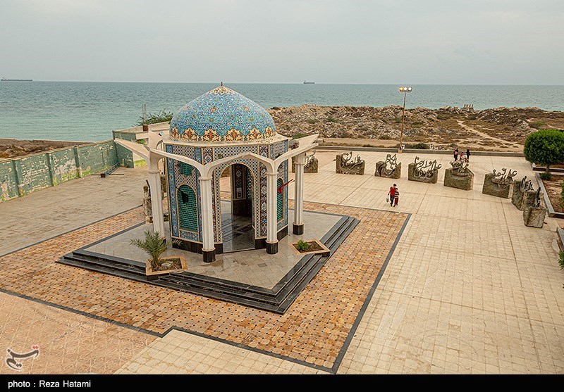
Highlights include Palmyran Grave, Kharg and Unknown Martyrs Mausoleum.
Weather in Khārk
Forecast from MET Norway (CC BY 4.0). Full forecast
About Khārk
Kharg (Persian: خارگ) is a city in, and the capital of, Kharg District in Bushehr County, Bushehr province, Iran. The city is located on Kharg Island in the Persian Gulf.
From the Wikipedia article Kharg (city) (this version), under CC BY-SA 4.0.
Museums and landmarks3



Parks, trails and playgrounds3


Where to stay1

Churches and places of worship2

Schools, colleges and libraries1
Islamic Azad University, Kharg Marine Sciences and Technologies Branch
School · 1.3 km
Healthcare1
Map of Khārk
11 places. The map loads OpenStreetMap tiles when you open it.
Getting there and nearby towns
Kharg Airport (KHK) is the nearest airport with scheduled flights listed in OpenStreetMap, 1 km away.
- Bandar-e Rīg 38 km northeast, about 38 min by car
- Bandar-e Genāveh 40 km northeast, about 40 min by car
- Māl-e Khalīfeh 41 km northeast, about 41 min by car
- Moḩammad Şāleḩī 51 km northeast, about 51 min by car
- Chahār Rūstā’ī 54 km northeast, about 54 min by car
- Jazīreh-ye Shīf 57 km east, about 57 min by car
- Bushehr 59 km southeast, about 59 min by car
- Shabānkāreh 69 km east, about 1 h 15 min by car
- Āb Pakhsh 73 km east, about 1 h 15 min by car
- Borāzjān 86 km east, about 1 h 30 min by car
Drive times are estimates from straight-line distance, not routes.
Local news
Headlines from INDB.
Reviews, tips and questions
Loading what members have shared...
Sources and licences
- GeoNames (CC BY 4.0): population, coordinates, regions and time zone
- OpenStreetMap contributors (ODbL 1.0): places, airports, map data
- Wikidata (CC0 1.0): elevation, founding date, time zone, website
- Wikimedia Commons (see each image): photos
- Wikipedia (CC BY-SA 4.0): overview and history text
Photo credits
- Kharg Island in 2022 (07), Reza Hatami, CC BY 4.0
- DSC00014 گنبد بقعه میر محمد در جزیره خارک, نادر مظلومی, CC BY-SA 4.0
- مسجد و قبور پالمیریان-نماهای گوناگون آثار تمدن تدمر و پالمیر مربوط به دوره اشکانیان 06, خسرو حیرت نگاری, CC BY-SA 4.0
- Kharg Island in 2022 (06), Reza Hatami, CC BY 4.0
- Kharg Island in 2022 (08), Reza Hatami, CC BY 4.0
Page built November 8, 2026. Spotted a mistake? Tell us or suggest a place.