


Why visit Marvdasht
Townapedia lists 5 museums and landmarks, 16 parks and trails, 62 places to eat, 4 places to stay and 5 attractions in and around town.
Weather in Marvdasht
Forecast from MET Norway (CC BY 4.0). Full forecast
About Marvdasht
Marvdasht (Persian: مرودشت) is a city in the Central District of Marvdasht County, Fars province, Iran, serving as capital of both the county and the district.
From the Wikipedia article Marvdasht (this version), under CC BY-SA 4.0.
Things to do5


Museums and landmarks5


Parks, trails and playgrounds16

4 more on the map.
Restaurants and cafes62

رستوران سناتور
Restaurant · Kebab · 0.8 km
کنارگذر بولوار قدس, مرودشت
Mo-Su 16:00-19:00
بیرون بر مادر
Restaurant · Chicken · 0.6 km
خیابان حافظ جنوبی, مرودشت
sunrise-sunset

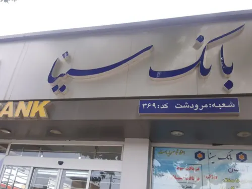
رستوران زیتون
Restaurant · Pizza, Regional, Kebab, Asian, Coffee Shop · 1.0 km
بولوار امام خمینی, مرودشت

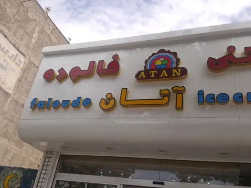


50 more on the map.
History
Marvdasht is as ancient as the history of Iran and the Persian Empire. Its former capital Persepolis is in the vicinity of the city, and a few kilometers farther Naqsh-e-Rostam, Naqsh-e Rajab and the ruins of the ancient city of Estakhr are reminiscent of the region's importance in historic times.
Archaeological excavations have shown that civilized people had already been living in the Marvdasht Plains for millennia when Darius chose the plains of mount Rahmat for his royal residence.
The modern city of Marvdasht was constructed in the 20th century. After the Pahlavi government built a sugar factory in 1935 (1314 Persian calendar), the city gradually developed around the factory. More and more people left the nearby villages or abandoned their nomadic life to settle in the developing city.
People from farther areas also migrated to the city. In the years before the 1979 Iranian Revolution, Marvdasht became the most important industrial city of Fars province, as other factories such as the petrochemical complex, Azmayesh (producing household appliances and intended to be biggest in the Middle East), the Charmineh leather factory, the Fars meat complex and the Dadli biscuit company were constructed. These required a huge workforce, and the population of Marvdasht increased until it became the second most populated city in Fars province.
From the History section of Marvdasht on Wikipedia, under CC BY-SA 4.0.
Where to stay4
Churches and places of worship21
Shopping30
Gas and EV charging8
Schools, colleges and libraries43
Healthcare30
داروخانه شبانه روزی
Clinic and pharmacy · 0.7 km
خیابان شهید قمصور بیگلر ۴۳, مرودشت
Map of Marvdasht
224 places. The map loads OpenStreetMap tiles when you open it.
Getting there and nearby towns
Shiraz Shahid Dastgheib International Airport (SYZ) is the nearest airport with scheduled flights listed in OpenStreetMap, 42 km away.
- Shamsābād-e Borzū 11 km northeast, about 11 min by car
- Zangīābād 12 km northeast, about 12 min by car
- Zarqān 14 km southwest, about 14 min by car
- Lapū’ī 17 km southwest, about 17 min by car
- Ḩājjīābād 17 km northeast, about 17 min by car
- Dūdej 18 km southwest, about 18 min by car
- Khalaf Ţāḩūneh 20 km northeast, about 20 min by car
- Seyyedān 24 km northeast, about 24 min by car
- Shahr-e Ṣadrā 30 km west, about 30 min by car
- Shiraz 39 km southwest, about 39 min by car
Drive times are estimates from straight-line distance, not routes.
Local news
Headlines from INDB.
Reviews, tips and questions
Loading what members have shared...
Sources and licences
- GeoNames (CC BY 4.0): population, coordinates, regions and time zone
- Mapillary (see each image): photos
- OpenStreetMap contributors (ODbL 1.0): places, airports, map data
- Wikidata (CC0 1.0): elevation, founding date, time zone, website
- Wikimedia Commons (see each image): photos
- Wikipedia (CC BY-SA 4.0): overview and history text
Photo credits
- Tachar Persepolis Iran, درفش کاویانی, CC BY-SA 3.0
- Marvdasht D market, Harold Krabs, CC BY-SA 4.0
- Marvdasht bank eghtesad novin, Harold Krabs, CC BY-SA 4.0
- Marvdasht bank sepah v2, Harold Krabs, CC BY-SA 4.0
- Marvdash bank mellat, Harold Krabs, CC BY-SA 4.0
- Rock relief of Xerxes, Nima boroumand, CC BY-SA 4.0
- Street-level photo, ebinejati, CC BY-SA 4.0
- Street-level photo, ebinejati, CC BY-SA 4.0
- Street-level photo, ebinejati, CC BY-SA 4.0
- Street-level photo, ebinejati, CC BY-SA 4.0
- Street-level photo, ebinejati, CC BY-SA 4.0
- Street-level photo, ebinejati, CC BY-SA 4.0
- Street-level photo, ebinejati, CC BY-SA 4.0
- Street-level photo, ebinejati, CC BY-SA 4.0
- Street-level photo, ebinejati, CC BY-SA 4.0
- Street-level photo, ebinejati, CC BY-SA 4.0
- Street-level photo, ebinejati, CC BY-SA 4.0
- Street-level photo, ebinejati, CC BY-SA 4.0
Page built November 8, 2026. Spotted a mistake? Tell us or suggest a place.