



Why visit Zangīābād
Townapedia lists 12 museums and landmarks and 1 place to stay in and around town.
Highlights include Istakhr and Naqsh-e Rajab.
Weather in Zangīābād
Forecast from MET Norway (CC BY 4.0). Full forecast
Museums and landmarks12

Istakhr
Monument and historic site · 5.4 km
An ancient city in Fars Province, Iran, a monument registered in the National Monuments List of Iran
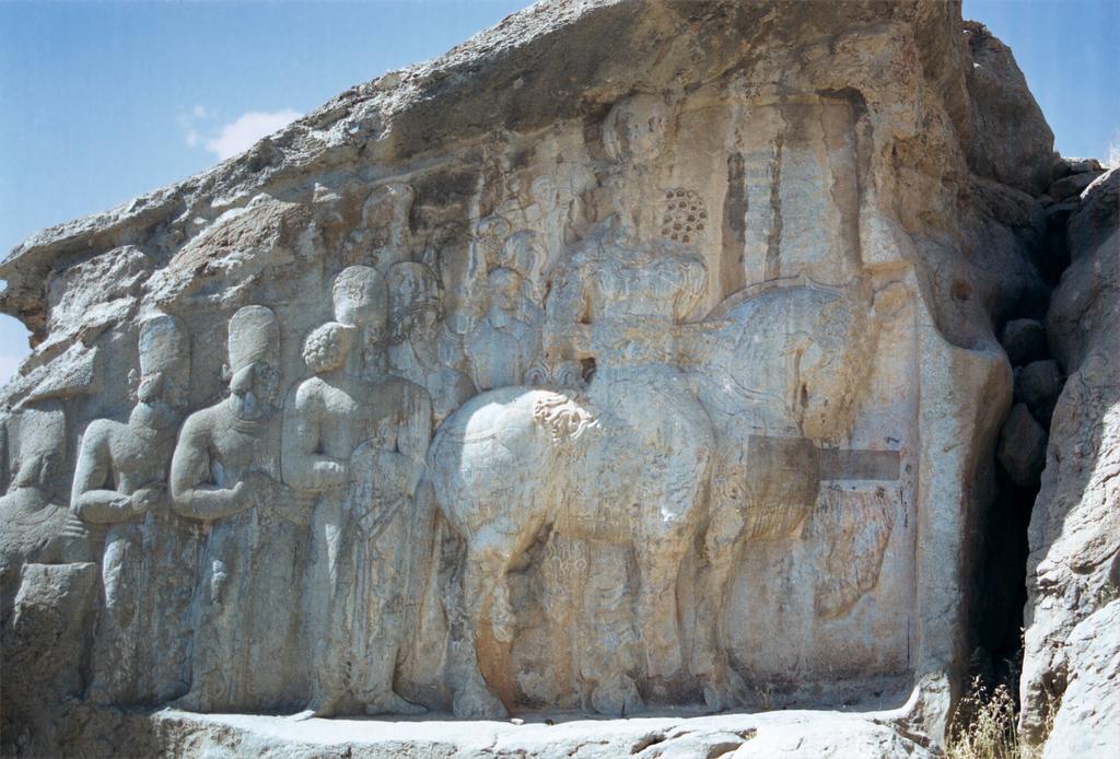
Naqsh-e Rajab
Monument and historic site · 3.4 km
Iranian national heritage site

Naqsh-e Rustam
Monument and historic site · 2.5 km
Necropolis in Fars Province, Iranian national heritage site
Naqsh-e Rostam
Monument and historic site · 2.4 km
Ancient archeological site and necropolis



Where to stay1

Naqsh e rostam Traditional guest house
Motel and hotel · 1.8 km
24/7
Gas and EV charging1

Healthcare1

Map of Zangīābād
15 places. The map loads OpenStreetMap tiles when you open it.
Getting there and nearby towns
Shiraz Shahid Dastgheib International Airport (SYZ) is the nearest airport with scheduled flights listed in OpenStreetMap, 55 km away.
- Shamsābād-e Borzū 1 km south, about 1 min by car
- Ḩājjīābād 7 km east, about 7 min by car
- Khalaf Ţāḩūneh 10 km east, about 10 min by car
- Marvdasht 12 km southwest, about 12 min by car
- Seyyedān 15 km east, about 15 min by car
- Fārūq 18 km east, about 18 min by car
- Zarqān 26 km southwest, about 26 min by car
- Lapū’ī 28 km southwest, about 28 min by car
- Shahr-e Ṣadrā 39 km southwest, about 39 min by car
- Shiraz 51 km southwest, about 51 min by car
Drive times are estimates from straight-line distance, not routes.
Local news
Headlines from INDB.
Reviews, tips and questions
Loading what members have shared...
Sources and licences
- GeoNames (CC BY 4.0): population, coordinates, regions and time zone
- OpenStreetMap contributors (ODbL 1.0): places, airports, map data
- Wikidata (CC0 1.0): elevation, founding date, time zone, website, landmarks and historic places
- Wikimedia Commons (see each image): photos
Photo credits
- Persepolis, Iran, Jesse Allen, Public domain
- Naqsh-e Rajab - Shapur parade, Philippe Chavin ( Simorg ), CC BY-SA 3.0
- The Islamic Republic 049 (8498647398), Stefan Krasowski from New York, NY, USA, CC BY 2.0
- Darius detail on the Darius vase, Carlo Raso, CC BY-SA 2.0
- The Double Equestrian Relief of Bahram II (AD 276-293), Naqsh-e Rostam, Iran (48098814427), Carole Raddato from Frankfurt, Germany, CC BY-SA 2.0
- Equestrian relief of Hormizd II, c AD 303–309, Naqsh-e Rostam, Iran (48098806707), Carole Raddato from Frankfurt, Germany, CC BY-SA 2.0
- Naghsh Rostam - Rostam inscription - panoramio (3), Alireza Javaheri, CC BY 3.0
- Naghsh-e rostam, Irán, 2016-09-24, DD 12, Diego Delso, CC BY-SA 4.0
- Darius I, Rumlu, Public domain
- Naqsh-e Rustam necropolis in Iran, Maasaak, CC BY-SA 4.0
- Sasanian relief commemorating an equestrian victory by king Bahram II (r. AD 276-293), Naqsh-e Rostam, Iran (48098755203), Carole Raddato from Frankfurt, Germany, CC BY-SA 2.0
- Naghsh-e rostam, Irán, 2016-09-24, DD 10, Diego Delso, CC BY-SA 4.0
- History History IMG 0238 Iran (3472017847), Ninara from Helsinki, Finland, CC BY 2.0
- Naqsherostam5, user:Aarash, CC BY-SA 3.0
- Naqsherostam42, آرش, CC BY-SA 3.0
- Naqsh Rostam Orang, Erich Schmidt, Public domain
- Naqsherostam36, آرش, CC BY-SA 3.0
- Naqsh-e Rustam 3, درفش کاویانی, CC BY-SA 3.0
- Naqsherostam4, user:Aarash, CC BY-SA 3.0
- Naqsh Rostam Dariush, Erich Schmidt, Public domain
- Naqsh-e Rustam 4, درفش کاویانی, CC BY-SA 3.0
- Naqsherostam6, user:Aarash, CC BY-SA 3.0
- Naqsherostam47, آرش, CC BY-SA 3.0
- Naqsherostam49, آرش, CC BY-SA 3.0
- Naqsherostam43, آرش, CC BY-SA 3.0
- Naqsherostam50, آرش, CC BY-SA 3.0
- Naqsherostam30, user:Aarash, CC BY-SA 3.0
- Naqsherostam3, user:Aarash, CC BY-SA 3.0
- Naqsherostam37, Arche ( آرش ), CC BY-SA 3.0
- Naqsh-e Rustam 7, درفش کاویانی, CC BY-SA 3.0
- Graves in Tomb of Darius I, Erich Schmidt, CC BY-SA 3.0
- Naqsherostam39, آرش, CC BY-SA 3.0
- Naqsh-e Rustam 5, درفش کاویانی, CC BY-SA 3.0
- Naqsherostam31, آرش, CC BY-SA 3.0
- Naqsherostam48, آرش, CC BY-SA 3.0
- Naqsherostam35, آرش, CC BY-SA 3.0
- Naqsh-e Rustam 2, درفش کاویانی, CC BY-SA 3.0
- Naqsherostam29, آرش, CC BY-SA 3.0
- Naqsherostam1, user:Aarash, CC BY-SA 3.0
- Naqsherostam41, آرش, CC BY-SA 3.0
- Tomb of Artaxerxes I, Naqsh-e Rustam, Bernard Gagnon, CC BY-SA 4.0
- Tomb of Darius II, Naqsh-e Rustam 01, Bernard Gagnon, CC BY-SA 4.0


Page built November 8, 2026. Spotted a mistake? Tell us or suggest a place.