


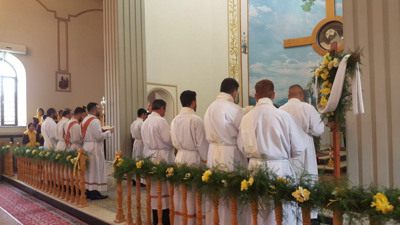

Orūmīyeh, Iran
ارومیه
Orūmīyeh is a regional capital of 577,307 people in West Azerbaijan, Iran.
Why visit Orūmīyeh
Townapedia lists 11 museums and landmarks, 41 parks and trails, 107 places to eat, 28 places to stay and 6 attractions in and around town.
Highlights include Geoy Tepe, Seh Gonbad Tower, بوستان گل مریم and پارک ائللر باغی.
Weather in Orūmīyeh
Forecast from MET Norway (CC BY 4.0). Full forecast
About Orūmīyeh
Urmia (Persian: ارومیه; pronounced [oɾumiˈje] ) is the largest city in West Azerbaijan Province of Iran. In the Central District of Urmia County, it is capital of the province, the county, and the district. The city is situated near the borders of Iran with Turkey and Iraq.
From the Wikipedia article Urmia (this version), under CC BY-SA 4.0.
Travel tips from other travellers: Orūmīyeh on Wikivoyage (CC BY-SA 4.0).
Things to do6


Museums and landmarks11

Geoy Tepe
Monument and historic site · 7.2 km
Iranian national heritage site


Seh Gonbad Tower
Monument and historic site · 1.1 km
Mausoleum tower in Urmia, Iranian national heritage site

آرامگاه سید حسین عرب باغی
Monument and historic site · 1.0 km
خیابان آرامگاه, ارومیه

Parks, trails and playgrounds41


29 more on the map.
Restaurants and cafes107

coffe burger parking|کافه برگر پارکینگ
Cafe · Coffee Shop, Burger · 2.3 km
16متری اول خیابان اصغری(بهنق), ارومیه
24/7

دنر زغالی رُست|Roast döner
Restaurant · Kebab · 2.5 km
35 بلوار سربازان گمنام, ارومیه
Mo-Su 11:00-23:00
دورنا
Restaurant · Regional, Chicken · 1.3 km
123 خیابان کشتگر, ارومیه
7/4
Qablameh Restaurant
Restaurant · 3.4 km
بلوار درستکار, urmia
Mo-Su 12:00-23:30
Rostams Càfe - کافه رستمز
Cafe · Coffee Shop, Cake, Chocolate, Donut · 2.5 km
بلوار سربازان گمنام, ارومیه
09:00-23:00

نان کره ای خوش طعم
Bakery · 3.7 km
خیابان معرفت /ساختمان سامان, ارومیه
Mo-Su 05:00-21:00
کافه تارگت
Cafe · 2.0 km
کافه تارگت اماده ارایه انواع نوشیدنی گرم و سرد و غذاهای مختلف می باشد
خیابان امام 2 سردار سلیمانی جنب شهر بازی پشت کافه بیروت, ارومیه
11:00-24:00
95 more on the map.
Where to stay28
Qods Dormitory (Urmia's Medical Sciences University)
Motel and hotel · 1.1 km
خیام شمالی
Boys Dormitory- Urmia University Of Medical Sciences
Motel and hotel · 2.1 km
شهید رجائی
Churches and places of worship96
Naneh Maryam Church
Church · Syriac Orthodox, Adventist · 1.1 km
خیام, ارومیه
Imam Zaman Mosque
Place of worship · Nondenominational · 3.5 km
خیابان المهدی, urmia
Shopping68
کانسپت استور زیرا
Shop · 1.3 km
خیابان حافظ یک، روبروی کوی ششم، پلاک ۲۹۶، کانسپت استور زیرا خیابان حافظ, ارومیه
Gas and EV charging18
جایگاه سی ان جی و پمپ بنزین برادران مذهبی
Gas station · 3.1 km
بزرگراه خاتم الانبیا, ارومیه
Schools, colleges and libraries119
Healthcare92
Imam Khomeini's Educational Hospital (Trauma Center)
Hospital · 2.0 km
بلوار ارشاد, ارومیه
Day Clinic of Imam Khomeini's Educational Hospital
Clinic and pharmacy · 2.1 km
شفا
Kowsar's General Hospital of Obstetrics and Gynecology
Hospital · 3.1 km
بلوار آیت اله حسنی
Map of Orūmīyeh
250 places. The map loads OpenStreetMap tiles when you open it.
Getting there and nearby towns
Urmia International Airport (OMH) is the nearest airport with scheduled flights listed in OpenStreetMap, 13 km away.
- Şadāqeh 4 km east, about 4 min by car
- Bozveh 6 km southwest, about 6 min by car
- Qoţlū 8 km southeast, about 8 min by car
- Band 9 km southwest, about 9 min by car
- Bārān Dūz 16 km south, about 16 min by car
- Bālānej 19 km southeast, about 19 min by car
- Nūshīn 20 km north, about 20 min by car
- Naqadeh 72 km southeast, about 1 h 15 min by car
- Salmās 77 km north, about 1 h 15 min by car
- Bonāb 90 km east, about 1 h 30 min by car
Drive times are estimates from straight-line distance, not routes.
Local news
Headlines from INDB.
Reviews, tips and questions
Loading what members have shared...
Sources and licences
- GeoNames (CC BY 4.0): population, coordinates, regions and time zone
- OpenStreetMap contributors (ODbL 1.0): places, airports, map data
- Wikidata (CC0 1.0): elevation, founding date, time zone, website, landmarks and historic places
- Wikimedia Commons (see each image): photos
- Wikipedia (CC BY-SA 4.0): overview and history text
Photo credits
- نمایی از شهر ارومیه, Anna-Freud, CC BY-SA 4.0
- Administrative division, Donfarzad, CC BY-SA 3.0
- Üç günbəz türbəsi 202209 (1), Rəcəb Yaxşı, CC BY-SA 4.0
- Müqəddəs Məryəm kilsəsi Urmiya (26), Rəcəb Yaxşı, CC BY-SA 4.0
- Saint Mary's Assyrian Chaldean Catholic Church in Urmia1, Mar Sharb, CC BY 2.0
- Sardar Mosque in Urmia, Anna-Freud, CC BY-SA 4.0
- Jame Mosque of Urmia-2, Toni Afshar, CC BY-SA 4.0
- MenAre 01, Alireza Tajfar, CC BY-SA 4.0
- گوی تپه ارومیه 4, XDR, CC BY-SA 4.0
- Urmia Nane Maryam Church ارومیه کلیسای ننه مریم, MySarnevesht, CC BY-SA 4.0
- بالوو, Amir a57, CC BY-SA 4.0
- Urmia Synagogue, Amir a57, CC BY-SA 3.0
- نمای کلی مسجد سال 1399, Diazinon.bm, CC BY-SA 4.0
- Jaameh mosque of Urmia - Sassanian Period - panoramio, Nima ZANDI, CC BY-SA 3.0
- Hayat Masjed Jamee NJT, Amirmo.njt, CC BY-SA 4.0
- Masjed Jamee NJT2, Amirmo.njt, CC BY-SA 4.0
- Masjed-Jamee-Urmia-NJT, Amirmo.njt, CC BY-SA 4.0
- Majed jamee NJT, Amirmo.njt, CC BY-SA 4.0
- Majed jamee Description-NJT, Amirmo.njt, CC BY-SA 4.0
- Masjed Jamee Mehrab NJT, Amirmo.njt, CC BY-SA 4.0
- Darvaze Masjed Jamee NJT, Amirmo.njt, CC BY-SA 4.0
- مسجد جامع در حال مرمت, Diazinon.bm, CC BY-SA 4.0
- گذرگاه بازار, Diazinon.bm, CC BY-SA 4.0
- بازار ارومیه, Diazinon.bm, CC BY-SA 4.0
- ادویه فروشی, Diazinon.bm, CC BY-SA 4.0
- سقف چهارسوق در بازار ارومیه, Diazinon.bm, CC BY-SA 4.0
- مسجد جامع ارومیه, Yalchinyazir, CC BY-SA 4.0
- URMIA BAZAR - panoramio, Behrooz Rezvani, CC BY 3.0
- سر در مسجد مناره, King-solomon, CC BY-SA 4.0
- گنبد و سر در مسجد مناره, King-solomon, CC BY-SA 4.0
- گنبد مسجد مناره, King-solomon, CC BY-SA 4.0
- نمای کلی مسجد سردار, Diazinon.bm, CC BY-SA 4.0
- کاشیکاریهای مسجد سردار, Diazinon.bm, CC BY-SA 4.0
- حیاط مدرسه هدایت, Diazinon.bm, CC BY-SA 4.0
- Masjed Sardar NJT7, Amirmo.njt, CC BY-SA 4.0
- Masjed Sardar NJT4, Amirmo.njt, CC BY-SA 4.0
- Masjed Sardar NJT, Amirmo.njt, CC BY-SA 4.0
- Masjed Sardar NJT3, Amirmo.njt, CC BY-SA 4.0
- Masjed Sardar NJT5, Amirmo.njt, CC BY-SA 4.0
- Masjed Sardar NJT6, Amirmo.njt, CC BY-SA 4.0


Page built November 8, 2026. Spotted a mistake? Tell us or suggest a place.