


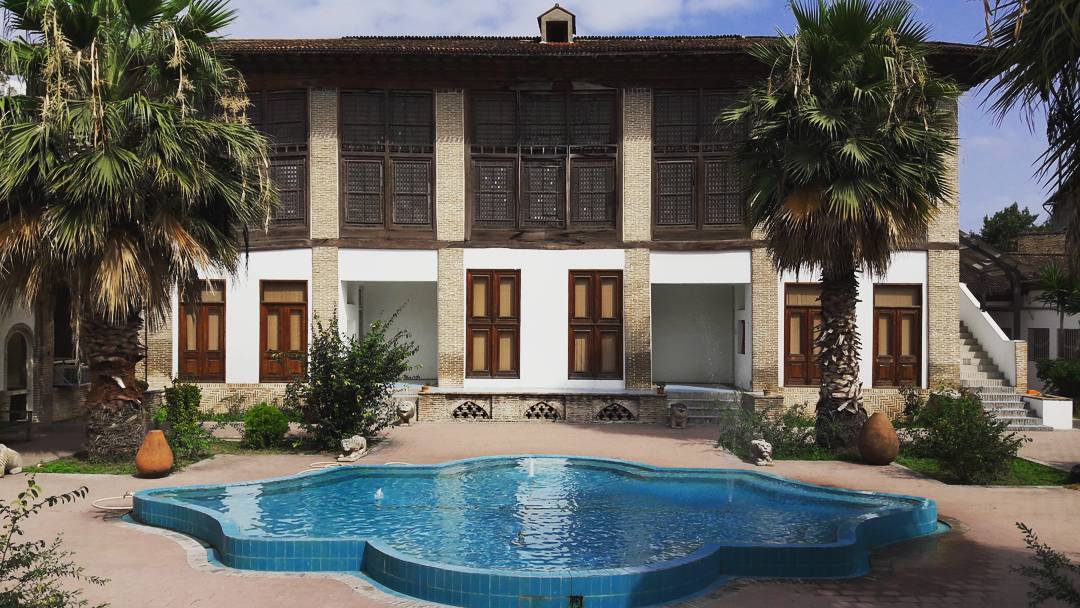


Why visit Sari
Townapedia lists 16 museums and landmarks, 20 parks and trails, 124 places to eat, 5 places to stay and 4 attractions in and around town.
Highlights include Haftn Host and موسسه فرهنگی و هنری هفت آینه.
Weather in Sari
Forecast from MET Norway (CC BY 4.0). Full forecast
About Sari
Sari (Persian: ساری [sɒːˈɾiː] ) is a city in the Central District of Sari County, Mazandaran province, serving as capital of the district, county, and province. Sari was the former capital of Iran for a short period and is in the north of the country, between the northern slopes of the Alborz Mountains and southern coast of the Mazandaran Sea. Sari is the largest and most populous city of Mazandaran and ranked as the most livable city in Iran.
From the Wikipedia article Sari, Iran (this version), under CC BY-SA 4.0.
Travel tips from other travellers: Sari on Wikivoyage (CC BY-SA 4.0).
Things to do4

Museums and landmarks16


4 more on the map.
Parks, trails and playgrounds20


8 more on the map.
Restaurants and cafes124

اوپه باربیکیو
Restaurant · Pizza, Burger, Kebab, Steak House, Breakfast, Diner, Lunch, Cafe · 0.8 km
پیوندی پیوند ۴/۱, ساری خیابان فرهنگ
Mo-Su 08:00-24:00

Doping
Cafe · Coffee Shop, Sandwich, Ice Cream, Tea · 1.0 km
پانزده خرداد, ساری
24/7
Gharen catering
Restaurant · Local
قارن ۱۱ (کوچه برق)
Mo-Su 11:30-16:00
فست فود کوک
Restaurant · Salad, Pizza, Burger, Pasta, Sandwich · 1.9 km
پیروزی ۳۲, ساری
sa-fr 12:00-23:00
کافه لونا
Cafe · Coffee Shop, Pizza, Sandwich · 1.2 km
شهابی, ساری
Mo-Su 08:00-23:00

Karma
Restaurant · Italian, Pasta, Breakfast, American, Pizza, Russian, Steak House · 1.8 km
سلمان فارسی
Mo-Su 09:00-01:00
Mia Coffee Store
Cafe · Coffee Shop · 1.0 km
ولیعصر (کوی دکتر سنگ)
112 more on the map.
Where to stay5
Churches and places of worship37
Shopping64
Gas and EV charging8
Schools, colleges and libraries48
دبستان پسرانه شهید شترداران - دبیرستان پسرانه شهید ضامنی
School · Shia · 1.6 km
دخانیات 5 (شهید طبری), ساری
دبستان پسرانه قائم مقام فراهانی - دبستان دخترانه شهدای غزه
School · Shia · 1.2 km
پژمان, ساری
Healthcare83
کلینیک الگانت
Hospital · 0.9 km
خیابان پانزده خرداد، کوچه مهتاب، بلوک دو آراد, ساری
کلینیک زیبایی دکتر مرصاد
Clinic and pharmacy · 0.7 km
بین فرهنگ 19 و 21 ، ساختمان زورق ، طبقه 5 واحد 14, ساری
Map of Sari
250 places. The map loads OpenStreetMap tiles when you open it.
Getting there and nearby towns
Sari Dasht-e-Naz International Airport (SRY) is the nearest airport with scheduled flights listed in OpenStreetMap, 15 km away.
- Pol-e Gardan 3 km southeast, about 3 min by car
- Gol Chīnī 3 km south, about 3 min by car
- Qā’em Shahr 20 km southwest, about 20 min by car
- Bābol 34 km west, about 34 min by car
- Bāqer Tangeh 36 km northwest, about 36 min by car
- Kalleh Bast 39 km west, about 39 min by car
- Bābolsar 40 km northwest, about 40 min by car
- Ojāksar 42 km west, about 42 min by car
- Behshahr 46 km east, about 46 min by car
- Fereydūn Kenār 50 km west, about 50 min by car
Drive times are estimates from straight-line distance, not routes.
Local news
Headlines from INDB.
Reviews, tips and questions
Loading what members have shared...
Sources and licences
- GeoNames (CC BY 4.0): population, coordinates, regions and time zone
- OpenStreetMap contributors (ODbL 1.0): places, airports, map data
- Wikidata (CC0 1.0): elevation, founding date, time zone, website
- Wikimedia Commons (see each image): photos
- Wikipedia (CC BY-SA 4.0): overview and history text
Photo credits
- Melal Park (Melal means nations) 2, Rizorius, CC BY-SA 4.0
- Kolbadi house, Samaneh 1987, CC BY-SA 4.0
- Jameh Mosque of Sari, Alirastkhiz1988, CC BY-SA 4.0
- Fazeli sere 11, Gholamreza Ahmadi, CC BY 4.0
- Fazeli sere 10, Gholamreza Ahmadi, CC BY 4.0
- Fazeli house 31, Farhad Babaei, CC BY 4.0
- Fazeli house 27, Farhad Babaei, CC BY 4.0
- Fazeli sere 03, Gholamreza Ahmadi, CC BY 4.0
- Fazeli house 28, Farhad Babaei, CC BY 4.0
- Fazeli sere 06, Gholamreza Ahmadi, CC BY 4.0
- Fazeli sere 09, Gholamreza Ahmadi, CC BY 4.0
- Fazeli sere 04, Gholamreza Ahmadi, CC BY 4.0
- Fazeli sere 01, Gholamreza Ahmadi, CC BY 4.0
- Fazeli house 32, Farhad Babaei, CC BY 4.0
- Fazeli house 36, Farhad Babaei, CC BY 4.0
- Fazeli house 26, Farhad Babaei, CC BY 4.0
- Fazeli sere 23, Gholamreza Ahmadi, CC BY 4.0
- Fazeli sere 02, Gholamreza Ahmadi, CC BY 4.0
- Fazeli house 37, Farhad Babaei, CC BY 4.0
- Fazeli sere 08, Gholamreza Ahmadi, CC BY 4.0
- Fazeli sere 18, Gholamreza Ahmadi, CC BY 4.0
- Fazeli sere 22, Gholamreza Ahmadi, CC BY 4.0
- Fazeli sere 17, Gholamreza Ahmadi, CC BY 4.0
- Fazeli sere 05, Gholamreza Ahmadi, CC BY 4.0
- Fazeli sere 12, Gholamreza Ahmadi, CC BY 4.0
- Fazeli sere 19, Gholamreza Ahmadi, CC BY 4.0
- Fazeli sere 21, Gholamreza Ahmadi, CC BY 4.0
- Fazeli house 33, Farhad Babaei, CC BY 4.0
- Fazeli sere 15, Gholamreza Ahmadi, CC BY 4.0
- Fazeli sere 16, Gholamreza Ahmadi, CC BY 4.0
- Fazeli house 38, Farhad Babaei, CC BY 4.0
- Fazeli sere 07, Gholamreza Ahmadi, CC BY 4.0
- Fazeli house 34, Farhad Babaei, CC BY 4.0
- Fazeli sere 13, Gholamreza Ahmadi, CC BY 4.0
- Fazeli house 35, Farhad Babaei, CC BY 4.0
- Fazeli house 29, Farhad Babaei, CC BY 4.0
- Fazeli sere 20, Gholamreza Ahmadi, CC BY 4.0
- Fazeli house 30, Farhad Babaei, CC BY 4.0
- Fazeli sere 14, Gholamreza Ahmadi, CC BY 4.0
- Fazeli house 25, Farhad Babaei, CC BY 4.0


Page built November 8, 2026. Spotted a mistake? Tell us or suggest a place.