Townapedia
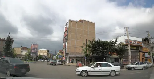
Gilan - Talesh - panoramio
Gilan - Talesh - panoramio · Alireza Javaheri, CC BY 3.0
Nature of Agh Evlar
Nature of Agh Evlar · Omid Jafarnezhad, CC BY 3.0
Pelophylax ridibundus in Hashtpar by Aryo solhjou
Pelophylax ridibundus in Hashtpar by Aryo solhjou · Aryo Solhjou, CC BY 3.0

Sūrā Posht, Iran

سوراپشت

Sūrā Posht is a town of 1,535 people in Gilan Province, Iran.

Loading the weather...
Population1,535 GeoNames
Local nameسوراپشت
Elevation24 m 79 ft
Time zoneAsia/Tehran
Nearest airportArdabil Airport (ADU) 74 km

Why visit Sūrā Posht

Townapedia lists 3 museums and landmarks, 4 parks and trails and 13 places to eat in and around town.

About Sūrā Posht

Suraposht (Persian: سوراپشت) is a village in Tula Rud Rural District of the Central District in Talesh County, Gilan province, Iran.

From the Wikipedia article Suraposht (this version), under CC BY-SA 4.0.

Museums and landmarks3

ارشاد اسلامی تالش

Museum · 1.7 km

Open in Google Maps

کاخ سردار امجد

Monument and historic site · 2.4 km

Open in Google Maps · Wikipedia

کانون فکری

Museum · 1.8 km

Open in Google Maps

Parks, trails and playgrounds4

بوستان پدر

Park · 2.3 km

Open in Google Maps

بوستان مادر

Park · 2.0 km

Open in Google Maps

پارک شهر

Park · 2.3 km

Open in Google Maps

پارک قدس

Park · 1.6 km

Open in Google Maps

Restaurants and cafes13

خانه معلم

Restaurant · 2.3 km

Open in Google Maps

نانوایی

Bakery · 1.3 km

Open in Google Maps

بربری پزی

Bakery · 2.4 km

Open in Google Maps

بستنی سنتی عمو ...

Ice cream · 2.1 km

Open in Google Maps

لواش پزی روستا

Bakery · 1.4 km

Open in Google Maps

نانوایی

Bakery · 1.7 km

Open in Google Maps

نانوایی دو منظوره سنگک و بربری خالقی شال

Bakery · 2.3 km

Open in Google Maps

نانوایی لواشی سنتی

Bakery · 1.8 km

Open in Google Maps

کافه گپ

Cafe · 2.0 km

Open in Google Maps

کافی شاپ چاکلی

Cafe · 2.2 km

Open in Google Maps

فست فود رومانا

Fast food · Pizza, Sandwich · 2.2 km

پاسداران, تالش پارک شهر نبش خیابان پاسداران

Mo-Su 09:00-23:00
Open in Google Maps · 09383344591

مرغ سوخاری ۵۶

Fast food · Chicken · 2.3 km

بلوار ولیعصر, تالش

Sa-Fr 16:00-24:00

Open in Google Maps · 01344238964

1 more on the map.

Advertisement

Churches and places of worship12

(امام حسین (ع

Place of worship · 2.3 km

Open in Google Maps

(مسجد حضرت ابولفضل(ع

Place of worship · 2.1 km

Open in Google Maps

حوزه علمیه

Place of worship · 2.3 km

Open in Google Maps

مسجد امام حسن مجتبی ع

Place of worship · 1.4 km

Open in Google Maps

مسجد جامع

Place of worship · 2.3 km

Open in Google Maps

مسجد جعفر صادق

Place of worship · 2.3 km

Open in Google Maps

مسجد حضرت رقیه

Place of worship · 1.1 km

Open in Google Maps

مسجد سید الشهدا

Place of worship · 1.3 km

Open in Google Maps

مسجد صاحب الزمان

Place of worship · 2.4 km

Open in Google Maps

مسجد عباسیه

Place of worship · 2.0 km

Open in Google Maps

مسجد قاسمیه

Place of worship · 1.8 km

Open in Google Maps

مسجد محمدیه

Place of worship · 2.3 km

Open in Google Maps

Shopping24

Gas and EV charging1

Advertisement

Schools, colleges and libraries21

Healthcare15

  • داروخانه گیاهپزشکی دکتر عباس مهرداد لمر

    Clinic and pharmacy · 2.2 km

    امام خمینی, تالش

    Open in Google Maps

  • داروخانه گیاهپزشگی نگار تالش

    Clinic and pharmacy · 2.4 km

    شهید نواب صفوی

    Open in Google Maps

  • داروخانه شبانه روزی دکتر اسماعیلی

    Clinic and pharmacy · 2.0 km

    Open in Google Maps

  • کلینیک شفا

    Clinic and pharmacy · 2.4 km

    Open in Google Maps

  • کلینیک گفتاردرمانی شفا

    Clinic and pharmacy · 2.1 km

    معین, تالش

    Open in Google Maps

  • Shahid Norani hospital

    Hospital · 1.8 km

    Open in Google Maps

  • داروخانه

    Clinic and pharmacy · 2.2 km

    Open in Google Maps

  • داروخانه دکتر امامی نژاد

    Clinic and pharmacy · 2.3 km

    Open in Google Maps

  • داروخانه دکتر پورفرهادی

    Clinic and pharmacy · 2.2 km

    Open in Google Maps

  • داروخانه دکتر فلاح

    Clinic and pharmacy · 2.3 km

    Open in Google Maps

  • داروخانه دکتر نجاتی

    Clinic and pharmacy · 2.1 km

    Open in Google Maps

  • شبکه بهداشت حیان

    Hospital · 1.2 km

    Open in Google Maps

Map of Sūrā Posht

93 places. The map loads OpenStreetMap tiles when you open it.

Getting there and nearby towns

Ardabil Airport (ADU) is the nearest airport with scheduled flights listed in OpenStreetMap, 74 km away.

  • Khvājeh Karī 2 km north, about 2 min by car
  • Anūsh Maḩalleh 2 km northwest, about 2 min by car
  • Hashtpar 2 km west, about 2 min by car
  • Khalkhāl 41 km southwest, about 41 min by car
  • Bandar-e Anzalī 59 km southeast, about 59 min by car
  • Āstārā 70 km north, about 1 h 15 min by car
  • Fūman 72 km southeast, about 1 h 15 min by car
  • Ardabīl 75 km northwest, about 1 h 15 min by car
  • Rasht 82 km southeast, about 1 h 15 min by car
  • Khoshk Bījār 87 km southeast, about 1 h 30 min by car

Drive times are estimates from straight-line distance, not routes.

Reviews, tips and questions

Loading what members have shared...

Sources and licences

Photo credits

Page built November 8, 2026. Spotted a mistake? Tell us or suggest a place.