


Why visit Akranes
Townapedia lists 6 museums and landmarks, 5 parks and trails, 12 places to eat, 5 places to stay and 4 attractions in and around town.
Highlights include Akranes Museum Centre and Akranesvöllur.
Weather in Akranes
Forecast from MET Norway (CC BY 4.0). Full forecast
About Akranes
Akranes (Icelandic pronunciation: [ˈaːkraˌnɛːs] ) is a port town in the municipality of
From the Wikipedia article Akranes (this version), under CC BY-SA 4.0.
Things to do4


Museums and landmarks6



Parks, trails and playgrounds5





Restaurants and cafes12




Domino's
Fast food · Pizza · 1.2 km
Smiðjuvellir, Akranes
Mo-Fr 16:00-22:00; Sa-Su 11:00-22:00
History
Akranes was settled in the 9th century by the brothers Þormóður and Ketill, sons of Bresi, who came from Ireland. The town started to form in the mid-17th century as a fishing village. In 1942, it was formally chartered, and in the following years it had the biggest surge in population in its history.
Industry has been a big and growing employer: a cement plant has been operated in the town since the 1950s, and an aluminium smelting plant has been in operation near the town since 1998.
From the History section of Akranes on Wikipedia, under CC BY-SA 4.0.
Where to stay5
Churches and places of worship2
Shopping7
Gas and EV charging8
Schools, colleges and libraries5
Healthcare2
Map of Akranes
56 places. The map loads OpenStreetMap tiles when you open it.
Getting there and nearby towns
Reykjavik Airport (RKV) is the nearest airport with scheduled flights listed in OpenStreetMap, 22 km away.
- Seltjarnarnes 19 km south, about 19 min by car
- Reykjavík 22 km southeast, about 22 min by car
- Kópavogur 25 km south, about 25 min by car
- Borgarnes 25 km north, about 25 min by car
- Garðabær 27 km south, about 27 min by car
- Hafnarfjörður 29 km south, about 29 min by car
- Keflavík 42 km southwest, about 42 min by car
- Grindavík 57 km south, about 57 min by car
- Þorlákshöfn 62 km southeast, about 1 h by car
- Selfoss 68 km southeast, about 1 h 15 min by car
Drive times are estimates from straight-line distance, not routes.
Local news
Headlines from INDB.
Reviews, tips and questions
Loading what members have shared...
Sources and licences
- GeoNames (CC BY 4.0): population, coordinates, regions and time zone
- OpenStreetMap contributors (ODbL 1.0): places, airports, map data
- Openverse (see each image): photos
- Wikidata (CC0 1.0): elevation, founding date, time zone, website, landmarks and historic places
- Wikimedia Commons (see each image): photos
- Wikipedia (CC BY-SA 4.0): overview and history text
Photo credits
- Akranes loftmynd, Helgarun, CC BY-SA 3.0
- Safnasvæðið á Akranesi1, Tryggvidor, CC BY-SA 3.0
- Akranes stadium, FV82, CC BY-SA 4.0
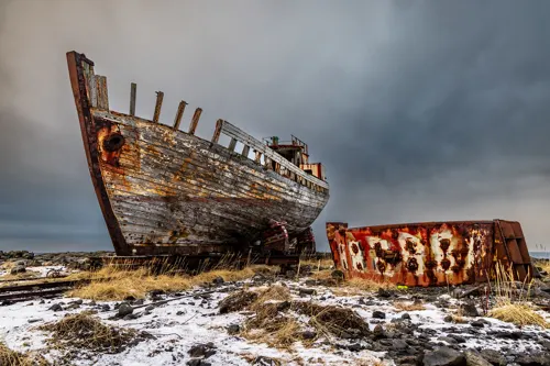
- Ghost Ship, Simaron, CC BY-SA 2.0
Page built November 2, 2026. Spotted a mistake? Tell us or suggest a place.