


Why visit Grindavík
Townapedia lists 15 museums and landmarks, 2 parks and trails, 16 places to eat, 8 places to stay and 53 attractions in and around town.
Highlights include Reykjanesviti, Fagradals-Hagafell, Kvikan and The Icelandic Museum of Rock 'n' Roll.
Weather in Grindavík
Forecast from MET Norway (CC BY 4.0). Full forecast
About Grindavík
Grindavík (Icelandic pronunciation: [ˈkrɪntaˌviːk] ) is a fishing town in the Southern Peninsula district of Iceland, located near Þorbjörn.
From the Wikipedia article Grindavík (this version), under CC BY-SA 4.0.
Things to do53
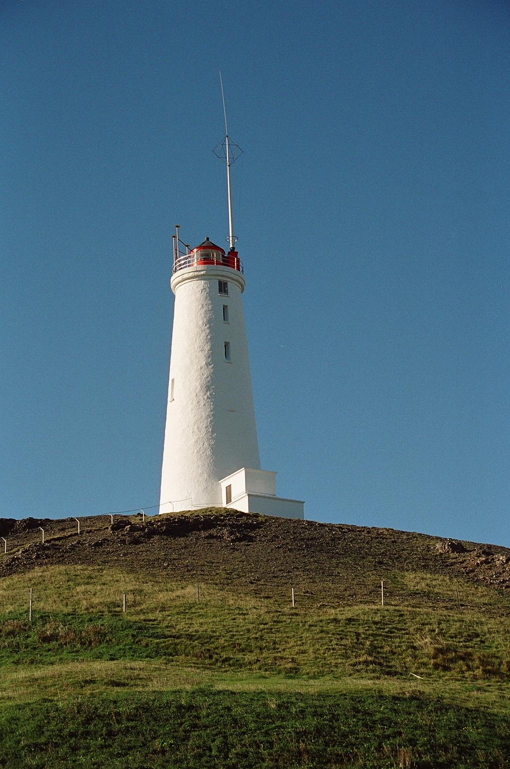
Reykjanesviti
Lighthouse · 13.3 km
Lighthouse in Iceland
Reykjanes-aðalviti



41 more on the map.
Museums and landmarks15

The Icelandic Museum of Rock 'n' Roll
Museum · 17.7 km
Music museum in Reykjanesbær, Iceland


Blue Lagoon
Monument and historic site · 4.7 km
Jan 01-May 25: Mo-Su 08:00-22:00; May 26-Jun 29: Mo-Su...

Reykjanestá
Monument and historic site · 13.8 km
Viewpoint. Furthest point on the Reykjanes peninsula.



Eruptoin crater by Fagradalsfjall
Monument and historic site · 10.1 km
According to Icelandic Meteorology Office the fissure is around 200 meters long. Eldfjallafræði og náttúruvárhópur Háskóla Íslands segir...
Selatangar
Monument and historic site · 9.9 km
Ruins of old fishing station buildings
3 more on the map.
Parks, trails and playgrounds2

Sundlaug Grindavíkur
Sports field and stadium · 0.7 km
1-3 Austurvegur, Grindavík

Restaurants and cafes16

Spa Restaurant
Restaurant · 4.6 km
With expansive windows revealing the luminous warmth of the Retreat Lagoon, you can fulfill yourself on the restaurant’s light...
11 Norðurljósavegur, Grindavík
Mo-Su 07:30-22:00

Retreat Lounge
Restaurant · 4.6 km
Wall-to-wall glass opens to the light and lava of the surrounding lagoon while the wood-burning fireplace brings warmth and wellbeing.


4 more on the map.
History
Landnáma or The Book of Settlements mentions that around 934, two Viking settlers, Molda-Gnúpur Hrólfsson [ˈmɔltaˌknuːpʏr ˈr̥oulsˌsɔːn] and Þórir Haustmyrkur Vígbjóðsson [ˈθouːrɪr ˈhœystˌmɪr̥kʏr ˈviɣˌpjouðsˌsɔːn], arrived in the Reykjanes area. Þórir settled in Selvogur and Krísuvík and Molda-Gnúpur in Grindavík.
The sons of Moldar-Gnúpur established three settlements; Þórkötlustaðahverfi [ˈθour̥ˌkʰœhtlʏˌstaːðaˌkʰvɛrvɪ], Járngerðarstaðarhverfi [ˈjau(r)tnˌcɛrðar̥ˌstaːðar̥ˌkʰvɛrvɪ] and Staðarhverfi [ˈstaːðar̥ˌkʰvɛrvɪ]. The modern version of Grindavík is situated mainly in what was Járngerðarstaðarhverfi.
The town has been an important fishing station since medieval times. In the 13th century its fishing rights were owned by the Bishop of Skálholt, who took payment in stacks of salted cod. It was the scene of fierce disputes between English fishermen and German merchants in the 16th century, leading to 280 Germans storming the ship of John Breye (also known as John the Broad) in 1532 and killing 15 people, including John. The English were subsequently expelled from Iceland.
In June 1627, Grindavík was raided by Barbary Pirates in an event known as the Turkish Abductions. Twelve Icelanders and three Danes, along with two vessels were taken, and with captives taken from other Icelandic settlements, transported into slavery in Salé.
From the History section of Grindavík on Wikipedia, under CC BY-SA 4.0.
Where to stay8
Churches and places of worship3
Gas and EV charging2
Schools, colleges and libraries4
Map of Grindavík
103 places. The map loads OpenStreetMap tiles when you open it.
Getting there and nearby towns
Naval Air Station Keflavik (KEF) is the nearest airport with scheduled flights listed in OpenStreetMap, 18 km away.
- Keflavík 19 km north, about 19 min by car
- Reykjanesbær 19 km north, about 19 min by car
- Hafnarfjörður 35 km northeast, about 35 min by car
- Garðabær 38 km northeast, about 38 min by car
- Kópavogur 40 km northeast, about 40 min by car
- Reykjavík 42 km northeast, about 42 min by car
- Seltjarnarnes 41 km northeast, about 41 min by car
- Þorlákshöfn 52 km east, about 52 min by car
- Akranes 57 km north, about 57 min by car
- Borgarnes 82 km north, about 1 h 15 min by car
Drive times are estimates from straight-line distance, not routes.
Local news
Headlines from INDB.
Reviews, tips and questions
Loading what members have shared...
Sources and licences
- GeoNames (CC BY 4.0): population, coordinates, regions and time zone
- OpenStreetMap contributors (ODbL 1.0): places, airports, map data
- Wikidata (CC0 1.0): elevation, founding date, time zone, website, landmarks and historic places
- Wikimedia Commons (see each image): photos
- Wikipedia (CC BY-SA 4.0): overview and history text
Photo credits
- Grindavík apríl 2025, Steinninn, CC BY-SA 4.0
- Grindavíkurkirkja - panoramio, Jon Gretarsson, CC BY-SA 3.0
- Icelandic horse Grindavík 02, Rémih, CC BY-SA 4.0
- Iceland - Grindavík, www.GlynLowe.com, CC BY 2.0
- Icelandic horse Grindavík 01, Rémih, CC BY-SA 4.0
- Icelandic horse Grindavík 03, Rémih, CC BY-SA 4.0
- Icelandic horse Grindavík 04, Rémih, CC BY-SA 4.0
- Grindavíkurvöllur 'Grindavík Field', Quintin Soloviev, CC BY 4.0
- Grindavíkurvöllur - 52076927287, Tadeusz Hare, CC BY-SA 2.0
- Grindavík 2024, Steinninn, CC BY 4.0
- Grindavík, Iceland after the eruption in 2025, Quintin Soloviev, CC BY 4.0
- Hraun við Grindavík, Steinninn, CC BY 4.0
- Grindavík nóvember 2024, Steinninn, CC BY 4.0
- Defence barrier north of Grindavík, Gaggi96, CC0
- View on Grindavík, Iceland from north (Road 43), Alexander Grebenkov, CC BY 3.0
- View of Grindavík from Þorbjörn Mountain, Iceland, 20230430 1530 3659, Jakub Hałun, CC BY-SA 4.0
- Leuchtturm Island1, Reykholt, CC BY-SA 3.0
- Viking world museum, Leon Petrosyan, CC BY-SA 3.0
- Blue Lagoon 2012-08-23 (4), Bloody-libu, CC BY-SA 3.0
- Gunnuhver 4, Christian Bickel, CC BY-SA 2.0 de
- Faro de Hopsnes, Suðurland, Islandia, 2014-08-13, DD 082, Diego Delso, CC BY-SA 4.0
- 2014-04-27 10-36-27 Iceland - Grindavík Grindavík, Hansueli Krapf This file was uploaded with Commonist ., CC BY-SA 3.0
- Reykjanestá (5968023752), Richard Gould from Vancouver, Canada, CC BY-SA 2.0
- View on Atlantic Ocean from Road 427 on Borgarhraun, east of Grindavík, Iceland, Alexander Grebenkov, CC BY 3.0
- FMA crash photo1, Unknown author, Public domain
- Bridge across continents iceland, Chris 73, CC BY-SA 3.0
- Litli-Hrútur - Volcanic Eruption in Iceland July 2023 (53062519222), Anthony Quintano from Mount Laurel, United States, CC BY 2.0
- Naval Radio Transmitter Facility Grindavík, Olga Ernst, CC BY-SA 4.0
- Kirkja heilags Jóhannesar Páls II ferming, Steinninn, CC BY 4.0
- B-24D LIberator Hot Stuff serial number 41-23728, Warbirdfan, CC BY-SA 3.0
- Senecio vulgaris 215572757, Attila Oláh, CC BY 4.0
- Grindavik (36283594816), Mark Gunn from Novato, California, USA, CC BY 2.0
- Iceland Day Two -14 (23063564821), Ryan Stavely, CC BY-SA 2.0
- Iceland Day Two -15 (22634045987), Ryan Stavely, CC BY-SA 2.0
- Island 2013 421 Grindavik (9482564362), Klaus Nahr from Germany, CC BY-SA 2.0
- Island 2013 420 Grindavik (9482557706), Klaus Nahr from Germany, CC BY-SA 2.0
- Island 2013 425 Grindavik (9482597440), Klaus Nahr from Germany, CC BY-SA 2.0
- Iceland Today - Society, Landscapes and Infrastructure (P-070318-00-17), Europäische Kommission - Audiovisueller Dienst, Halldór Kolbeins, CE - Service audiovisuel, EC - Audiovisual Service, FACTSTORY, CC BY 4.0
- Fulmarus glacialis (side), Hans Hillewaert, CC BY-SA 3.0
- Fulmarus glacialis (landing), Hans Hillewaert, CC BY-SA 3.0


Page built November 2, 2026. Spotted a mistake? Tell us or suggest a place.