
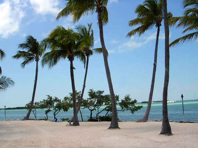


Islamorada, Village of Islands, Florida
Islamorada, Village of Islands is a village of 7,068 people in Monroe County, Florida.
Why visit Islamorada, Village of Islands
Townapedia lists 1 museum or landmark, 6 parks and trails, 10 places to eat, 2 places to stay and 2 attractions in and around town.
Highlights include B&B Tavernier Cinema 5, Snake Creek Bridge, San José y Las Animas and Tavernier Creek Marina.
August is the warmest month, with average highs of 90°F; January lows average 64°F.
Weather in Islamorada, Village of Islands
Forecast from the National Weather Service. Full forecast
About Islamorada, Village of Islands
Islamorada (eye-la-mor-AH-dah also sometimes spelled Isla Morada) is an incorporated village in Monroe County, Florida, United States. It is located directly between Miami and Key West on five islands, Tea Table Key, Lower Matecumbe Key, Upper Matecumbe Key, Windley Key, and Plantation Key, in the Florida Keys. As of the 2020 census, the village had a population of 7,107, up from 6,119 in 2010.
From the Wikipedia article Islamorada, Florida (this version), under CC BY-SA 4.0.
Things to do2



Snake Creek Bridge
Bridge · 3.8 mi
Bridge in United States of America
Museums and landmarks1

San José y Las Animas
Monument and historic site · National Register of Historic Places · 4.2 mi
Historic shipwreck in Florida, United States
Parks, trails and playgrounds6


Plantation Key Colony Civic Club
Park · 0.9 mi
Boat ramp and park
155 Jasmine Street, Tavernier
Restaurants and cafes10

The Elite Label
Bar and pub · 0.8 mi
The Elite Label is a premier mobile bar and cocktail catering company serving South Florida, the Florida Keys, Key Largo, and Key West.
24/7

City Hall Cafe
Restaurant · Regional, American, Sandwich, Seafood, Salad · 1.2 mi
88511 Overseas Highway, Tavernier
Mo-Sa 10:30-21:00

Domino's
Fast food · Pizza · 1.6 mi
91200 Overseas Highway, Tavernier
Mo-Th 10:00-24:00; Fr-Sa 10:00-01:00; Su 10:00-24:00
Dunkin'
Fast food · Donut, Coffee Shop · 1.5 mi
91292 Overseas Highway, Tavernier
Mo-Sa 05:00-19:00; Su 06:00-19:00
History
The name "Islamorada" (Spanish pronunciation: [ˈisla moˈɾaða]), spelled isla morada in Spanish, "Island Home", came from townsite founder William J. Krome.
Islamorada was the location of one of the stations of the Overseas Railroad.
Islamorada was hit almost directly by the Labor Day Hurricane of 1935, causing 423 deaths. A memorial, including the ashes of over 300 victims, exists today at Overseas Highway, mile marker 82.
Baseball player Ted Williams began visiting Islamorada in 1943, and for the next 45 years, he was the island's most well-known resident. After his retirement from baseball, he became the national spokesman for Sears sporting goods and became renowned for his abilities as a fisherman. Over the decades, he hosted numerous celebrities at his Islamorada house and took them on local fishing trips.
The village was incorporated on December 31, 1997. Before this date, Islamorada referred to the evolving community island of Upper Matecumbe Key.
From the History section of Islamorada, Florida on Wikipedia, under CC BY-SA 4.0.
Where to stay2
Churches and places of worship5
Shopping2
Gas and EV charging5
Schools, colleges and libraries6
Treasure Village Montessori Charter School
School · 2.8 mi
86731 Overseas Hwy, Islamorada
Upper Keys Academic Connections For Excellence
School · 0.6 mi
73 High Point Rd, Tavernier
Healthcare3
Map of Islamorada, Village of Islands
42 places. The map loads OpenStreetMap tiles when you open it.
Climate by month
Monthly table
| Month | High | Low | Rain | Snow |
|---|---|---|---|---|
| Jan | 75°F | 64°F | 2.1 in | 0.0 in |
| Feb | 77°F | 65°F | 2.2 in | 0.0 in |
| Mar | 79°F | 67°F | 1.6 in | 0.0 in |
| Apr | 83°F | 72°F | 1.9 in | 0.0 in |
| May | 86°F | 75°F | 3.8 in | 0.0 in |
| Jun | 88°F | 78°F | 5.6 in | 0.0 in |
| Jul | 89°F | 80°F | 4.0 in | 0.0 in |
| Aug | 90°F | 79°F | 5.6 in | 0.0 in |
| Sep | 88°F | 78°F | 8.0 in | 0.0 in |
| Oct | 85°F | 75°F | 5.6 in | 0.0 in |
| Nov | 80°F | 70°F | 2.4 in | 0.0 in |
| Dec | 77°F | 67°F | 2.1 in | 0.0 in |
U.S. Climate Normals 1991-2020 for Tavernier (2 mi away), NOAA NCEI.
People and cost of living
American Community Survey 5-year estimates, 2020-2024, U.S. Census Bureau. Estimates have margins of error, larger for small towns.
Disaster history
Monroe County has had 31 federal disaster declarations since 2000, most often for hurricanes.
- 2024-10-11: Hurricane Milton (Hurricane)
- 2024-10-07: Hurricane Milton (Hurricane)
- 2024-09-28: Hurricane Helene (Hurricane)
- 2024-09-24: Tropical Storm Helene (Tropical Storm)
- 2024-08-10: Hurricane Debby (Tropical Storm)
- 2024-08-03: Tropical Storm Debby (Tropical Storm)
OpenFEMA disaster declarations summaries.
Getting there and nearby towns
Ocean Reef Club Airport (OCA) is the nearest airport with scheduled flights listed in OpenStreetMap, 29 miles away.
- Tavernier 4 mi northeast, about 6 min by car
- Key Largo 12 mi northeast, about 20 min by car
- Florida City 32 mi north, about 51 min by car
- Homestead 34 mi north, about 54 min by car
- Marathon 35 mi southwest, about 56 min by car
- Leisure City 36 mi north, about 57 min by car
- Naranja 37 mi north, about 1 h by car
- Princeton 39 mi north, about 1 h by car
- Cutler Bay 43 mi north, about 1 h 15 min by car
- South Miami Heights 43 mi north, about 1 h 15 min by car
Drive times are estimates from straight-line distance, not routes.
Local news
Headlines from INDB, the NEMICO news database.
Reviews, tips and questions
Loading what members have shared...
Sources and licences
- NCES EDGE (Public domain): public schools
- NOAA NCEI U.S. Climate Normals 1991-2020 (Public domain): climate by month
- OpenFEMA (Public domain): disaster declarations
- OpenStreetMap contributors (ODbL 1.0): places, airports, map data
- U.S. Census Bureau (Public domain): population, income, housing, education, commute
- Wikidata (CC0 1.0): elevation, founding date, time zone, website, landmarks and historic places
- Wikimedia Commons (see each image): photos
- Wikipedia (CC BY-SA 4.0): overview and history text
Photo credits
- Islamorada Florida, User:Ex1le, CC BY-SA 3.0
- Snake Creek Florida drawbridge, JKBrooks85, Public domain
- Dusk - Flickr - GR167, GR from Key Largo, Public domain
- Idalia (53153852617), GR, Public domain
- From the Florida Keys (33930826951), GR from Key Largo, Public domain
- Ominous - Flickr - GR167, GR from Key Largo, Public domain
- Blazing - Flickr - GR167, GR from Key Largo, Public domain
- Calm (35365778164), GR from Key Largo, Public domain
- Patches - Flickr - GR167, GR from Key Largo, Public domain
- Magic Time - Flickr - GR167, GR from Key Largo, Public domain
- Glassy Sea - Flickr - GR167, GR from Key Largo, Public domain
- Tranquility - Flickr - GR167, GR from Key Largo, Public domain
- 25 North 80 West (49522312453), GR from Key Largo, Public domain
- Islamorada - panoramio (13), Marc Dahl (midnitema…, CC BY-SA 3.0
- Camponotus planatus casent0103696 head 1, April Nobile, CC BY 4.0
- Camponotus planatus casent0103696 label 1, April Nobile, CC BY 4.0
- Camponotus planatus casent0103696 dorsal 1, April Nobile, CC BY 4.0
- Camponotus planatus casent0103696 profile 1, April Nobile, CC BY 4.0
- Sunset in the Florida Keys (39699557914), Judy Gallagher, CC BY 2.0
- Kayaks - panoramio, Anders*, CC BY 3.0
- The Green Turtle Inn, Islamorada Florida, Matt Kieffer, CC BY-SA 2.0
- Sargassum seaweed blob - 52930583808, Symbiosis, CC BY 2.0
- Sargassum seaweed blob - 52930525055, Symbiosis, CC BY 2.0
- Sargassum seaweed blob - 52930525060, Symbiosis, CC BY 2.0
- Sargassum seaweed blob - 52930145171, Symbiosis, CC BY 2.0
- Sargassum seaweed blob, Symbiosis, CC BY 2.0
- Sargassum seaweed blob - 52930292399, Symbiosis, CC BY 2.0
- Sargassum seaweed blob - 52930582888, Symbiosis, CC BY 2.0
- Sargassum seaweed blob - 52930292444, Symbiosis, CC BY 2.0
- Sargassum seaweed blob - 52929552607, Symbiosis, CC BY 2.0
- Shallow Sea In Florida Keys, Michael Adams, CC BY-SA 3.0


Page built October 30, 2026. Spotted a mistake? Tell us or suggest a place.