



Why visit Ama
Townapedia lists 15 museums and landmarks, 3 parks and trails, 19 places to eat, 8 places to stay and 6 attractions in and around town.
Highlights include Mt. Atodo, Mt. Kinkoji, 村上家資料館 and 海士町後鳥羽院資料館.
Weather in Ama
Forecast from MET Norway (CC BY 4.0). Full forecast
About Ama
Ama (海士町, Ama-chō) is a town located on Nakanoshima, in Oki District, Shimane Prefecture, Japan.
From the Wikipedia article Ama, Shimane (this version), under CC BY-SA 4.0.
Things to do6

Museums and landmarks15




3 more on the map.
Parks, trails and playgrounds3

Restaurants and cafes19



7 more on the map.
History
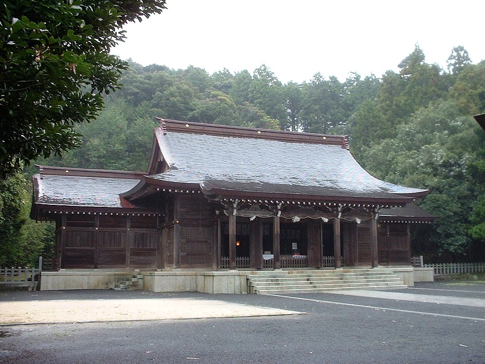
Ama was part of the ancient Oki Province, and the island consisted of a single district, also called Ama, and three villages. Emperor Go-Toba, defeated in the Jōkyū War in 1221, was exiled to the Oki Islands, and lived in Ama for 19 years until his death in 1239. Oki Shrine was built in 1939 to commemorate the 700th year of his death.
From the History section of Ama, Shimane on Wikipedia, under CC BY-SA 4.0.
Where to stay8
Churches and places of worship9
Shopping2
Gas and EV charging2
Schools, colleges and libraries6
Healthcare1
Map of Ama
71 places. The map loads OpenStreetMap tiles when you open it.
Getting there and nearby towns
Oki Airport (OKI) is the nearest airport with scheduled flights listed in OpenStreetMap, 23 km away.
- Funagoshi 8 km west, about 8 min by car
- Kōri 10 km southwest, about 10 min by car
- Nishida 23 km northeast, about 23 min by car
- Sakaiminato 63 km south, about 1 h by car
- Matsue 68 km south, about 1 h 15 min by car
- Mikuriya 74 km southeast, about 1 h 15 min by car
- Yasugichō 76 km south, about 1 h 15 min by car
- Yonago 77 km south, about 1 h 15 min by car
- Kishimoto 84 km south, about 1 h 30 min by car
- Izumo 86 km south, about 1 h 30 min by car
Drive times are estimates from straight-line distance, not routes.
Local news
Headlines from INDB.
Reviews, tips and questions
Loading what members have shared...
Sources and licences
- GeoNames (CC BY 4.0): population, coordinates, regions and time zone
- OpenStreetMap contributors (ODbL 1.0): places, airports, map data
- Wikidata (CC0 1.0): elevation, founding date, time zone, website
- Wikimedia Commons (see each image): photos
- Wikipedia (CC BY-SA 4.0): overview and history text
Photo credits
- Camp site at Akyia-kaigan coast, Ama (Nakanoshima), Yuvalr, CC BY-SA 4.0
- Oki shrine, Bakkai at Japanese Wikipedia, CC BY-SA 3.0
- Okidozen high school view, inomata2009, CC BY-SA 3.0
- Ama Town Fukui Elementary School ac, Asturio Cantabrio, CC BY-SA 4.0
- 海士町後鳥羽院資料館 ac, Asturio Cantabrio, CC BY-SA 4.0
- Hinamadihime torii, Fukuneko 2nd, CC BY 4.0
- Ama Town Central Library entrance ac (1), Asturio Cantabrio, CC BY-SA 4.0
- Oki Shrine 3, Totti, CC BY-SA 4.0
- Oki Shrine 2, Totti, CC BY-SA 4.0
- Oki Shrine 1, Totti, CC BY-SA 4.0
- ISS023-E-37532 - View of Earth, Earth Science and Remote Sensing Unit , Lyndon B. Johnson Space Center, Public domain
- ISS038-E-7596 - View of Earth, Earth Science and Remote Sensing Unit , Lyndon B. Johnson Space Center, Public domain
- ISS038-E-7595 - View of Earth, Earth Science and Remote Sensing Unit , Lyndon B. Johnson Space Center, Public domain
- Tengawa no mizu 3, Totti, CC BY-SA 4.0
- Tengawa no mizu 2, Totti, CC BY-SA 4.0
- Tengawa no mizu 1, Totti, CC BY-SA 4.0
- Nakanoshima Akiya coast 2, Totti, CC BY-SA 4.0
- Nakanoshima Akiya coast, Totti, CC BY-SA 4.0
- Isokaze okikanko, Kuruman, CC BY 2.0
- Nishinoshima Beppu Port (2), Yuvalr, CC BY-SA 4.0
- Nishinoshima Beppu Port (1), Yuvalr, CC BY-SA 4.0


Page built November 5, 2026. Spotted a mistake? Tell us or suggest a place.