
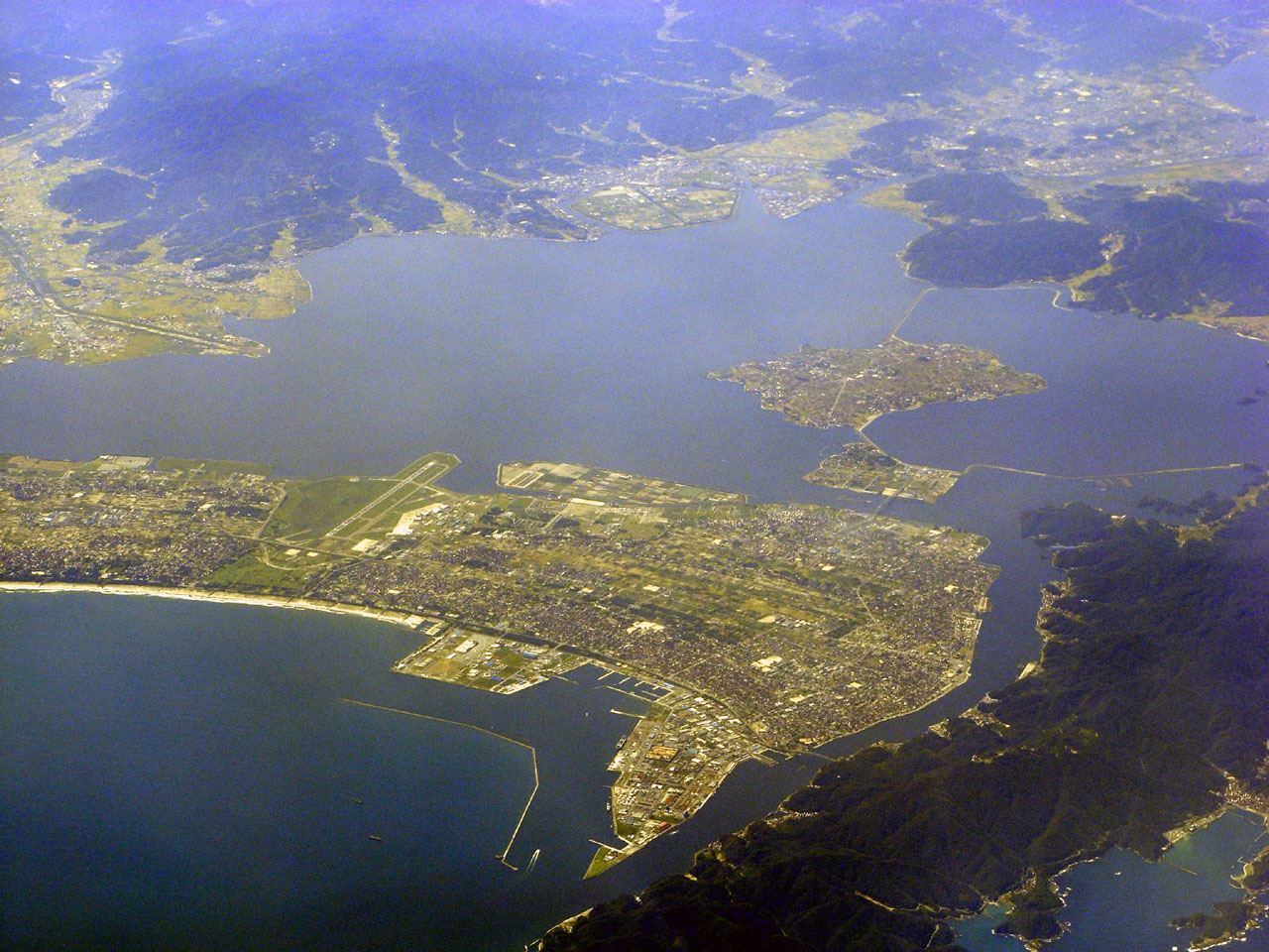


Sakaiminato, Japan
境港市
Sakaiminato is a town of 36,324 people in Tottori, Japan, founded in August 10, 1954.
Why visit Sakaiminato
Townapedia lists 10 museums and landmarks, 40 parks and trails, 36 places to eat, 7 places to stay and 9 attractions in and around town.
Highlights include Eshima Ohashi Bridge, Mt. Takao, Shigeru Mizuki Memorial Museum and Meteor Museum.
Weather in Sakaiminato
Forecast from MET Norway (CC BY 4.0). Full forecast
About Sakaiminato
Sakaiminato (境港市, Sakaiminato-shi) is a city in Tottori Prefecture, Japan. As of 31 December 2021, the city had an estimated population of 32,012 in 13178 households and a population density of 1110 persons per km2. The total area of the city is 272.06 square kilometres (105.04 sq mi).
From the Wikipedia article Sakaiminato (this version), under CC BY-SA 4.0.
Travel tips from other travellers: Sakaiminato on Wikivoyage (CC BY-SA 4.0).
Things to do9




Museums and landmarks10



Parks, trails and playgrounds40




28 more on the map.
Restaurants and cafes36

Tairyo-maru
Restaurant · Sushi · 1.1 km
215 大正町
Mo-Su 11:00-21:00

コーヒータイムA・C
Cafe · Pizza, Coffee Shop · 1.1 km
月曜日定休
Tu-Su 11:00-23:00
お魚天国 すし若
Restaurant · Sushi · 2.6 km
Mo-Fr 11:00-22:00; Sa-Su 10:00-22:00



24 more on the map.
History
The area of Sakaiminato was part of ancient Hōki Province and number remains from the Yayoi period and Kofun period have been found within city limits. In the Muromachi period, the area was dominated by the powerful Amago clan from Izumo Province and occupied an important position as a landing point for rice and navy anchorage. During the Sengoku period, it came under the control of the Mōri clan, and during the Edo Period, it was part of the holdings of the Ikeda clan of Tottori Domain. Following the Meiji restoration, the port prospered as a strategic point for domestic shipping routes in the Sea of Japan, and was designated as a trading port in 1896 for continental trade with Busan, Incheon, and Wonsan on the Korean Peninsula. The town of Sakai was established on October 21, 1889, with the establishment of the modern municipalities system. It was raised to city status on April 1, 1956, changing its name to Sakaiminato at that time.
From the History section of Sakaiminato on Wikipedia, under CC BY-SA 4.0.
Where to stay7
Churches and places of worship26
Shopping13
Gas and EV charging3
Schools, colleges and libraries12
Healthcare6
Map of Sakaiminato
162 places. The map loads OpenStreetMap tiles when you open it.
Getting there and nearby towns
Miho Airport (YGJ) is the nearest airport with scheduled flights listed in OpenStreetMap, 5 km away.
- Yasugichō 13 km south, about 13 min by car
- Yonago 15 km southeast, about 15 min by car
- Matsue 17 km west, about 17 min by car
- Hiezu 17 km southeast, about 17 min by car
- Izumo 46 km southwest, about 46 min by car
- Maniwa 65 km southeast, about 1 h by car
- Niimi 65 km south, about 1 h by car
- Shōbara 79 km south, about 1 h 15 min by car
- Tsuyama 88 km southeast, about 1 h 30 min by car
- Miyoshi 89 km southwest, about 1 h 30 min by car
Drive times are estimates from straight-line distance, not routes.
Local news
Headlines from INDB.
Reviews, tips and questions
Loading what members have shared...
Sources and licences
- GeoNames (CC BY 4.0): population, coordinates, regions and time zone
- OpenStreetMap contributors (ODbL 1.0): places, airports, map data
- Wikidata (CC0 1.0): elevation, founding date, time zone, website, landmarks and historic places
- Wikimedia Commons (see each image): photos
- Wikipedia (CC BY-SA 4.0): overview and history text
Photo credits
- SakaiminatoCity, BehBeh, CC BY-SA 3.0
- Sakaiminato city Sakai elementary school, KASEI, CC BY-SA 3.0
- Tottori Saiseikai Sakaiminato hospital 01, Bioika0201, CC BY-SA 4.0
- Sakaiminato Chamber of Commerce and Industry, Suikotei, CC BY 4.0
- Sakaiminato-city Bunka Hall 01, Bioika0201, CC BY-SA 4.0
- Dio Sakaiminato store, Mti, CC BY-SA 3.0
- Sakaiminato shimin Taiikukan 01, Mti, CC BY-SA 3.0
- Sakaiminato station 2, MK Products, CC BY-SA 3.0
- Sakaiminato shimin Taiikukan 02, Bioika0201, CC BY-SA 4.0
- Sakaiminato shimin Taiikukan 03, Bioika0201, CC BY-SA 4.0
- Sakaiminato Shimin Onsui Pool 02, Bioika0201, CC BY-SA 4.0
- Sakaiminato Shimin Onsui Pool 01, Bioika0201, CC BY-SA 4.0
- Sakaiminato Daini Shimin Taiikukan 01, Bioika0201, CC BY-SA 4.0
- Sakaiminato Daini Shimin Taiikukan 02, Bioika0201, CC BY-SA 4.0
- Tottori Saiseikai Sakaiminato hospital 02, Bioika0201, CC BY-SA 4.0
- Sakaiminato shimin Taiikukan 04, Bioika0201, CC BY-SA 4.0
- Sakaiminato Higashi-Honmachi Post office, Suikotei, CC BY 4.0
- Sakaiminato, Tottori Prefecture, Japan - panoramio (7), kajikawa, CC BY 3.0
- Sakaiminato, Tottori Prefecture, Japan - panoramio (12), kajikawa, CC BY 3.0
- Sakaiminato, Tottori Prefecture, Japan - panoramio (14), kajikawa, CC BY 3.0
- Sakaiminato, Tottori Prefecture, Japan - panoramio (15), kajikawa, CC BY 3.0
- Sakaiminato, Tottori Prefecture, Japan - panoramio (6), kajikawa, CC BY 3.0
- Sakaiminato, Tottori Prefecture, Japan - panoramio (10), kajikawa, CC BY 3.0
- Sakaiminato-shi Banner, z tanuki, CC BY 3.0
- Sakaiminato, Tottori Prefecture, Japan - panoramio (9), kajikawa, CC BY 3.0
- Sakaiminato, Tottori Prefecture, Japan - panoramio (1), kajikawa, CC BY 3.0
- Sakaiminato Station -02, Aimaimyi, CC BY-SA 3.0
- Eimachi, Sakaiminato, Tottori Prefecture 684-0006, Japan - panoramio (1), kajikawa, CC BY 3.0
- 江島大橋, 国道559号線, CC BY-SA 3.0
- Sakaiminato city Agarimichi elementary school, KASEI, CC BY-SA 3.0
- Sakaiminato city Amariko elementary school, KASEI, CC BY-SA 3.0
- Sakaiminato city Nakahama elementary school, KASEI, CC BY-SA 3.0
- Sakaiminato city Watari elementary school, KASEI, CC BY-SA 3.0
- Sakaiminato city Tonoe elementary school, KASEI, CC BY-SA 3.0
- Sakaiminato city Dai1 junior high school, KASEI, CC BY-SA 3.0
- Sakaiminato city Dai3 junior high school, KASEI, CC BY-SA 3.0
- Daini junuor high school, Mti, CC BY-SA 3.0
- 境港水木ロード妖怪神社PA098302, No machine-readable author provided. おぉたむすねィく探検隊 assumed (based on copyright claims)., CC BY-SA 3.0
- Umitokurashinoshiryoukan, KASEI, CC BY-SA 3.0
- Meteo Plaza ac, Asturio Cantabrio, CC BY-SA 4.0
- Mizuki Shigeru Road -01, Aimaimyi, CC BY-SA 3.0
- Tottori prefectural Sakai high school, KASEI, CC BY-SA 3.0
- Onyado Nono Sakaiminato, Totti, CC BY-SA 4.0
- Sakaiminato Public Marina Campground 02, Bioika0201, CC BY-SA 4.0


Page built November 5, 2026. Spotted a mistake? Tell us or suggest a place.