



Fukushima, Japan
福島市
Fukushima is a regional capital of 294,237 people in Fukushima, Japan, founded in April 1, 1907.
Why visit Fukushima
Townapedia lists 41 museums and landmarks, 88 parks and trails, 113 places to eat, 17 places to stay and 23 attractions in and around town.
Highlights include Fukushima College, Takakanonuma Greenland, Fukushima Prefectural Museum of Art and Ayutaki Ferry Site.
Weather in Fukushima
Forecast from MET Norway (CC BY 4.0). Full forecast
About Fukushima
Fukushima (福島市, Fukushima-shi; Japanese pronunciation: [ɸɯ̥̈.kɯ̈́.ɕì.mä̀, -ɕí.mä́.ɕì]) is the capital city of Fukushima Prefecture, Japan. It is located in the northern part of the Nakadōri or central region of the prefecture. As of 1 August 2023, the city had an estimated population of 275,850 in 122,130 households and a population density of 359 inhabitants per square kilometre (930/sq mi). The total area of the city is 767.72 square kilometres (296.42 sq mi).
From the Wikipedia article Fukushima (city) (this version), under CC BY-SA 4.0.
Travel tips from other travellers: Fukushima on Wikivoyage (CC BY-SA 4.0).
Things to do23

Fukushima College
School
Higher education institution in Fukushima Prefecture, Japan

Takakanonuma Greenland
Monument and historic site · 7.7 km
Former theme park in Fukushima, Japan



Fukushima Prefectural Culture Center - Main Concert Hall
Cinema and theater · 2.1 km


11 more on the map.
Museums and landmarks41

Ayutaki Ferry Site
Monument and historic site · 7.8 km
Archaeological site in Japan

Miyahata Site
Monument and historic site · 6.1 km
Archaeological site in Fukushima, Japan

Nihomatsu Domain Monumental Stele
Monument and historic site · 17.1 km
Stele in Fukushima, Japan

Shutoku Museum of Art
Museum · 11.3 km
Art museum in Koori, Fukushima, Japan
Wadai Site
Monument and historic site · 12.4 km
Archaeological site in Fukushima, Japan



29 more on the map.
Parks, trails and playgrounds88




76 more on the map.
Restaurants and cafes113

Komeda Coffee Shop
Cafe · Breakfast, Cake, Coffee Shop, Grill, Sandwich · 2.5 km
1-15-9 県道70
Mo-Su 07:00-23:00



新時代 福島西口店
Bar and pub · Japanese · 1.0 km
Mo-Sa 11:00-14:30, 16:00-00:00; Su,PH 11:00-00:00
101 more on the map.
Where to stay17
Churches and places of worship63
Shopping48
Gas and EV charging30
Schools, colleges and libraries73
Healthcare38
Map of Fukushima
250 places. The map loads OpenStreetMap tiles when you open it.
Getting there and nearby towns
Fukushima Airport (FKS) is the nearest airport with scheduled flights listed in OpenStreetMap, 58 km away.
- Date 8 km north, about 8 min by car
- Iizakamachi 9 km north, about 9 min by car
- Hobaramachi 10 km northeast, about 10 min by car
- Koori 10 km northeast, about 10 min by car
- Yanagawamachi-saiwaichō 16 km northeast, about 16 min by car
- Fujita 16 km northeast, about 16 min by car
- Nihommatsu 19 km south, about 19 min by car
- Dake-onsen 19 km southwest, about 19 min by car
- Kōriyama 40 km south, about 40 min by car
- Sendai 67 km northeast, about 1 h by car
Drive times are estimates from straight-line distance, not routes.
Local news
Headlines from INDB.
Reviews, tips and questions
Loading what members have shared...
Sources and licences
- GeoNames (CC BY 4.0): population, coordinates, regions and time zone
- OpenStreetMap contributors (ODbL 1.0): places, airports, map data
- Wikidata (CC0 1.0): elevation, founding date, time zone, website, landmarks and historic places
- Wikimedia Commons (see each image): photos
- Wikipedia (CC BY-SA 4.0): overview and history text
Photo credits
- Fukushima City with a view of Fukushima Station, Purplepumpkins, CC BY-SA 3.0
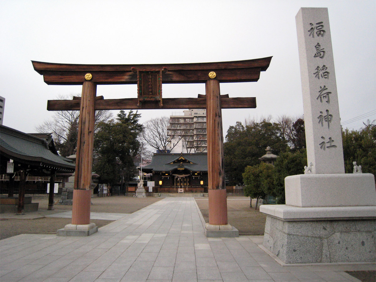
- Fukushima inari, Fk, CC BY-SA 2.5
- Fukushima Prefectural Government Office North Building, 掬茶, CC BY-SA 4.0
- Fukushima Prefectural Government Office buildings 202605, 掬茶, CC BY-SA 4.0
- City Tower Fukushima, 掬茶, CC BY-SA 4.0
- Fukushima Prefectural Government Office Main Building, 掬茶, CC BY-SA 4.0
- Fukushima Prefectural Police Headquarters, Shuricastle, CC BY-SA 4.0
- Heiwa Street in Fukushima City, 掬茶, CC BY-SA 4.0
- Fukushima 20200808 104401, Ka23 13, CC BY-SA 4.0
- Fukushima Police Station (Fukushima) 202605, 掬茶, CC BY-SA 4.0
- Fukushima 20200809 154612, Ka23 13, CC BY-SA 4.0
- Fukushima 20200809 191036, Ka23 13, CC BY-SA 4.0
- Fukushima 20200809 154755, Ka23 13, CC BY-SA 4.0
- 77 Bank Fukushima branch, Suikotei, CC BY 4.0
- Fukushima-Girls'-Normal-School-Memorial-2012050401, Hasec, CC0
- Fukushima-Girls'-Norma-School-Memorial-2012050402, Hasec, CC0
- Fukushima 20200808 105004, Ka23 13, CC BY-SA 4.0
- Kirayaka Bank Fukushima Branch, Suikotei, CC BY 4.0
- Music Bus, Fukushima, MikaPr65, CC BY-SA 4.0
- Fukushima 20030731 172828, Ka23 13, CC BY-SA 4.0
- NHK Fukushima Broadcasting Hall 20260505b, 掬茶, CC BY-SA 4.0
- NHK Fukushima Broadcasting Hall 20260505a, 掬茶, CC BY-SA 4.0
- Fukushima 20201031 164517, Ka23 13, CC BY-SA 4.0
- Fukushima 20200808 181049, Ka23 13, CC BY-SA 4.0
- Fukushima 20200808 181122, Ka23 13, CC BY-SA 4.0
- Fukushima 20200808 182947, Ka23 13, CC BY-SA 4.0
- Fukushima Prefectural Museum of Art 202605, 掬茶, CC BY-SA 4.0
- Miyahata Site, Ty19080914, CC BY-SA 4.0
- Nihonmatsu Domain Kaisekimei-hi 01, Suikotei, CC BY-SA 4.0
- Fukushima-Univ-Entrance01, Hasec, Public domain
- Fukushima Prefectural Culture Center 20090809, ja:User:Proshikok, Public domain
- Fukushima-City-Music-Hall01, Hasec, Public domain
- Mt.Shinobu-yama, ja:利用者:Townphoto, CC BY 3.0
- Sakura no Seibo Junior College, Abasaa, Public domain
- Aeon fukusima1, Sgtfn319, CC BY-SA 3.0
- Yakushidou Iouji (Fukushima), Mizuhara gumi ( 会話 ), CC BY 3.0
- Ohara General Hospital, Altomarina, CC BY-SA 3.0
- Fukushima City Minka-en entrance, Yasu ( talk ), CC BY-SA 3.0
- Fukushima Medical University Hospital, Kozo, Public domain
- Fukushima-Pref-Library03, Hasec, Public domain
- Fukushimaken Gokoku Shrine2, Haseyu-, Public domain
- Fukushima nisseki byoin, Purplepumpkins, CC BY-SA 3.0
- 20100418花見山公園全景, Original uploader was BehBeh at ja.wikipedia, CC BY-SA 3.0
- Watari Hospital 1, Ebiebi2, CC BY-SA 4.0
- Moriai Sports Park, 国土地理院, CC BY 4.0
- Fukushima city Fukushima-daisan elementary school, 運動会プロテインパワー, CC BY-SA 4.0
- Kifune-jinja (Iizaka, Fukushima-city) 02, Higa4, CC0
- Fukushima College Miyashiro Campus, Abasaa, Public domain
- Shichirigahama by Aōdō Denzen (Shutoku Museum), Aōdō Denzen 亜欧堂田善 (1748-1822), Public domain
- Fukushima Keibajo Front Close, Purplepumpkins, CC BY-SA 3.0
- Fukushima sanchu, Purplepumpkins, CC BY-SA 3.0


Page built November 4, 2026. Spotted a mistake? Tell us or suggest a place.