
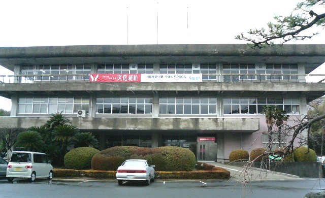


Hikari, Japan
光市
Hikari is a town of 51,040 people in Yamaguchi, Japan, founded in October 4, 2004.
Why visit Hikari
Townapedia lists 4 museums and landmarks, 31 parks and trails, 13 places to eat, 6 places to stay and 8 attractions in and around town.
Highlights include 伊藤公資料館 and 虹ヶ浜海水浴場.
Weather in Hikari
Forecast from MET Norway (CC BY 4.0). Full forecast
About Hikari
Hikari (光市, Hikari-shi) is a city located in Yamaguchi Prefecture, Japan. As of 31 May 2023, the city had an estimated population of 49,100 in 23577 households and a population density of 530 persons per km2. The total area of the city is 92.13 square kilometres (35.57 sq mi). The name Hikari itself means "brilliance" or "light" in Japanese.
From the Wikipedia article Hikari, Yamaguchi (this version), under CC BY-SA 4.0.
Things to do8



Museums and landmarks4


Parks, trails and playgrounds31




19 more on the map.
Restaurants and cafes13




1 more on the map.
History
The area of Hikai was part of an ancient Suō Province and traces of settlements dating to the Yayoi period have been found. Murozumi Bay used to be called Mitarai Bay, and was a key point for maritime traffic on the Seto Inland Sea in ancient times. The name comes from the legend that Empress Jingū washed her hands in this bay when she was on her way to conquer the Korean Peninsula. In addition, the Silla expeditionary force led by Otomo Satehiko found shelter here when it was caught in a storm. During the Edo Period, the area was part of the holdings of Chōshū Domain and prospered as a port-of-call for the kitamaebune coastal trade. Following the Meiji restoration, the villages of Mitsui, Shimada, Mii and Asae within Kumage District, Yamaguchi was established with the creation of the modern municipalities system on April 1, 1889. These municipalities were merged for the town of Shunan on April 1, 1939. The town was renamed Hikari on October 1, 1940, On April 1, 1943 Hikari merged with the town of Murozumi to form the city of Hikari.
From the History section of Hikari, Yamaguchi on Wikipedia, under CC BY-SA 4.0.
Where to stay6
Churches and places of worship41
Shopping12
Gas and EV charging10
Schools, colleges and libraries27
Healthcare9
Map of Hikari
161 places. The map loads OpenStreetMap tiles when you open it.
Getting there and nearby towns
Iwakuni Kintaikyo Airport (IWK) is the nearest airport with scheduled flights listed in OpenStreetMap, 35 km away.
- Kudamatsu 10 km northwest, about 10 min by car
- Tabuse 11 km east, about 11 min by car
- Hirao 11 km east, about 11 min by car
- Tokuyama 16 km northwest, about 16 min by car
- Yanai 15 km east, about 15 min by car
- Iwakuni 34 km northeast, about 34 min by car
- Hōfu 37 km west, about 37 min by car
- Ōtake 38 km northeast, about 38 min by car
- Kunisaki 49 km southwest, about 49 min by car
- Yamaguchi 51 km northwest, about 51 min by car
Drive times are estimates from straight-line distance, not routes.
Local news
Headlines from INDB.
Reviews, tips and questions
Loading what members have shared...
Sources and licences
- GeoNames (CC BY 4.0): population, coordinates, regions and time zone
- OpenStreetMap contributors (ODbL 1.0): places, airports, map data
- Wikidata (CC0 1.0): elevation, founding date, time zone, website
- Wikimedia Commons (see each image): photos
- Wikipedia (CC BY-SA 4.0): overview and history text
Photo credits
- Hikari city office, Muyo at Japanese Wikipedia, CC BY-SA 3.0
- Nijigahama Beach in Hikari, Yamaguchi - Jan 8, 2013 (1), Konstantin Leonov | GONE. RIP FLICKR. | http://oldstable.org/ | https://twitter.com/k_oldstable, CC BY 2.0
- Nijigahama Beach in Hikari, Yamaguchi - Jan 8, 2013 (2), Konstantin Leonov | GONE. RIP FLICKR. | http://oldstable.org/ | https://twitter.com/k_oldstable, CC BY 2.0
- 2 Chome Nijigahama, Hikari-shi, Yamaguchi-ken 743-0022, Japan - panoramio, warabi hatogaya, CC BY 3.0
- Hikari Station Transfer information board, Sashimiteishoku, CC0
- Hikari Station waiting room 202604, Sashimiteishoku, CC0
- Hikari Station 202604, Sashimiteishoku, CC0
- Hikari Station platform 202604, Sashimiteishoku, CC0
- Kasadojima Island and Suo Sea from train near Hikari Station, そらみみ, CC BY-SA 4.0
- Nijigahama in Hikari, -21 Apr. 2013 a, DAISUKE from Japan, CC BY-SA 2.1 jp
- Fugenji hikari, 芋虫太郎, CC BY-SA 4.0
- Hikarigaoka HS (Hikari), Wiki708, CC BY 3.0
- 虹が浜 - panoramio (1), warabi hatogaya, CC BY 3.0
- R188-193, Puchi-masashi, CC BY-SA 4.0
- 光市千坊台からの風景 - panoramio, yuu.dash.ri3, CC BY-SA 3.0
- 室積海岸 - panoramio, Yobito KAYANUMA, CC BY-SA 3.0
- 草地を穿り返す猪 2009-12-13 - panoramio, yuu.dash.ri3, CC BY-SA 3.0
- 虹が浜 - panoramio, warabi hatogaya, CC BY 3.0
- 虹ヶ浜 - panoramio, warabi hatogaya, CC BY 3.0
- 室積犬 - panoramio, shikabane taro, CC BY 3.0
- 室積 - panoramio, shikabane taro, CC BY 3.0
- 光駅前 - panoramio, warabi hatogaya, CC BY 3.0
- Shimata Station platform 202604, Sashimiteishoku, CC0
- Shimata Station waiting room, Sashimiteishoku, CC0
- Shimata Station 202604, Sashimiteishoku, CC0
- Iwata Station (Yamaguchi) platform 202604, Sashimiteishoku, CC0
- Iwata Station (Yamaguchi) waiting room, Sashimiteishoku, CC0
- Iwata Station (Yamaguchi) 202604, Sashimiteishoku, CC0
- Sumo wrestler preparing fot the fight, RF Vila, CC BY-SA 4.0
- ISS006-E-36322 - View of Japan, Earth Science and Remote Sensing Unit , Lyndon B. Johnson Space Center, Public domain
- ISS065-E-213787 - View of Earth, Earth Science and Remote Sensing Unit , Lyndon B. Johnson Space Center, Public domain
- ISS065-E-213786 - View of Earth, Earth Science and Remote Sensing Unit , Lyndon B. Johnson Space Center, Public domain


Page built November 5, 2026. Spotted a mistake? Tell us or suggest a place.