


Hokuto, Japan
北杜市
Hokuto is a town of 46,888 people in Yamanashi, Japan, founded in November 1, 2004.
Why visit Hokuto
Townapedia lists 82 museums and landmarks, 21 parks and trails, 154 places to eat, 95 places to stay and 46 attractions in and around town.
Highlights include Gomi Apple Orchard, Fujimi Kougen Snow Resort, Hirayama Ikuo Silk Road Museum and Idojiri Site.
Weather in Hokuto
Forecast from MET Norway (CC BY 4.0). Full forecast
About Hokuto
Hokuto (北杜市, Hokuto-shi) is a city located in Yamanashi Prefecture, Japan. As of 1 October 2020, the city had an estimated population of 45,684 in 22,091 households, and a population density of 78 inhabitants per square kilometre (200/sq mi). The total area of the city is 602.48 square kilometres (232.62 sq mi).
From the Wikipedia article Hokuto, Yamanashi (this version), under CC BY-SA 4.0.
Travel tips from other travellers: Hokuto on Wikivoyage (CC BY-SA 4.0).
Things to do46



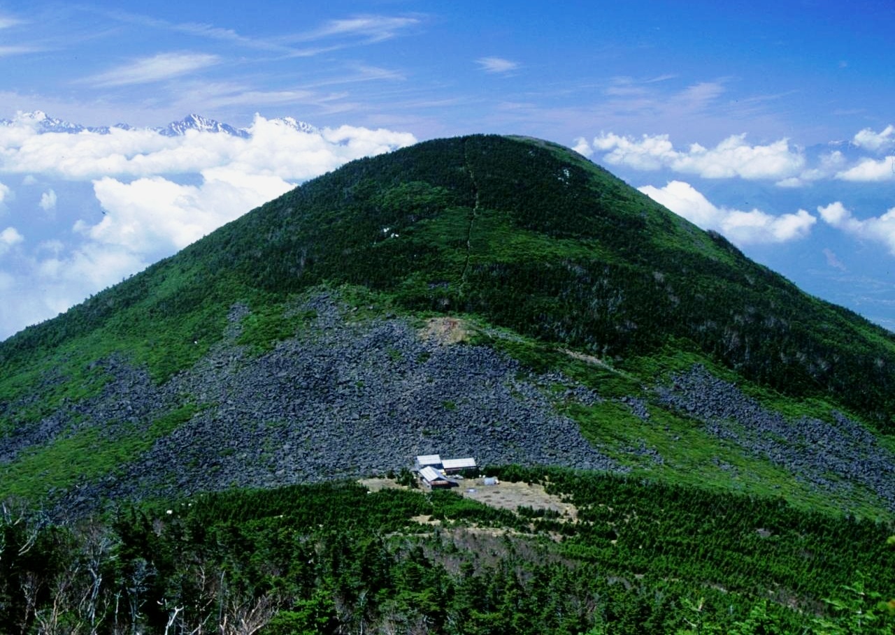


34 more on the map.
Museums and landmarks82

Hirayama Ikuo Silk Road Museum
Museum · 6.0 km
Archaeology museum in Yamanashi , Japan
6
Mo-Su 10:00-17:00; Jan-Mar off

Idojiri Site
Monument and historic site · 11.6 km
Archaeological site in Fujimi, Nagano, Japan

Kinsei ruins
Monument and historic site · 1.8 km
Archaeological site in Hokuto, Japan


Nakamura Keith Haring Collection
Museum · 9.1 km
Biographical museum in Japan

Umenoki ruins
Monument and historic site · 7.9 km
Archaeological site

Yadegawa ruins
Monument and historic site · 14.7 km
National Historic Site of Japan containing paleolithic settlement ruins of c. 12000 BCE

70 more on the map.
Parks, trails and playgrounds21






9 more on the map.
Restaurants and cafes154






142 more on the map.
History
During the Edo period, all of Kai Province was tenryō territory under direct control of the Tokugawa shogunate. During the cadastral reform of the early Meiji period on April 1, 1889, the rural district of Kitakoma was formed.
The modern city of Hokuto was established on November 1, 2004, from the merger of the towns of Hakushū, Nagasaka, Sutama and Takane, and the villages of Akeno, Mukawa and Ōizumi (all from Kitakoma District). On March 15, 2006, Hokuto absorbed the town of Kobuchisawa (also from Kitakoma District). Kitakoma District was dissolved as a result of this merger.
From the History section of Hokuto, Yamanashi on Wikipedia, under CC BY-SA 4.0.
Where to stay95
Churches and places of worship43
Shopping25
Gas and EV charging24
Schools, colleges and libraries45
Healthcare12
Map of Hokuto
250 places. The map loads OpenStreetMap tiles when you open it.
Getting there and nearby towns
Shinshu-Matsumoto Airport (MMJ) is the nearest airport with scheduled flights listed in OpenStreetMap, 56 km away.
- Fujimi 15 km northwest, about 15 min by car
- Nirasaki 16 km south, about 16 min by car
- Ryūō 23 km southeast, about 23 min by car
- Kofu 24 km southeast, about 24 min by car
- Minami-Alps 25 km south, about 25 min by car
- Chino 28 km northwest, about 28 min by car
- Isawa 30 km southeast, about 30 min by car
- Suwa 34 km northwest, about 34 min by car
- Enzan 34 km southeast, about 34 min by car
- Ina 40 km west, about 40 min by car
Drive times are estimates from straight-line distance, not routes.
Local news
Headlines from INDB.
Reviews, tips and questions
Loading what members have shared...
Sources and licences
- GeoNames (CC BY 4.0): population, coordinates, regions and time zone
- OpenStreetMap contributors (ODbL 1.0): places, airports, map data
- Wikidata (CC0 1.0): elevation, founding date, time zone, website, landmarks and historic places
- Wikimedia Commons (see each image): photos
- Wikipedia (CC BY-SA 4.0): overview and history text
Photo credits
- KEEP Farm01n4592, 663highland, CC BY 2.5
- Koyo Hospital, Hokuto City, Yamanashi, Triglav, CC BY-SA 4.0
- Takane-nishi elementary school, Hokuto City, Yamanashi, Triglav, CC BY-SA 4.0
- Reneiji, Hokuto City, Yamanashi, Triglav, CC BY-SA 4.0
- Sakamoto Denki shop in Hokuto, Nov 2024, Mr.choppers, CC BY-SA 4.0
- Takane-nishi elementary school swimming pool, Hokuto City, Yamanashi, Triglav, CC BY-SA 4.0
- Yamanashi Prefectural Road 17 (Chino-Hokuto-Nirasaki Line) at Nagasaka-Kamijo, Nagasaka-cho, Hokuto city, 小石川人晃, CC BY-SA 4.0
- Kita-Shojigataki, Takisaw, Public domain
- 平山郁夫シルクロード美術館20220618-P1380431, くろふね, CC BY 4.0
- Kinsei iseki, 上条ジョー, CC BY-SA 3.0
- Umenoki Site, MChew, CC BY-SA 4.0
- Idojiri ruins, Takuma-sa, CC BY-SA 3.0
- Suntory-hakushu-distillery, iwaim ( talk ), CC BY-SA 3.0
- Mt.Kayagatake from Mt.Akadake 01, Σ64, CC BY-SA 3.0
- Doryu Falls (01), kiwa dokokano, CC BY-SA 3.0
- 富士見高原上, 苗場山, CC BY-SA 3.0
- Mt.Hinata 14, Σ64, CC BY 3.0
- Mt.Gongendake from Mt.Nakadake, Σ64, CC BY-SA 3.0
- 100612 Kiyosato Porcelain Museum Hokuto Yamanashi pref Japan03s3, 663highland, CC BY-SA 4.0
- Mount Amigasa from Mount Gongen 1994-5-14, alpsdake, Public domain
- 谷戸城跡, Libra1111, CC BY-SA 4.0
- P1000772 misogi 2, 立志堂, CC BY-SA 3.0
- Magaritake, Pasocom001, CC BY-SA 3.0
- Atsuna-jinja shaden ac (1), Asturio Cantabrio, CC BY-SA 4.0
- Miwa-jinja Sutama haiden ac (1), Asturio Cantabrio, CC BY-SA 4.0
- Suwa-jinja Sutama torii ac, Asturio Cantabrio, CC BY-SA 4.0
- Mt.Kanagatake 03, Σ64, CC BY 3.0
- Kayagatake, Ans, CC BY-SA 3.0
- Nirasaki High School, さかおり ( talk ), CC BY-SA 3.0
- Teikyo Gakuen Junior College, Asasa198, CC BY-SA 4.0
- Mt.Amagoidake 05, Σ64, CC BY 3.0
- Mount Hinata (northeast side) 2016-05-04, FoxyStranger Kawasaki, CC BY-SA 3.0
- Nirasaki Chuo Park, 国土地理院, CC BY 4.0
- 100612 Kiyosato Porcelain Museum Hokuto Yamanashi pref Japan01s3, 663highland, CC BY-SA 4.0
- Nirasaki-Higashi Junior High School, Sakaori ( talk ), CC BY-SA 3.0
- 北杜市金田一春彦記念図書館正面, Hinayoshi, CC BY-SA 4.0
- 熱那神社(北杜市)の拝殿, Mc43810, CC BY-SA 4.0
- 2013–2015 Daihatsu Mira e∶S X in Bright Silver Metallic, rear left, Mr.choppers, CC BY-SA 4.0
- 長坂町長坂上条 - panoramio (1), 浅野ます道, CC BY 3.0
- 長坂町長坂上条 - panoramio, 浅野ます道, CC BY 3.0
- Yamanashi Prefectural Flower Center "Heidi's Village" 02, Duke Yuin, CC BY 2.0


Page built November 5, 2026. Spotted a mistake? Tell us or suggest a place.