


Ikeda, Japan
池田町
Ikeda is a town of 9,793 people in Nagano, Japan, founded in April 1, 1889.
Why visit Ikeda
Townapedia lists 4 museums and landmarks, 8 parks and trails, 19 places to eat and 4 places to stay in and around town.
Highlights include 北アルプス展望美術館, 安曇野ちひろ美術館, あづみ野広場マレットゴルフ場 and アルプス広場マレットゴルフ場.
Weather in Ikeda
Forecast from MET Norway (CC BY 4.0). Full forecast
About Ikeda
Ikeda (池田町, Ikeda-machi) is a town located in Nagano Prefecture, Japan. As of 1 April 2019, the town had an estimated population of 9,793 in 3947 households, and a population density of 247 persons per km2. The total area of the town is 40.16 square kilometres (15.51 sq mi). Ikeda is listed as one of The Most Beautiful Villages in Japan.
From the Wikipedia article Ikeda, Nagano (this version), under CC BY-SA 4.0.
Museums and landmarks4



Parks, trails and playgrounds8


Restaurants and cafes19


7 more on the map.
Where to stay4




History
The area of present-day Ikeda was part of ancient Shinano Province. Ikeda developed as a post station on the Chikukhi kaidō, a highway connecting inland regions of Shinano with the Sea of Japan at Itoigawa. The village of Ikedamachi was created with the establishment of the modern municipalities system on April 1, 1889. It was elevated to town status on April 1, 1915, as Ikeda. Ikeda annexed the neighboring village of Aisome on November 1, 1955.
From the History section of Ikeda, Nagano on Wikipedia, under CC BY-SA 4.0.
Churches and places of worship10
Shopping3
Gas and EV charging5
Schools, colleges and libraries8
Healthcare2
Map of Ikeda
63 places. The map loads OpenStreetMap tiles when you open it.
Getting there and nearby towns
Shinshu-Matsumoto Airport (MMJ) is the nearest airport with scheduled flights listed in OpenStreetMap, 28 km away.
- Hotaka 9 km south, about 9 min by car
- Ōmachi 9 km north, about 9 min by car
- Azumino 14 km south, about 14 min by car
- Omi 15 km east, about 15 min by car
- Matsumoto 22 km south, about 22 min by car
- Chikuma 22 km northeast, about 22 min by car
- Sakaki 27 km east, about 27 min by car
- Ueda 36 km east, about 36 min by car
- Okaya 43 km south, about 43 min by car
- Tōmi 43 km east, about 43 min by car
Drive times are estimates from straight-line distance, not routes.
Local news
Headlines from INDB.
Reviews, tips and questions
Loading what members have shared...
Sources and licences
- GeoNames (CC BY 4.0): population, coordinates, regions and time zone
- OpenStreetMap contributors (ODbL 1.0): places, airports, map data
- Openverse (see each image): photos
- Wikidata (CC0 1.0): elevation, founding date, time zone, website
- Wikimedia Commons (see each image): photos
- Wikipedia (CC BY-SA 4.0): overview and history text
Photo credits
- Ikeda town hall, アラツク, CC BY-SA 4.0
- Nagano, Ikeda Town Library exterior03, Ina-valley, CC BY-SA 4.0
- Nagano, Ikeda Town Library exterior02, Ina-valley, CC BY-SA 4.0
- Nagano, Ikeda Town Library exterior 01, Ina-valley, CC BY-SA 4.0
- Nagano, Ikeda Town Library exterior04, Golden hamster, CC BY-SA 4.0
- Nishina-3, 江戸村のとくぞう, CC BY-SA 3.0
- 150922 Chihiro Art Museum Azumino Japan01s3, 663highland, CC BY 2.5
- Owada shrine 20180303 1, Araisyohei, CC BY-SA 4.0
- Suzumushiso, photo: Qurren ( talk ) Taken with Canon PowerShot G9 X, CC BY-SA 4.0
- Nishina Shinmei Shrine-Honden, The original uploader was NMC100 at Japanese Wikipedia ., CC BY-SA 3.0
- Matsukawa-mura Library Exterior 1, Ina-valley, CC0
- ISS030-E-190834 - View of Earth, Earth Science and Remote Sensing Unit , Lyndon B. Johnson Space Center, Public domain
- ISS030-E-190831 - View of Earth, Earth Science and Remote Sensing Unit , Lyndon B. Johnson Space Center, Public domain
- ISS030-E-184149 - View of Earth, Earth Science and Remote Sensing Unit , Lyndon B. Johnson Space Center, Public domain
- ISS030-E-187391 - View of Earth, Earth Science and Remote Sensing Unit , Lyndon B. Johnson Space Center, Public domain
- ISS030-E-190832 - View of Earth, Earth Science and Remote Sensing Unit , Lyndon B. Johnson Space Center, Public domain
- ISS030-E-190835 - View of Earth, Earth Science and Remote Sensing Unit , Lyndon B. Johnson Space Center, Public domain
- ISS029-E-42054 - View of Earth, Earth Science and Remote Sensing Unit , Lyndon B. Johnson Space Center, Public domain
- ISS030-E-190833 - View of Earth, Earth Science and Remote Sensing Unit , Lyndon B. Johnson Space Center, Public domain
- ISS030-E-187392 - View of Earth, Earth Science and Remote Sensing Unit , Lyndon B. Johnson Space Center, Public domain
- 信濃松川駅 - panoramio, くろふね, CC BY 3.0
- JR East HB-E300 Resort View Furusato at Shinano-Matsukawa Station 20101002, くろふね, CC BY 3.0
- Shinano-Matsukawa Sta 02, 掬茶, CC BY-SA 3.0
- Matsukawa village information center, 掬茶, CC BY-SA 3.0
- Shinano-Matsukawa Sta 01, 掬茶, CC BY-SA 3.0
- Michinoeki AzuminoMatsukawa, アラツク, CC BY-SA 4.0
- Matsukawa-mura Library Exterior 2, Ina-valley, CC0
- Matsukawa-mura Library11, Ina-valley, CC0
- Matsukawa-mura Library12, Ina-valley, CC0
- Mount Ariake and Azumi-bushi monument, さかおり, CC BY-SA 4.0
- Matsukawa-mura Library interior4, Ina-valley, CC0
- Matsukawa-Mura Library interior6, Ina-valley, CC0
- Matsukawa-mura Library interior5, Ina-valley, CC0
- Matsukawa-mura Library interior3, Ina-valley, CC0
- Matsukawa-mura Library interior2, Ina-valley, CC0
- Matsukawa-mura Library10, Ina-valley, CC0
- Matsukawa village office, photo: Qurren ( talk ) Taken with Canon IXY 10S, CC BY-SA 3.0
- Matsukawa-mura Library interior9, Ina-valley, CC0
- Matsukawa-mura Library interior8, Ina-valley, CC0
- Matsukawa-mura Library interior7, Ina-valley, CC0
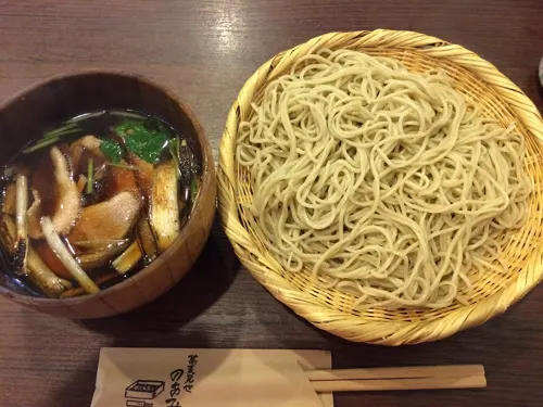
- Soba noodle with duck soup, pelican, CC BY-SA 2.0


Page built November 5, 2026. Spotted a mistake? Tell us or suggest a place.