


Kanaya, Japan
金谷町
Kanaya is a town of 20,286 people in Shizuoka, Japan, founded in April 1, 1889.
Why visit Kanaya
Townapedia lists 58 museums and landmarks, 50 parks and trails, 85 places to eat, 10 places to stay and 23 attractions in and around town.
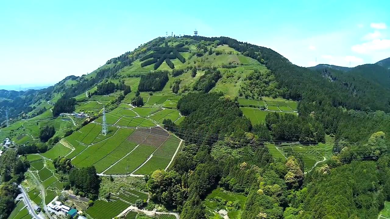
Highlights include Hōrai Bridge, 火剣山, Tea City Museum and 島田市博物館.
Weather in Kanaya
Forecast from MET Norway (CC BY 4.0). Full forecast
About Kanaya
Kanaya (金谷町, Kanaya-chō) was a town located in Haibara District, Shizuoka Prefecture, Japan. As of 2005, the town had an estimated population of 20,364 and a density of 318.29 persons per km2. The total area was 64.36 km2.
From the Wikipedia article Kanaya, Shizuoka (this version), under CC BY-SA 4.0.
Things to do23




11 more on the map.
Museums and landmarks58






46 more on the map.
Parks, trails and playgrounds50



38 more on the map.
Restaurants and cafes85


ガンジス川
Restaurant · Indian · 1.4 km
Mo-Fr 11:00-15:00,17:00-22:00; Sa,Su,PH 11:00-22:00
73 more on the map.
History
On May 5, 2005, Kanaya was merged into its long-time twin city, the expanded city of Shimada and thus no longer exists as an independent municipality.
Kanaya was developed from the Edo period as Kanaya-juku, a post town on the Tōkaidō. Located on the west bank of the Ōi River, Kanaya prospered from the Tokugawa Shogunate's policy of not allowing any bridge or ferry to be established on the Ōi River in order to strengthen Edo's defenses. Travellers waiting to cross the river on foot were often trapped in Kanaya for days, if not weeks, waiting for the river to become shallow enough to ford.
Kanaya Town was established in 1889. It merged with neighboring Goka Village in 1957.
From the History section of Kanaya, Shizuoka on Wikipedia, under CC BY-SA 4.0.
Where to stay10
Churches and places of worship97
Shopping24
Gas and EV charging23
Schools, colleges and libraries26
Healthcare19
Map of Kanaya
250 places. The map loads OpenStreetMap tiles when you open it.
Getting there and nearby towns
Shizuoka Airport (FSZ) is the nearest airport with scheduled flights listed in OpenStreetMap, 6 km away.
- Shimada 5 km east, about 5 min by car
- Kakegawa 12 km southwest, about 12 min by car
- Fujieda 14 km east, about 14 min by car
- Sagara 17 km southeast, about 17 min by car
- Yaizu 18 km east, about 18 min by car
- Mori 18 km west, about 18 min by car
- Iwata 29 km southwest, about 29 min by car
- Hamamatsu 38 km west, about 38 min by car
- Shinshiro 58 km west, about 58 min by car
- Fuji 64 km northeast, about 1 h by car
Drive times are estimates from straight-line distance, not routes.
Local news
Headlines from INDB.
Reviews, tips and questions
Loading what members have shared...
Sources and licences
- GeoNames (CC BY 4.0): population, coordinates, regions and time zone
- OpenStreetMap contributors (ODbL 1.0): places, airports, map data
- Wikidata (CC0 1.0): elevation, founding date, time zone, website, landmarks and historic places
- Wikimedia Commons (see each image): photos
- Wikipedia (CC BY-SA 4.0): overview and history text
Photo credits
- Oigawa Railway Kanaya Sta Ticket gate 2026, にぶさま, CC BY-SA 4.0
- Oigawa Railway Kanaya Sta Concourse 2026, にぶさま, CC BY-SA 4.0
- Oigawa Railway Kanaya Sta Ticket vending machine 2026, にぶさま, CC BY-SA 4.0
- Kanaya Station platforms Jan 3 2022 various, Nesnad, CC BY-SA 4.0
- Kanaya Station platforms Jan 3 2022 various 14 13 14 150000, Nesnad, CC BY-SA 4.0
- Kanayastation-JRtokaidoline-platforms-march2014, Nesnad, CC BY-SA 3.0
- Oigawa Railway C10 8 Percy at Shin-kanaya Sta, にぶさま, CC BY-SA 4.0
- Oigawa Railway 7200 7305 at Shin-kanaya Sta, にぶさま, CC BY-SA 4.0
- Oigawa Railway 7200 7204 at Shin-kanaya Sta, にぶさま, CC BY-SA 4.0
- Daitetsu Advance Bus Bertie II at Shin-kanaya Station, にぶさま, CC BY-SA 4.0
- Loco-Train Nia at Shin-kanaya Sta, にぶさま, CC BY-SA 4.0
- Daitetsu Advance Bus Bertie II at Shin-kanaya Sta 2026, にぶさま, CC BY-SA 4.0
- Oigawa Railway 21001 series in Shin-Kanaya Station 20180203, Kounoichi, CC BY-SA 4.0
- Oigawa Railway E101 Electric Locomotive in Shin-Kanaya Station 20180203, Kounoichi, CC BY-SA 4.0
- Oigawa Railway C56 44 Steam Locomotive in Shin-Kanaya Station 20180203, Kounoichi, CC BY-SA 4.0
- Shinkanaya Thomas, キャンター, CC BY 3.0
- Houraibashi, しんかわな, CC BY-SA 3.0
- Oi-jinja (Shimada) haiden, Saigen Jiro, CC0
- Shimada Municipal Hospital, Waka77, Public domain
- Awagatake (Aerial), SUGI MAKOTO, CC BY 3.0
- Tea Museum, Shizuoka ac (1), Asturio Cantabrio, CC BY-SA 4.0
- 海野光弘版画記念館, やきつべ, CC BY-SA 4.0
- Shimada Municipal Kanaya Elementary School, Nyao148, CC BY-SA 4.0
- Shimada City Museum Feb.2018, さかおり, CC BY-SA 4.0
- Oigawa Railway PC12 Kawaneonsen-Sasamado, にぶさま, CC BY-SA 4.0
- Oigawa Railway E101 EL Exp SUMATA 1, にぶさま, CC BY-SA 4.0
- Shizuoka Pref r-381 Oigawa bridge and Mt Fuji, Hosousu, CC BY 4.0
- トンネル - panoramio, ESU, CC BY 3.0
- 牧之原公園の夜景 - panoramio, Sato S, CC BY-SA 3.0
- 牧之原公園の夜景 - panoramio (1), Sato S, CC BY-SA 3.0
- Passenger cars of Oigawa Railway, Motokoka, CC BY-SA 4.0
- 茶待夢 - panoramio, Sato S, CC BY-SA 3.0
- World Tea Museum, photo: Qurren ( talk ) Taken with Canon IXY 430F (Digital IXUS 245 HS), CC BY-SA 3.0
- Oigawa Railway Limited Express Thomas PC Interior, にぶさま, CC BY-SA 4.0
- Oigawa-Naro80+2, まも, Public domain
- Oigawa Railway C56 44 James, 要塞騎士, CC BY-SA 4.0
- Oigawa Railway 313, まも (Mamo), CC0
- The Plate of Oigawa Railway C56 44 Steam Locomotive 20180203, Kounoichi, CC BY-SA 4.0
- Oigawa-E102+SL express, まも, Public domain
- Japan National Route 1 -23, Aimaimyi, CC BY-SA 3.0


Page built November 5, 2026. Spotted a mistake? Tell us or suggest a place.