


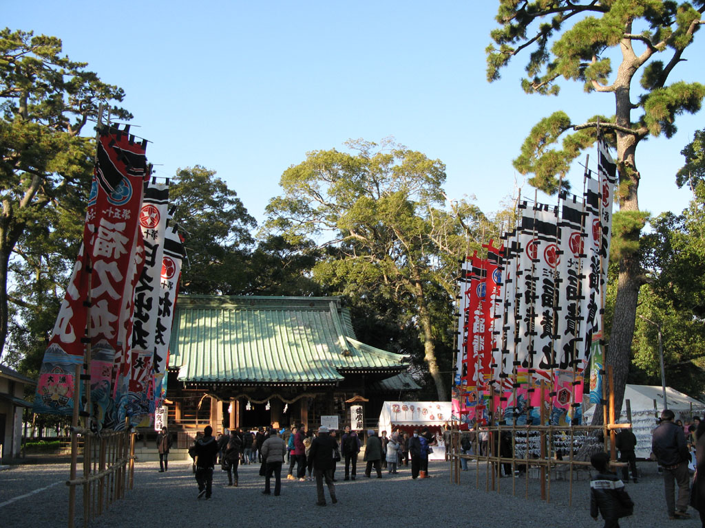
Yaizu, Japan
焼津市
Yaizu is a town of 139,578 people in Shizuoka, Japan, founded in April 1, 1889.
Why visit Yaizu
Townapedia lists 27 museums and landmarks, 85 parks and trails, 159 places to eat, 12 places to stay and 15 attractions in and around town.
Highlights include Hōrai Bridge, Shizuoka University of Welfare, Shida Gunga ruins and Toro.
Weather in Yaizu
Forecast from MET Norway (CC BY 4.0). Full forecast
About Yaizu
Yaizu (焼津市, Yaizu-shi) is a city located in central Shizuoka Prefecture, Japan. As of 31 January 2026, the city had an estimated population of 133,916 in 61,125 households, and a population density of 1,905 persons per km2. The total area of the city is 70.31 square kilometres (27.15 sq mi). Yaizu is a noted port for commercial fishing.
From the Wikipedia article Yaizu (this version), under CC BY-SA 4.0.
Things to do15




3 more on the map.
Museums and landmarks27

Shida Gunga ruins
Monument and historic site · 7.0 km
Archeological site

Toro
Monument and historic site · 12.6 km
Archaeological site in Shizuoka Prefecture, Japan






15 more on the map.
Parks, trails and playgrounds85



73 more on the map.
Restaurants and cafes159


昼めし喫茶 ちょい呑み 片山
Restaurant · Seafood, Japanese · 6.6 km
12:00 - 20:00

147 more on the map.
History
Yaizu is an ancient settlement, with Yaizu Shrine claiming to have been founded in the 5th century during the Kofun period, and numerous kofun tumuli are found within the city limits. During the Edo period, Yaizu developed as a port under Tanaka Domain, and fish from Yaizu was frequently supplied to the retired shōgun Tokugawa Ieyasu at nearby Sunpu Castle. In the October 1, 1886, establishment of the modern municipalities system after the Meiji Restoration, Yaizu Village was established within Mashizu District, Shizuoka prefecture. Mashizu District merged into neighboring Shida District in 1896. The following year, in 1897, author Lafcadio Hearn began his residence in Yaizu.
From the History section of Yaizu on Wikipedia, under CC BY-SA 4.0.
Where to stay12
Churches and places of worship80
Shopping53
Gas and EV charging42
Schools, colleges and libraries45
Healthcare49
Map of Yaizu
250 places. The map loads OpenStreetMap tiles when you open it.
Getting there and nearby towns
Shizuoka Airport (FSZ) is the nearest airport with scheduled flights listed in OpenStreetMap, 14 km away.
- Fujieda 5 km west, about 5 min by car
- Shizuoka 14 km northeast, about 14 min by car
- Shimada 14 km southwest, about 14 min by car
- Sumiyoshi 15 km southwest, about 15 min by car
- Kanaya 18 km west, about 18 min by car
- Maruobara 22 km southwest, about 22 min by car
- Toyokawa 84 km west, about 1 h 30 min by car
- Iida 85 km northwest, about 1 h 30 min by car
- Toyohashi 86 km west, about 1 h 30 min by car
- Odawara 88 km northeast, about 1 h 30 min by car
Drive times are estimates from straight-line distance, not routes.
Local news
Headlines from INDB.
Reviews, tips and questions
Loading what members have shared...
Sources and licences
- GeoNames (CC BY 4.0): population, coordinates, regions and time zone
- OpenStreetMap contributors (ODbL 1.0): places, airports, map data
- Wikidata (CC0 1.0): elevation, founding date, time zone, website, landmarks and historic places
- Wikimedia Commons (see each image): photos
- Wikipedia (CC BY-SA 4.0): overview and history text
Photo credits
- Yaizu City Hall 2020-04 ac (3), Asturio Cantabrio, CC BY-SA 4.0
- Yaizu station Ashiyu, Totti, CC BY-SA 4.0
- Yaizu 20190814195649 (49845725411), inunami, CC BY 2.0
- Yaizu 20190814195527 (49845726256), inunami, CC BY 2.0
- Yaizu-jinja 01, buku2photo, CC BY 3.0
- Yaizu-jinja 02, buku2photo, CC BY 3.0
- SunLife Yaizu Kuroshio Onsen, Totti, CC BY-SA 4.0
- Tide Station Yaizu 200524, IXTA9839, CC BY-SA 4.0
- Yaizu Port 2009-05-03, Yoshizumi Endo, CC BY-SA 2.0
- Yaizu City Minato JHS gate 200524, IXTA9839, CC BY-SA 4.0
- Houraibashi, しんかわな, CC BY-SA 3.0
- Campus or SUW, Zlatan18, CC BY-SA 3.0
- Shida-gunga-ato zenkei, Saigen Jiro, CC0
- Toro3, Unknown author, Public domain
- BiVi Fujieda 150712, IXTA9839, CC BY-SA 4.0
- Yaizu City Hospital, Abasaa, Public domain
- Rengeji ike-1, 江戸村のとくぞう, CC BY-SA 4.0
- Tank Locomotive of SUNEN-Line-1, 江戸村のとくぞう, CC BY-SA 4.0
- Nyakuōji kofun group 07, Halowand, CC BY-SA 4.0
- Yaizu Cultural Center ac (1), Asturio Cantabrio, CC BY-SA 4.0
- Mount Hanazawa, Alpsdake, CC BY-SA 4.0
- Yaizu Fishery Museum 2020-04 ac (1), Asturio Cantabrio, CC BY-SA 4.0
- Kiyomida Koen no Koyo 20191121, 撮影: 小幡ひろみ 権利者: 小幡ひろみ, CC BY 4.0
- Shizuoka-Sangyo-Univ-Iwata-2014072101, Hasec, CC0
- Mount Takakusa, Alpsdake, CC BY-SA 4.0
- Mount Mankan, Alpsdake, CC BY-SA 4.0
- Nyakuōji kofun group 05, Halowand, CC BY-SA 4.0
- Asahiyama Castle-Fujieda City, 港北の乱, CC BY-SA 4.0
- Fuefukidan-Park, やきつべ, CC BY-SA 4.0
- YaizuCity-Mt.Kokuzou, やきつべ, CC BY-SA 4.0
- Marukofuji, Alpsdake, CC BY-SA 4.0
- 潮山(静岡県藤枝市), やきつべ, CC BY-SA 4.0
- 20241212 Junya Dohi, Newriver0104, CC BY-SA 4.0
- Mugil cephalus 01, buku2photo, CC BY 3.0
- 焼津駅 - panoramio, くろふね, CC BY 3.0
- Japanese-national-railways-C50-96-20120404, LERK, CC BY-SA 3.0
- 焼津港 - panoramio, alonfloc, CC BY 3.0
- 小泉八雲諷詠の地碑, VASO258, CC0
- 八雲通り(焼津市), Yaritsusozai, CC BY 4.0
- 護心寺(焼津市), VASO258, CC0


Page built November 4, 2026. Spotted a mistake? Tell us or suggest a place.