
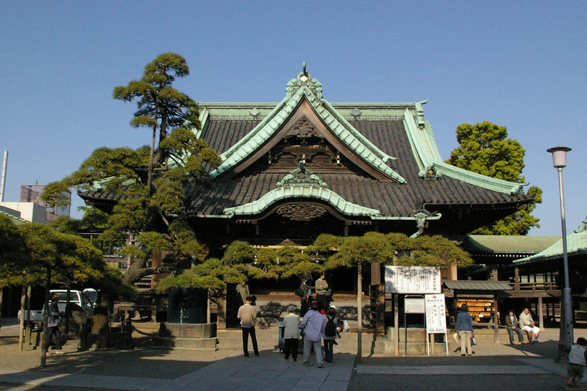


Katsushika, Japan
葛飾区
Katsushika is a town of 453,093 people in Tokyo, Japan, founded in May 3, 1947.
Why visit Katsushika
Townapedia lists 27 museums and landmarks, 62 parks and trails, 271 places to eat, 7 places to stay and 22 attractions in and around town.
Highlights include Asakusa International Theater, Chiba University of Commerce, Amuse Museum and Asakura Museum of Sculpture.
Weather in Katsushika
Forecast from MET Norway (CC BY 4.0). Full forecast
About Katsushika
Katsushika (葛飾区, Katsushika-ku; Japanese pronunciation: [kä̀.t͡sɨ́.ɕi̥.kä̀, -kä́(.kɯ̈̀)]) is a special ward in the Tokyo Metropolis in Japan. It is known as Katsushika City in English.
From the Wikipedia article Katsushika (this version), under CC BY-SA 4.0.
Things to do22

Asakusa International Theater
Cinema and theater · 5.6 km
Building in Tokyo, Japan

Chiba University of Commerce
School · 5.2 km
Higher education institution in Chiba Prefecture, Japan

Digital Hollywood University
School · 8.0 km
Private university in Chiyoda, Japan

Hanayashiki
Monument and historic site · 5.4 km
Amusement park in Asakusa, Taitō, Tokyo


Ryōgoku Bridge
Bridge · 7.0 km
Japanese bridge in Tokyo built in 1659

Ryōunkaku
Monument and historic site · 5.5 km
Former building in Tokyo, Japan


Tokyo Christian University
School · 2.1 km
Private university in Chiba, Japan


10 more on the map.
Museums and landmarks27

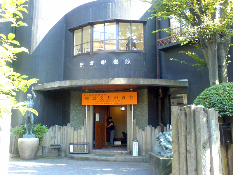
Asakura Museum of Sculpture
Museum · 7.4 km
Art museum in Tokyo, Japan


Horinouchi Shell Mound
Monument and historic site · 6.2 km
Archaeological site in Ichikawa, Japan

Municipal Museum of Archaeology in Ichikawa
Museum · 6.3 km
Museum in Ichikawa, Chiba, Japan


National Museum of Nature and Science
Museum · 6.9 km
National Science Museum in Tokyo, Japan

National Museum of Western Art
Museum · 7.0 km
Art museum in Tokyo, Japan


Soya Shell Mound
Monument and historic site · 7.8 km
Shell midden in Chiba, Japan

15 more on the map.
Parks, trails and playgrounds62


Kiyosumi Garden
Park · 7.6 km
Traditional Japanese stroll garden located in Fukagawa, Tokyo


Mukōjima-Hyakkaen Garden
Park · 3.3 km
Flower garden located in Sumida, Tokyo


Yokoamichō Park
Park · 6.2 km
Public park and memorial in Tokyo, Japan
50 more on the map.
Restaurants and cafes271


Doutor Coffee Shop
Cafe · Coffee Shop · 1.4 km
11, 葛飾区
Mo-Fr 07:15-21:30; Sa 07:45-21:30; Su,PH 07:45-21:00


259 more on the map.
History
Katsushika District was originally a division of Musashi Province. When the province was divided and reconfigured, the district was partitioned between Kita-Katsushika District (within Saitama Prefecture), Higashi-Katsushika District (within Chiba Prefecture) and the remainder was based in Tokyo Prefecture. Minami-Katsushika District conformed today's Katsushika Ward proper, plus Edogawa, Koto and Sumida wards.
On October 1, 1932, the former Minami-Katsushika District of what was then known as Tokyo Prefecture, and its seven towns and villages, merged and became part of the old Tokyo City.
Katsushika contains the Kasai Shrine, Narihira Santosen Temple, the "Bound Jizō" of Ōoka Echizen, and Shibamata Taishakuten, selected as one of the 100 Soundscapes of Japan and 100 Landscapes of Japan (Heisei era).
From the History section of Katsushika on Wikipedia, under CC BY-SA 4.0.
Where to stay7
Churches and places of worship62
Shopping66
Gas and EV charging9
Schools, colleges and libraries44
Healthcare50
Map of Katsushika
250 places. The map loads OpenStreetMap tiles when you open it.
Getting there and nearby towns
Tokyo International Airport (HND) is the nearest airport with scheduled flights listed in OpenStreetMap, 22 km away.
- Matsudo 7 km northeast, about 7 min by car
- Kita 11 km west, about 11 min by car
- Tokyo 15 km west, about 15 min by car
- Kawaguchi 15 km northwest, about 15 min by car
- Nagareyama 14 km north, about 14 min by car
- Kamagaya 14 km east, about 14 min by car
- Nakano 17 km west, about 17 min by car
- Kashiwa 18 km northeast, about 18 min by car
- Koshigaya 18 km north, about 18 min by car
- Narashino 18 km east, about 18 min by car
Drive times are estimates from straight-line distance, not routes.
Local news
Headlines from INDB.
Reviews, tips and questions
Loading what members have shared...
Sources and licences
- GeoNames (CC BY 4.0): population, coordinates, regions and time zone
- OpenStreetMap contributors (ODbL 1.0): places, airports, map data
- Wikidata (CC0 1.0): elevation, founding date, time zone, website, landmarks and historic places
- Wikimedia Commons (see each image): photos
- Wikipedia (CC BY-SA 4.0): overview and history text
Photo credits
- Shibamata Taishakuten, Los688, Public domain
- Katsushika city Tateishi library 20200501 152638, LERK, CC BY-SA 4.0
- Honden elementary school Katsushika city Tokyo 20200501 152716, LERK, CC BY-SA 4.0
- Tateishi Library,Katsushika,Tokyo, Tetracosane This photo was taken with iPhone 4S, CC BY-SA 4.0
- Higashitateishi ryokuchi park katsushika 2014, Kentin, CC BY-SA 4.0
- Hon-Okudo bashi,Katsushika,Tokyo,Japan, Tetracosane, CC BY-SA 4.0
- View of Heiwabashi,Katsushika,Tokyo, Tetracosane This photo was taken with iPhone SE (1st generation), CC BY-SA 4.0
- 7-Eleven store Katsushika-Higashi-tateishi-1chome shop Tokyo Japan 20160831 170858, LERK, CC BY-SA 4.0
- Chiba-Univ-of-Commerce01, Hasec, CC0
- Solacity, Koh-etsu, CC0
- Asakusa Hanayashiki -01, Aimaimyi, CC BY-SA 3.0
- Manseibashi-Downside, 妖精書士, CC BY-SA 3.0
- Ryougokubashi, Hykw-a4, CC BY-SA 3.0
- Jintan 12kai cropped, Jintan_12kai.jpg : User:Kaerutalk derivative work: 0607crp ( talk ), CC BY 3.0
- Tokyo Soramachi 2012, Kakidai, CC BY-SA 3.0
- Teikyo University of Science Senju Campus, Abasaa, Public domain
- Tokyo Denki University, Ocdp, CC BY-SA 3.0
- TokyoDentalCollege20110319, 三人日, CC BY-SA 3.0
- AM view1, Amuse Museum, CC BY-SA 3.0
- ASAKURA Museum of Sculpture 20051002, ja:利用者:Jmho, Public domain
- Daimyōtokei Museum02, Higa4, CC0
- Edo-Tokyo Museum, Wiiii, CC BY-SA 3.0
- 堀之内貝塚, Tsuyoshi chiba, CC BY-SA 4.0
- Municipal Museum of Archaeology in Ichikawa, Fred Cherrygarden, CC BY-SA 4.0
- Museum of Contemporary Art Tokyo 2009, Wiiii, CC BY-SA 3.0
- NMNC01s3200, 663highland, CC BY 2.5
- National museum of western art05s3200, 663highland, CC BY-SA 4.0
- Shunkaen Bonsai Museum, Abasaa, Public domain
- Soya Shell Midden, Abasaa, Public domain
- 2018 Sumida Hokusai Museum 2, Kakidai, CC BY-SA 4.0
- Arakawa Nature Park, Abasaa, Public domain
- Edogawa Shizen Zoo, しんぎんぐきゃっと, CC BY-SA 4.0
- Kibaparkview-andskytree-2011, Nesnad, CC BY-SA 3.0
- Kiyosumi-1, Irina Gelbukh, CC BY-SA 3.0
- Former Iwasaki Family House and Garden 2010, Wiiii, CC BY-SA 3.0
- Mizumoto-koen 001,Katsushika,Tokyo, Los688, Public domain
- Mukojima1, Irina Gelbukh, CC BY-SA 3.0
- Ojima komatsugawa park 2009, User:Kentin, CC BY-SA 3.0
- Sumida Park, Mnd, CC BY-SA 3.0
- UenoPark Hanami, The original uploader was Sdalu at English Wikipedia ., CC BY-SA 3.0
- Ueno-zoo, Los688, Public domain
- Tokyo air raid memorial, Nick-D, CC BY-SA 3.0
- 東京聖栄大学(新小岩), Suginami, CC BY-SA 4.0
- Yatsurugi-jinja (Katsushika) 01, youichirou seki from Japan. This photo was taken with NTT DoCoMo NEC N-06B, CC BY-SA 3.0
- Minami-Katsushika High School, Abasaa, Public domain
- Jyokoji temple higashiyotsugi katsushika 2015, Kentin, CC BY-SA 4.0
- Enjo-ji (Katsushika), Abasaa, Public domain
- Kumano Jinja (Katsushika), Abasaa, Public domain
- Kamikomatsu elementary school Katsushika Tokyo 20200501 163028, LERK, CC BY-SA 4.0
- Hosoda elementary school Katsushika Tokyo 20240102, Shokupan This photo was taken with Casio Exilim EX-Z600, CC BY-SA 4.0
- Kamihirai junior high school 20200501 164246, LERK, CC BY-SA 4.0
- Zempuku-in (Yotsugi, Katsushika) 02, Higa4, CC0
- Shōyō-ji (Katsushika) 02, Higa4, CC0
- Nanzo-in (Tateishi, Katsushika), Abasaa, Public domain
- Yotsugi Shirahige-jinja (Yotsugi, Katsushika) 01, Higa4, CC0
- Hara Inari-jinja (Higashi-Tateishi, Katsushika) 02, Higa4, CC0
- Nakahara Hachiman Jinja, Abasaa, Public domain
- Ichidō-in (Aoto, Katsushika) 05, Higa4, CC0
- Ichiju-ji (Katsushika) 01, Higa4, CC0
- TCUInzai, 杉山真大, CC BY-SA 3.0


Page built November 4, 2026. Spotted a mistake? Tell us or suggest a place.