


Kitakata, Japan
喜多方市
Kitakata is a town of 46,269 people in Fukushima, Japan, founded in January 4, 2006.
Why visit Kitakata
Townapedia lists 134 museums and landmarks, 63 parks and trails, 119 places to eat, 18 places to stay and 16 attractions in and around town.
Highlights include University of Aizu, Sannokura, Cat Museum Kirinoko Doll Museum and 日中線記念館(旧熱塩駅).
Weather in Kitakata
Forecast from MET Norway (CC BY 4.0). Full forecast
About Kitakata
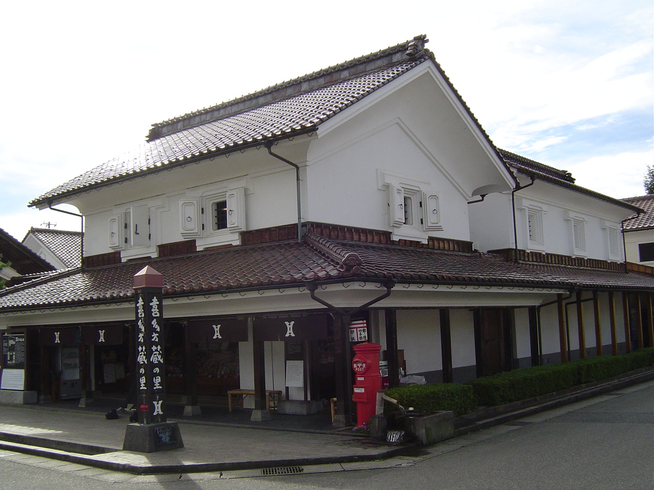
Kitakata (喜多方市, Kitakata-shi) is a city located in Fukushima Prefecture, Japan. As of 1 March 2020, the city had an estimated population of 46,269 in 16,769 households, and a population density of 83 persons per km2. The total area of the city was 554.63 square kilometres (214.14 sq mi). Kitakata was once written '北方', which meant 'northern place'.
From the Wikipedia article Kitakata, Fukushima (this version), under CC BY-SA 4.0.
Things to do16

University of Aizu
School · 15.4 km
Higher education institution in Fukushima Prefecture, Japan



恋人岬
Scenic view · 7.5 km
Shishizawatei-577 Kumaguramachi Oguni, Kitakata, Fukushima 966-0022日本
4 more on the map.
Museums and landmarks134



Furuyashiki Site
Monument and historic site · 5.3 km
Kofun period archaeological site in Kitakata, Tōhoku, Japan
Aizu Sanju-San Kannon
Monument and historic site · 真言宗 · 1.5 km
日本遺産:会津三十三観音:第四番:高吉観音:十一面観世音菩薩:御詠歌:かきわけて まいりておがむ たかよしの ほとけのひかり みちぞかがやく
Aizu Sanju-San Kannon
Monument and historic site · 曹洞宗 · 2.0 km
日本遺産:会津三十三観音:第三番:綾金観音:十一面観世音菩薩:御詠歌:つゆのみの ゆめまぼろしの よのなかに みをあやがねと いでいのるらん
Aizu Sanju-San Kannon
Monument and historic site · 真言宗 · 2.7 km
日本遺産:会津三十三観音:第六番:勝観音:十一面観世音菩薩:御詠歌:ひてるとも やまのこおりは よもとけじ さとにしぐれの あらんかぎりは
Aizu Sanju-San Kannon
Monument and historic site · 曹洞宗 · 3.2 km
日本遺産:会津三十三観音:第二番:松野観音:千手観世音菩薩:御詠歌:あさひさす ゆうひかがやく おやまでら まつののさとに はるるうすぐも
122 more on the map.
Parks, trails and playgrounds63




51 more on the map.
Restaurants and cafes119



Cafe terrace わさび
Restaurant · Crepe, Curry, Fish
8859-1
Th-Tu 11:00-16:00
Kura Bistro
Restaurant · Ramen · 0.6 km
4648-6
Mo-Su 11:00-14:00, 17:00-19:00

107 more on the map.
History
The area of present-day Kitakata was part of ancient Mutsu Province, and formed part of the holdings of Aizu Domain during the Edo period. The town developed as a local administrative center and market town, noted for its lacquerware and brewing of sake. After the Meiji Restoration, it was organized as part of Yama District, Fukushima Prefecture. The town of Kitakami was created with the establishment of the modern municipalities system on April 1, 1889.
In 1882, more than 3,000 peasants gathered at the Danjo-ga-hara Field in Shiokawa and then marched on the Kitakata Police Station to rebel against the oppression of the prefectural government. Known as the Kitakata Incident of 1882, it was the first public expression of the Freedom and People's Rights Movement in the Tohoku area.
Kitakata Town was raised to city status on March 31, 1954, after merging with Matsuyama village, Kamisammiya village, Iwasuki village, Sekishiba village, Kumakura village, Keitoku village, and Shiokawa village. On January 4, 2006, the towns of Shiokawa and Yamato, and the villages of Atsushiokanō and Takasato (all from Yama District) were merged into Kitakata.
From the History section of Kitakata, Fukushima on Wikipedia, under CC BY-SA 4.0.
Where to stay18
Churches and places of worship67
Shopping30
Gas and EV charging10
Schools, colleges and libraries38
Healthcare27
Map of Kitakata
250 places. The map loads OpenStreetMap tiles when you open it.
Getting there and nearby towns
Fukushima Airport (FKS) is the nearest airport with scheduled flights listed in OpenStreetMap, 68 km away.
- Oikawa 9 km south, about 9 min by car
- Bange 10 km southwest, about 10 min by car
- Ōshio 10 km east, about 10 min by car
- Ōtera 15 km southeast, about 15 min by car
- Aizu-Wakamatsu 19 km south, about 19 min by car
- Yanaizu 19 km southwest, about 19 min by car
- Nozawa 21 km west, about 21 min by car
- Kōriyama 53 km southeast, about 53 min by car
- Fukushima 54 km east, about 54 min by car
- Nasushiobara 77 km south, about 1 h 15 min by car
Drive times are estimates from straight-line distance, not routes.
Local news
Headlines from INDB.
Reviews, tips and questions
Loading what members have shared...
Sources and licences
- GeoNames (CC BY 4.0): population, coordinates, regions and time zone
- OpenStreetMap contributors (ODbL 1.0): places, airports, map data
- Wikidata (CC0 1.0): elevation, founding date, time zone, website, landmarks and historic places
- Wikimedia Commons (see each image): photos
- Wikipedia (CC BY-SA 4.0): overview and history text
Photo credits
- 喜多方市役所, Altomarina, CC BY-SA 3.0
- Museum,Kitakata (1390820482), contri from Yonezawa-Shi, Yamagata, Japan, CC BY-SA 2.0
- University of Aizu in bloom, Terakin, CC BY-SA 3.0
- Nittyu line memorial, Qwert1234, Public domain
- Manpouji, Kitakata, Fukushima, Japan - 20071010, Shuu4771 ., Public domain
- 心清水八幡神社, Qwert1234, CC BY-SA 4.0
- Shrine Shingu-Kumano-jinja 2, Qwert1234, Public domain
- Aizu Agricultural & forestry High School, Altomarina, CC BY-SA 3.0
- Kitakata High School, May 2022, Miyuki Meinaka, CC BY-SA 4.0
- Kitakata Tooh High School, Abasaa, Public domain
- Gotenbakouen entrance001, Tm3594, CC BY-SA 4.0
- 土蔵 (1389928661), contri from Yonezawa-Shi, Yamagata, Japan, CC BY-SA 2.0
- とりらー(きくすい・喜多方市)20241229-P1061758, くろふね, CC BY 4.0
- きくすい(喜多方市)20241229-P1061738, くろふね, CC BY 4.0
- 安勝寺(喜多方市)20241228-P1061712, くろふね, CC BY 4.0
- 喜多方ガーデンホテルからの風景 - panoramio (1), くろふね, CC BY 3.0
- 喜多方ガーデンホテルからの風景 - panoramio, くろふね, CC BY 3.0
- 喜多方ガーデンホテルからの風景 - panoramio (2), くろふね, CC BY 3.0
- 土蔵 (1389930991), contri from Yonezawa-Shi, Yamagata, Japan, CC BY-SA 2.0
- Japanese Post Box (1389929977), contri from Yonezawa-Shi, Yamagata, Japan, CC BY-SA 2.0
- 香福 告白ラーメン 青春ラーメン (43639532752), inunami, CC BY-SA 2.0
- 大和川酒蔵北方風土館(喜多方市)20241228-P1061734, くろふね, CC BY 4.0
- 北宮諏方神社(喜多方市)20241228-P1061720, くろふね, CC BY 4.0
- 大和川ミュージアム四方20251206-P1076407, くろふね, CC BY 4.0
- 会津バス喜多方営業所20251206-P1076395, くろふね, CC BY 4.0
- 土蔵 (1389932019), contri from Yonezawa-Shi, Yamagata, Japan, CC BY-SA 2.0
- 日中線記念自転車歩行者道 - panoramio (2), くろふね, CC BY 3.0
- 日中線のしだれ桜 05, くろふね, CC BY-SA 4.0
- 日中線記念自転車歩行者道 - panoramio (3), くろふね, CC BY 3.0
- 日中線のしだれ桜 06, くろふね, CC BY-SA 4.0
- 井戸 - panoramio, Haruki Ota (HRKo), CC BY-SA 3.0
- 日中線のしだれ桜 04, くろふね, CC BY-SA 4.0
- 日中線記念自転車歩行者道 - panoramio (1), くろふね, CC BY 3.0
- 喜多方ラーメン神社20251206-P1076411, くろふね, CC BY 4.0
- くるくる軒 - panoramio, くろふね, CC BY 3.0
- 日中線記念自転車歩行者道 - panoramio, くろふね, CC BY 3.0
- 日中線のしだれ桜 03, くろふね, CC BY-SA 4.0
- C11 63 - Mapillary (210626403896407), tm3594 @ Mapillary, CC BY-SA 4.0
- 日中線のしだれ桜 02, くろふね, CC BY-SA 4.0
- 日中線記念自転車歩行者道 - panoramio (5), くろふね, CC BY 3.0


Page built November 4, 2026. Spotted a mistake? Tell us or suggest a place.