



Komagane, Japan
駒ヶ根市
Komagane is a town of 32,202 people in Nagano, Japan, founded in July 1, 1954.
Why visit Komagane
Townapedia lists 65 museums and landmarks, 45 parks and trails, 66 places to eat, 22 places to stay and 22 attractions in and around town.
Highlights include Nagano College of Nursing, Mount Takazuya, Old Sanshū Kaidō and Old Sanshū Kaidō.
Weather in Komagane
Forecast from MET Norway (CC BY 4.0). Full forecast
About Komagane
Komagane (駒ヶ根市, Komagane-shi) is a city located in Nagano Prefecture, Japan. As of 1 February 2019, the city had an estimated population of 32,210 in 12,937 households, and a population density of 190 persons per km2. The total area of the city is 165.86 square kilometres (64.04 sq mi).
From the Wikipedia article Komagane, Nagano (this version), under CC BY-SA 4.0.
Travel tips from other travellers: Komagane on Wikivoyage (CC BY-SA 4.0).
Things to do22

Nagano College of Nursing
School · 3.3 km
Higher education institution in Nagano Prefecture, Japan




Senninzuka Park Sunset Point (100 Selected Sunsets of Nagano)
Scenic view · 6.4 km

10 more on the map.
Museums and landmarks65



53 more on the map.
Parks, trails and playgrounds45

殿島城址公園
Park · 10.1 km
築城年代は定かではないが天文年間(1532年~1555年)に殿島大和守重国によって築かれたと云われる。また、神林入道沙弥閑という人物が文明18年(1486年)に御符札を払った殿島の人物として「諏訪御符札之古書」に記されており、殿島城との関連が考えられている。 殿島大和守は...


33 more on the map.
Restaurants and cafes66




54 more on the map.
History
The area of present-day Komagane was part of ancient Shinano Province. The city was founded on July 1, 1954 by the merger of the towns of Akaho and Miyata with the villages of Nakasawa and Ina (all from Kamiina District).
From the History section of Komagane, Nagano on Wikipedia, under CC BY-SA 4.0.
Where to stay22
Churches and places of worship34
Shopping17
Gas and EV charging18
Schools, colleges and libraries9
Healthcare7
Map of Komagane
250 places. The map loads OpenStreetMap tiles when you open it.
Getting there and nearby towns
Shinshu-Matsumoto Airport (MMJ) is the nearest airport with scheduled flights listed in OpenStreetMap, 50 km away.
- Ina 12 km north, about 12 min by car
- Iida 24 km southwest, about 24 min by car
- Tatsuno 30 km north, about 30 min by car
- Chino 37 km northeast, about 37 min by car
- Okaya 39 km north, about 39 min by car
- Suwa 39 km northeast, about 39 min by car
- Shimosuwa 42 km north, about 42 min by car
- Nakatsugawa 47 km southwest, about 47 min by car
- Kofu 57 km east, about 57 min by car
- Matsumoto 58 km north, about 58 min by car
Drive times are estimates from straight-line distance, not routes.
Local news
Headlines from INDB.
Reviews, tips and questions
Loading what members have shared...
Sources and licences
- GeoNames (CC BY 4.0): population, coordinates, regions and time zone
- OpenStreetMap contributors (ODbL 1.0): places, airports, map data
- Wikidata (CC0 1.0): elevation, founding date, time zone, website, landmarks and historic places
- Wikimedia Commons (see each image): photos
- Wikipedia (CC BY-SA 4.0): overview and history text
Photo credits
- Komagane city hall, Ebiebi2, Public domain
- Kozenji (Komagane) Hondo 2012-08, photo: Qurren ( talk ) Taken with Canon IXY 10S (Digital IXUS 210), CC BY-SA 4.0
- Komagane Police Station Komagane Ekimae Koban, Suikotei, CC BY 4.0
- Ina Bus 23530 in Komagane, Suikotei, CC BY 4.0
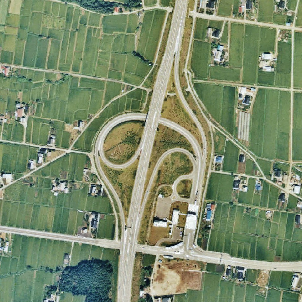
- Komagane IC 1976, retouch: Qurren ( talk )., Attribution
- Akaho, Komagane, Nagano Prefecture 399-4117, Japan - panoramio, alonfloc, CC BY 3.0
- Komagane Family Vacation Village, photo: Qurren ( talk ) Taken with Canon PowerShot G9 X, CC BY-SA 4.0
- Komagane Kogen Art Museum, photo: Qurren ( talk ) Taken with Canon IXY 10S (Digital IXUS 210), CC BY-SA 3.0
- Komagane Kogen Art Museum ruins 2022-03, photo: Qurren ( talk ) Taken with Canon PowerShot G9 X, CC BY-SA 4.0
- Kozenji (Komagane) Niomon 2012-08, photo: Qurren ( talk ) Taken with Canon IXY 10S (Digital IXUS 210), CC BY-SA 4.0
- Kozenji (Komagane) auditorium 2012-08, photo: Qurren ( talk ) Taken with Canon IXY 10S (Digital IXUS 210), CC BY-SA 4.0
- Kozenji (Komagane) Sanmon 2012-08, photo: Qurren ( talk ) Taken with Canon IXY 10S (Digital IXUS 210), CC BY-SA 4.0
- Kozenji (Komagane) three-storied pagoda 2012-08, photo: Qurren ( talk ) Taken with Canon IXY 10S (Digital IXUS 210), CC BY-SA 4.0
- INFORMEL NAKAGAWAMURA MUSEUM, main building and symbol tower exterior in 2012-11-24, Mukasora ( talk ), CC BY-SA 3.0
- Kouzenji 2, Junichi, CC BY-SA 3.0
- 大御食神社正面, Hansaki460, CC BY-SA 3.0
- Showa Inan General Hospital Hospital, アラツク, CC BY-SA 4.0
- Iijima Magistrate's office ac, Asturio Cantabrio, CC BY-SA 4.0
- 安楽寺三門, 濃間, CC BY-SA 4.0
- 西岸寺山門, 濃間, CC BY-SA 4.0
- Nagano College of Nursing, Asasa198, CC BY-SA 4.0
- Akaho High School, Asasa198, CC BY-SA 4.0
- Iijima Town Iijima junior High School ac, Asturio Cantabrio, CC BY-SA 4.0
- Iijima Nagano from Mount Eboshi, Alpsdake, CC BY-SA 3.0
- Miyada Village Library, ハレ, CC BY 2.1 jp
- Komagane City Library, KATSURA Roen, CC BY 3.0
- Iijima Town Library ac, Asturio Cantabrio, CC BY-SA 4.0
- 伊那福岡駅より飯田方面を見る - panoramio, ESU, CC BY 3.0
- ブリキの蜘蛛 - panoramio, ESU, CC BY 3.0
- 車窓Ⅱ - panoramio, ESU, CC BY 3.0
- Tenryugawa Joryu River Office, Suikotei, CC BY 4.0
- Minakata Dam, photo: Qurren ( talk ), with IXY DIGITAL 70 compact digital camera., CC BY-SA 3.0
- 田切駅 - panoramio, ardosa, CC BY 3.0
- Chuo Expressway and Nakatagiri River, photo: Qurren ( talk ) Taken with Canon IXY 10S (Digital IXUS 210), CC BY-SA 3.0
- Nakatagiri River, photo: Qurren ( talk ) Taken with Canon IXY 10S (Digital IXUS 210), CC BY-SA 3.0
- 駒ヶ根アルプスシオン教会 - panoramio, officeshema, CC BY 3.0
- Komagatake SA 1976, retouch: Qurren ( talk )., Attribution
- Route 153 ( Iijima Tagiri), Alpsdake This photo was taken with Canon EOS 250D, CC BY-SA 4.0
- Route 153 and Nagano Prefectural Road Route 18, Alpsdake This photo was taken with Canon EOS 800D, CC BY-SA 4.0
- Komagatake Service Area for Tokyo 001, Ocdp, CC0


Page built November 5, 2026. Spotted a mistake? Tell us or suggest a place.