



Iida, Japan
飯田市
Iida is a town of 101,536 people in Nagano, Japan, founded in April 1, 1937.
Why visit Iida
Townapedia lists 151 museums and landmarks, 57 parks and trails, 144 places to eat, 10 places to stay and 10 attractions in and around town.
Highlights include Iida Puppet Theater, Kuroda Hall of Japanese Puppetry Tradition, Sanshū Kaidō and Zakōji Kaidō.
Weather in Iida
Forecast from MET Norway (CC BY 4.0). Full forecast
About Iida
Iida (飯田市, Iida-shi; Japanese pronunciation: [ìí.dä́(.ɕì), íí-]) is a city in Nagano Prefecture, Japan. As of 1 March 2019, Iida had an estimated population of 101,536, and a population density of 154 persons per km2. The total area of the city is 658.66 square kilometres (254.31 sq mi). Iida is an environmental model city (環境モデル都市, Kankyō moderu toshi), a municipality designated by the Japanese government to be a model for making large cuts in greenhouse gas emissions towards a low-carbon society.
From the Wikipedia article Iida, Nagano (this version), under CC BY-SA 4.0.
Things to do10







Museums and landmarks151


Gonga Administrative Complex ruins
Monument and historic site · 4.1 km
Archaeological site



Iida Castle Sakuramaru Gomon (Akamon)
Monument and historic site · 1.0 km
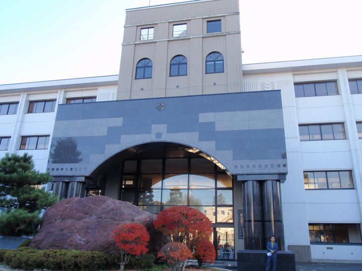
Iida Municipal Otemachi Elementary School Auditorium
Monument and historic site · 1.1 km
139 more on the map.
Parks, trails and playgrounds57




45 more on the map.
Restaurants and cafes144

Shanghai-Ro
Restaurant · Chinese, Ramen · 0.8 km
3-1-1
Mo-Su 11:00-15:00, 17:00-21:00
大雅飯店
Restaurant · Chinese · 1.8 km
4, 飯田市
11:00-14:00,17:00-21:00; Mo off

bakery&cafe 黒猫
Cafe · Coffee Shop, Milk Pan · 2.8 km
木曜日・金曜日以外営業 営業時間:8時30分~12時30分 モーニング:8時30分~10時30分 夜猫:18時~23時
132 more on the map.
History
The area of present-day Iida was part of ancient Shinano Province. The area was part of the holdings of Iida Domain during the Edo period and developed as a jōkamachi surrounding Iida Castle. The town of Iida was created within Shimoina District with the establishment of the municipalities system on April 1, 1889. It was raised to city status on April 1, 1937. Iida escaped the bombings that damaged many other Japanese cities during World War II; however, most of central Iida was destroyed by a massive fire that swept through the central section of the city two years after the end of the war, in 1947.
On September 30, 1956 the city limits were expanded by annexing the neighboring villages of Zakoji, Matsuo, Tatsuoka, Miho, Igara, Yamamoto and Shimohizakata, followed by Kawaji on March 31, 1961, Chiyo, Tatsue, and Kamihizakata on March 31, 1964, the town of Kanae on December 1, 1984, Kamisato on July 1, 1993, and Kami and Minamishinano on October 1, 2005.
On February 5, 2013, Iida became one of the few Japanese cities to have a roundabout.
From the History section of Iida, Nagano on Wikipedia, under CC BY-SA 4.0.
Where to stay10
Churches and places of worship52
Shopping20
Gas and EV charging17
Schools, colleges and libraries20
Healthcare14
Map of Iida
250 places. The map loads OpenStreetMap tiles when you open it.
Getting there and nearby towns
Shinshu-Matsumoto Airport (MMJ) is the nearest airport with scheduled flights listed in OpenStreetMap, 73 km away.
- Ajima 6 km east, about 6 min by car
- Ichiba 8 km northeast, about 8 min by car
- Kani 70 km west, about 1 h 15 min by car
- Seto 73 km southwest, about 1 h 15 min by car
- Toyota 78 km southwest, about 1 h 15 min by car
- Matsumoto 80 km north, about 1 h 15 min by car
- Komaki 86 km west, about 1 h 30 min by car
- Okazaki 87 km southwest, about 1 h 30 min by car
- Toyokawa 87 km southwest, about 1 h 30 min by car
- Kakamigahara 87 km west, about 1 h 30 min by car
Drive times are estimates from straight-line distance, not routes.
Local news
Headlines from INDB.
Reviews, tips and questions
Loading what members have shared...
Sources and licences
- GeoNames (CC BY 4.0): population, coordinates, regions and time zone
- OpenStreetMap contributors (ODbL 1.0): places, airports, map data
- Wikidata (CC0 1.0): elevation, founding date, time zone, website, landmarks and historic places
- Wikimedia Commons (see each image): photos
- Wikipedia (CC BY-SA 4.0): overview and history text
Photo credits
- 風越山遠景, 西脇 充, CC BY-SA 4.0
- Iida City Museum exterior ac (1), Asturio Cantabrio, CC BY-SA 4.0
- Ogasawara klan museum, Opqr, CC BY-SA 4.0
- Iida Ringo Namiki road in November ac, Asturio Cantabrio, CC BY-SA 4.0
- Nagano prefecturel Iida High School, おでん, CC BY-SA 3.0
- 飯田市立動物園 2014.9.10 - panoramio, Nankou Oronain (as36…, CC BY-SA 3.0
- Iida municipal hospital, アラツク, CC BY-SA 4.0
- Otemachi elementary school, photo: Qurren ( talk ) Taken with Canon IXY 430F (Digital IXUS 245 HS), CC BY-SA 3.0
- Osahime-jinja 2, photo: Qurren ( talk ) Taken with Canon IXY 430F (Digital IXUS 245 HS), CC BY-SA 3.0
- 正永寺の2代目の桜, じゃ・いあん, CC BY-SA 4.0
- 黄梅院, じゃ・いあん, CC BY-SA 4.0
- 愛宕稲荷神社 飯田市愛宕町 2014.9.09 - panoramio, Nankou Oronain (as36…, CC BY-SA 3.0
- Gohdohachimangu-20181006(1)sa, Araisyohei, CC BY 4.0
- 白山社 参道01, Kzu06, CC BY-SA 4.0
- Iida City Central Library exterior in Apr. 2018 ac, Asturio Cantabrio, CC BY-SA 4.0
- Iida Fuetsu HighSchool, Asasa198, CC BY-SA 4.0
- Shimoina Agriculture Senior High School, Asasa198, CC BY-SA 4.0
- Iiida Joshi High School, Asasa198, CC BY-SA 4.0
- Matsukawa river in Kanae bridge ac (1), Asturio Cantabrio, CC BY-SA 4.0
- Iinuma Tenjinzuka Kofun, funkyu-1, Saigen Jiro, CC0
- Iida Higashi JuniorHighSchool, Asasa198, CC BY-SA 4.0
- Apple Trees Street, Iida, Miyuki Meinaka, CC BY-SA 4.0
- Iida City Zoo, photo: Qurren ( talk ) Taken with Canon IXY 430F (Digital IXUS 245 HS), CC BY-SA 3.0
- Iida OIDE Osahime HighSchool, Asasa198, CC BY-SA 4.0
- Fumonin Tenmangu Iida City 1, じゃ・いあん (Ja Ian), CC BY-SA 4.0
- Iida Tokiwa Theatre ac (1), Asturio Cantabrio, CC BY-SA 4.0
- 正永寺本堂, じゃ・いあん, CC BY-SA 4.0
- Iida City Kamisato Library exterior in Apr. 2018 ac, Asturio Cantabrio, CC BY-SA 4.0


Page built November 4, 2026. Spotted a mistake? Tell us or suggest a place.