


Konan, Japan
湖南市
Konan is a town of 54,607 people in Shiga, Japan, founded in October 1, 2004.
Why visit Konan
Townapedia lists 23 museums and landmarks, 83 parks and trails, 75 places to eat, 13 places to stay and 19 attractions in and around town.
Highlights include 天山, 阿星山, Yasu City History and Folk Museum and 東海道石部宿歴史民俗資料館.
Weather in Konan
Forecast from MET Norway (CC BY 4.0). Full forecast
About Konan
Konan (湖南市, Konan-shi) is a city located in southern Shiga Prefecture, Japan. As of 1 October 2021, the city had an estimated population of 54,607 in 24305 households and a population density of 780 persons per km2. The total area of the city is 70.4 square kilometres (27.2 sq mi).
From the Wikipedia article Konan, Shiga (this version), under CC BY-SA 4.0.
Things to do19






7 more on the map.
Museums and landmarks23

Yasu City History and Folk Museum
Museum · 9.4 km
Museum in Yasu, Shiga, Japan




藤榮神社
Monument and historic site · 7.1 km
藤榮神社の標柱。明治の三筆のひとりであり水口出身の巖谷一六の書。 領界標石を転用したため裏には転用前の文字が残っている。
11 more on the map.
Parks, trails and playgrounds83




71 more on the map.
Restaurants and cafes75




63 more on the map.
History
Konan is part of ancient Ōmi Province and contains Ishibe-juku, the 51st post station on the route of the Tōkaidō highway connecting Heian-kyō with the eastern provinces during the Edo period. The village of Ishibe was established within Kōka District, Shiga with the creation of the modern municipalities system on April 1, 1889. It was elevated to town status on June 1, 1903. On October 1, 2004, Ishibe merged with the neighboring town of Kōsei (also from Kōka District) to form the city of Konan. I
From the History section of Konan, Shiga on Wikipedia, under CC BY-SA 4.0.
Where to stay13
Churches and places of worship35
Shopping19
Gas and EV charging8
Schools, colleges and libraries27
Healthcare15
Map of Konan
250 places. The map loads OpenStreetMap tiles when you open it.
Getting there and nearby towns
Osaka Itami Airport (ITM) is the nearest airport with scheduled flights listed in OpenStreetMap, 64 km away.
- Kusatsu 12 km west, about 12 min by car
- Moriyama 13 km northwest, about 13 min by car
- Yasu 13 km northwest, about 13 min by car
- Ōmihachiman 14 km north, about 14 min by car
- Hino 14 km east, about 14 min by car
- Ōtsu 21 km west, about 21 min by car
- Echigawa 21 km northeast, about 21 min by car
- Iga 27 km south, about 27 min by car
- Kyoto 31 km west, about 31 min by car
- Hikone 31 km northeast, about 31 min by car
Drive times are estimates from straight-line distance, not routes.
Local news
Headlines from INDB.
Reviews, tips and questions
Loading what members have shared...
Sources and licences
- GeoNames (CC BY 4.0): population, coordinates, regions and time zone
- OpenStreetMap contributors (ODbL 1.0): places, airports, map data
- Wikidata (CC0 1.0): elevation, founding date, time zone, website, landmarks and historic places
- Wikimedia Commons (see each image): photos
- Wikipedia (CC BY-SA 4.0): overview and history text
Photo credits
- Konan City Hall, Bakkai at Japanese Wikipedia, CC BY-SA 3.0
- Yuratani river in Konan, Shiga - upstream 02, Motokoka, CC BY-SA 4.0
- Tōkaidō in Hari, Konan, Shiga, Motokoka, CC BY-SA 4.0
- Yuratani river in Konan, Shiga - upstream 01, Motokoka, CC BY-SA 4.0
- Tōkaidō in Natsumi, Konan, Shiga, Motokoka, CC BY-SA 4.0
- Yuratani river in Konan, Shiga - downstream, Motokoka, CC BY-SA 4.0
- Yasu City History and Folklore Museum ac (1), Asturio Cantabrio, CC BY-SA 4.0
- Minakuchi, kamoseiro, CC BY-SA 2.5
- Ishibeshuku museum02s3200, 663highland, CC BY 2.5
- Shiga Kibougaoka-west gate, Takuma-sa, CC BY-SA 3.0
- Minakuchi-HS, イココ, CC BY-SA 4.0
- Ishibe highschool02s3200, 663highland, CC BY 2.5
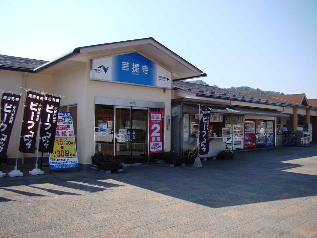
- BodaijiPA-kudari, しんかわな, CC BY-SA 3.0
- AL.PLAZA Minakuchi 2017, EVandRailway, CC BY-SA 4.0
- Konze-ES, イココ, CC BY-SA 4.0
- Ishibe-ES, イココ, CC BY-SA 4.0
- Mikumo-higashi-ES, イココ, CC BY-SA 4.0
- Ayano-ES, イココ, CC BY-SA 4.0
- Mikumo-ES, イココ, CC BY-SA 4.0
- Hiking trails of Mount Handou 01, Motokoka, CC BY-SA 4.0
- Daichi-ji, Koka 01 - Entrance, Motokoka, CC BY-SA 4.0
- Minakuchi-JHS, 運動会プロテインパワー, CC BY-SA 4.0
- Kashiwagi-jinja 10, Motokoka, CC BY-SA 4.0
- Amayama2 shiga, 笹谷康之, CC BY-SA 4.0
- Koka City Stadium 05, Motokoka, CC BY-SA 4.0
- Bantani-Elementary-School2019, 運動会プロテインパワー, CC BY-SA 4.0
- ISS030-E-190794 - View of Earth, Earth Science and Remote Sensing Unit , Lyndon B. Johnson Space Center, Public domain
- ISS047-E-50441 - View of Earth, Earth Science and Remote Sensing Unit , Lyndon B. Johnson Space Center, Public domain
- ISS030-E-190792 - View of Earth, Earth Science and Remote Sensing Unit , Lyndon B. Johnson Space Center, Public domain
- ISS030-E-184129 - View of Earth, Earth Science and Remote Sensing Unit , Lyndon B. Johnson Space Center, Public domain
- ISS030-E-187359 - View of Earth, Earth Science and Remote Sensing Unit , Lyndon B. Johnson Space Center, Public domain
- ISS030-E-190791 - View of Earth, Earth Science and Remote Sensing Unit , Lyndon B. Johnson Space Center, Public domain
- ISS030-E-190793 - View of Earth, Earth Science and Remote Sensing Unit , Lyndon B. Johnson Space Center, Public domain
- Stele of Tōkaidō Natsumi Shindendō, Motokoka, CC BY-SA 4.0
- Yuratani-gawa road tunnel 01, Motokoka, CC BY-SA 4.0
- Yuratani-gawa road tunnel 02, Motokoka, CC BY-SA 4.0
- Yuratani-gawa road tunnel 04, Motokoka, CC BY-SA 4.0
- Yuratani-gawa road tunnel 03, Motokoka, CC BY-SA 4.0
- Yuratani-gawa road tunnel 05, Motokoka, CC BY-SA 4.0
- R001-2019 NO2-582-2, Puchi-masashi, CC BY-SA 4.0


Page built November 5, 2026. Spotted a mistake? Tell us or suggest a place.