


Ōtsu, Japan
大津市
Ōtsu is a regional capital of 345,070 people in Shiga, Japan, founded in April 1, 1933.
Why visit Ōtsu
Townapedia lists 147 museums and landmarks, 70 parks and trails, 178 places to eat, 16 places to stay and 50 attractions in and around town.
Highlights include Bukkyo University, Doshisha University, Bukkyo University Museum of Religious Culture and Chisō Gallery.
Weather in Ōtsu
Forecast from MET Norway (CC BY 4.0). Full forecast
About Ōtsu
Ōtsu (大津市, Ōtsu-shi; Japanese pronunciation: [ó̞ò̞.t͡sɨ̀, ò̞ó̞.t͡sɨ̥.ɕì, ó̞ó̞.t͡sɨ̥-]) is the capital city of Shiga Prefecture, Japan. As of 1 October 2021, the city had an estimated population of 343,991 in 153,458 households and a population density of 740 persons per km2. The total area of the city is 464.51 square kilometres (179.35 sq mi).
From the Wikipedia article Ōtsu (this version), under CC BY-SA 4.0.
Travel tips from other travellers: Ōtsu on Wikivoyage (CC BY-SA 4.0).
Things to do50
Bukkyo University
School · 12.7 km
Higher education institution in Kyoto Prefecture, Japan

Doshisha University
School · 10.2 km
Private university in Kyoto, Japan

Doshisha Women's College of Liberal Arts
School · 9.9 km
Private women's college in Kyoto, Japan


Heian Jogakuin University
School · 10.1 km
Higher education institution in Kyoto Prefecture, Japan

Kyoto Aquarium
Zoo and aquarium · 10.9 km
Building in Shimogyo-ku, Kyoto Prefecture, Japan

Kyoto Bunkyo University
School · 12.2 km
Higher education institution in Kyoto Prefecture, Japan

Kyoto City University of Arts
School · 9.5 km
Higher education institution in Kyoto Prefecture, Japan

Kyoto College of Graduate Studies for Informatics
School · 8.6 km
Internet technology school in Kyoto, Japan

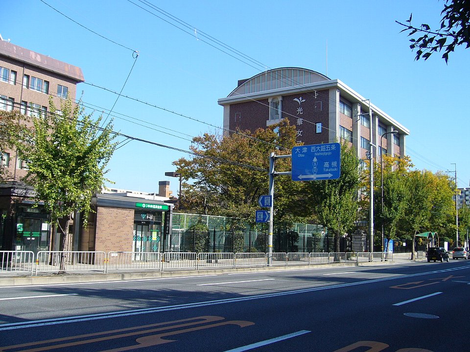
Kyoto Koka Women's University
School · 13.5 km
A private college in Kyoto, Japan
38 more on the map.
Museums and landmarks147

Bukkyo University Museum of Religious Culture
Museum · 16.5 km
Museum in Kyoto, Japan



Hayaagari Tile Kiln Site
Monument and historic site · 11.7 km
Archaeological site in Japan


Katagihara temple ruins
Monument and historic site · 16.4 km
Temple ruins in Kyoto, Japan


Koryo Museum of Art
Museum · 12.2 km
Korean art museum in Kyoto Prefecture, Japan

Kuse temple ruins
Monument and historic site · 17.5 km
Archaeological site

Kyoto City Archaeological Museum
Museum · 11.2 km
Archive organization in Kyoto, Japan


135 more on the map.
Parks, trails and playgrounds70






58 more on the map.
Restaurants and cafes178

166 more on the map.
History
Ōtsu is part of ancient Ōmi Province and has been settled since at least the Yayoi period. It was an important center of inland water transportation on Lake Biwa and was referred to in the Man'yōshū as Shiga no Ōwada (志賀の大わだ) and Shigatsu (志賀津). It was also on the main land routes, the Tōkaidō and the Nakasendō connecting the eastern provinces with the ancient capitals of Japan. Additionally, the ancient Hokurikudō, which connected Kyoto to the provinces of northern Honshu, ran through Ōtsu. From 667 to 672, the Ōmi Ōtsu Palace, founded by Emperor Tenji, was the capital of Japan. Following the Jinshin War Ōtsu was renamed Furutsu (古津; "old port"). A new capital, Heian-kyō, (now Kyoto), was established in the immediate neighborhood in 794, and Ōtsu (meaning "big port") was revived as an important traffic point and satellite town of the capital. With the establishment of the new capital, the name of the city was restored to "Ōtsu".
Ōtsu prospered during the Edo period because of its port on Lake Biwa and as Ōtsu-juku, a major shukuba on the Tōkaidō and Nakasendō highways. The city was under direct administration of the Tokugawa shogunate, both for its strategic location and for its role as a center of travel and trade. Zeze Domain was based in Zeze, a neighboring castle town, and the smaller Katada Domain occupied the northern area of the present-day city from 1698 to 1826.
From the History section of Ōtsu on Wikipedia, under CC BY-SA 4.0.
Where to stay16
Churches and places of worship84
Shopping41
Gas and EV charging5
Schools, colleges and libraries15
Healthcare42
Map of Ōtsu
250 places. The map loads OpenStreetMap tiles when you open it.
Getting there and nearby towns
Osaka Itami Airport (ITM) is the nearest airport with scheduled flights listed in OpenStreetMap, 46 km away.
- Kyoto 11 km west, about 11 min by car
- Takatsuki 28 km southwest, about 28 min by car
- Ibaraki 34 km southwest, about 34 min by car
- Ikoma 38 km southwest, about 38 min by car
- Kadoma 39 km southwest, about 39 min by car
- Moriguchi 40 km southwest, about 40 min by car
- Minoh 41 km southwest, about 41 min by car
- Kawanishi 46 km southwest, about 46 min by car
- Osaka 48 km southwest, about 48 min by car
- Itami 49 km southwest, about 49 min by car
Drive times are estimates from straight-line distance, not routes.
Local news
Headlines from INDB.
Reviews, tips and questions
Loading what members have shared...
Sources and licences
- GeoNames (CC BY 4.0): population, coordinates, regions and time zone
- OpenStreetMap contributors (ODbL 1.0): places, airports, map data
- Wikidata (CC0 1.0): elevation, founding date, time zone, website, landmarks and historic places
- Wikimedia Commons (see each image): photos
- Wikipedia (CC BY-SA 4.0): overview and history text
Photo credits
- Otsu at the south end of Lake Biwa in Shiga prefecture, Gpwitteveen, CC BY-SA 4.0
- Bukkyo University 2017 a, 桂鷺淵, CC BY-SA 4.0
- Mukoku-kan (Kyotanabe Campus, Doshisha University), RoyHalzenski, Public domain
- Yuwakan, Doujo koho, CC BY-SA 3.0
- 五条大橋, KeraKera55, CC BY-SA 4.0
- Hanazono University Saisho-kan, Blancoyrojo, CC BY-SA 4.0
- Kyoto St Agnes Episcopal Church02st3200, 663highland, CC BY 2.5
- Kyoto Aquarium in 2013-5-2 No,27, Mti, CC BY-SA 3.0
- Kyu-Kyotokotokogeigakko-Honkan-20071215, The original uploader was Otraff at Japanese Wikipedia ., CC BY-SA 3.0
- Bukkyo University Museum of Religious Culture140513NI1, Atelier Verde, CC BY-SA 3.0
- Genda Shigyō, Genda Shigyō, CC BY-SA 4.0
- Hosomi Museum ac, Asturio Cantabrio, CC BY-SA 4.0
- Katagiharahaiji, dragon2850, CC BY-SA 3.0
- Kyoto Kitamura Art Museum 2013-08, At by At, CC BY-SA 3.0
- Koryo Museum, 今紫, CC BY-SA 4.0
- Kuse Haiji, gaikan, Saigen Jiro, CC0
- KyotoArchaeologicalMuseum, PlusMinus, CC BY-SA 3.0
- 京都国際マンガミュージアム, ja:利用者:珈琲ルンバ, CC BY-SA 3.0
- Kyoto Municipal Museum of Art 1933 ⅱ, Kakidai, CC BY-SA 4.0
- Iwatayama Monkey Park, Minseong Kim, CC BY-SA 4.0
- Kyoto City zoo, East Entrace. 京都市動物園:東出入口, Kamigata0, CC BY-SA 4.0
- 251213 Maruyama Park Kyoto Japan08s3, 663highland, CC BY-SA 4.0
- Cathedral of Roman Catholic Diocese of Kyoto, 聖石大戦ぶぅぶぅ, CC BY-SA 4.0
- Otsu nagisa park, Rock.jazz.cafe, CC BY-SA 4.0
- Miidera keidai, KENPEI, CC BY-SA 3.0
- Otsu Prince Hotel 20090509-002, J o, CC BY-SA 3.0
- Otsu City Library exterior ac, Asturio Cantabrio, CC BY-SA 4.0
- Otsu City Hirano elementary school, KishujiRapid, CC BY-SA 4.0
- Uchide-JHS, イココ, CC BY-SA 4.0
- Otsu Red Cross Hospital, KENPEI, CC BY-SA 3.0
- Shiga-Univ-Affiliated-Schools-Entrance-2016081701, Hasec, CC0
- Shiga Junior College High School, Own work, CC BY-SA 3.0
- Gichuji hondo, KENPEI, CC BY-SA 3.0
- Otsu City Chuo elementary school, KishujiRapid, CC BY-SA 4.0
- Ohsaka-Elementary-School2019, 運動会プロテインパワー, CC BY-SA 4.0
- Kuhon-ji (Otsu, Shiga) 02, Higa4, CC0
- Chōju-ji (Otsu, Shiga) 01, Higa4, CC0
- Denkō-in (Otsu, Shiga) 01, Higa4, CC0
- Kōsai-ji (Otsu, Shiga) 01, Higa4, CC0
- Yuisen-ji (Otsu, Shiga) 02, Higa4, CC0
- Jōnen-ji (Otsu, Shiga) 01, Higa4, CC0
- Kyoto Bunkyo Univ, Bakkai at Japanese Wikipedia, CC BY-SA 3.0
- Kyoto Koka Womens Univ, Bakkai at Japanese Wikipedia, CC BY-SA 3.0
- KyotoChiso2022-07-04-2, Miya, CC BY-SA 4.0
- Otsu city hospital 2023-06, 運動会プロテインパワー, CC BY-SA 4.0
- Otsu City Nagara elementary school, KishujiRapid, CC BY-SA 4.0
- JP 日本 Japan 京都 Kyoto 塩小路通 Shiokōji Street 京都市立藝術大學 Kyoto City University of Arts campus June 2026 N13P 03, TKdows 2026, CC0
- Super Hotel - panoramio, DVMG, CC BY 3.0


Page built November 4, 2026. Spotted a mistake? Tell us or suggest a place.