


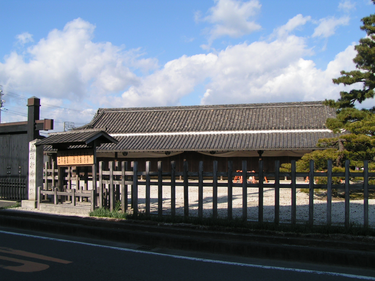

Kosai, Japan
湖西市
Kosai is a town of 59,770 people in Shizuoka, Japan, founded in January 1, 1972.
Why visit Kosai
Townapedia lists 40 museums and landmarks, 66 parks and trails, 102 places to eat, 29 places to stay and 13 attractions in and around town.
Highlights include Toyohashi University of Technology, Hamanako Aquatic Experience Center Wotto, 新居関所 and Ōchiwatoge temple ruins.
Weather in Kosai
Forecast from MET Norway (CC BY 4.0). Full forecast
About Kosai
Kosai (湖西市, Kosai-shi) is a city located in far western Shizuoka Prefecture, Japan. As of 30 June 2019, the city had an estimated population of 57,885 in 24,232 households, and a population density of 668.7 persons per km2. The total area of the city is 85.65 square kilometres (33.07 sq mi).
From the Wikipedia article Kosai, Shizuoka (this version), under CC BY-SA 4.0.
Travel tips from other travellers: Kosai on Wikivoyage (CC BY-SA 4.0).
Things to do13

Toyohashi University of Technology
School · 10.4 km
Higher education institution in Aichi Prefecture, Japan




1 more on the map.
Museums and landmarks40

Ōchiwatoge temple ruins
Monument and historic site · 9.7 km
Archaeological site in Kosai, Japan




28 more on the map.
Parks, trails and playgrounds66






54 more on the map.
Restaurants and cafes102

四季彩
Restaurant · Western · 6.8 km
6, 湖西市
Mo-Su 11:00-14:30,17:30-20:30; Tu off

Ichikawa Coffee
Cafe · Coffee Shop, Tea · 4.2 km
Mo-Fr 08:00-20:00; Sa-Su 09:00-19:00
どoco 弁天島店
Restaurant · Okonomiyaki · 7.5 km
広島お好み焼き。MARGARITA内にある。
We-Su 19:00-24:00
90 more on the map.
History
The area around Kosai has been noted for the production of Japanese pottery and porcelain since the Kofun period. During the Edo period, Kosai was tenryō territory administered directly by the Tokugawa shogunate, and the location of a barrier gate regulating traffic on the old Tōkaidō highway connecting Edo with Kyoto. A post station named Shirasuka-juku developed near the barrier, and this was the forerunner of modern Kosai. During the establishment of the modern municipalities system of the early Meiji period in 1889, the area was reorganized into five villages within Hamana District, Shizuoka. Four of these villages (Washizu, Iride, Shirasuka, Chibata) merged to form the city of Kosai on January 1, 1972.
On March 23, 2010, the town of Arai (from Hamana District) was merged into Kosai. Hamana District was dissolved as a result of this merger.
From the History section of Kosai, Shizuoka on Wikipedia, under CC BY-SA 4.0.
Where to stay29
Churches and places of worship80
Shopping26
Gas and EV charging14
Schools, colleges and libraries32
Healthcare12
Map of Kosai
250 places. The map loads OpenStreetMap tiles when you open it.
Getting there and nearby towns
Shizuoka Airport (FSZ) is the nearest airport with scheduled flights listed in OpenStreetMap, 62 km away.
- Toyohashi 15 km northwest, about 15 min by car
- Toyokawa 17 km northwest, about 17 min by car
- Hamamatsu 19 km east, about 19 min by car
- Shinshiro 22 km north, about 22 min by car
- Hamakita 26 km northeast, about 26 min by car
- Iwata 30 km east, about 30 min by car
- Gamagōri 30 km northwest, about 30 min by car
- Fukuroi 36 km east, about 36 min by car
- Mori 40 km east, about 40 min by car
- Okazaki 43 km northwest, about 43 min by car
Drive times are estimates from straight-line distance, not routes.
Local news
Headlines from INDB.
Reviews, tips and questions
Loading what members have shared...
Sources and licences
- GeoNames (CC BY 4.0): population, coordinates, regions and time zone
- OpenStreetMap contributors (ODbL 1.0): places, airports, map data
- Wikidata (CC0 1.0): elevation, founding date, time zone, website, landmarks and historic places
- Wikimedia Commons (see each image): photos
- Wikipedia (CC BY-SA 4.0): overview and history text
Photo credits
- Kosai City Office, KK77, CC BY-SA 3.0
- Kosai undo koen, Wakadanari, CC BY-SA 4.0
- Toyohashi University of Technology 120825, Umako, CC0
- Ochiba Pass, Alpsdake, CC BY-SA 4.0
- Araisekisho, A10ml at Japanese Wikipedia, Public domain
- Daigan-ji, Yanajin33, CC BY-SA 3.0
- Municipal Kosai Hospital, Abasaa, Public domain
- Humonji1, Bariston, CC BY-SA 4.0
- 230126 Hamanako Garden Park Hamamatsu Japan07s3, 663highland, CC BY-SA 4.0
- Kosai High School, Abasaa, Public domain
- Le Temple Shintô Futagawa-hachiman-jinja - Le haiden (La construction du culte), Yanajin33, CC BY-SA 3.0
- Le Temple Shintô Futagawa-Fushimi-Inari - Le haiden (La construction du culte), Yanajin33, CC BY-SA 3.0
- Le Temple Bouddhiste Shô'on-ji - Le bâtiment principal "Le hon-dô", Yanajin33, CC BY-SA 3.0
- Toyota Sakichi Birthplace, Yanajin33, CC BY-SA 3.0
- Futagawa-Yado, Yanajin33, CC BY-SA 3.0
- 230126 Hamanako Garden Park Hamamatsu Japan02s3, 663highland, CC BY-SA 4.0
- Arai (5759536868), Utagawa Hiroshige, Public domain
- Hutagawa sshiryoukan1, Bariston, CC BY-SA 4.0
- Humonji3, Bariston, CC BY-SA 4.0
- Toyota Sakichi Memorial Hall Gate, Yanajin33, CC BY-SA 3.0
- ISS045-E-5666 - View of Earth, Earth Science and Remote Sensing Unit , Lyndon B. Johnson Space Center, Public domain
- ISS023-E-31416 - View of Earth, Earth Science and Remote Sensing Unit , Lyndon B. Johnson Space Center, Public domain
- ISS048-E-42855 - View of Earth, Earth Science and Remote Sensing Unit , Lyndon B. Johnson Space Center, Public domain
- FDKエナジー, Aokusa, CC0
- アメニティプラザ, Cakoko23, CC BY-SA 4.0
- R042-001-001, Puchi-masashi, CC BY-SA 4.0
- 遠州灘海岸1 - panoramio, hakamata.h, CC BY 3.0
- 遠州灘海岸4 - panoramio, hakamata.h, CC BY 3.0
- 遠州灘海岸3 - panoramio, hakamata.h, CC BY 3.0
- 遠州灘海岸2 - panoramio, hakamata.h, CC BY 3.0
- JA Topia Hamamatsu Washizu Branch, Suikotei, CC BY 4.0
- サンライズ瀬戸・出雲 (49843124347), inunami, CC BY 2.0
- Washizu Station Aug2014 01, Aokusa, CC BY-SA 4.0
- Washizu Station Aug2014 03, Aokusa, CC BY-SA 4.0
- Washizu Station Aug2014 02, Aokusa, CC BY-SA 4.0
- Washizustation-platforms-march2014, Nesnad, CC BY-SA 3.0
- R001-2016 2-373, Puchi-masashi, CC BY-SA 4.0
- Japan National Route 1 -39, Aimaimyi, CC BY-SA 3.0
- Dream (54150854836), lazy fri13th, CC BY 2.0
- 洗浄 済み (54151146378), lazy fri13th, CC BY 2.0


Page built November 5, 2026. Spotted a mistake? Tell us or suggest a place.