


Kōshū, Japan
甲州市
Kōshū is a town of 31,526 people in Yamanashi, Japan, founded in November 1, 2005.
Why visit Kōshū
Townapedia lists 71 museums and landmarks, 25 parks and trails, 89 places to eat, 31 places to stay and 54 attractions in and around town.
Highlights include Yamanashi Eiwa College, Mt. Daibosatsurei, 旧甲州街道 and 甘草屋敷.
Weather in Kōshū
Forecast from MET Norway (CC BY 4.0). Full forecast
About Kōshū
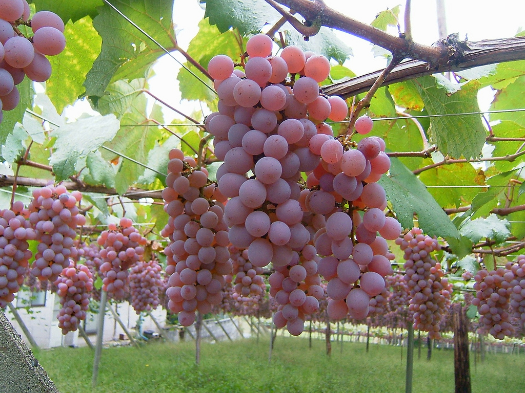
Kōshū (甲州市, Kōshū-shi; Japanese pronunciation: [kó̞ò̞.ɕɨ̀ɨ̀, kò̞ó̞.ɕɨ́ɨ̀.ɕì, kó̞ó̞.ɕɨ́ɨ̀-]) is a city located in Yamanashi Prefecture, Japan. As of 1 September 2020, the city had an estimated population of 29,659 in 13,141 households, and a population density of 120 persons per km². The total area of the city is 264.11 square kilometres (101.97 sq mi). The city is the home of the indigenous Koshu grape and is synonymous with viticulture and wine production in Japan.
From the Wikipedia article Kōshū, Yamanashi (this version), under CC BY-SA 4.0.
Travel tips from other travellers: Kōshū on Wikivoyage (CC BY-SA 4.0).
Things to do54

Yamanashi Eiwa College
School · 15.8 km
Higher education institution in Yamanashi Prefecture, Japan






42 more on the map.
Museums and landmarks71





59 more on the map.
Parks, trails and playgrounds25





13 more on the map.
Restaurants and cafes89

Koropokkuru
Cafe · 3.6 km
LO17:00 第2木曜は夜営業。変更、その他イベントなどURL参考。
Mo,Th-Su 11:30-18:00; Tu-We off; Th[2] 11:30-20:00


Utage
Restaurant · Japanese · 8.3 km
2, 山梨市
Fr-Tu 11:30-14:00, 18:00-22:00
77 more on the map.
History
Kōshū is located near the center of ancient Kai Province and contains many ruins from the Jōmon period and burial mounds from the Kofun period. During the Heian period, the area was developed in shōen under control of the Minamoto clan, which devolved into feudal holdings by the Nikaido clan and later the Takeda clan from the Kamakura through Sengoku periods. During the Edo period, all of Kai Province was tenryō territory under direct control of the Tokugawa shogunate. Following the Meiji restoration, the area was organized into villages within Yamanashi District of Yamanashi Prefecture, which was later divided into Higashiyamanashi District and Nishiyamanashi District Many of these villages were consolidated into the city of Enzan, the town of Katsunuma, and the village of Yamato by April 1, 1955. The modern city of Kōshū was established on November 1, 2005, from the merger of these three municipalities.
From the History section of Kōshū, Yamanashi on Wikipedia, under CC BY-SA 4.0.
Where to stay31
Churches and places of worship57
Shopping24
Gas and EV charging30
Schools, colleges and libraries50
Healthcare22
Map of Kōshū
250 places. The map loads OpenStreetMap tiles when you open it.
Getting there and nearby towns
Yokota Air Base (OKO) is the nearest airport with scheduled flights listed in OpenStreetMap, 52 km away.
- Enzan 4 km southwest, about 4 min by car
- Yamanashi 9 km southwest, about 9 min by car
- Isawa 15 km southwest, about 15 min by car
- Kofu 20 km west, about 20 min by car
- Ōtsuki 22 km southeast, about 22 min by car
- Tsuru 23 km southeast, about 23 min by car
- Ryūō 26 km west, about 26 min by car
- Fujikawaguchiko 27 km south, about 27 min by car
- Nirasaki 29 km west, about 29 min by car
- Minami-Alps 30 km southwest, about 30 min by car
Drive times are estimates from straight-line distance, not routes.
Local news
Headlines from INDB.
Reviews, tips and questions
Loading what members have shared...
Sources and licences
- GeoNames (CC BY 4.0): population, coordinates, regions and time zone
- OpenStreetMap contributors (ODbL 1.0): places, airports, map data
- Wikidata (CC0 1.0): elevation, founding date, time zone, website, landmarks and historic places
- Wikimedia Commons (see each image): photos
- Wikipedia (CC BY-SA 4.0): overview and history text
Photo credits
- Katsunuma vineyard 02, genta_hgr, CC BY 2.0
- Yamanashi Eiwa College front gate, さかおり ( talk, CC BY-SA 3.0
- Kogakuji temple, さかおり ( talk ), CC BY-SA 3.0
- 清白寺仏殿, Shouichin, CC BY-SA 3.0
- Ichinomiya-sengen Shrine in Ichikawamisato, Yamanashi, Japan - 2010, さかおり ( talk ), CC BY-SA 3.0
- Mt Kentokusan, アラツク, CC BY-SA 4.0
- Oimatakubo-hachiman shrine Haiden March 2014, Sakaori ( talk ), CC BY 3.0
- 大善寺本堂 - panoramio, painreef3108, CC BY 3.0
- Mount Daibosatsurei, Oyama no taisho, Public domain
- Ookuratakamaru, Oda230, CC BY-SA 3.0
- Koganesawayama, Oda230, CC BY-SA 3.0
- Yamanashioka shrine Yamanashi-City in the Mt.Ishimori №1, さかおり ( talk ), CC BY-SA 3.0
- The main gate of a Buddhist temple of the Hokoji- temple, さかおり ( talk ), CC BY-SA 3.0
- Keitokuin Sanmon 2006, (関西地方), Public domain
- Eishoin№1, さかおり ( talk ) 07:21, 18 March 2010 (UTC), CC BY-SA 3.0
- Mt.Takigo 01, Σ64, CC BY 3.0
- Old Takano House, Wiiii, CC BY-SA 3.0
- Main hall of Risshou-ji Temple.Koshu city, Sakaori ( talk ), CC BY-SA 3.0
- Kyozuka-kofun Old tomb at Fuefuki-city, さかおり ( talk ), CC BY-SA 3.0
- Shakado relics museum, さかおり ( talk ), CC BY-SA 3.0
- 笛吹市フルーツ公園 - panoramio, funk bass, CC BY 3.0
- Fruit Park Fujiya Hotel Front, Sakaori ( talk ), CC BY-SA 3.0
- 牛奥ノ雁ヶ腹摺山, 保姆虫, CC BY-SA 4.0
- Sashidenoisodaitakesanjinja, Yamaoka yoshito, CC BY-SA 3.0
- Mt.Daibosatsurei from Mt.Kasatori 03, Σ64, CC BY 3.0
- Museums in Yamanashi prefecture-1, 江戸村のとくぞう, CC BY-SA 4.0
- Daizen-ji-4a, 江戸村のとくぞう, CC BY-SA 4.0
- Yamanashi prefectural Enzan High School, さかおり ( talk, CC BY-SA 3.0
- Buddha Hall, Seihaku-ji 201906-1, Suikotei, CC BY-SA 4.0
- Kogakuji temple Oct. 10, 2021 A, さかおり, CC BY-SA 4.0
- 笠取小屋から見た黒川鶏冠山と大菩薩嶺, Koda6029, CC BY-SA 4.0
- Yamanashi prefectural Yamanashi High School, さかおり ( talk ), CC BY-SA 3.0
- Ichinomiya-sengen Shrine A-2010, さかおり ( talk ), CC BY-SA 3.0
- Mt.Kurodake (Daibosatsu) 01, Σ64, CC BY 3.0
- Koganesawayama-Fujisan, Oda230, CC BY-SA 3.0
- Jiunji-Temple main gate, Sakaori ( talk ), CC BY-SA 3.0
- Enzan Kamihagihara Uwahara in Koshu, Yamanashi, Japan, Yasu ( talk ), CC BY-SA 3.0
- Hodo-in temple in Koshu, Yamanashi, Japan, Yasu ( talk ), CC BY-SA 3.0
- Monument of Bansu Mashimo.A, Sakaori ( talk ), CC BY 3.0
- Monument of Bansu Mashimo.B, Sakaori ( talk ), CC BY 3.0
- 2008-06-01 EF64 18, sodai gomi This photo was taken with Canon PowerShot S3 IS, CC BY 2.0


Page built November 5, 2026. Spotted a mistake? Tell us or suggest a place.