


Minamiise, Japan
南伊勢町
Minamiise is a town of 10,989 people in Mie, Japan, founded in October 1, 2005.
Why visit Minamiise
Townapedia lists 29 museums and landmarks, 13 parks and trails, 59 places to eat, 39 places to stay and 21 attractions in and around town.
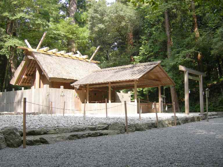
Highlights include Yokoyama View Point, Kazahi Prayer Shrine, Sagawa Memorial Museum of Shinto and Japanese Culture and Ise-Shima National Park.
Weather in Minamiise
Forecast from MET Norway (CC BY 4.0). Full forecast
About Minamiise
Minamiise (南伊勢町, Minamiise-chō) is a town located in Watarai District, Mie Prefecture, Japan. As of 1 August 2021, the town had an estimated population of 11,745 in 5752 households and a population density of 48 persons per km2. The total area of the town was 241.89 square kilometres (93.39 sq mi).
From the Wikipedia article Minamiise, Mie (this version), under CC BY-SA 4.0.
Things to do21


9 more on the map.
Museums and landmarks29

Sagawa Memorial Museum of Shinto and Japanese Culture
Museum · 15.2 km
Museum in Ise, Mie, Japan






17 more on the map.
Parks, trails and playgrounds13







1 more on the map.
Restaurants and cafes59


47 more on the map.
History
The area of Minamiise was once part of the ancient Shima Province, and was transferred to Ise Province in 1582. The village of Gokasho was established with the creation of the modern municipalities system on April 1, 1889. It was raised to town status in 1940. Gokasho merged with the neighboring villages of Honohara, Minami and Shikutaso to form the town of Nansei in 1955. On October 1, 2005, Nansei merged with the town of Nantō to form the town of Minamiise.
From the History section of Minamiise, Mie on Wikipedia, under CC BY-SA 4.0.
Where to stay39
Churches and places of worship15
Shopping10
Gas and EV charging6
Schools, colleges and libraries25
Healthcare7
Map of Minamiise
224 places. The map loads OpenStreetMap tiles when you open it.
Getting there and nearby towns
Chūbu Centrair International Airport (NGO) is the nearest airport with scheduled flights listed in OpenStreetMap, 58 km away.
- Shima 12 km east, about 12 min by car
- Ise 15 km north, about 15 min by car
- Matsusaka 30 km northwest, about 30 min by car
- Kihoku 37 km southwest, about 37 min by car
- Tsu 46 km north, about 46 min by car
- Minamichita 46 km northeast, about 46 min by car
- Owase 56 km southwest, about 56 min by car
- Suzuka 60 km north, about 1 h by car
- Taketoyo 59 km north, about 59 min by car
- Kameyama 60 km north, about 1 h by car
Drive times are estimates from straight-line distance, not routes.
Local news
Headlines from INDB.
Reviews, tips and questions
Loading what members have shared...
Sources and licences
- GeoNames (CC BY 4.0): population, coordinates, regions and time zone
- OpenStreetMap contributors (ODbL 1.0): places, airports, map data
- Wikidata (CC0 1.0): elevation, founding date, time zone, website, landmarks and historic places
- Wikimedia Commons (see each image): photos
- Wikipedia (CC BY-SA 4.0): overview and history text
Photo credits
- Minamiise Town Hall ac (1), Asturio Cantabrio, CC BY-SA 4.0
- The Museum of Shinto and Japanese Culture, Kogakkan University in 2011, Miyuki Meinaka, CC BY-SA 3.0
- Toba Mie - overview, The original uploader was Michalkun at English Wikipedia ., CC BY-SA 2.5
- Ise-Shrine Itagaki-minami-gomon, MaedaAkihiko, CC0
- Aramatsuri-no-miya 02, N yotarou, CC BY-SA 4.0
- Izawa-no-miya 07, N yotarou, CC BY-SA 4.0
- Yoyogi high school, Miyuki Meinaka, Public domain
- Shima City Library, Miyuki Meinaka, CC0
- Yokoyama Viewpoint (2019-12-19), Alpsdake, CC BY-SA 4.0
- Minamiise Municipal Hospital, Alpsdake, CC BY-SA 4.0
- Kazahinomi-no-miya 01, No machine-readable author provided. N yotarou assumed (based on copyright claims)., CC BY 2.5
- 伊勢現代美術館外観, Isms14, CC BY-SA 3.0
- Saminaga-jinja 04, N yotarou, CC BY-SA 4.0
- Koyasu Shrine, Ise, Miyuki Meinaka, CC BY-SA 3.0
- Ōmizu-jinja 01, N yotarou, CC BY-SA 4.0
- Oyamazumi Shrine, Ise, Miyuki Meinaka, CC BY-SA 3.0
- Takimatsuri-no-kami 01, N yotarou, CC BY-SA 4.0
- Kintetsu Kashikojima Country Club and its surroundings, Miyuki Meinaka, CC BY-SA 4.0
- Kashikojima Hojoen 01, Miyuki Meinaka, CC BY-SA 3.0
- SumMiel entrance, Miyuki Meinaka, CC BY-SA 4.0
- Gochi Fukuju-ji Temple, Miyuki Meinaka, CC BY-SA 4.0
- Kashikojima Maruyama Park, Miyuki Meinaka, CC BY-SA 4.0
- Tasoura Jigan-ji ac, Asturio Cantabrio, CC BY-SA 4.0
- Gokasyo Aisu-no-Yakata ac, Asturio Cantabrio, CC BY-SA 4.0
- Naiku 001, Ocdp, CC0
- Shima City Library ac (1), Asturio Cantabrio, CC BY-SA 4.0
- Yokoyama Viewpoint 001, Naokijp, CC BY-SA 4.0
- Kashikojima Hojoen 02, Miyuki Meinaka, CC BY-SA 4.0
- Gokasho-Ura, James Fichera, CC0
- Cathay Pacific Boeing 747-400 (49772652182), Melvin Loi from Macau, Macau, CC BY-SA 2.0
- 県道12号線 - panoramio (4), Yobito KAYANUMA, CC BY-SA 3.0
- Nambari, Shima.Ckk-75-12 c28 24, Geographical Survey Institute of Japan, Attribution
- Tokurinji Temple, Hamajima, Miyuki Meinaka, Public domain
- Nambari in Shima, Miyuki Meinaka, Public domain
- Nambari Kusunomiya, Miyuki Meinaka, Public domain
- Nozomi bridge at Hiyamaji, Miyuki Meinaka, Public domain
- Former Hamajima Town Nambari Elementary School, Miyuki Meinaka, Public domain
- Hiyamaji-Nambari Line End, Miyuki Meinaka, Public domain
- Nambari Coastline Park, Miyuki Meinaka, Public domain
- 県道12号線 - panoramio (3), Yobito KAYANUMA, CC BY-SA 3.0


Page built November 5, 2026. Spotted a mistake? Tell us or suggest a place.