


Mukō, Japan
向日市
Mukō is a town of 56,859 people in Kyoto, Japan, founded in April 1, 1889.
Why visit Mukō
Townapedia lists 33 museums and landmarks, 104 parks and trails, 266 places to eat, 1 place to stay and 12 attractions in and around town.
Highlights include Kyoto Aquarium, Kyoto City University of Arts, Katagihara temple ruins and Nagaoka-kyō.
Weather in Mukō
Forecast from MET Norway (CC BY 4.0). Full forecast
About Mukō
Mukō (向日市, Mukō-shi) is a city in Kyoto Prefecture, Japan. As of 1 September 2023, the city has an estimated population of 56,070 in 23,748 households and a population density of 2200 persons per km2. The total area of the city is 7.72 square kilometres (2.98 sq mi).
From the Wikipedia article Mukō (this version), under CC BY-SA 4.0.
Things to do12

Kyoto Aquarium
Zoo and aquarium · 4.7 km
Building in Shimogyo-ku, Kyoto Prefecture, Japan

Kyoto City University of Arts
School · 5.9 km
Higher education institution in Kyoto Prefecture, Japan
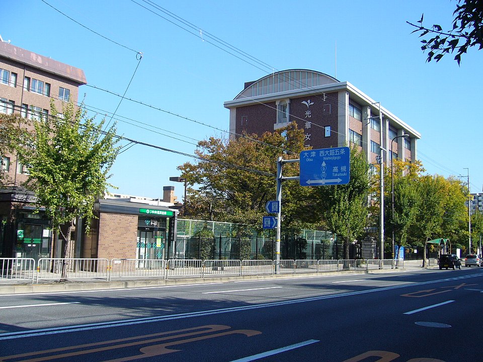
Kyoto Koka Women's University
School · 3.8 km
A private college in Kyoto, Japan

Kyoto Saga University of Arts
School · 5.5 km
Higher education institution in Kyoto Prefecture, Japan

Kyoto Tower
Monument and historic site · 5.6 km
Observation tower in Kyoto, Japan

Kyoto University of Advanced Science
School · 5.2 km
Higher education institution in Kyoto Prefecture, Japan

Kyoto University of Foreign Studies
School · 4.5 km
Foreign language university in Kyoto, Japan




Museums and landmarks33

Katagihara temple ruins
Monument and historic site · 1.4 km
Temple ruins in Kyoto, Japan

Nagaoka-kyō
Monument and historic site · 2.5 km
Human settlement in Japan

Ryūkoku Museum
Museum · 5.3 km
Museum of Buddhist art and history in Kyoto, Japan

Saihō-ji Temple
Monument and historic site · 3.5 km
Rinzai Zen Buddhist temple located in Matsuo, Japan



21 more on the map.
Parks, trails and playgrounds104



The Kids
Playground · 1.2 km
Mo-Fr 10:00-18:00; PH,Sa,Su 10:00-19:00

92 more on the map.
Restaurants and cafes266

254 more on the map.
History
The area of Mukō was part of ancient Yamashiro Province. At the end of the 8th century, Emperor Kanmu moved his capital from Heijō-kyō to Nagaoka-kyō. The new capital encompassed a large part of modern Muko, where research has revealed the palace to have been located. In the south, it also included parts of Nagaokakyō. In 794, because of the location's humid climate and reputation as a breeding ground for disease, Kammu relocated his capital from Nagaoka to Heian-kyō, now known as Kyoto. Mukō developed as a market town in 1592, during Azuchi–Momoyama period. The town's main road, called Saigoku Kaido, flourished because it connected Tō-ji in Kyoto and Nishinomiya Shrine in Settsu Province. Saigoku Kaido, which still presents a traditional and historical setting, changed name National Route 171 as important road.
From the History section of Mukō on Wikipedia, under CC BY-SA 4.0.
Where to stay1
Churches and places of worship57
Shopping49
Gas and EV charging8
Schools, colleges and libraries26
Healthcare40
Map of Mukō
250 places. The map loads OpenStreetMap tiles when you open it.
Getting there and nearby towns
Osaka Itami Airport (ITM) is the nearest airport with scheduled flights listed in OpenStreetMap, 31 km away.
- Kyoto 8 km northeast, about 8 min by car
- Yawata 11 km south, about 11 min by car
- Takatsuki 15 km southwest, about 15 min by car
- Ōtsu 15 km east, about 15 min by car
- Ibaraki 21 km southwest, about 21 min by car
- Settsu 23 km southwest, about 23 min by car
- Kusatsu 25 km east, about 25 min by car
- Minoh 26 km southwest, about 26 min by car
- Kadoma 28 km southwest, about 28 min by car
- Moriguchi 29 km southwest, about 29 min by car
Drive times are estimates from straight-line distance, not routes.
Local news
Headlines from INDB.
Reviews, tips and questions
Loading what members have shared...
Sources and licences
- GeoNames (CC BY 4.0): population, coordinates, regions and time zone
- OpenStreetMap contributors (ODbL 1.0): places, airports, map data
- Wikidata (CC0 1.0): elevation, founding date, time zone, website, landmarks and historic places
- Wikimedia Commons (see each image): photos
- Wikipedia (CC BY-SA 4.0): overview and history text
Photo credits
- Muko City Hall, Bakkai at Japanese Wikipedia, CC BY-SA 3.0
- Kyoto Aquarium in 2013-5-2 No,27, Mti, CC BY-SA 3.0
- Kyoto Saga University of Arts140513NI1, Atelier Verde, CC BY-SA 3.0
- Kyoto Tower 2023-12 ac (1), Asturio Cantabrio, CC BY-SA 4.0
- Kyoto Gakuen University Uzumasa Campus ac, Asturio Cantabrio, CC BY-SA 4.0
- Kyoto University of Foreign Studies140512NI1, Atelier Verde, CC BY-SA 3.0
- 170128 Ryukoku University Omiya Campus Kyoto Japan02s3, 663highland, CC BY-SA 4.0
- Togetsukyo in Kyoto Arashiyama, Blue Lotus from Arashiyama, Kyoto, CC BY 2.0
- Katagiharahaiji, dragon2850, CC BY-SA 3.0
- Nagaoka-kyu-ato daigoku-den-2, Saigen Jiro, CC0
- 170128 Ryukoku Museum Kyoto Japan02n, 663highland, CC BY-SA 4.0
- Saihouji-kokedera01, Ivanoff~commonswiki, CC BY-SA 3.0
- Iwatayama Monkey Park, Minseong Kim, CC BY-SA 4.0
- Sannomiya Jinja(katagihara) Haiden, dragon2850, CC BY-SA 3.0
- Kawaoka-higashi elementary school, Crown user, CC BY-SA 3.0
- Daimyo-ji, Kyoto, 運動会プロテインパワー, CC BY-SA 4.0
- TeradoOtsukaKofun nt 1, Muscla3pin, CC BY-SA 4.0
- Ayatokunaka jinja, Jerry fish tkc, CC BY-SA 3.0
- ÆON MALL Kyoto Katsuragawa (1), Tokumeigakarinoaoshima, CC0
- Joraku-ji temple, Kyoto, 運動会プロテインパワー, CC BY-SA 4.0
- Nishiyamabetsuin - Gate, 運動会プロテインパワー, CC BY-SA 4.0
- Kyoto Koka Womens Univ, Bakkai at Japanese Wikipedia, CC BY-SA 3.0
- Terado Otsuka Kofun, kouenbu, Saigen Jiro, CC0
- Sannomiya Jinja(katagihara) Front, dragon2850, CC BY-SA 3.0
- Kyoto city Katsura-higashi elem-sch, Bakkai, CC BY 3.0
- Kyoto city Kawaoka elem-sch, Bakkai, CC BY 3.0
- Muko City Terado junior high school, KishujiRapid, CC BY-SA 4.0
- Muko City Nishinooka junior high school, KishujiRapid, CC BY-SA 4.0
- Katsuragawa junior high school, Crown user, CC BY-SA 3.0
- ÆON MALL Kyōto-Katsuragawa, Tokumeigakarinoaoshima, CC BY-SA 4.0
- JGSDF Type 20 rifle left rear view at Camp Katsura December 1, 2024 02, Hunini, CC BY-SA 4.0
- 阪急洛西口駅全景, NatsuTV, CC0
- 阪急洛西口駅改札口, NatsuTV, CC0
- 阪急洛西口駅券売機切符購入画面, NatsuTV, CC0
- 阪急洛西口駅西口, NatsuTV, CC0
- 阪急洛西口駅東口, NatsuTV, CC0
- 阪急洛西口駅トイレ, NatsuTV, CC0
- 阪急洛西口駅トイレ案内図, NatsuTV, CC0
- 阪急洛西口駅駅名標, NatsuTV, CC0
- 阪急洛西口駅2号線ホーム, NatsuTV, CC0
- JP 日本 Japan 京都 Kyoto 塩小路通 Shiokōji Street 京都市立藝術大學 Kyoto City University of Arts campus June 2026 N13P 03, TKdows 2026, CC0


Page built November 5, 2026. Spotted a mistake? Tell us or suggest a place.