


Namioka, Japan
浪岡町
Namioka is a town of 20,681 people in Aomori, Japan, founded in June 1, 1940.
Why visit Namioka
Townapedia lists 20 museums and landmarks, 23 parks and trails, 35 places to eat, 3 places to stay and 10 attractions in and around town.
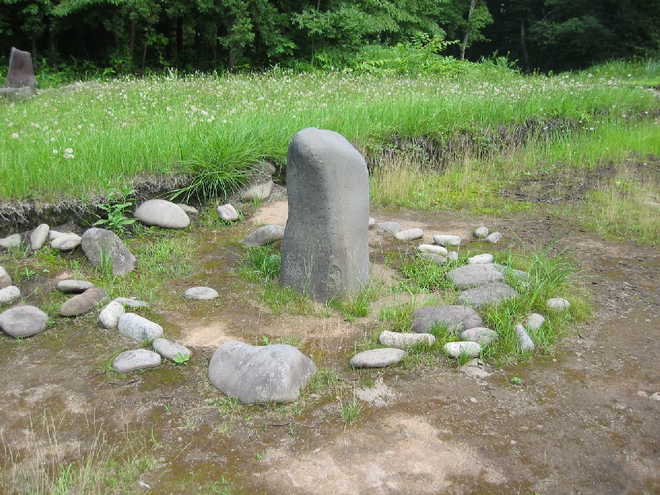
Highlights include Goshogawara Sue Pottery Kiln Site and Komakino Site.
Weather in Namioka
Forecast from MET Norway (CC BY 4.0). Full forecast
About Namioka
Namioka (浪岡町, Namioka-machi) was a town located in Minamitsugaru District in central Aomori Prefecture, Japan.
From the Wikipedia article Namioka, Aomori (this version), under CC BY-SA 4.0.
Things to do10


Museums and landmarks20

Goshogawara Sue Pottery Kiln Site
Monument and historic site · 6.5 km
Archaeological site in Japan
Komakino Site
Monument and historic site · 12.0 km
Archaeological site in Aomori, Japan

Takayashikidate Site
Monument and historic site · 3.0 km
Archeological site in Aomori, Tohuku, Japan

Tareyanagi Site
Monument and historic site · 9.0 km
Archaeological site in Inakadate, Japan


8 more on the map.
Parks, trails and playgrounds23


11 more on the map.
Restaurants and cafes35


23 more on the map.
Where to stay3
Churches and places of worship21
Shopping12
Gas and EV charging17
Schools, colleges and libraries23
Healthcare12
Map of Namioka
176 places. The map loads OpenStreetMap tiles when you open it.
Getting there and nearby towns
Aomori Airport (AOJ) is the nearest airport with scheduled flights listed in OpenStreetMap, 9 km away.
- Kuroishi 7 km south, about 7 min by car
- Inakadate 9 km south, about 9 min by car
- Fujisaki 10 km southwest, about 10 min by car
- Aomori 17 km northeast, about 17 min by car
- Hirosaki 16 km southwest, about 16 min by car
- Ōdate 49 km south, about 49 min by car
- Shichinohe 48 km east, about 48 min by car
- Takanosu 57 km south, about 57 min by car
- Noshiro 73 km southwest, about 1 h 15 min by car
- Mutsu 83 km northeast, about 1 h 30 min by car
Drive times are estimates from straight-line distance, not routes.
Local news
Headlines from INDB.
Reviews, tips and questions
Loading what members have shared...
Sources and licences
- GeoNames (CC BY 4.0): population, coordinates, regions and time zone
- OpenStreetMap contributors (ODbL 1.0): places, airports, map data
- Wikidata (CC0 1.0): elevation, founding date, time zone, website, landmarks and historic places
- Wikimedia Commons (see each image): photos
- Wikipedia (CC BY-SA 4.0): overview and history text
Photo credits
- Namioka Station Gates, にっしーーー, CC BY-SA 4.0
- Namioka Station Platform, にっしーーー, CC BY-SA 4.0
- NamiokaIC, Yauchi, CC BY-SA 4.0
- Collapsed house in Namioka, Aomori, Benlisquare, CC BY-SA 4.0
- Nakata Namioka Ōaza Daishaka, Aomori-shi, Aomori-ken 038-1301, Japan - panoramio, torakiti, CC BY 3.0
- 小牧野遺跡1, Sapphire at Japanese Wikipedia, CC BY-SA 3.0
- Tareyanagi site, MChew, CC BY-SA 4.0
- Namioka Castle site, MChew, CC BY-SA 4.0
- National Hospital Organization Aomori National Hospital, Waka77, Public domain
- Aomori Prefectural Kuroishi High School 1, Ebiebi2, CC BY-SA 3.0
- Haiden of Kuroishi Shrine, 掬茶, CC BY-SA 4.0
- Takayashikidate, MChew, CC BY-SA 4.0
- Aomori Prefectural Namioka High School 1, Ebiebi2, CC BY-SA 4.0
- Aomorihosp, 青森病院, CC BY-SA 4.0
- ISS055-E-99837 - View of Earth, Earth Science and Remote Sensing Unit, NASA Johnson Space Center, Public domain
- ISS055-E-104653 - View of Earth, Earth Science and Remote Sensing Unit, NASA Johnson Space Center, Public domain
- ISS055-E-104654 - View of Earth, Earth Science and Remote Sensing Unit, NASA Johnson Space Center, Public domain
- ISS055-E-99836 - View of Earth, Earth Science and Remote Sensing Unit, NASA Johnson Space Center, Public domain
- 黒石市(Kuroishi City) - panoramio - torakiti, torakiti, CC BY 3.0
- Kuroishi Kokeshi Wikivoyage banner, torakiti, CC BY 3.0
- 黒石市(Kuroishi City) - panoramio, torakiti, CC BY 3.0
- HagurotaiBS, Yauchi, CC BY-SA 4.0
- Agricultural drone in use on rice field near Nisoshi, Aomori, Benlisquare, CC BY-SA 4.0
- Takadate PA, アラツク, CC BY-SA 4.0
- Daishaka Station waiting room, にっしーーー, CC BY-SA 4.0
- Daishaka Station building, にっしーーー, CC BY-SA 4.0
- Daishaka Station Platform, にっしーーー, CC BY-SA 4.0
- Tsugaru Expressway widening project, Mccunicano, CC BY-SA 4.0
- Apple guard rails in Aomori, Benlisquare, CC BY-SA 4.0
- Ou line Kita-tokiwa Station waiting room, にっしーーー, CC BY-SA 4.0
- Ou line Kita-tokiwa Station Platform, にっしーーー, CC BY-SA 4.0
- Mount Bonju from National Route 7, Mccunicano, CC BY-SA 4.0
- SpoCulIn Kuroishi, 掬茶, CC BY-SA 4.0
- Universe (supermarket) Kuroishi Ekimae Store, 掬茶, CC BY-SA 4.0
- Hellowork Kuroishi, 掬茶, CC BY-SA 4.0
- Konan Railway Tsugaru Train, sodai gomi, CC BY 2.0
- 黒石駅 - panoramio, くろふね, CC BY 3.0
- Kuroishi Station 20220821, 掬茶, CC BY-SA 4.0
- 黒石駅 - panoramio (1), くろふね, CC BY 3.0
- ニッカン サンスポ スポニチ (55051837894), inunami, CC BY 4.0


Page built November 4, 2026. Spotted a mistake? Tell us or suggest a place.