


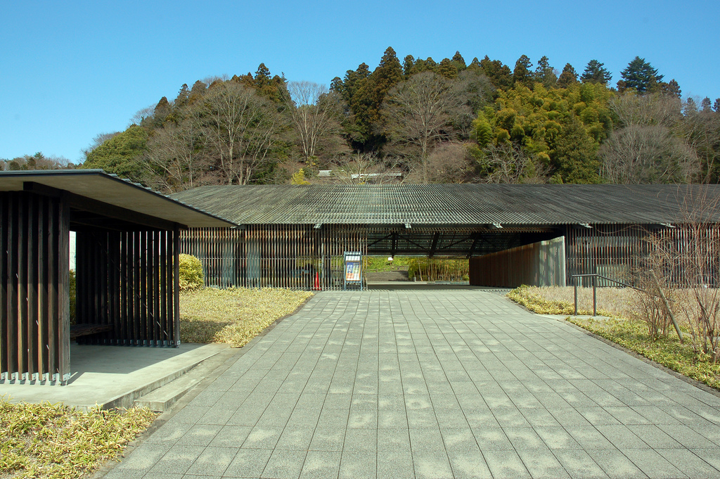
Nasukarasuyama, Japan
那須烏山市
Nasukarasuyama is a town of 24,875 people in Tochigi, Japan, founded in October 1, 2005.
Why visit Nasukarasuyama
Townapedia lists 14 museums and landmarks, 19 parks and trails, 18 places to eat, 7 places to stay and 4 attractions in and around town.
Highlights include 鎌倉山, Chōjagadaira Kanga ruins, Nakagawa-machi Batō Hiroshige Museum of Art and 市貝町芝ざくら公園.
Weather in Nasukarasuyama
Forecast from MET Norway (CC BY 4.0). Full forecast
About Nasukarasuyama
Nasukarasuyama (那須烏山市, Nasukarasuyama-shi) is a city located in Tochigi Prefecture, Japan. As of 1 August 2020, the city had an estimated population of 25,783 in 10,509 households, and a population density of 150 persons per km2. The total area of the city is 174.35 square kilometres (67.32 sq mi).
From the Wikipedia article Nasukarasuyama (this version), under CC BY-SA 4.0.
Things to do4



Museums and landmarks14

Chōjagadaira Kanga ruins
Monument and historic site · 11.4 km
Archaeological site in Nakagawa, Japan
Nakagawa-machi Batō Hiroshige Museum of Art
Museum · 9.7 km
Museum of Art opened in Nakagawa, Tochigi, Japan in November 2000 and presents rotating exhibitions of Ukiyo-e from Aoki's collection...


2 more on the map.
Parks, trails and playgrounds19




7 more on the map.
Restaurants and cafes18



6 more on the map.
History
The area began as a castle town for Karasuyama Domain in the Edo period, centered on Karasuyama Castle, a fortification dating to the Kamakura period. Karasuyama Town was established with the creation of the modern municipalities system on April 1, 1889. It merged with the neighboring villages of Mukada, Sakai, and Nanago on March 31, 1954. The modern city of Nasukarasuyama was established on October 1, 2005, from the merger of the towns of Karasuyama and Minaminasu (both from Nasu District).
From the History section of Nasukarasuyama on Wikipedia, under CC BY-SA 4.0.
Where to stay7
Churches and places of worship17
Shopping11
Gas and EV charging6
Schools, colleges and libraries17
Healthcare10
Map of Nasukarasuyama
123 places. The map loads OpenStreetMap tiles when you open it.
Getting there and nearby towns
Ibaraki Airport (IBR) is the nearest airport with scheduled flights listed in OpenStreetMap, 57 km away.
- Karasuyama 1 km west, about 1 min by car
- Motegi 15 km south, about 15 min by car
- Ujiie 18 km west, about 18 min by car
- Mashiko 21 km south, about 21 min by car
- Daigo 21 km northeast, about 21 min by car
- Ōtawara 26 km northwest, about 26 min by car
- Ōmiya 26 km southeast, about 26 min by car
- Yaita 26 km northwest, about 26 min by car
- Mooka 28 km southwest, about 28 min by car
- Kaminokawa 33 km southwest, about 33 min by car
Drive times are estimates from straight-line distance, not routes.
Local news
Headlines from INDB.
Reviews, tips and questions
Loading what members have shared...
Sources and licences
- GeoNames (CC BY 4.0): population, coordinates, regions and time zone
- OpenStreetMap contributors (ODbL 1.0): places, airports, map data
- Wikidata (CC0 1.0): elevation, founding date, time zone, website, landmarks and historic places
- Wikimedia Commons (see each image): photos
- Wikipedia (CC BY-SA 4.0): overview and history text
Photo credits
- Tochigi Ryumon-Waterfall, MaedaAkihiko, CC BY-SA 4.0
- Karasuyama Library in Nasukarasuyama, しょち, CC BY 2.1 jp
- Nasu-minami Hospital, Nasukarasuyama - Aug 12, 2024, inunami, CC BY 2.0
- AMeDAS Nasukarasuyama, Miyuki Meinaka, CC BY-SA 4.0
- Tochigi Prefectural Road Route 274 (MaGino Osawa Line) in Osawa, Nasukarasuyama City, 小石川人晃, CC BY-SA 4.0
- Bato Hiroshige Museum 2009, Photo by Woranol Sattayavinij, CC BY 2.0
- Shibazakura-ichikai, Tatsundo h at Japanese Wikipedia, CC BY-SA 3.0
- Ruins of Karasuyama Castle, Abasaa, Public domain
- Bato HighSchool, Asasa198, CC BY-SA 4.0
- Karasuyama Junior High School, Asasa198, CC BY-SA 4.0
- JR east Karasuyama line (3955843092), Yamaguchi Yoshiaki, CC BY-SA 2.0
- Railway semaphore signal at the Karasuyama station, Tochigi pref., Japan, Hisi21, CC0
- KiHa40 Karasuyama 20090912, Yoshiaki Yamaguchi, CC BY-SA 2.0
- YashioKankoBus 25-25, Rsa, CC BY-SA 3.0
- 烏山駅 - panoramio, くろふね, CC BY 3.0
- JR east Karasuyama line (3955844350), Yamaguchi Yoshiaki from Japan, CC BY-SA 2.0
- 妙光寺 - panoramio, くろふね, CC BY 3.0
- 開運不動尊 - panoramio, くろふね, CC BY 3.0
- 天性寺 - panoramio, くろふね, CC BY 3.0
- 天性寺 - panoramio - くろふね, くろふね, CC BY 3.0
- 境橋下流 - panoramio, Ryusuke Seto, CC BY 3.0
- A Japanese old bridge Sakaibashi - panoramio, Ryusuke Seto, CC BY 3.0
- 龍門の滝 - panoramio - くろふね, くろふね, CC BY 3.0
- 龍門の滝 - panoramio, くろふね, CC BY 3.0
- 滝駅 - panoramio, くろふね, CC BY 3.0
- Ryumon Fall (Tochigi) park, photo: Qurren ( talk ) Taken with Canon IXY 430F (Digital IXUS 245 HS), CC BY-SA 3.0
- JR Karasuyama Taki Station 2020, Miyuki Meinaka, CC BY-SA 4.0
- 神長トンネル - panoramio, Yobito KAYANUMA, CC BY-SA 3.0
- 太平寺 - panoramio - くろふね, くろふね, CC BY 3.0
- 太平寺 - panoramio - くろふね (1), くろふね, CC BY 3.0
- 太平寺 - panoramio, くろふね, CC BY 3.0
- Buergeria buergeri from iNaturalist 149050315, Yoshihiro Tokue, CC BY 4.0
- 那珂川 - panoramio, Yobito KAYANUMA, CC BY-SA 3.0
- Kobana station with ACCUM, Miyuki Meinaka, CC BY-SA 4.0
- Kobana station approaching ACCUM, Miyuki Meinaka, CC BY-SA 4.0
- Kobana station close up, Miyuki Meinaka, CC BY-SA 4.0
- Kobana station from south side, Miyuki Meinaka, CC BY-SA 4.0
- 芝ざくら公園 2011年8月 - panoramio (2), Masashi Taomoto, CC BY 3.0
- 芝ざくら公園 2011年8月 - panoramio (1), Masashi Taomoto, CC BY 3.0
- 芝ざくら公園 2011年8月 - panoramio, Masashi Taomoto, CC BY 3.0


Page built November 5, 2026. Spotted a mistake? Tell us or suggest a place.