


Ōbu, Japan
大府市
Ōbu is a town of 93,123 people in Aichi, Japan, founded in October 1, 1889.
Why visit Ōbu
Townapedia lists 34 museums and landmarks, 189 parks and trails, 136 places to eat and 6 attractions in and around town.
Highlights include Shigakkan University, Daido University, Irimi Shell Midden and Kariya City Art Museum.
Weather in Ōbu
Forecast from MET Norway (CC BY 4.0). Full forecast
About Ōbu
Ōbu (大府市, Ōbu-shi; Japanese pronunciation: [ó̞ò̞.bɯ̈̀, ò̞ó̞.bɯ̈́(.ɕì), ó̞ó̞.bɯ̈́(.ɕì)]) is a city located in Aichi Prefecture, Japan. As of 1 October 2019, the city had an estimated population of 92,179 in 39,382 households, and a population density of 2,739 persons per km2. The total area of the city is 33.66 square kilometres (13.00 sq mi). Ōbu has been a member of the World Health Organization’s Alliance for Healthy Cities (AFHC) since June 5, 2000.
From the Wikipedia article Ōbu (this version), under CC BY-SA 4.0.
Things to do6


Fujita Health University
School · 7.6 km
Higher education institution in Aichi Prefecture, Japan

Ohkagakuen University
School · 5.3 km
Higher education institution in Aichi Prefecture, Japan


Museums and landmarks34

Irimi Shell Midden
Monument and historic site · 4.0 km
Archaeological site in Japan

Kariya City Art Museum
Museum · 6.2 km
Museum in Kariya City, Aichi, Japan




22 more on the map.
Parks, trails and playgrounds189


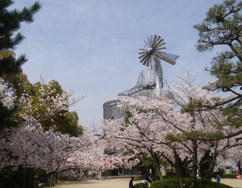


177 more on the map.
Restaurants and cafes136


ハッピー ボイス I
Cafe · Breakfast, Coffee Shop · 1.5 km
旧155号線沿い
Mo-Sa 00:00-24:00



124 more on the map.
Churches and places of worship47
Shopping40
Gas and EV charging13
Schools, colleges and libraries66
Healthcare25
Map of Ōbu
250 places. The map loads OpenStreetMap tiles when you open it.
Getting there and nearby towns
Chūbu Centrair International Airport (NGO) is the nearest airport with scheduled flights listed in OpenStreetMap, 22 km away.
- Kariya 5 km southeast, about 5 min by car
- Anjō 14 km southeast, about 14 min by car
- Handa 15 km south, about 15 min by car
- Tokoname 17 km southwest, about 17 min by car
- Nagoya 19 km north, about 19 min by car
- Toyota 20 km east, about 20 min by car
- Nishio 19 km southeast, about 19 min by car
- Taketoyo 19 km south, about 19 min by car
- Okazaki 21 km east, about 21 min by car
- Kuwana 26 km west, about 26 min by car
Drive times are estimates from straight-line distance, not routes.
Local news
Headlines from INDB.
Reviews, tips and questions
Loading what members have shared...
Sources and licences
- GeoNames (CC BY 4.0): population, coordinates, regions and time zone
- OpenStreetMap contributors (ODbL 1.0): places, airports, map data
- Wikidata (CC0 1.0): elevation, founding date, time zone, website, landmarks and historic places
- Wikimedia Commons (see each image): photos
- Wikipedia (CC BY-SA 4.0): overview and history text
Photo credits
- Obu City Hall ac, Asturio Cantabrio, CC BY-SA 4.0
- 0417daido 0150, daido082, CC BY-SA 3.0
- Ohkagakuen University, Abasaa, Public domain
- 140112 Kariya City Art Museum Kariya Aich pref Japan01s3, 663highland, CC BY 2.5
- ÆON MALL Odaka (6), Tokumeigakarinoaoshima, CC0
- Resora obu, コヲダ, CC BY-SA 4.0
- TOMATO Memorial Hall in Aichi 02, 八幡鏡太郎, CC BY 4.0
- 140112Kijo Park Kariya Aichi pref Japan02s5, 663highland, CC BY 2.5
- Obu City Futatsuike Park1, At by At, CC0
- Obu City Okura Park ac (1), Asturio Cantabrio, CC BY-SA 4.0
- Oodakaryokuchi2, Bariston, CC BY-SA 4.0
- ObuHighschool, Asasa198, CC BY-SA 3.0
- Odai Park 2023-10 ac (1), Asturio Cantabrio, CC BY-SA 4.0
- Heisyu Memorial Hall, Bariston, CC BY-SA 4.0
- Hikami Anego Jinja Haiden, Midori Ward Nagoya 2015, Tomio344456, CC BY-SA 4.0
- Minami Seikyo Hospital, Abasaa, Public domain
- Shurakuen Daibutsu 2025-12 ac (2), Asturio Cantabrio, CC BY-SA 4.0
- Yakan Pond ac (2), Asturio Cantabrio, CC BY-SA 4.0
- Allobu exterior in 2018 ac (1), Asturio Cantabrio, CC BY-SA 4.0
- Okehazama-Shinmeisha, Midori Ward Nagoya 2012, Tomio344456, CC BY-SA 3.0
- Kariya city museum of local history-c, Asturio Cantabrio, CC BY-SA 4.0
- Nagoya City Odaka Junior High School 20160521, 円周率3パーセント, CC BY-SA 4.0
- RASPA Otagawa South, Kiyok, CC BY-SA 4.0
- Kariya Syosyu-ji ac (1), Asturio Cantabrio, CC BY-SA 4.0
- Kariya Senkoji ac (1), Asturio Cantabrio, CC BY-SA 4.0
- Kariya Syokakuji ac, Asturio Cantabrio, CC BY-SA 4.0
- Ichiharainari, Bariston, CC BY-SA 4.0
- Kariya city Museum of History exterior ac (2), Asturio Cantabrio, CC BY-SA 4.0
- Kariya Junenji 2020-04 ac (1), Asturio Cantabrio, CC BY-SA 4.0
- Hachioji-jinja ac (2), Asturio Cantabrio, CC BY-SA 4.0
- Kyosen-ji Kariya 2025-08 ac (2), Asturio Cantabrio, CC BY-SA 4.0
- Iou-ji Temple ac (1), Asturio Cantabrio, CC BY-SA 4.0
- Anyo-ji hondo ac (1), Asturio Cantabrio, CC BY-SA 4.0
- Shuzui House Jinzoseki ac (1), Asturio Cantabrio, CC BY-SA 4.0
- Distant View of Fujita Health University from Mount Futamura, Kutsukake-cho Toyoake 2018, Tomio344456, CC BY-SA 4.0
- Shigakkan University, 2018, Ykawa9955, CC BY-SA 4.0
- Irimikaizuka1, Bariston, CC BY-SA 4.0
- Wave studium Kariya and Wing Arena Kariya 2013-08, At by At, CC BY-SA 3.0
- Lawn Square in Odaka Ryokuchi (1), Odaka-cho Midori Ward Nagoya 2020, Tomio344456, CC BY-SA 4.0
- Shurakuendaibutsu1, Bariston, CC BY-SA 4.0
- Aichi Children's Health and Medical Center, 運動会プロテインパワー, CC BY-SA 4.0
- Tokai city Oike Park rose garden ac (1), Asturio Cantabrio, CC BY-SA 4.0
- Aichikenko1, Bariston, CC BY-SA 4.0
- Saizeriya Yoshikawa factory, Ebiebi2, CC BY-SA 3.0
- Tihoku heiwa park 0001, Shoya48, CC BY-SA 3.0
- Obu Midori Park in Aichi 03, 八幡鏡太郎, CC BY 4.0
- Momoyama, HHeLiBe, CC BY-SA 4.0
- Kariya City Kariya Higashi Junior High School, Narutanu, CC BY-SA 4.0
- Kariya City Hidaka Elementary School in Oct. 2018, Narutanu, CC BY-SA 4.0
- Nagoya City Odakaminami Elementary School 20160521-02, 円周率3パーセント, CC BY-SA 4.0
- Luvit-town-Kariya, HQA02330, CC BY-SA 4.0


Page built November 4, 2026. Spotted a mistake? Tell us or suggest a place.