




Ōgaki, Japan
大垣市
Ōgaki is a town of 161,539 people in Gifu, Japan, founded in April 1, 1918.
Why visit Ōgaki
Townapedia lists 104 museums and landmarks, 110 parks and trails, 98 places to eat, 4 places to stay and 9 attractions in and around town.
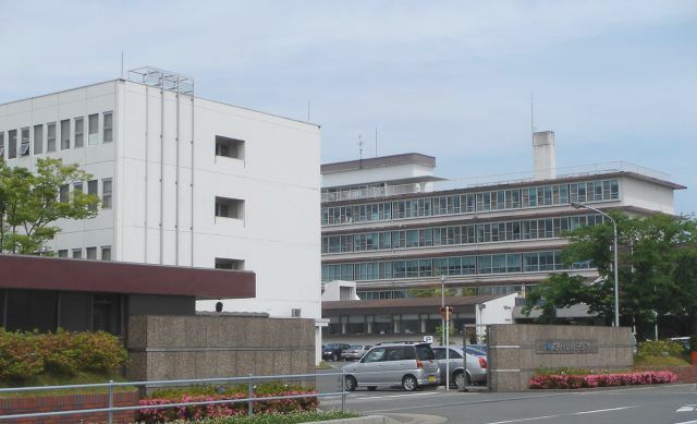
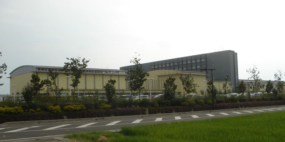
Highlights include Asahi University, Gifu College of Nursing, Gifu City Science Museum and Gifu Sekigahara Battlefield Memorial Museum.
Weather in Ōgaki
Forecast from MET Norway (CC BY 4.0). Full forecast
About Ōgaki
Ōgaki (大垣市, Ōgaki-shi; Japanese pronunciation: [ò̞ó̞.ɡä́.k̟ʲí, -k̟ʲi̥.ɕì, -ŋä́-]) is a city located in Gifu, Japan. As of October 31, 2018, the city had an estimated population of 161,539, and a population density of 782 persons per km2 in 65,931 households. The total area of the city was 206.57 square kilometres (79.76 sq mi). Ōgaki was the final destination for the haiku poet Matsuo Bashō on one of his long journeys as recounted in his book Oku no Hosomichi. Every November the city holds a Bashō Festival.
From the Wikipedia article Ōgaki (this version), under CC BY-SA 4.0.
Travel tips from other travellers: Ōgaki on Wikivoyage (CC BY-SA 4.0).
Things to do9
Asahi University
School · 7.6 km
Higher education institution in Gifu Prefecture, Japan
Gifu College of Nursing
School · 8.0 km
Higher education institution in Gifu Prefecture, Japan
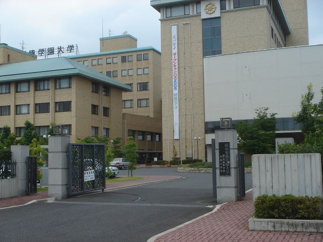
Gifu Shotoku Gakuen University
School · 8.3 km
Higher education institution in Gifu Prefecture, Japan

Institute of Advanced Media Arts and Sciences
School · 4.0 km
Higher education institution in Gifu Prefecture, Japan

National Institute of Technology, Gifu College
School · 11.9 km
National college in Motosu, Japan




Museums and landmarks104

Gifu City Science Museum
Museum · 12.0 km
Museum in Gifu, Gifu, Japan

Gifu Sekigahara Battlefield Memorial Museum
Museum · 13.8 km
Museum in Sekigahara, Gifu, Japan
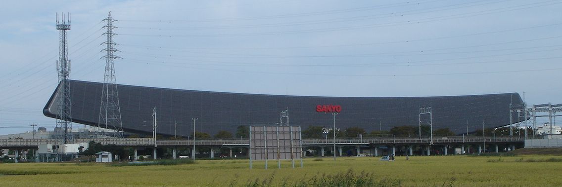

Tarui Ichirizuka
Monument and historic site · 9.8 km
Historic site in Gifu, Japan

The Museum of Fine Arts, Gifu
Museum · 11.8 km
Art museum in Gifu, Gifu, Japan






92 more on the map.
Parks, trails and playgrounds110




98 more on the map.
Restaurants and cafes98



86 more on the map.
History
The area around Ōgaki was part of traditional Mino Province. During the Edo period, the area developed as a castle town for Ōgaki Domain under the Tokugawa shogunate. In the post-Meiji restoration cadastral reforms, the town of Ogaki was established within Anpachi District, Gifu Prefecture with the creation of the modern municipalities system on July 1, 1889. It was raised to city status on April 1, 1918. The city suffered severe flooding during the 1934 Muroto typhoon, and was largely destroyed in six air raids in 1945.
From the History section of Ōgaki on Wikipedia, under CC BY-SA 4.0.
Where to stay4
Churches and places of worship85
Shopping37
Gas and EV charging18
Schools, colleges and libraries64
Healthcare28
Map of Ōgaki
250 places. The map loads OpenStreetMap tiles when you open it.
Getting there and nearby towns
Gifu Airbase (QGU) is the nearest airport with scheduled flights listed in OpenStreetMap, 23 km away.
- Ichinomiya 18 km east, about 18 min by car
- Inazawa 19 km southeast, about 19 min by car
- Komaki 28 km east, about 28 min by car
- Nagoya 32 km southeast, about 32 min by car
- Seto 46 km east, about 46 min by car
- Kariya 53 km southeast, about 53 min by car
- Toyota 57 km southeast, about 57 min by car
- Handa 59 km southeast, about 59 min by car
- Anjō 61 km southeast, about 1 h by car
- Okazaki 67 km southeast, about 1 h by car
Drive times are estimates from straight-line distance, not routes.
Local news
Headlines from INDB.
Reviews, tips and questions
Loading what members have shared...
Sources and licences
- GeoNames (CC BY 4.0): population, coordinates, regions and time zone
- OpenStreetMap contributors (ODbL 1.0): places, airports, map data
- Wikidata (CC0 1.0): elevation, founding date, time zone, website, landmarks and historic places
- Wikimedia Commons (see each image): photos
- Wikipedia (CC BY-SA 4.0): overview and history text
Photo credits
- 110319 ogaki cstl, 名古屋太郎, CC BY-SA 3.0
- 2 Chome Kuruwamachi, Ōgaki-shi, Gifu-ken 503-0887, Japan - panoramio (2), blue.reaf, CC BY 3.0
- Asahi University, Monami at Japanese Wikipedia, CC BY-SA 3.0
- Gifu College of Nursing1, Monami at Japanese Wikipedia, CC BY-SA 3.0
- Yoro-waterfall, Kikuhiko Mizusaki, CC BY-SA 3.0
- Gifu City Science Museum 1, Hide-sp, CC BY-SA 3.0
- Sekigahara Battlefield Memorial Hall, Bariston, CC BY-SA 4.0
- Solar Ark, Monami at Japanese Wikipedia, CC BY-SA 3.0
- Tarui Ichirizuka 02, Monami at Japanese Wikipedia, CC BY-SA 3.0
- THE MUSEUM OF FINE ARTS,GIFU 1, Hide-sp, CC BY-SA 3.0
- Asanaka park, Opqr, CC BY-SA 4.0
- Ogaki Tenshu, Kichiverde, Public domain
- Ogaki Weman's College2007-1, Monami, CC BY-SA 3.0
- AQUA WALK Ogaki Shopping Center 02, Gnsin, CC BY-SA 3.0
- LOC City Ogaki Shopping Center 03, Gnsin, CC BY-SA 3.0
- Aeon-Ogaki-Shopping Center01, Monami, CC BY-SA 3.0
- Ogaki-Municipal-Hospital01, Monami, CC BY-SA 3.0
- Ogaki Kita Senior High School01, Monami, CC BY-SA 3.0
- Ogaki West High School01, Monami, CC BY-SA 3.0
- Ishibiki-Jinja, Metroplex, CC BY-SA 3.0
- Musubu-Jinjya01, Monami, CC BY-SA 3.0
- Entsū-ji temple, Ogaki, 2016, 大野 一将, CC BY-SA 4.0
- Saien-ji temple, Ogaki, 2017, 大野 一将, CC BY-SA 4.0
- 大垣市郷土館, Opqr, CC BY-SA 4.0
- Moriya tadashi museum, Opqr, CC BY-SA 4.0
- Anraku-ji temple, Ogaki, 2017, 大野 一将, CC BY-SA 4.0
- 妙法寺 (大垣市赤坂町), へぼ飯, CC0
- Softpia Japan Workshop 24, Asturio Cantabrio, CC BY-SA 4.0
- Gifu Shotoku Gakuen University1, The original uploader was Monami at Japanese Wikipedia ., CC BY-SA 3.0
- 岐阜協立大学校名, 岐阜経済大学企画広報課, CC BY-SA 4.0
- Akasaka-hommachi, Metroplex, CC BY-SA 3.0
- Hiro-Gakuen1, Monami, CC BY-SA 3.0
- Ogaki Medical Association School of Nursing01, Monami, CC BY-SA 3.0
- AEON TOWN Ogaki EAST, Sinryow, CC BY 4.0
- Anpachi-Hyakubaien2008-2, Monami, CC BY-SA 3.0
- Ocyaya-yashiki01, Monami, CC BY-SA 3.0
- Ogaki city Kobun elem-sch, Bakkai, CC BY-SA 3.0
- Ozu-kouen2008-1, Monami, CC BY-SA 3.0
- Al plaza tsurumi, Opqr, CC BY-SA 4.0
- Ogaki Ayasato Elementary School, hyolee2, CC BY-SA 4.0
- Ogaki Uruu Elementary School, hyolee2, CC BY-SA 4.0
- Ogaki-koen Park 20160618, 円周率3パーセント, CC BY-SA 4.0


Page built November 4, 2026. Spotted a mistake? Tell us or suggest a place.