
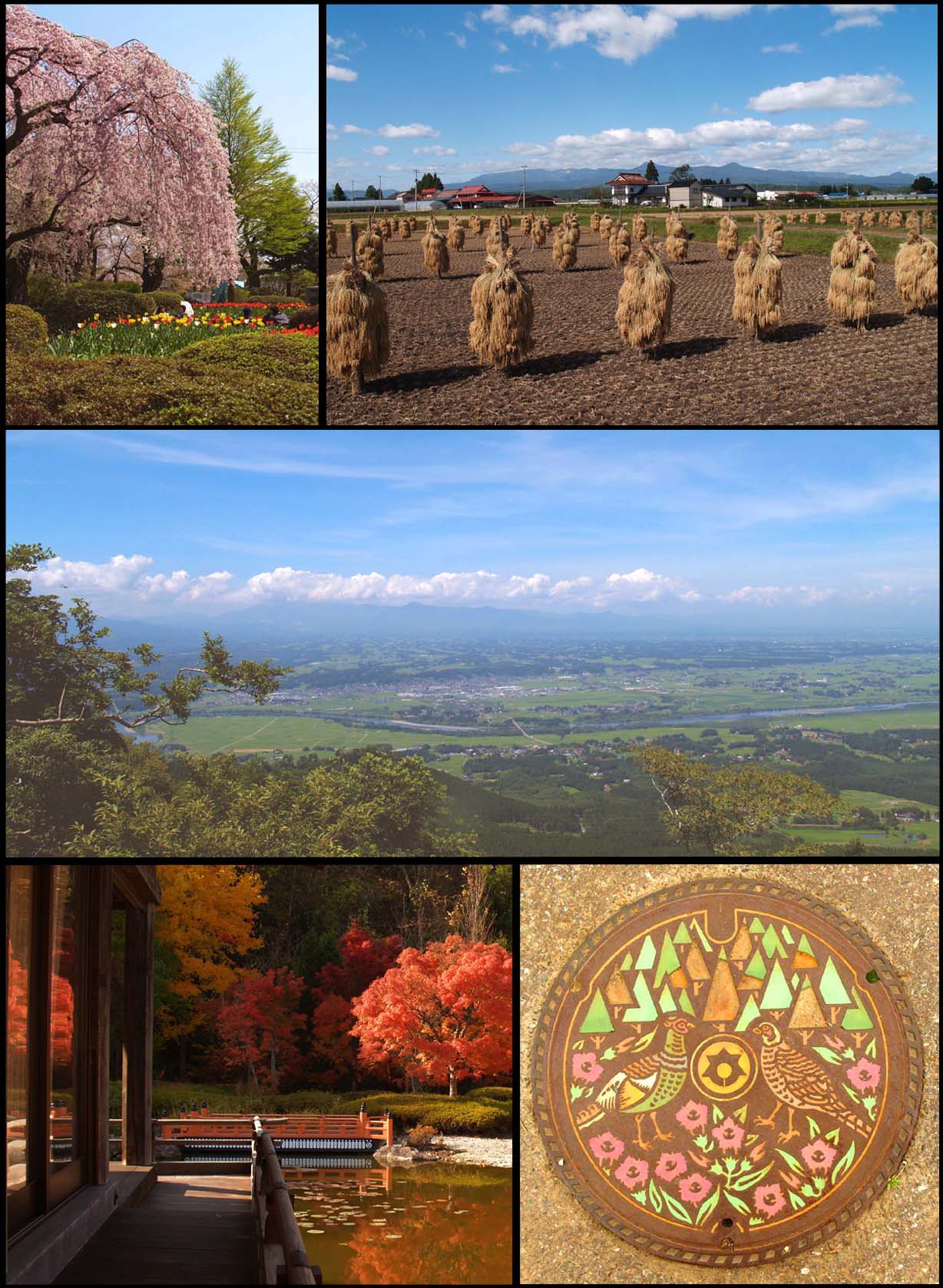


Ōshū, Japan
奥州市
Ōshū is a town of 112,937 people in Iwate, Japan, founded in February 20, 2006.
Why visit Ōshū
Townapedia lists 27 museums and landmarks, 17 parks and trails, 204 places to eat, 19 places to stay and 15 attractions in and around town.
Highlights include Chōjagahara temple ruins, Kabayama Site, 水沢公園 and 水沢競馬場.
Weather in Ōshū
Forecast from MET Norway (CC BY 4.0). Full forecast
About Ōshū
Ōshū (奥州市, Ōshū-shi; Japanese pronunciation: [ó̞ò̞.ɕɨ̀ɨ̀, ò̞ó̞.ɕɨ́ɨ̀.ɕì, ó̞ó̞.ɕɨ́ɨ̀-]) is a city located in Iwate Prefecture, Japan. As of 30 April 2020, the city had an estimated population of 114,620 and a population density of 120 persons per km2 in 45,728 households. The total area of the city is 993.30 square kilometres (383.52 sq mi). Ōshū is famous for its Maesawa Beef, numerous festivals, historic temples and shrines and Fujiwara no Sato, a theme park and movie lot based on the exploits of the Northern Fujiwaras in the 12th century. Many famous people claim Ōshū as their home, including Los Angeles Dodgers baseball player Shohei Ohtani and Ichiro Ozawa, the long-time leader of the Democratic Party of Japan.
From the Wikipedia article Ōshū, Iwate (this version), under CC BY-SA 4.0.
Things to do15


3 more on the map.
Museums and landmarks27

Chōjagahara temple ruins
Monument and historic site · 15.4 km
Archaeological site in Ōshū, Japan

Kabayama Site
Monument and historic site · 11.8 km
Archaeological site in Kitakami, Iwate, Japan

Muryōkō-in Ato
Monument and historic site · 16.9 km
Site of a former temple

Takadachi Gikeidō
Monument and historic site · 16.5 km
Archeological site in Hiraizumi, Japan

Yanagi no Gosho Site
Monument and historic site · 16.7 km
Site of a forme palace in Hiraizumi, Japan




15 more on the map.
Parks, trails and playgrounds17



5 more on the map.
Restaurants and cafes204



192 more on the map.
History
The area of present-day Ōshū was part of ancient Mutsu Province, and has been settled since at least the Japanese Paleolithic period. Isawa is especially rich in Kofun Period remains from the 5th century. By the Nara period, Japanese hunters, trappers, settlers and itinerant missionaries were visiting and settling in this area, and coming into contact with the native Emishi people. In 729, Kokuseki-ji temple claims to have been established by the Buddhist priest Gyōki in a mountainous area to the east of the Kitakami River in what is now Mizusawa. In 776, two separate attacks were launched by the imperial dynasty against the Emishi with little success.
Fujiwara no Kiyohira, the founder of the Ōshū Fujiwara dynasty, was born in Fort Toyota which is now in the Iwayado area of Esashi. Around 1100, he relocated to Hiraizumi where he and his descendants ruled for nearly a hundred years.
In 1348, a Zen Buddhist priest named Mutei Ryōshō founded the temple of Shōbō-ji near Kokuseki-ji temple in Mizusawa. It is the third head temple of the Sōtō sect of Zen Buddhism and boasts the largest thatched roof in Japan.
From the History section of Ōshū, Iwate on Wikipedia, under CC BY-SA 4.0.
Where to stay19
Churches and places of worship43
Shopping42
Gas and EV charging15
Schools, colleges and libraries23
Healthcare60
Map of Ōshū
250 places. The map loads OpenStreetMap tiles when you open it.
Getting there and nearby towns
Hanamaki Airport (HNA) is the nearest airport with scheduled flights listed in OpenStreetMap, 32 km away.
- Mizusawa 3 km west, about 3 min by car
- Kanegasaki 8 km northwest, about 8 min by car
- Kitakami 17 km north, about 17 min by car
- Tateishi 18 km south, about 18 min by car
- Ichinoseki 25 km south, about 25 min by car
- Hanamaki 28 km north, about 28 min by car
- Tōno 37 km northeast, about 37 min by car
- Morioka 62 km north, about 1 h by car
- Ōsaki 64 km south, about 1 h by car
- Ishinomaki 81 km south, about 1 h 15 min by car
Drive times are estimates from straight-line distance, not routes.
Local news
Headlines from INDB.
Reviews, tips and questions
Loading what members have shared...
Sources and licences
- GeoNames (CC BY 4.0): population, coordinates, regions and time zone
- OpenStreetMap contributors (ODbL 1.0): places, airports, map data
- Wikidata (CC0 1.0): elevation, founding date, time zone, website, landmarks and historic places
- Wikimedia Commons (see each image): photos
- Wikipedia (CC BY-SA 4.0): overview and history text
Photo credits
- OSHU Composite, User:Iwatebud, CC BY-SA 3.0
- Cyoujagahara, No machine-readable author provided. Usiwakamaru assumed (based on copyright claims)., Public domain
- 樺山遺跡, 小池 隆, CC BY 3.0
- 230728 Muryokoin Hiraizumi Iwate pref Japan14s3, 663highland, CC BY-SA 4.0
- 230728 Takadachi Gikei-do Hiraizumi Iwate pref Japan03s3, 663highland, CC BY-SA 4.0
- Yanaginogosho Site, Nerotaso, CC BY-SA 3.0
- Oshu shohoji sanmon, Hokahoka, CC BY-SA 3.0
- 021michinoku folk village3200, 663highland, CC BY-SA 4.0
- 日高神社, Task taste, CC BY-SA 4.0
- Mizusawa Racecourse 01, Bedside Moon, CC BY-SA 3.0
- 黒石寺, Task taste, CC BY-SA 4.0
- 水沢公園, Task taste, CC BY-SA 4.0
- Iwate Prefectural Isawa Hospital 1, Ebiebi2, CC BY-SA 4.0
- Menkoi Art Museum, 広瀬川, Public domain
- メイプル, Task taste, CC BY-SA 4.0
- Iwayado Highschool, Yauchi, CC BY-SA 4.0
- 20-181michinoku folk village3872, 663highland, CC BY 2.5
- Oshu city Anetai elementary school Distant view 202411, とらもん192, CC BY 4.0
- Oshu Space and Astronomy Museum, Yauchi, CC BY-SA 4.0
- Kimura-Hisashi Museum, Yauchi, CC BY-SA 4.0
- Saito-Makoto Museum, Yauchi, CC BY-SA 4.0
- Mizusawa Commercial High School, Yauchi, CC BY-SA 4.0
- バイキンマン (11163543633), Tagosaku, CC BY 2.0
- ひとめぼれ (11163941516), Tagosaku, CC BY 2.0
- Cherry blossom - panoramio - masanori shiratori, masanori shiratori, CC BY-SA 3.0
- Mizusawa Shinkin Bank Haranaka Branch, Suikotei, CC BY 4.0
- Mizusawaesashi Station West Exit 202409, とらもん192, CC BY 4.0
- Tohoku-shinkansen-Mizusawaesashi-station-building-east-20110616-173656, LERK, CC BY-SA 4.0
- Mizusawa Shinkin Bank Ekimae Branch, Suikotei, CC BY 4.0
- Iwate Prefectural Road Route 251 (Tamasato Mizusawa Line) at Mizusawa-Sakurakawa, Oshu City, 小石川人晃, CC BY-SA 4.0
- Mizusawa-Tec HighSchool, Yauchi, CC BY-SA 4.0
- Mizusawa Yokomachi Post office, Suikotei, CC BY 4.0
- Old-Sugi-Tree-and-Oshu-City-Hall-2013080401, Hasec, CC0
- Old-Sugi-Tree-and-Oshu-City-Hall-2013080402, Hasec, CC0
- Komagata Jinja (Oshu), Suikotei, CC BY 4.0
- Toryo HighSchool Oshu, Yauchi, CC BY-SA 4.0
- Kyu Abe-ke Jyutaku Omoya 02, Suikotei, CC BY 4.0
- Kyu Abe-ke Jyutaku Niwamon, Suikotei, CC BY 4.0
- Kyu Abe-ke Jyutaku Omotemon, Suikotei, CC BY 4.0
- Saito-Makoto former residence, Yauchi, CC BY-SA 4.0


Page built November 4, 2026. Spotted a mistake? Tell us or suggest a place.