


Tsuyama, Japan
津山市
Tsuyama is a town of 102,294 people in Okayama, Japan, founded in February 11, 1929.
Why visit Tsuyama
Townapedia lists 127 museums and landmarks, 21 parks and trails, 225 places to eat, 10 places to stay and 11 attractions in and around town.
Highlights include Mimasaka University, Tsuyama National College of Technology, Nagi Museum of Contemporary Art and Tsuyama Manabi Railway Museum.
Weather in Tsuyama
Forecast from MET Norway (CC BY 4.0). Full forecast
About Tsuyama
Tsuyama (津山市, Tsuyama-shi) is a city in Okayama Prefecture, Japan. In February 2023, the city had an estimated population of 97,507 in 45,653 households and a population density of 190 persons per km2. The total area of the city is 506.33 square kilometres (195.50 sq mi).
From the Wikipedia article Tsuyama (this version), under CC BY-SA 4.0.
Travel tips from other travellers: Tsuyama on Wikivoyage (CC BY-SA 4.0).
Things to do11

Mimasaka University
School · 2.9 km
Higher education institution in Okayama Prefecture, Japan





Museums and landmarks127

Nagi Museum of Contemporary Art
Museum · 17.9 km
Art museum in Nagi, Okayama, Japan




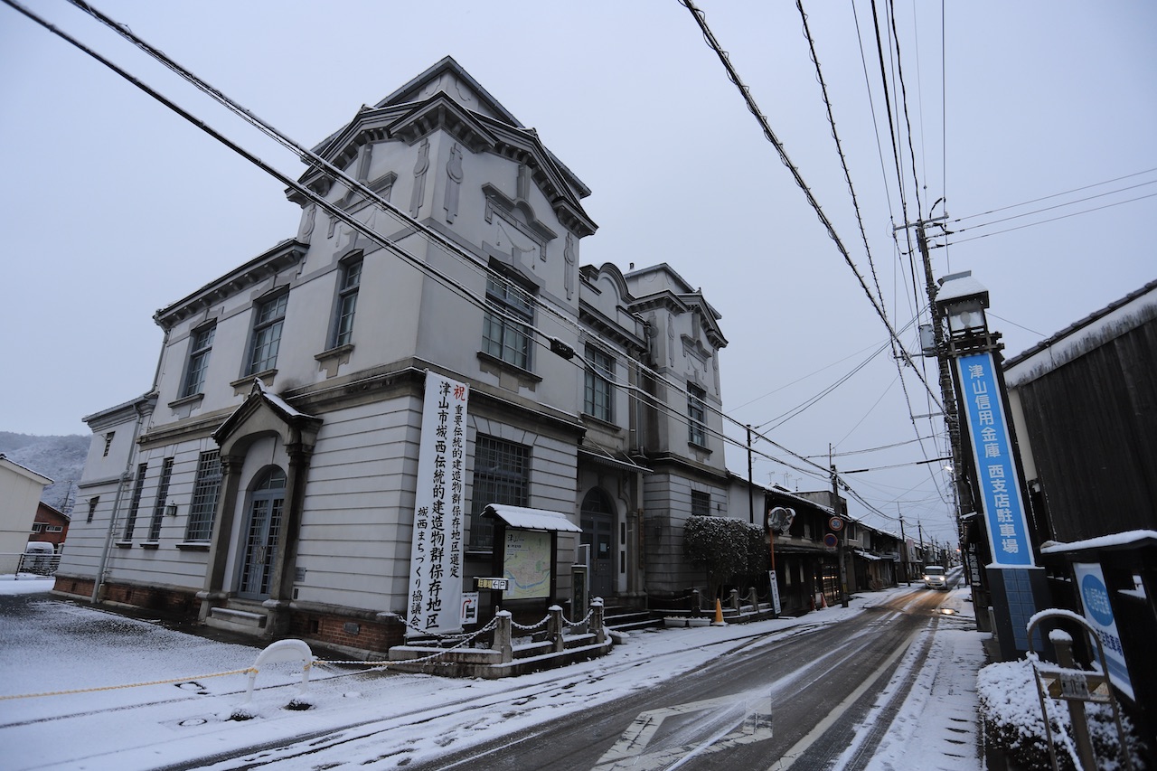


115 more on the map.
Parks, trails and playgrounds21




9 more on the map.
Restaurants and cafes225


Bamiyan
Restaurant · Chinese
営業時間 平日10:00~02:00、土曜10:00~02:00、日祝10:00~02:00 暫定 平日10:00~20:00、土曜10:00~20:00、日祝10:00~20:00 テイクアウト可

213 more on the map.
History
Tsuyama was the center of ancient Mimasaka Province and the location of its kokufu and the Mimasaka Kokubun-ji. It was also on the pilgrimage route to Izumo Shrine and had a number of inn stations. In the latter half of the Sengoku period, Mori Ranmaru's younger brother, Mori Tadamasa, received the area as his domain. He constructed Tsuruyama Castle on the site of an ancient castle which had been erected by the Yamana clan, and laid out a new castle town which became the nucleus of the modern city. At the same time, Tsuruyama was renamed "Tsuyama".
Under the Tokugawa Shogunate, Tsuyama Castle was the headquarters of a cadet branch of the Matsudaira clan and the center of Tsuyama Domain. Tsuyama is known for the 17th century Tsuyama Castle, whose grandeur was said to rival that of Himeji Castle in neighboring Hyōgo Prefecture. The castle was destroyed in 1874. Today only the stone foundations remain, except for a single turret that was reconstructed in 2005.
From the History section of Tsuyama on Wikipedia, under CC BY-SA 4.0.
Where to stay10
Churches and places of worship55
Shopping41
Gas and EV charging6
Schools, colleges and libraries36
Okayama Prefectural Tsuyama Commercial High School
School · 2.1 km
531, 津山市
National Institute of Technology, Tsuyama College
School · 3.5 km
624-1, 津山市
Healthcare32
Map of Tsuyama
250 places. The map loads OpenStreetMap tiles when you open it.
Getting there and nearby towns
Okayama Airport (OKJ) is the nearest airport with scheduled flights listed in OpenStreetMap, 35 km away.
- Katsumada 11 km east, about 11 min by car
- Sakai 13 km southwest, about 13 min by car
- Hayashino 15 km southeast, about 15 min by car
- Shimoyuge 15 km south, about 15 min by car
- Nishiya 17 km northwest, about 17 min by car
- Nagi 18 km northeast, about 18 min by car
- Maniwa 26 km west, about 26 min by car
- Himeji 69 km east, about 1 h 15 min by car
- Kakogawachō-honmachi 82 km east, about 1 h 15 min by car
- Fukuyama 86 km southwest, about 1 h 30 min by car
Drive times are estimates from straight-line distance, not routes.
Local news
Headlines from INDB.
Reviews, tips and questions
Loading what members have shared...
Sources and licences
- GeoNames (CC BY 4.0): population, coordinates, regions and time zone
- OpenStreetMap contributors (ODbL 1.0): places, airports, map data
- Wikidata (CC0 1.0): elevation, founding date, time zone, website, landmarks and historic places
- Wikimedia Commons (see each image): photos
- Wikipedia (CC BY-SA 4.0): overview and history text
Photo credits
- Aerial photo of Tsuyama Cstl 1976, 国土交通省, Attribution
- Tsuyama 20211009121159 (51823747393), inunami, CC BY 2.0
- Tsuyama Railway roundhouse -01, Aimaimyi, CC BY-SA 3.0
- Tsuyama 20211009121636 (51824357130), inunami, CC BY 2.0
- Tsuyama 20211009121441 (51823979224), inunami, CC BY 2.0
- Mazda Demio DJ Tsuyama, MikaPr65, CC BY-SA 4.0
- Tsuyama Station - various - Aug 14 2019 940am 09 45 29 181000, Nesnad, CC BY 4.0
- Tsuyama 20210103114743 (51346823956), inunami, CC BY 2.0
- Tsuyama 20210102173808 (51346825436), inunami, CC BY 2.0
- Tsuyama 20210102181640 (51346100272), inunami, CC BY 2.0
- Tsuyama station north plaza 20180313 122755 05114, Ytsubokura, CC BY-SA 4.0
- Tsuyama 20210103121008 (51346823686), inunami, CC BY 2.0
- Tsuyama 20210102173907 (51347849680), inunami, CC BY 2.0
- Tsuyama Station - various - Aug 14 2019 940am 09 45 22 420000, Nesnad, CC BY 4.0
- Tsuyama Station - various - Aug 14 2019 940am 09 45 05 840000, Nesnad, CC BY 4.0
- Tsuyama Station - various - Aug 14 2019 940am 09 44 57 782000, Nesnad, CC BY 4.0
- Tsuyama Station - various - Aug 14 2019 940am 09 45 13 789000, Nesnad, CC BY 4.0
- Tsuyama 20210102174328 (51346101182), inunami, CC BY 2.0
- Tsuyama Station - various - Aug 14 2019 940am, Nesnad, CC BY 4.0
- Tsuyama 20211009122511 (51824356985), inunami, CC BY 2.0
- Tsuyama Station - various - Aug 14 2019 940am 09 44 51 372000, Nesnad, CC BY 4.0
- Tsuyama Funatsukiba 01, VZP10224, CC BY-SA 4.0
- Tsuyama Station - various - Aug 14 2019 940am 09 45 36 196000, Nesnad, CC BY 4.0
- Tsuyama Funatsukiba Nage, VZP10224, CC BY-SA 4.0
- Tsuyama 20211009131709 (51824355115), inunami, CC BY 2.0
- Tsuyama 20211009131712 (51822689002), inunami, CC BY 2.0
- Nagi MOCA, Phronimoi, CC BY-SA 3.0
- 津山城 備中櫓と桜, denteru, CC BY 3.0
- AEON Tsuyama Shopping Center, Phronimoi, CC BY-SA 3.0
- Joto Tsuyama Okayama07n4272, 663highland, CC BY 2.5
- Daikokuten Bussan Headquarters 20240102, Phronimoi, CC BY-SA 4.0
- 妙願寺山門, Yobis12steps, CC BY-SA 4.0
- Tsuyama1, Waka77, Public domain
- Tsuyama high01, Unknown author, CC BY-SA 3.0
- Tsuyama Central Hospital, Phronimoi, CC BY-SA 3.0
- Shurakuen Tsuyama05n4272, 663highland, CC BY 2.5
- Tsuruyama hachimangu 06, Reggaeman, CC BY-SA 3.0
- Mimasakakokubunji hondou, Saigen Jiro, CC0
- ALNE-TSUYAMA, Phronimoi, CC BY-SA 3.0
- 津山市立図書館本館, K1012031746, CC BY-SA 3.0
- 徳守神社 正門と鳥居, 鍋屋, CC BY-SA 4.0
- Tsuyama Railroad Educational Museum 20160410, Rsa, CC BY-SA 3.0
- Myoho-ji (Tsuyama) - Gate, 運動会プロテインパワー, CC BY-SA 4.0
- Hongyo-ji (Tsuyama) - Gate, 運動会プロテインパワー, CC BY-SA 4.0
- Myosho-ji (Tsuyama) - Gate, 運動会プロテインパワー, CC BY-SA 4.0
- The house of old joto,tsuyama,okayama 004, しろやぎ, CC BY-SA 4.0
- Sendaiinari shrine tsuyama city, Osakana2000, CC BY-SA 4.0
- 20190609 志戸部八幡神社, Osakana2000, CC BY-SA 4.0
- Tsuyama City Museum20171126-01, Miya, CC BY-SA 4.0
- 津山市 神南備山(かんなびさん) (45920581994), 津山市立図書館 Public Library of Tsuyama, CC BY 2.0
- TsuyamaNationalCollegeOfTechonology-image01, Kyoro353, CC BY-SA 3.0
- TsuyamaNationalCollegeOfTechonology-image02, Unknown author, CC BY-SA 3.0
- Mimasaka university gate, 運動会プロテインパワー, CC BY-SA 4.0
- Okayama Prefectural Tsuyama Technical High School 1, Ebiebi2, CC0
- Mimasaka Senior High School main building, Katsuhiro Mae, CC BY-SA 3.0
- Tsuyama Natural Wonder Museum 2026, Vetalapancavimsatika, CC BY-SA 4.0
- Sakushu Joto-yashiki Tsuyama01n3200, 663highland, CC BY 2.5
- IMG2850.tsuyama, 八幡大佐, CC BY-SA 4.0
- 作州民芸館 正面より, 漱石の猫, CC BY-SA 4.0


Page built November 4, 2026. Spotted a mistake? Tell us or suggest a place.