


Shiraoi, Japan
白老町
Shiraoi is a town of 17,759 people in Hokkaido, Japan, founded in November 1, 1954.
Why visit Shiraoi
Townapedia lists 29 museums and landmarks, 42 parks and trails, 12 places to eat, 16 places to stay and 7 attractions in and around town.
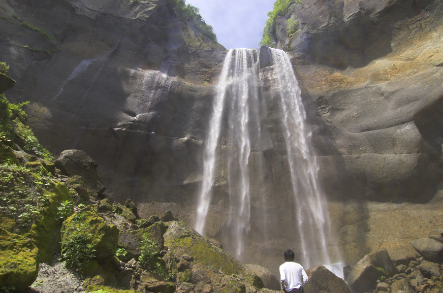
Highlights include Noboribetsu Marine Park Nixe, インクラの滝, Sendai Domain (Sendai-han) Shiraoi major jin'ya museum and National Ainu Museum.
Weather in Shiraoi
Forecast from MET Norway (CC BY 4.0). Full forecast
About Shiraoi
Shiraoi (Japanese: 白老町, Hepburn: Shiraoi-chō) is a town located in Iburi, Hokkaido, Japan. As of September 2016, the town had a population of 17,759. It was established in 1867 by the feudal lords of Sendai. Most of the area of the town is forested and parts lie within the Shikotsu-Tōya National Park.
From the Wikipedia article Shiraoi, Hokkaido (this version), under CC BY-SA 4.0.
Travel tips from other travellers: Shiraoi on Wikivoyage (CC BY-SA 4.0).
Things to do7

Noboribetsu Marine Park Nixe
Monument and historic site · 17.3 km
Aquarium in Noboribetsu, Japan



Museums and landmarks29




17 more on the map.
Parks, trails and playgrounds42


苫小牧市ときわスケートセンター
Sports field and stadium · 14.8 km
1, 苫小牧市
Mo-Su 10:00-18:00; Th[4] off; Apr 1-May 31 off; Dec 31-Jan 2 off

30 more on the map.
Restaurants and cafes12

Restaurant REPUN for hotel guests
Restaurant · French · 1.9 km
15, 白老町
"Limited for hotel guests only."


History
Shiraoi, like the rest of Hokkaido, was populated by the Ainu. According to the town's official website, the name, Shiraoi, means "rainbows" in the Ainu language. Other sources state that the name comes from Shiraunai meaning "horse-flies".
In 1867, the Sendai domain established a fort in Shiraoi and work began on Shiogama Shrine (塩釜神社, Shiogama Jinja). The following year the Boshin War caused Sendai to retreat from Shiraoi and return to Sendai proper. After the revolt was put down the government dismantled the fort in 1870.
The end of the 19th century saw expansion of the town. A road was established connecting Shiraoi with Muroran, Sapporo, and Hakodate in 1873. Nineteen years later, the first railroad station was established. The villages of Shadai and Shikiu were established. Two significant events occurred during this expansion: in 1874, Mount Tarumae erupted, and in 1881, the Emperor Meiji visited.
From the History section of Shiraoi, Hokkaido on Wikipedia, under CC BY-SA 4.0.
Where to stay16
Churches and places of worship9
Shopping4
Gas and EV charging6
Schools, colleges and libraries16
Healthcare6
Map of Shiraoi
147 places. The map loads OpenStreetMap tiles when you open it.
Getting there and nearby towns
New Chitose Airport (CTS) is the nearest airport with scheduled flights listed in OpenStreetMap, 38 km away.
- Noboribetsu 18 km southwest, about 18 min by car
- Tomakomai 23 km northeast, about 23 min by car
- Chitose 39 km northeast, about 39 min by car
- Muroran 39 km southwest, about 39 min by car
- Sōbetsu 38 km west, about 38 min by car
- Date 41 km west, about 41 min by car
- Eniwa 42 km northeast, about 42 min by car
- Sapporo 57 km north, about 57 min by car
- Ebetsu 64 km north, about 1 h by car
- Tōbetsu 75 km north, about 1 h 15 min by car
Drive times are estimates from straight-line distance, not routes.
Local news
Headlines from INDB.
Reviews, tips and questions
Loading what members have shared...
Sources and licences
- GeoNames (CC BY 4.0): population, coordinates, regions and time zone
- OpenStreetMap contributors (ODbL 1.0): places, airports, map data
- Wikidata (CC0 1.0): elevation, founding date, time zone, website, landmarks and historic places
- Wikimedia Commons (see each image): photos
- Wikipedia (CC BY-SA 4.0): overview and history text
Photo credits
- Shiraoi Town Hall, Ozizo, Public domain
- Shiraoi Station 202608, 掬茶, CC BY-SA 4.0
- D51 333 steam locomotive in Shiraoi, Hokkaido, 掬茶, CC BY-SA 4.0
- Shiraoi Poroto Mintar, Higa4, CC0
- Shiraoi-upopoy 01, Higa4, CC0
- Shiraoi-upopoy 04, Higa4, CC0
- Shiraoi-upopoy 03, Higa4, CC0
- Shiraoi-upopoy 02, Higa4, CC0
- Shiraoi-upopoy 20, Higa4, CC0
- Shiraoi-upopoy 19, Higa4, CC0
- Shiraoi-upopoy 21, Higa4, CC0
- Shiraoi-upopoy 22, Higa4, CC0
- Shiraoi-upopoy 23, Higa4, CC0
- Shiraoi-upopoy 24, Higa4, CC0
- Shiraoi-upopoy 37, Higa4, CC0
- Shiraoi-upopoy 38, Higa4, CC0
- Shiraoi-upopoy 36, Higa4, CC0
- Shiraoi-upopoy 39, Higa4, CC0
- Shiraoi-upopoy 18, Higa4, CC0
- Shiraoi-upopoy 27, Higa4, CC0
- Shiraoi-upopoy 28, Higa4, CC0
- Shiraoi-upopoy 40, Higa4, CC0
- Shiraoi-upopoy 44, Higa4, CC0
- Shiraoi-upopoy 17, Higa4, CC0
- Nixe Castle of Noboribetsu Marine Park NIXE 20260822b, 掬茶, CC BY-SA 4.0
- Ainu Museum building, Abasaa, Public domain
- Inkura, Tomo200006, CC BY-SA 3.0
- Hokkaido Tomakomai Minami High School, Yasu ( talk ), CC BY-SA 3.0
- National Institute of Technology,Tomakomai College, Endou subaru, CC BY-SA 4.0
- 仙台藩白老元陣屋追手門, AITNIM, CC BY-SA 4.0
- Tomakomaikomazawa, 飛龍原爆固め, CC BY-SA 3.0
- Shiraoi Town Shiraoi Junior High School, 禁樹なずな, CC BY-SA 4.0
- Shiraoi Town Shiraoi Elementary School, 禁樹なずな, CC BY-SA 4.0
- National Ainu Museum 20260822a, 掬茶, CC BY-SA 4.0
- UPOPOY 202608, 掬茶, CC BY-SA 4.0
- Woman playing traditional Ainu instrument, David Ooms from Belgium, CC BY 2.0
- JRHokkaido-kiha150-101-20120724, LERK, CC BY-SA 3.0
- Japanese-national-railways-D51-333-20120724, LERK, CC BY-SA 3.0
- 松浦武四郎の碑 北海道白老郡白老町 2025-12-13, Narumi.SBT, CC BY-SA 4.0
- KAI Poroto by Hoshino Resorts, 掬茶, CC BY-SA 4.0
- 西山ピーク(Nishiyama) - panoramio, pakku, CC BY 3.0


Page built November 4, 2026. Spotted a mistake? Tell us or suggest a place.