


Takarazuka, Japan
宝塚市
Takarazuka is a town of 226,432 people in Hyōgo, Japan, founded in April 1, 1954.
Why visit Takarazuka
Townapedia lists 35 museums and landmarks, 54 parks and trails, 299 places to eat, 4 places to stay and 21 attractions in and around town.
Highlights include Cine Pipia, Ashiya University, The Osamu Tezuka Manga Museum and Amagasaki Cultural Center.
Weather in Takarazuka
Forecast from MET Norway (CC BY 4.0). Full forecast
About Takarazuka
Takarazuka (宝塚市, Takarazuka-shi) is a city located in Hyōgo Prefecture, Japan. As of 1 February 2024, the city had an estimated population of 221,846 in 96,729 households and a population density of 2,200 persons per km². The total area of the city is 101.80 square kilometres (39.31 sq mi). Known as the "inner parlor" of Kansai, Takarazuka is famous for the Takarazuka Revue, hot springs, and the Takarazuka Tourism Fireworks Display held since 1913.
From the Wikipedia article Takarazuka, Hyōgo (this version), under CC BY-SA 4.0.
Travel tips from other travellers: Takarazuka on Wikivoyage (CC BY-SA 4.0).
Things to do21


Ashiya University
School · 6.9 km
Higher education institution in Hyōgo Prefecture, Japan

Hyogo Medical University
School · 9.2 km
Higher education institution in Hyōgo Prefecture, Japan

Hyogo Performing Arts Center
Cinema and theater · 6.2 km
Building in Nishinomiya, Hyogo Prefecture, Japan
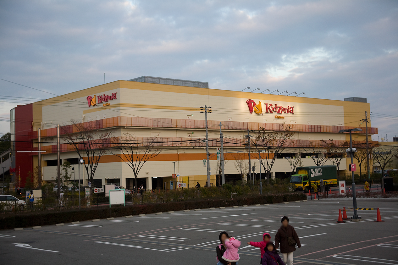
KidZania Koshien
Monument and historic site · 9.2 km
Family edutainment center amusement park

Kobe College
School · 4.3 km
Higher education institution in Hyōgo Prefecture, Japan

Kobe Pharmaceutical University
School · 10.0 km
Higher education institution in Hyōgo Prefecture, Japan

Konan University
School · 11.2 km
Higher education institution in Hyōgo Prefecture, Japan

Konan Women's University
School · 9.6 km
Private women's college in Higashinada-ku, Kobe, Hyōgo, Japan

Koshien University
School · 2.3 km
Higher education institution in Hyōgo Prefecture, Japan

Kwansei Gakuin University
School · 3.6 km
Private university in Hyōgo, Japan
Osaka Aoyama College
School · 9.9 km
Higher education institution in Osaka Prefecture, Japan
9 more on the map.
Museums and landmarks35


Egenoyama Site
Monument and historic site · 8.9 km
Yayoi period settlement trace in Ashiya, Hyōgo, Japan

Itami City Museum of Insects
Museum · 3.6 km
Museum in Hyōgo Prefecture, Japan


Kamo Site
Monument and historic site · 5.2 km
Archaeological site in Kawanishi, Hyōgo, Japan

Kurokawa Institute of Ancient Cultures
Museum · 6.0 km
Museum in Japan

Tano Site
Monument and historic site · 8.3 km
Archaeological site in Japan


23 more on the map.
Parks, trails and playgrounds54




42 more on the map.
Restaurants and cafes299


Yuri Cofee 百合珈琲
Cafe · Coffee Shop, Breakfast, Lunch · 1.3 km
11, Takarazuka
Mo-Sa 09:00-18:00

287 more on the map.
History
The area of Takarazuka was part of ancient Settsu Province and has been inhabited since ancient times, with many kofun burial mounds found within the city limits. The Mefu Jinja dates from the Nara period. From the Heian period, numerous landed estates shōen controlled by the Fujiwara family were developed in the area. Takarazuka onsen is mentioned in Kamakura period records. In the Muromachi period, Kohama town developed as a temple town for Kōshō-ji, and subsequently Kohama Inn was established as a post station on Arima Road. The area was mostly tenryō territory under direct control of the Tokugawa shogunate in the Edo Period.
The village of Kohama (小浜村) was established on April 1, 1889 within Kawabe District, Hyōgo, with the creation of the modern municipalities system. In 1897, Hankaku Railroad (current Fukuchiyama Line) completed. In 1910, the Minoh Arima Electric Railway (current Hankyu Takarazuka Main Line completed). Takarazuka was a center of the culture from the 1910s to 1940s in what has been dubbed the age of Hanshinkan Modernism. This included the opening of the Takarazuka Girls' Opera (current Takarazuka Revue) on April 1, 1914.
From the History section of Takarazuka, Hyōgo on Wikipedia, under CC BY-SA 4.0.
Where to stay4
Churches and places of worship38
Shopping45
Gas and EV charging9
Schools, colleges and libraries31
Healthcare63
Map of Takarazuka
250 places. The map loads OpenStreetMap tiles when you open it.
Getting there and nearby towns
Osaka Itami Airport (ITM) is the nearest airport with scheduled flights listed in OpenStreetMap, 8 km away.
- Itami 4 km southeast, about 4 min by car
- Kawanishi 6 km east, about 6 min by car
- Ikeda 7 km east, about 7 min by car
- Nishinomiya 10 km south, about 10 min by car
- Ashiya 9 km southwest, about 9 min by car
- Kimokawa 9 km north, about 9 min by car
- Toyonaka 10 km east, about 10 min by car
- Osaka 18 km southeast, about 18 min by car
- Kobe 20 km southwest, about 20 min by car
- Kyoto 44 km northeast, about 44 min by car
Drive times are estimates from straight-line distance, not routes.
Local news
Headlines from INDB.
Reviews, tips and questions
Loading what members have shared...
Sources and licences
- GeoNames (CC BY 4.0): population, coordinates, regions and time zone
- OpenStreetMap contributors (ODbL 1.0): places, airports, map data
- Wikidata (CC0 1.0): elevation, founding date, time zone, website, landmarks and historic places
- Wikimedia Commons (see each image): photos
- Wikipedia (CC BY-SA 4.0): overview and history text
Photo credits
- Takarazuka Hyogo, user:Hiroyuki0904, Public domain
- TakarazukaJinjya, Hiroyuki0904, Public domain
- 251207 Kohama-Kotai-jinja Takarazuka Hyogo pref Japan03s3, 663highland, CC BY-SA 4.0
- 251207 Kohama-Kotai-jinja Takarazuka Hyogo pref Japan01s3, 663highland, CC BY-SA 4.0
- 251207 Kohama-Kotai-jinja Takarazuka Hyogo pref Japan02s3, 663highland, CC BY-SA 4.0
- 251207 Gosho-ji Takarazuka Hyogo pref Japan01s3, 663highland, CC BY-SA 4.0
- 251207 Gosho-ji Takarazuka Hyogo pref Japan02s3, 663highland, CC BY-SA 4.0
- 251207 Kohama-juku Takarazuka Hyogo pref Japan02s3, 663highland, CC BY-SA 4.0
- 251207 Kohama-juku Takarazuka Hyogo pref Japan01s3, 663highland, CC BY-SA 4.0
- 251207 Kohama-juku Takarazuka Hyogo pref Japan03s3, 663highland, CC BY-SA 4.0
- 251207 Kohama-juku Takarazuka Hyogo pref Japan06s3, 663highland, CC BY-SA 4.0
- 251207 Kohama-juku Takarazuka Hyogo pref Japan04s3, 663highland, CC BY-SA 4.0
- 251207 Kohama-juku Takarazuka Hyogo pref Japan05s3, 663highland, CC BY-SA 4.0
- 251207 Kohama-juku Takarazuka Hyogo pref Japan08s3, 663highland, CC BY-SA 4.0
- 251207 Kohama-juku Takarazuka Hyogo pref Japan07s3, 663highland, CC BY-SA 4.0
- Takarazukaminamiguchi - panoramio (2), DVMG, CC BY 3.0
- Hankyu Takarazukaminamiguchi Station platform - panoramio (11), DVMG, CC BY 3.0
- Hankyu Takarazukaminamiguchi Station platform - panoramio (10), DVMG, CC BY 3.0
- Takarazukaminamiguchi - panoramio, DVMG, CC BY 3.0
- Takarazukaminamiguchi - panoramio (3), DVMG, CC BY 3.0
- Hankyu Takarazukaminamiguchi Station platform - panoramio (12), DVMG, CC BY 3.0
- Takarazukaminamiguchi - panoramio (10), DVMG, CC BY 3.0
- Takarazukaminamiguchi - panoramio (13), DVMG, CC BY 3.0
- Hankyu Takarazukaminamiguchi Station platform - panoramio (14), DVMG, CC BY 3.0
- Hyogo Performing Arts Center night, User:Poprishchin, Public domain
- Vories kc 02, Miya, CC BY-SA 3.0
- Konan University3, The original uploader was 常時 舞蹴 at Japanese Wikipedia ., CC BY-SA 3.0
- 170311 Kwansei Gakuin University Nishinomiya Hyogo pref Japan08n, 663highland, CC BY-SA 4.0
- Amashin-alkaic, Kanko3131, CC BY-SA 3.0
- 240810 Cupnoodles Museum Osaka Ikeda Ikeda Osaka pref Japan01s3, 663highland, CC BY-SA 4.0
- Egenoyamaiseki1, KENPEI, CC BY-SA 3.0
- Itami City Museum of Insects1, KENPEI, CC BY-SA 3.0
- 150214 Itsuo Art Museum Ikeda Osaka pref Japan16n, 663highland, CC BY 2.5
- 加茂遺跡 (川西市) 出土 弥生土器, Saigen Jiro, Public domain
- Tano Site pit dwelling, MChew, CC BY-SA 4.0
- Satsukiyama zoo Gate, Hiyotchi, CC BY-SA 4.0
- Heirinji, Mass Ave 975 at English Wikipedia, CC BY-SA 3.0
- MefuJinjya, user:Hiroyuki0904, Public domain
- Hanshin race course 07, Cake6 ( talk ), CC BY-SA 3.0
- Iwashizujinjya, user:Hiroyuki0904, Public domain
- Sumiyoshijinjya, user:Hiroyuki0904, Public domain
- Takarazuka Hotel, Own work, CC BY-SA 3.0
- Takarazuka City Takarazuka Daiichi junior high school, KishujiRapid, CC BY-SA 4.0
- Osamu Tezuka Manga Museum ac (2), Asturio Cantabrio, CC BY-SA 4.0
- Kawamojinjya, user:Hiroyuki0904, CC BY 3.0
- 宝塚・皇太神社, user:Hiroyuki0904, Public domain
- Housenji(Takarazuka), おにく, CC BY-SA 4.0
- Takarazuka Arts Center ac (1), Asturio Cantabrio, CC BY-SA 4.0
- 阪神特別支援学校, Wikiwiki82~jawiki, CC BY-SA 4.0
- Takaraduka elementaly school, user:Hiroyuki0904, Public domain
- Takarazuka City Gotenyama junior high school, KishujiRapid, CC BY-SA 4.0
- Kwanseigakuin elementaryschool, 撮影者, CC BY-SA 3.0
- RZ Takarazuka Cine Pipia, Razgrad, CC BY-SA 4.0
- Takarazuka City Suehiro elementary school, KishujiRapid, CC BY-SA 4.0
- Takatsukasa elementary school, Takarazuka, 岩佐 栄三, CC0
- Takarazuka City Koumyou elementary school, KishujiRapid, CC BY-SA 4.0
- Takarazuka City Mefu elementary school, KishujiRapid, CC BY-SA 4.0
- Ashiya University Hyogo Japan 2008, Ofg, CC BY-SA 3.0
- Kobe-Pharmaceutical-Univ-2013042802, Hasec, CC0
- Konan-Women's-Univ-2014081101, Hasec, CC0
- Koshien University, もんじゃ, Public domain
- Kizzania, wiki0001, CC BY 3.0
- 寶塚神社, Nozomikobe, CC0


Page built November 4, 2026. Spotted a mistake? Tell us or suggest a place.