


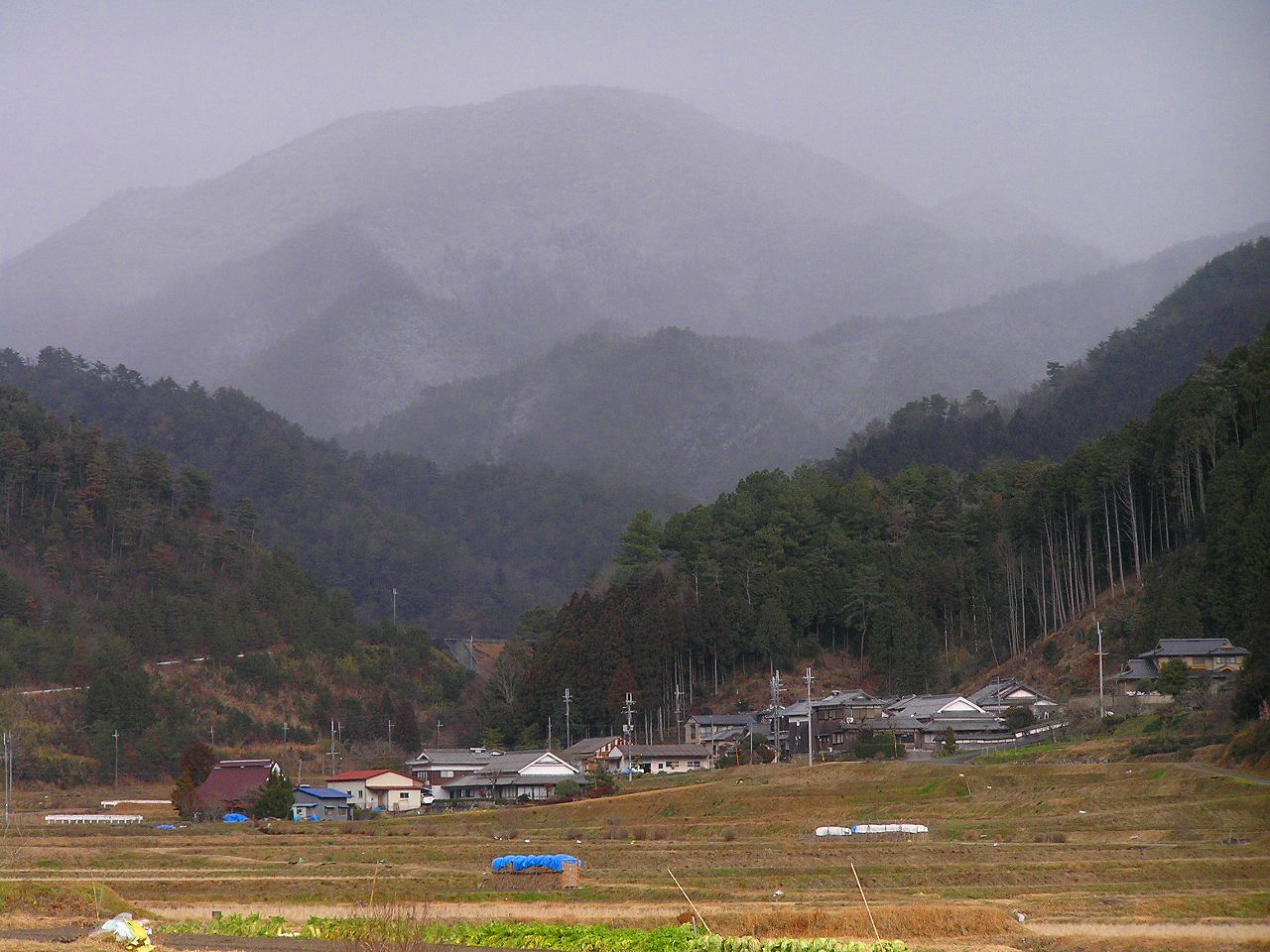


Tamba-Sasayama, Japan
丹波篠山市
Tamba-Sasayama is a town of 39,611 people in Hyōgo, Japan, founded in April 1, 1999.
Why visit Tamba-Sasayama
Townapedia lists 79 museums and landmarks, 28 parks and trails, 80 places to eat, 34 places to stay and 72 attractions in and around town.
Highlights include Mt. Hachigao, Mt. Koganegatake, 丹波伝統工芸公園立杭陶の郷 and Histrical Artifacts Museum.
Weather in Tamba-Sasayama
Forecast from MET Norway (CC BY 4.0). Full forecast
About Tamba-Sasayama
Tamba-Sasayama (丹波篠山市, Tanba-Sasayama-shi), formerly known as Sasayama (篠山市, Sasayama-shi), is a city in the central eastern part of Hyōgo Prefecture, Japan. As of 31 March 2022, the city had an estimated population of 40,050 in 17,523 households and a population density of 110 persons per km2. The total area of the city is 377.59 square kilometres (145.79 sq mi).
From the Wikipedia article Tamba-Sasayama (this version), under CC BY-SA 4.0.
Things to do72



60 more on the map.
Museums and landmarks79




67 more on the map.
Parks, trails and playgrounds28





16 more on the map.
Restaurants and cafes80





68 more on the map.
History
The area of Tamba-Sasayama was part of ancient Tanba Province, and corresponds almost exactly with ancient Taki District. Sasayama developed as a castle town around Sasayama Castle, which was constructed in the early Edo Period. The town of Sasayama was established on April 1, 1889, with the creation of the modern municipalities system, and expanded its borders through municipal mergers with neighboring villages in 1955 and 1975. It was raised to city status on April 1, 1999, from the merger of the former town of Sasayama, absorbing the towns of Konda, Nishiki and Tannan (all from Taki District).
On November 18, 2018, the city held a successful referendum on changing its name from Sasayama to Tamba-Sasayama in reference to the historical Tanba Province, which still has some influence on local branding and politics. The referendum about changing a municipality's name was the first of its kind in Japan, and the new name officially came into effect in May 2019.
From the History section of Tamba-Sasayama on Wikipedia, under CC BY-SA 4.0.
Where to stay34
Churches and places of worship54
Shopping23
Gas and EV charging8
Schools, colleges and libraries54
Healthcare10
Map of Tamba-Sasayama
250 places. The map loads OpenStreetMap tiles when you open it.
Getting there and nearby towns
Osaka Itami Airport (ITM) is the nearest airport with scheduled flights listed in OpenStreetMap, 38 km away.
- Sasayama 1 km south, about 1 min by car
- Tanba 19 km northwest, about 19 min by car
- Sandachō 21 km south, about 21 min by car
- Nishiwaki 24 km southwest, about 24 min by car
- Yashiro 29 km southwest, about 29 min by car
- Takarazuka 33 km southeast, about 33 min by car
- Kawanishi 34 km southeast, about 34 min by car
- Minoh 36 km southeast, about 36 min by car
- Itami 36 km southeast, about 36 min by car
- Kobe 43 km south, about 43 min by car
Drive times are estimates from straight-line distance, not routes.
Local news
Headlines from INDB.
Reviews, tips and questions
Loading what members have shared...
Sources and licences
- GeoNames (CC BY 4.0): population, coordinates, regions and time zone
- OpenStreetMap contributors (ODbL 1.0): places, airports, map data
- Wikidata (CC0 1.0): elevation, founding date, time zone, website
- Wikimedia Commons (see each image): photos
- Wikipedia (CC BY-SA 4.0): overview and history text
Photo credits
- Sasayama Castle 20130507-03, Baku13, CC BY-SA 3.0
- Mt. Mitake 御嶽(篠山市) DSCF2705, 松岡明芳, CC BY-SA 3.0
- P1141126西ヶ嶽(727m), 松岡明芳, CC BY-SA 3.0
- Yajuro01, Mass Ave 975, CC BY-SA 3.0
- 篠山春日神社本殿sasayama-kasugajinjaPA156109, 松岡明芳, CC BY-SA 3.0
- Bodai temple01 hyogo, Hound, CC BY-SA 3.0
- Tanba-Denen Symphony Hall01s3200, 663highland, CC BY 2.5
- Moshi elenentary school in 2014, Mti, CC BY-SA 3.0
- Takajosan05, Mass Ave 975, CC BY-SA 3.0
- 公園管理事務所, Akas1950, CC BY-SA 4.0
- Daikoku-ji 大国寺 (篠山市) 本堂 DSCF1324, 松岡明芳, CC BY-SA 3.0
- Sogen-temple宗玄寺古市8242241, 関西画像創庫, CC BY-SA 3.0
- Koganegadake (2941666278) (Cropped), Satoshi KAYA, CC BY-SA 2.0
- Kasuga fork culture museum01s3200, 663highland, CC BY 2.5
- Kaibara hachiman jinja15 2816, 663highland, CC BY 2.5
- 230502 Kaibara Jinya Tamba Hyogo pref Japan03s3, 663highland, CC BY-SA 4.0
- Koun-ji (Fukuchiyama), Hondo, 運動会プロテインパワー, CC BY-SA 4.0
- 三田・高売布神社, user:Hiroyuki0904, Public domain
- 140510 Tamba Traditional Art Craft Park Sue no Sato Sasayama Hyogo pref Japan02s3, 663highland, CC BY 2.5
- Mt.Sakazuki Sasayama,Hyogo 盃ヶ岳(篠山市藤岡)DSCF0018, 松岡明芳, CC BY-SA 4.0
- Enichi-ji, Tamba, 運動会プロテインパワー, CC BY-SA 4.0
- Kaibara HS, kei_yoshizaki, CC BY-SA 3.0
- Mitake01, Mass Ave 975, CC BY-SA 3.0
- Takashiro-yama, zenkei, Saigen Jiro, CC0
- Sasayama city Sasayama jhs, Bakkai, CC BY-SA 3.0
- Mt.Shiraga 白髪岳722m 松尾山より DSCF1149, 松岡明芳, CC BY-SA 3.0
- 大野山山頂, Kei425, CC BY-SA 4.0
- Yajurogatake&Route 372 (Japan),弥十郎ヶ嶽&国道372号 DSCF3728, 松岡明芳, CC BY-SA 3.0
- 2021-05-19 Tambasasayama,(兵庫県丹波篠山市・篠山盆地・兵庫医科大学ささやま医療センター・篠山城)空撮 DJI 0228, 松岡明芳, CC BY-SA 4.0
- Sasayama Municipal Museum of History05st3200, 663highland, CC BY 2.5
- Sasaymajyo01, 日: Jnn, CC BY 2.1 jp
- Sasaymajyo03, 日: Jnn, CC BY 2.1 jp
- 篠山城跡 Sasayama Castle Ruins - panoramio (1), iloverjoa, CC BY 3.0
- Sasayama elementary school - panoramio, ccfarmer, CC BY 3.0
- 篠山城跡 Sasayama Castle Ruins - panoramio, iloverjoa, CC BY 3.0
- 篠山市役所 Sasayama City Hall - panoramio, iloverjoa, CC BY 3.0
- ぼたん鍋専門店ぼたん亭 Boar meat restaurant BOTAN-TEI - panoramio, iloverjoa, CC BY 3.0
- Tatsumachi, Sasayama, Hyogo Prefecture 669-2323, Japan - panoramio (2), kajikawa, CC BY 3.0
- Sasayama Municipal Museum of History04st3200, 663highland, CC BY 2.5
- Sasayama Municipal Museum of History02st3200, 663highland, CC BY 2.5


Page built November 5, 2026. Spotted a mistake? Tell us or suggest a place.