



Why visit Tatsuno-kita
Townapedia lists 13 museums and landmarks, 13 parks and trails, 58 places to eat, 4 places to stay and 3 attractions in and around town.
Highlights include Mt. Mimuro, Mt. Mimuro, Ninji Haiji and ウォーター パーク.
Weather in Tatsuno-kita
Forecast from MET Norway (CC BY 4.0). Full forecast
Things to do3


Museums and landmarks13


Ninji Haiji
Monument and historic site · 2.6 km
Archaeological site in Kashiba, Japan


Emperor Korei’s Takaoka-no-Umasaka-no-Misasagi Tomb
Monument and historic site · 1.2 km
1 more on the map.
Parks, trails and playgrounds13



1 more on the map.
Restaurants and cafes58


babyface planet's Oji
Cafe · 2.3 km
生駒郡斑鳩町龍田西4-1-33 国道25号 / 国道168号 (Route 25 & 168)
46 more on the map.
Where to stay4
Churches and places of worship9
Shopping14
Gas and EV charging1
Schools, colleges and libraries15
Healthcare16
kusuri no aoki ikaruga
Clinic and pharmacy · 2.3 km
生駒郡斑鳩町龍田西5-7-2 国道25号 (Route 25)
Map of Tatsuno-kita
146 places. The map loads OpenStreetMap tiles when you open it.
Getting there and nearby towns
Osaka Itami Airport (ITM) is the nearest airport with scheduled flights listed in OpenStreetMap, 31 km away.
- Hōryūji 4 km northeast, about 4 min by car
- Kashiba 7 km south, about 7 min by car
- Ikoma 10 km north, about 10 min by car
- Fujiidera 9 km west, about 9 min by car
- Yamato-Takada 10 km southeast, about 10 min by car
- Tawaramoto 10 km southeast, about 10 min by car
- Taishi 10 km southwest, about 10 min by car
- Habikino 11 km southwest, about 11 min by car
- Katsuragi 12 km south, about 12 min by car
- Tenri 13 km east, about 13 min by car
Drive times are estimates from straight-line distance, not routes.
Local news
Headlines from INDB.
Reviews, tips and questions
Loading what members have shared...
Sources and licences
- GeoNames (CC BY 4.0): population, coordinates, regions and time zone
- OpenStreetMap contributors (ODbL 1.0): places, airports, map data
- Wikidata (CC0 1.0): elevation, founding date, time zone, website, landmarks and historic places
- Wikimedia Commons (see each image): photos
Photo credits
- Ninji Kita Haiji, garan-1, Saigen Jiro, CC0
- 190104 Chogosonshiji Heguri Nara pref Japan01s3, 663highland, CC BY 2.5
- Tatsuta River, Ikaruga, Nara02, Kansai explorer, CC BY 3.0
- Senjyuin gomado1, KENPEI, CC BY-SA 3.0
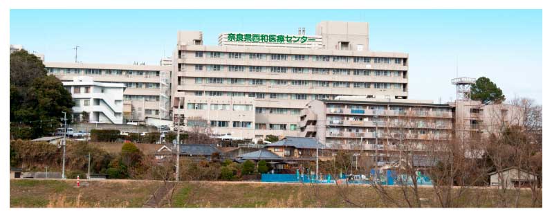
- 奈良県西和医療センター, 森田悠太郎, CC BY-SA 3.0
- 火幡神社拝殿 - DHvL2xjUMAAevQ1, Zeter114514, CC BY-SA 4.0
- Kataoka-jinja (Oji), haiden, Saigen Jiro, CC0
- 平隆寺, 村井徹也, CC BY-SA 4.0
- Kudo-jinja (Oji), torii, Saigen Jiro, CC0
- 王寺工業高校 イメージ, Jaminecrafter, CC BY-SA 4.0
- Naragakuen, Kourasu1, CC BY-SA 4.0
- 平隆寺 本堂内観, 村井徹也, CC BY-SA 4.0
- 松永久秀墓所, Popbeans, CC0
- Horyu-ji (5243252928), KimonBerlin, CC BY-SA 2.0
- 大法院の魚梁船の板材, Popbeans, CC BY-SA 4.0
- 三郷町立図書館, Popbeans, CC BY-SA 4.0
- 風鎮大祭の花火神事, Popbeans, CC BY-SA 4.0
- Nara Period (8th C.) (5243252388), KimonBerlin, CC BY-SA 2.0
- Horyu-ji (5243253602), KimonBerlin, CC BY-SA 2.0
- Shigisan 20200404102800 (50307342153), inunami, CC BY 2.0
- 近鉄生駒線 王寺駅にて Ōji station 2013.8.28 - panoramio, Nankou Oronain (as36…, CC BY-SA 3.0
- JR, Kintetsu Ōji Station, Sashimiteishoku, CC0
- Oji Station platforms 2022 Dec 30 various 15 23 36 714000, Nesnad, CC BY 4.0
- Oji Station platforms 2022 Dec 30 various 15 23 45 009000, Nesnad, CC BY 4.0
- Kintetsu Ōji Station, Sashimiteishoku, CC0
- JR Ōji Station west entrance, Sashimiteishoku, CC0
- Oji Station platforms 2022 Dec 30 various, Nesnad, CC BY 4.0
- 王寺駅 - panoramio, くろふね, CC BY 3.0
- Shigisan 20200404121209 (50308171667), inunami, CC BY 2.0
- 王寺駅 - panoramio - くろふね, くろふね, CC BY 3.0
- Oji station , 王寺駅 - panoramio, z tanuki, CC BY 3.0
- MUFG Bank Yamato-Oji Branch, Suikotei, CC BY 4.0
- Nara Kotsu NRN 200 KA 189 at Oji Station, 由紀奈, CC BY-SA 4.0
- Sangō Station (Nara) 202509, Sashimiteishoku, CC0
- Oji Sta. Bldg. W. - panoramio, Nagono, CC BY-SA 3.0
- JR Sango Sta. - panoramio, Nagono, CC BY-SA 3.0
- Seiwa Police station Oji Ekimae Koban, Suikotei, CC BY 4.0
- JR王寺駅前 2005.12.31 - panoramio, Nankou Oronain (as36…, CC BY-SA 3.0
- JR Ōji Station north entrance, Sashimiteishoku, CC0
- Sangō Station (Nara) waiting room, Sashimiteishoku, CC0


Page built November 5, 2026. Spotted a mistake? Tell us or suggest a place.